Safety Score: 3,3 of 5.0 based on data from 9 authorites. Meaning please reconsider your need to travel to Netherlands.
Travel warnings are updated daily. Source: Travel Warning Netherlands. Last Update: 2024-08-13 08:21:03
Explore Oudeland
The district Oudeland of Hoogvliet in Gemeente Rotterdam (South Holland) is located in Netherlands about 41 mi south-west of Amsterdam, the country's capital.
If you need a place to sleep, we compiled a list of available hotels close to the map centre further down the page.
Depending on your travel schedule, you might want to pay a visit to some of the following locations: The Hague, Haarlem, Heemskerk, Amsterdam and Sint-Niklaas. To further explore this place, just scroll down and browse the available info.
Local weather forecast
Todays Local Weather Conditions & Forecast: 4°C / 40 °F
| Morning Temperature | 4°C / 39 °F |
| Evening Temperature | 6°C / 43 °F |
| Night Temperature | 8°C / 47 °F |
| Chance of rainfall | 7% |
| Air Humidity | 87% |
| Air Pressure | 1014 hPa |
| Wind Speed | Fresh Breeze with 16 km/h (10 mph) from North |
| Cloud Conditions | Overcast clouds, covering 100% of sky |
| General Conditions | Moderate rain |
Sunday, 24th of November 2024
14°C (57 °F)
15°C (60 °F)
Light rain, fresh breeze, overcast clouds.
Monday, 25th of November 2024
10°C (50 °F)
9°C (48 °F)
Moderate rain, fresh breeze, overcast clouds.
Tuesday, 26th of November 2024
10°C (50 °F)
8°C (47 °F)
Light rain, fresh breeze, overcast clouds.
Hotels and Places to Stay
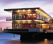
Delta Hotel
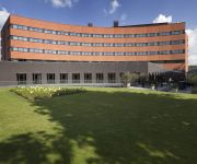
Novotel Rotterdam Schiedam
Carlton Oasis Hotel
Van der Valk Hotel Rotterdam-Blijdorp
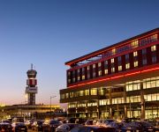
Best Western Plus Rotterdam Airport Hotel
Worldhotel Wings Rotterdam The Hague Airport
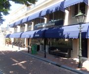
Hotel de Sluiskop
Bastion Hotel Vlaardingen
Atlas
Campanile - Rotterdam Vlaardingen
Videos from this area
These are videos related to the place based on their proximity to this place.
Afval Loont
Hoogvlieters kunnen vanaf 9 september 2013 met hun oud papier, plastic afval, textiel, frituurvet en kleine elektrische apparaten terecht bij Afval Loont, in de voormalige brandweerkazerne...
A15 Afrit 19 (Charlois) to Afrit 16 (N218 Spijkenisse) (NL)
Movie of the Dutch motorway A15 from the interjunction 19 at Rotterdam Charlois to the interjunction 16 with the N218 to Spijkenisse.
Lekker schaatsen op de Binnenban / Hoogvliet 2014
010FM was aanwezig op de Binnenban in Hoogvliet met een actie voor Kanker en ex Kankerpatiënten en de Voedselbank met de zangers Bob Offenberg en Ton Tax. Het kan nog tot zaterdag 3 januari ...
Ons Hoogvliet - Aflevering 13 - Intocht Sinterklaas 2013
Afgelopen week was het zo ver. St. Nicolaas arriveerde per stoomboot in Hoogvliet. Deelraadsvoorzitter Edwin Smid ontving St. Nicolaas en zijn Pieten op het Winkelcentrum Hoogvliet. Na een...
DVS Junioren Taptoe Hoogvliet + afscheid ivm overstap Marchingband
DVS Junioren treden op tijdens Taptoe Hoogvliet op zaterdag 29 september 2012 DVS brengt hun show Beautiful Day Na afloop van de taptoe gaan een 6tal jongens hen verlaten i.v.m. de overstap...
Ons Hoogvliet - Aflevering 18 - 60 jaar Scouting Hoogvliet
De scoutingvereniging van Hoogvliet bestaat 60 jaar.
Ons Hoogvliet - Aflevering 5 - Vrijwillige Brandweer
Edwin Smid bezocht onlangs de Vrijwillige Brandweer. Deze vrijwilligers spelen een belangrijke rol in de veiligheid van Hoogvliet. Edwin ging kijken hoe de sfeer is en wat mensen motiveert...
Ons Hoogvliet - Aflevering 22 - Hoogvlietse Radio Omroep 010fm
Hoogvliet heeft zijn eigen radiozender, radio 010 fm. Edwin Smid bezocht samen met Vincent van de Broek, programmamakers en vrijwilligers van dit Hoogvlietse radiostation. Een enthousiaste...
Videos provided by Youtube are under the copyright of their owners.
Attractions and noteworthy things
Distances are based on the centre of the city/town and sightseeing location. This list contains brief abstracts about monuments, holiday activities, national parcs, museums, organisations and more from the area as well as interesting facts about the region itself. Where available, you'll find the corresponding homepage. Otherwise the related wikipedia article.
Vlaardingen
Vlaardingen is a city in South Holland in the Netherlands. It is located on the north bank of the Nieuwe Maas/Nieuwe Waterweg river at the confluence with the Oude Maas. The municipality administers an area of 26.71 square kilometres, of which 23.81 square kilometres is land, with 71,938 residents (in May 2006).
Pernis, Netherlands
Pernis is a neighborhood and submunicipality (since 3 March 2010) of Rotterdam, Netherlands. The district has a population of 4,789 (2011) on a total area size of 1.60 km². Pernis is thus a full submunicipality of Rotterdam, but the former independent municipality had its own district council already. Although surrounded by ports, Pernis has preserved its village-like atmosphere very well. Pernis is best known for its petrochemical industry. Refineries define its skyline.
Poortugaal
Poortugaal is a village that is situated near the municipality of Rotterdam. Together with Rhoon, Poortugaal forms the municipality of Albrandswaard. The village has a long history dating back to the 15th century. It has a church dating from that period. The name is probably derived from Portugal. Since January 1, 1985, the village has been part of the municipality of Albrandswaard together with Rhoon.
Hoogvliet
Hoogvliet is a borough of Rotterdam, Netherlands. As of 1 January 2004, it had 36,619 inhabitants. There is also a national chain of Dutch supermarkets with the same name.
Hekelingen
Hekelingen is a village in the Dutch province of South Holland. It is located immediately to the south of Spijkenisse. From 1812 to 1817, Hekelingen was part of Spijkenisse. It was a separate municipality from 1817 until 1 January 1966, when it merged with Spijkenisse.
Battle of Vlaardingen (1351)
There was a civil war in Holland and Hainaut (which was in a personal union with Holland) in 1350 between the Hooks and the Cods. The Hooks were fighting for the Countess Margaret of Hainault, supported by England, while the Cods were fighting for Margaret's son William, who was ruling Holland in name of Margaret. William defeated the Hooks and the English in the Battle of Vlaardingen in 1351.
Langebakkersoord
Langebakkersoord is a former municipality in the Dutch province of South Holland. It was located northwest of Hoogvliet, on the confluence of the Oude Maas and Nieuwe Maas rivers. Langebakkersoord was a separate municipality between 1817 and 1826, when it merged with Pernis.
Tussenwater (Rotterdam Metro)
Tussenwater is an above-ground subway station of the Rotterdam Metro lines C and D. The station is located in the borough Hoogvliet in Rotterdam. The station is situated just before the tracks of lines C and D split. Because of this, the station has four running tracks, which are situated along three platforms. The northern two tracks (for southbound/westbound trains) share one platform, while the southern two tracks each have their own platform.
Oude Maas
The Oude Maas ("Old Meuse") is a distributary of the Rhine River, and a former distributary of the Maas River, in the Dutch province of South Holland. It begins at the city of Dordrecht where the Beneden Merwede river splits into the Noord River and the Oude Maas. It ends when it joins the Nieuwe Maas to form Het Scheur
Nieuwe Maas
The Nieuwe Maas ("New Meuse") is a distributary of the Rhine River, and a former distributary of the Maas River, in the Dutch province of South Holland. It runs from the confluence of the rivers Noord and Lek, and flows west through Rotterdam. It ends west of the city where it meets the Oude Maas ("Old Meuse"), near Vlaardingen, to form Het Scheur. The total length is approximately 24 kilometres .
Poortugaal (Rotterdam Metro)
Poortugaal is an above-ground subway station of Rotterdam Metro line D. The station is located in Poortugaal, a village in the municipality Albrandswaard to the southwest of Rotterdam. The station was opened on October 25, 1974. On that date, the North-South Line was extended from its former terminus, Slinge, towards Zalmplaat station. Right outside the station, passengers can get on RET-operated bus lines 62 and 79.
Pernis (Rotterdam Metro)
Pernis is an above-ground subway station of Rotterdam Metro line C. The station is located in the village of Pernis, near Rotterdam. The station was opened in November 2002, as a result of an extension of the East-West Line (also formerly called Caland line). This extension connected the former terminus Marconiplein to the North-South Line (also Erasmus line) at Tussenwater station.
Hoogvliet (Rotterdam Metro)
Hoogvliet is an above-ground subway station of the Rotterdam Metro lines C and D. The station is located in the borough Hoogvliet in Rotterdam and features two side platforms. The station was opened on October 25, 1974. On that date, the North-South Line (currently operated by line D trains) was extended from its former terminus, Slinge, towards Zalmplaat station.
Zalmplaat (Rotterdam Metro)
Zalmplaat is an above-ground subway station of the Rotterdam Metro lines C and D. The station is located in the borough Hoogvliet in Rotterdam and features two side platforms. The station was opened on October 25, 1974. On that date, the North-South Line (currently operated by line D trains) was extended from its former terminus, Slinge, towards Zalmplaat station. Until the line was extended further towards De Akkers in 1985, Zalmplaat was the southern terminus of the line.
Spijkenisse Centrum (Rotterdam Metro)
Spijkenisse Centrum is one of three (above-ground) subway stations in the Dutch city of Spijkenisse. The station is being served by trains of Rotterdam Metro lines C and D and features two side platforms. Located just outside the station is a hospital, as well as a bus station where travelers can get on local and regional buses. The station was opened on April 25, 1985.
Heemraadlaan (Rotterdam Metro)
Heemraadlaan is one of three (above-ground) subway stations in the Dutch city of Spijkenisse. The station is the penultimate stop for trains of Rotterdam Metro lines C and D and features two side platforms. The station is named for the large thoroughfare above which it is built. The station was opened on April 25, 1985.
Vijfsluizen (Rotterdam Metro)
Vijfsluizen is an above-ground of Rotterdam Metro line C. The station is located in the Vlaardingen area of the City of Schiedam, adjoining Rotterdam. It was designed by Zwarts & Jansma architects and entered service with the opening of the line on November 4, 2002. Vijfsluizen station is an important transfer point between the metro and buses.
Troelstralaan (Rotterdam Metro)
Troelstralaan is a metro station in Schiedam, situated on Rotterdam Metro line C. The station was opened on November 4, 2002, as part of the last major expansion of the Rotterdam metro. The main entrance, at the east end of the subway station, is located on the street named after P.J. Troelstralaan, and the island platform is accessible by entrances on both ends.
Boomgaardshoek
Boomgaardshoek is a neighborhood of Rotterdam, Netherlands. This part of Hoogvliet was built at the end of 70s early 80s and finished end of the 80's of the past century. When they started building this area it belonged to Poortugaal, in 1986 it became part of Rotterdam. One part of Boomgaardshoek has bird names and the other part has names of flowers. Those two are separated by a bike lane which comes from south Zalmplaat to North Tussenwater.
Meeuwenplaat
Meeuwenplaat is a neighborhood of Rotterdam, Netherlands.
Middengebied
Middengebied is a neighborhood of Rotterdam, Netherlands.
Nieuw Engeland
Nieuw Engeland is a neighborhood of Rotterdam, Netherlands.
Oudeland
Oudeland is a neighborhood of Rotterdam, Netherlands.
Westpunt (Rotterdam)
Westpunt is a neighborhood of Rotterdam, Netherlands.
Zalmplaat
Zalmplaat is a neighborhood of Rotterdam, Netherlands.


