Safety Score: 3,3 of 5.0 based on data from 9 authorites. Meaning please reconsider your need to travel to Netherlands.
Travel warnings are updated daily. Source: Travel Warning Netherlands. Last Update: 2024-08-13 08:21:03
Discover Elsbroek
The district Elsbroek of Hillegom in Gemeente Hillegom (South Holland) is a district in Netherlands about 15 mi south-west of Amsterdam, the country's capital city.
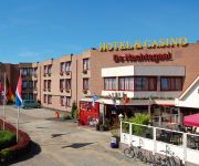
Looking for a place to stay? we compiled a list of available hotels close to the map centre further down the page.
When in this area, you might want to pay a visit to some of the following locations: Haarlem, Heemskerk, Amsterdam, Heiloo and The Hague. To further explore this place, just scroll down and browse the available info.
Local weather forecast
Todays Local Weather Conditions & Forecast: 6°C / 44 °F
| Morning Temperature | 6°C / 43 °F |
| Evening Temperature | 7°C / 45 °F |
| Night Temperature | 7°C / 45 °F |
| Chance of rainfall | 14% |
| Air Humidity | 64% |
| Air Pressure | 1000 hPa |
| Wind Speed | High wind, near gale with 24 km/h (15 mph) from East |
| Cloud Conditions | Overcast clouds, covering 97% of sky |
| General Conditions | Moderate rain |
Saturday, 23rd of November 2024
5°C (41 °F)
7°C (45 °F)
Moderate rain, fresh breeze, overcast clouds.
Sunday, 24th of November 2024
12°C (54 °F)
14°C (56 °F)
Moderate rain, fresh breeze, overcast clouds.
Monday, 25th of November 2024
12°C (53 °F)
10°C (50 °F)
Light rain, strong breeze, overcast clouds.
Hotels and Places to Stay
De Nachtegaal
Boutique Suites Lisse - Schiphol
Van der Valk Hotel Sassenheim-Leiden
Van der Valk Hotel Haarlem
Flora Entrance: Floraplein
Orion
Videos from this area
These are videos related to the place based on their proximity to this place.
Crazy Cart Paintball City Hillegom
John had his birthday and he won tickets through CrazyKarts.eu for 4 people to have a couple of rounds at Paintball City. I was invited and so was my wifey. We had the time of our lives! Happy...
Bloemencorso 2012 Hillegom Flower Parade 2012 in The Netherlands Hillegom
Bloemencorso 2012 in Hillegom, Flower parade 2012 in the city of Hillegom the center of the bulb area in The Netherlands, 20 minutes from Schiphol.
Woonboot zinkt op de Vosselaan in Hillegom 11-01-2015
Hillegom, 11 januari 2015 - Vanochtend vroeg omstreeks kwart over twee werd de brandweer post Hillegom met spoed gealarmeerd voor een lek / zinken woonboot op de Vosselaan in Hillegom welk...
Welkom bij Skicentrum Hillegom
In deze video geeft Erik du Pre, eigenaar van Skicentrum Hillegom, een rondleiding door zijn indoorbaan. Veel gestelde vragen van cursisten komen hier aan bod. Bijvoorbeeld de temperatuur in...
Samenvatting SV Hillegom 2 tegen Van Nispen
Ik heb deze video gemaakt met het videobewerkingsprogramma van YouTube (http://www.youtube.com/editor)
Ajax F2 op SV Hillegom Jeugdtoernooi 2014
AFC Ajax F2 te gast bij SV Hillegom Jeugdtoernooi april 2014.
Zeer Grote Brand schuur Hillegom
Hillegom – in de nacht van vrijdag op zaterdag 7 februari zijn de hulpdiensten even voor 12 uur gealarmeerd voor een brand aan de Oude Weerlaan in Hillegom. Bij aankomst bleek het om een...
Smartlappen Festival Hillegom Monique Smit en kids
Monique Smit nodigt kinderen uit op het podium op het Smartlappen Festival 2011 in Hillegom.
Oud en Nieuw Hillegom 1911 polygoon journaal
Unieke beelden van oud en nieuw in Hillegom. EIgen gemaakte illegale vuurwerkbommen. Laat de pelici dit maar niet zien.
Videos provided by Youtube are under the copyright of their owners.
Attractions and noteworthy things
Distances are based on the centre of the city/town and sightseeing location. This list contains brief abstracts about monuments, holiday activities, national parcs, museums, organisations and more from the area as well as interesting facts about the region itself. Where available, you'll find the corresponding homepage. Otherwise the related wikipedia article.
Sassenheim
Sassenheim is also the German name for Sanem, Luxembourg. Sassenheim Coat of arms of Sassenheim Location of Sassenheim Coordinates: {{#invoke:Coordinates|coord}}{{#coordinates:52|13|33|N|4|31|21|E|type:city_region:NL | |name= }} Country Netherlands Province Zuid-Holland Municipality Teylingen Population (2005) 14.906 Sassenheim is a town and former municipality in the western Netherlands, in the province of South Holland.
Nieuw-Vennep
Nieuw-Vennep is a town in the Dutch province of North Holland. It is a part of the municipality of Haarlemmermeer, and lies about 10 km southwest of Amsterdam Airport Schiphol. In 2006 it had about 30,000 inhabitants. The built-up area of the town was 3.71 km, and contained 7,513 residences. The wider statistical area of Nieuw-Vennep has a population of around 40,000. In 2001, the town of Nieuw-Vennep had 17,886 inhabitants.
Ringvaart
The Ringvaart (known in full as Ringvaart of the Haarlemmermeer Polder) is a canal in the province of North Holland, the Netherlands. The Ringvaart (Dutch meaning "ring canal") is a true circular canal surrounding the Haarlemmermeer polder and forms the boundary of the Haarlemmermeer municipality. Ringvaart is also the name of the dike bordering the canal. Construction of the canal began in 1839 as the first step to reclaim land from Haarlemmermeer (Dutch for Haarlem's Lake).
Keukenhof
Keukenhof, also known as the Garden of Europe, is the world's largest flower garden. It is situated near Lisse, Netherlands. According to the official website for the Keukenhof Park, approximately 7,000,000 (seven million) flower bulbs are planted annually in the park, which covers an area of 32 hectares. Keukenhof is located in South Holland in the small town of Lisse, south of Haarlem and southwest of Amsterdam. It is accessible by bus from the train stations of Haarlem, Leiden and Schiphol.
Rijpwetering
Rijpwetering is a town in the Dutch province of South Holland. It is a part of the municipality of Kaag en Braassem, and lies about 8 kilometres east of Leiden. In 2001, the town of Rijpwetering had 913 inhabitants. The built-up area of the town was 0.12 km², and contained 340 residences. The larger statistical area of Rijpwetering has a population of around 1440.
Navigable aqueduct
Navigable aqueducts (sometimes called water bridges) are bridge structures that carry navigable waterway canals over other rivers, valleys, railways or roads. They are primarily distinguished by their size, carrying a larger cross-section of water than most water-supply aqueducts. Although Roman aqueducts were sometimes used for transport, aqueducts were not generally used until the 17th century when the problems of summit level canals had been solved and modern canal systems started to appear.
Kaag
De Kaag is a village in the Dutch province of South Holland. It is a part of the municipality of Kaag en Braassem, and lies about 8 km northeast of Leiden. De Kaag lies on an island, Kagereiland, in a lake system called the Kaag Lakes. To reach De Kaag, a ferry is taken from Buitenkaag. De Kaag is also part of an area called the Duin- en Bollenstreek ("Dune and Bulb Region").
Berkenrode
Berkenrode, or Berckenroode is a former 'Heerlijkheid' in the Dutch province of North Holland, situated on the southwest side of Haarlem on the leidsevaart, north of Iepenrode and west of Heemstede. The original castle Berkenrode in the center of the moat was burned by the Spanish during the siege of Haarlem in 1572.
Zuidschalkwijk
Zuidschalkwijk was a hamlet in the northwestern Netherlands. It has been annexed by the city of Haarlem and is located about 4 km south of the city centre. Zuidschalkwijk was a separate municipality between 1817 and 1863, when it was merged with Haarlemmerliede en Spaarnwoude. On October 1, 1963 Zuidschalkwijk was transferred to Haarlem and became part of the Schalkwijk neighbourhood.
Groenendaal Park
Groenendaal park lies at the center of Heemstede, Netherlands. The park includes the grounds of old Heemstede country estates Bosbeek, and Meer en Berg. Along its western borders are the old Heemstede country estates Hartekamp, Huis te Manpad, and Iepenrode. On the eastern boundary is the city cemetery.
Slot Heemstede
Slot Heemstede is the site of the old castle of Heemstede. The property is situated at the site of the former castle 'Heerlijkheid Heemstede', or 'Huis te Heemstede', at a strategic position on mouth of the Spaarne river on the Haarlem lake (since 1853 pumped dry and called the Haarlemmermeer polder).
Hartekamp
Hartekamp, or Hartecamp, is the name of a villa in Heemstede, the Netherlands, on the Bennebroek border. It was once the summer home of George Clifford, who employed Linnaeus in 1737 to write his Hortus Cliffortianus, a detailed description of the gardens of Hartecamp.
De Naald, Heemstede
De Naald (the Needle) is a monument in Heemstede, the Netherlands, erected in 1817 by the city council to commemorate two battles on the Manpad road running next to the site. The site is at the corner of the Manpad, and Herenweg, on property belonging to the estate 'Huis te Manpad'.
Leidsevaart
The Leidsevaart (also known as Leidse trekvaart, Dutch for "Leiden's Pull-Canal") is a canal between the cities of Haarlem and Leiden in the Netherlands. It was dug in 1657, making it one of the oldest canals in the Netherlands. It was the major means of transport between Leiden and Haarlem for almost two centuries until the rail connection was established in the 19th century. The original stops along the railroad mirrored the toll bridges of the canal.
Museum De Cruquius
The Museum De Cruquius (or Cruquiusmuseum) occupies the old Cruquius steam pumping station in Cruquius, the Netherlands. It derives its name from Nicolaas Kruik (1678–1754), a Dutch land-surveyor and one of many promotors of a plan to pump the Haarlemmermeer (Haarlem lake) dry. Like many well-educated men of his time, he latinized his name to Nicolaus Samuel Cruquius.
De Vennip
De Vennip is a former municipality in the Dutch province of South Holland. It consisted of a small area of land east of Hillegom, and a large part of the Haarlemmermeer lake, including the island of Beinsdorp (which is now the name of a village in the Haarlemmermeer polder). According to the 19th century historian A.J. van der Aa, De Vennip used to be a manor, and was first mentioned in 1334.
Kagerplassen
The Kagerplassen (a Dutch term meaning "the Kaag Lakes") is a small lake system in South Holland located to the northeast of Leiden. The Kaag Lakes are a popular area for boating, watersports, fishing, camping and walking. Windmills, waterfront pasture land (weilanden) with grazing animals, quaint Dutch boats and buildings and (in season) flower fields are all part of the charm of boating and walking in this area. The Kaag Lakes are part of two municipalities: Kaag en Braassem and Teylingen.
Huis te Manpad
The Huis te Manpad, Heemstede is an historical villa and former summer home of Jacob van Lennep, bordered by the Leidsevaart, the Manpadslaan, and the Herenweg. It neighbors the estate of Hartekamp, famed for the gardens described by Linnaeus. Both estates still have trees and other flora dating from that period. The Haarlem archives have material about the estate dating back to 1558. The current main building dates from 1630.
Slot Teylingen
Slot Teylingen is a Dutch castle in the municipality of Teylingen, in Voorhout, near the border with Sassenheim. It is presumably the family keep of the noble family Van Teylingen, from which the Van Brederode family directly descended from. The castle was originally built to protect the north-south route in Hollandic territory. Later it became a forester's castle for the forestry of the counts of Holland, starting with William IV, count of Holland.
Het Kareol
Het Kareol is a large apartment complex on the Van Lennepweg in Aerdenhout.
Huigsloot
Huigsloot is a hamlet in the Dutch municipality of Haarlemmermeer, in the province of North Holland. It is located on the southeast of a polder, on Ringvaart, between Buitenkaag and Vredeburg. Before the creation of the polder of Haarlemmermeer, Huigsloot formed an isthmus in the lake. This isthmus was cut off from the nearby land by the construction of a canal in Ringvaart, which also formed a parcel of former land into a polder.
Huys Dever
The Huys Dever is a small castle in Lisse, Netherlands. It was probably built shortly after 1375 by Reinier Dever or d'Ever, a member of an old noble family from Holland.
Castlefest
Castlefest is a medieval/fantasy festival in the Netherlands, held in the first weekend of August in the gardens of Castle Keukenhof in Lisse since 2005. The festival takes part during 3 days on Friday, Saturday and Sunday with an opening concert on Thursday (since 2011). During the first edition 3,500 visitors attended the event, in 2007 the festival attracted 16,000 visitors and in 2011 more than 24,000 visitors entered the gates of Castlefest.
Iepenrode
Iepenrode, or Ipenrode, is the name of a villa in Heemstede, the Netherlands, between the Leidsevaart and Herenweg, located north of Huis te Manpad and south of Berkenrode. It was once the summer home of various mayors (burgemeesters) of Haarlem and is currently privately owned.
Arnoud, Hillegom
Arnoud was a small township in the Dutch province of South Holland. The township was located between Hillegom and Lisse. It consisted of a single street (Arnoudstraat) and was developed as part of the creation of De Arnoud factory in 1904. Over time the factory expanded and the houses on Arnoudstraat had to be torn down. The area of Arnoud is now called Hillegom-Zuid and is an industrial area with no inhabitants.


