Safety Score: 3,3 of 5.0 based on data from 9 authorites. Meaning please reconsider your need to travel to Netherlands.
Travel warnings are updated daily. Source: Travel Warning Netherlands. Last Update: 2024-08-13 08:21:03
Delve into Malta
The district Malta of Zierikzee in Schouwen-Duiveland (Provincie Zeeland) with it's 1,545 habitants Malta is a district located in Netherlands about 64 mi south-west of Amsterdam, the country's capital town.
In need of a room? We compiled a list of available hotels close to the map centre further down the page.
Since you are here already, you might want to pay a visit to some of the following locations: Middelburg, Sint-Niklaas, The Hague, Eeklo and Dendermonde. To further explore this place, just scroll down and browse the available info.
Local weather forecast
Todays Local Weather Conditions & Forecast: 6°C / 43 °F
| Morning Temperature | 5°C / 40 °F |
| Evening Temperature | 6°C / 43 °F |
| Night Temperature | 5°C / 40 °F |
| Chance of rainfall | 6% |
| Air Humidity | 66% |
| Air Pressure | 1003 hPa |
| Wind Speed | Fresh Breeze with 16 km/h (10 mph) from East |
| Cloud Conditions | Overcast clouds, covering 95% of sky |
| General Conditions | Rain and snow |
Saturday, 23rd of November 2024
5°C (41 °F)
9°C (47 °F)
Moderate rain, strong breeze, overcast clouds.
Sunday, 24th of November 2024
14°C (57 °F)
15°C (60 °F)
Light rain, strong breeze, overcast clouds.
Monday, 25th of November 2024
10°C (51 °F)
9°C (48 °F)
Moderate rain, strong breeze, overcast clouds.
Hotels and Places to Stay
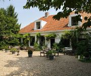
Hampshire Hotel Hostellerie Schuddebeurs
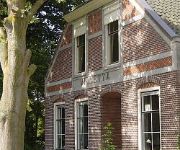
B&B Villetta
Videos from this area
These are videos related to the place based on their proximity to this place.
Fish 'n Chips 'n Holland
Rene Konings has been a much-appreciated bus driver for our tours for about 15 years. And for three days, I enjoyed the luxury of having Rene as my personal driver through the Netherlands....
Alert! N59
Uitzending omroep Zeeland omtrend geluidsoverlast van de N59, in de wijk Malta te zierikzee.
Officiële opening Nieuwe Kerk Zierikzee
Op woensdag 9 april 2014 opende Mr. Pieter van Vollenhove de Nieuwe Kerk in Zierikzee. Duur: 3 minuten.
De Poortwachter van Zierikzee
We gaan terug naar Zierikzee in het jaar 1813. Nederland behoort bij Franse keizerreijk en de Fransen gedragen zich als heer en meester in de stad. Dat laat het volk van de stad Zierikzee niet...
Videos provided by Youtube are under the copyright of their owners.
Attractions and noteworthy things
Distances are based on the centre of the city/town and sightseeing location. This list contains brief abstracts about monuments, holiday activities, national parcs, museums, organisations and more from the area as well as interesting facts about the region itself. Where available, you'll find the corresponding homepage. Otherwise the related wikipedia article.
Oosterschelde
The Oosterschelde (Eastern Scheldt) is an estuary in Zeeland, Netherlands, between Schouwen-Duiveland and Tholen on the north and Noord-Beveland and Zuid-Beveland on the south. Is is also the largest national park in the Netherlands, founded in 2002.
Grevelingen
Grevelingen or Grevelingenmeer is a former Rhine-Meuse estuary on the border of the Dutch provinces of South Holland and Zeeland that has become a lake due to the Delta Works. It is situated between the former islands of Goeree-Overflakkee (South Holland) and Schouwen-Duiveland (Zeeland) which are connected by the Brouwersdam on the west and the Grevelingendam on the east. Connexxion bus service 104 crosses the Brouwersdam, bus service 133 (and others) the Grevelingendam.
Zeeland Bridge
The Zeeland Bridge is the longest bridge in the Netherlands. The bridge spans the Oosterschelde estuary. It connects the islands of Schouwen-Duiveland and Noord-Beveland in the province of Zeeland. The Zeeland Bridge was built between 1963 and 1965. At the time of its completion, it was the longest bridge of Europe. It has a total length of 5,022 metres, and consists of 48 spans of 95 metres, 2 spans of 72.5 metres and a movable bridge with a width of 40 metres.
CyberBunker
CyberBunker is a Dutch company that, according to its website, hosts "services to any Web site 'except child pornography and anything related to terrorism'". It served as a host for both The pirate bay and as one of the many Wikileaks mirrors. It also allegedly hosts spam sites. The company is named for the place it was once housed in, a former Cold War bunker. The bunker had been built in 1955 just outside the small town of Kloetinge in the south of the Netherlands.
Ouwerkerk
Ouwerkerk is a town in the Dutch province of Zeeland. It is a part of the municipality of Schouwen-Duiveland, and lies about 26 km south of Hellevoetsluis. Ouwerkerk has also been known as Overkirk in British English, and as Auverquerque in French. Ouwerkerk was a separate municipality until 1961, when it was merged with Duiveland. In 2001, the town of Ouwerkerk had 454 inhabitants. The built-up area of the town was 0.15 km², and contained 202 residences.
Kattendijke
Kattendijke is a village in the Dutch province of Zeeland. It is located in the municipality of Goes on the Oosterschelde about 5 km northeast of the city of Goes. Until 1970, Kattendijke was a separate municipality. The municipality also covered the village of Wilhelminadorp.
Bommenede
Bommenede or Bommenee is a former island, village, and municipality in the Netherlands, located about 5 km east of the city of Brouwershaven.
Capelle en Botland
Capelle en Botland is a short-lived municipality in the Dutch province of Zeeland. It existed until 1813, when it was annexed by the municipality of Nieuwerkerk. The municipality covered the hamlet of Capelle, with a few scattered farms around it; an area with a population of 140 around 1850.,
Kapelle, Schouwen-Duiveland
Kapelle (formerly Capelle) is a hamlet in the Dutch province of Zeeland. It is located on the island of Schouwen-Duiveland, about 2 km west of Nieuwerkerk. Until 1813, the hamlet was part of the separate municipality of Capelle en Botland. In 1953, Capelle had grown into a small village, with about 20 houses and a population of around 100, when it was almost completely destroyed in the North Sea flood of 1953. All houses except two were swept away, and 42 inhabitants died.
Duivendijke
Duivendijke is a former village in the Dutch province of Zeeland. It was located about 2 km southwest of Brouwershaven on the island of Schouwen-Duiveland. The village had a church, which was demolished before the middle of the 18th century. The first bishop of Leeuwarden, Cunerus Petri, was born in Duivendijke around 1530. , Until 1961, Duivendijke was the name of a separate municipality, that also covered the hamlets Klaaskinderenkerke, Brijdorpe and Looperskapelle.
Duiveland
Duiveland is the name of a former island and a former municipality in the Dutch province of Zeeland. The island of Duiveland was joined to Schouwen in 1610, forming the island of Schouwen-Duiveland. It is the eastern part of the current island. The municipality of Duiveland was created in 1961 from the former municipalities of Nieuwerkerk, Ouwerkerk, and Oosterland. In 1997, it merged into the new municipality of Schouwen-Duiveland.
's-Heer Hendrikskinderen
's-Heer Hendrikskinderen is a village in the Dutch province of Zeeland. It is located in the municipality of Goes, about 2 km to the west of the city of Goes. 's-Heer Hendrikskinderen was a separate municipality until 1857.
Kloetinge
Kloetinge is a village in the Dutch province of Zeeland. It is located in the municipality of Goes, on the eastern side of the city. Kloetinge was a separate municipality until 1970, when it was merged with Goes. \t\t \t\t\tKloetinge, Geerteskerk foto2 2009-09-25 15.25. JPG \t\t\t Gertrudis church, front (west) \t\t\t \t\t \t\t \t\t\tGeerteskerk Kloetinge2. JPG \t\t\t Gertrudis church \t\t\t \t\t \t\t \t\t\tKloetingseMolen. JPG \t\t\t The Kloetinge windmill
Klaaskinderenkerke
Klaaskinderenkerke is a former village in the Dutch province of Zeeland. The polder Klaaskinderen was flooded on December 14, 1511, and was never reclaimed again. The church of Klaaskinderenkerke disappeared in this flood, and in the 19th century, only a small hamlet was left. The hamlet has now disappeared from the maps. It was located east of the village of Scharendijke. Klaaskinderenkerke was a separate municipality until 1813, when it was merged with Duivendijke.
Middenschouwen
Middenschouwen is a former municipality in the Dutch province of Zeeland. It covered the central part of the island of Schouwen-Duiveland. Middenschouwen was created in a merger of Duivendijke, Elkerzee, Ellemeet and Kerkwerve in 1961. It existed until 1997, when it was merged into the new municipality of Schouwen-Duiveland.
Rengerskerke en Zuidland
Rengerskerke en Zuidland is a former municipality in the Dutch province of Zeeland. It existed until 1813, when it was merged with Kerkwerve. The municipality consisted of two domains, Rengerskerke and Zuidland. Rengerskerke used to be a village about 3 km northwest of Zierikzee, until it was destroyed by a flood in 1662. Zuidland was a polder with a number of villages: Simonskerke, Zuidkerke, Brieskerke, Sint Jacobskerke and the hamlet of 's Heer-Arentshaven.
Wemeldinge
Wemeldinge is a village in the Dutch province of Zeeland. It is located in the municipality of Kapelle, about 4 km northwest of Yerseke. Wemeldinge was a separate municipality until 1970, when it was merged with Kapelle.
Relief of Goes
In August 1572, during the course of the Eighty Years' War, the city of Goes, in the Spanish Netherlands, was besieged by Dutch forces with the support of English troops sent by Queen Elizabeth I. This was a menace to the safety of the nearby city of Middelburg, also under siege.
Den Osse
Den Osse is a village in the municipality of Schouwen-Duiveland, in Zeeland, Netherlands.
Dumbarton House School
Dumbarton House School was a co-educational independent school located in Swansea, Wales in south Wales. The school opened in 1923 and closed in 1993. The buildings were demolished to make way for a new block of flats.
Battle of Zierikzee
The battle of Zierikzee was a naval battle between a Flemish fleet and an allied Franco-Hollandic fleet which took place on 10 and 11 August 1304. The battle, fought near the town of Zierikzee, ended in a Franco-Holland victory. The battle is part of a larger conflict between the Count of Flanders and his French feudal lord, King Philip IV of France (1296–1305). {{#invoke: Navbox | navbox }}
Dorpskerk, Ouddorp
The Dorpskerk of Ouddorp is completed in 1348 and situated in the towns centre. The tower is completed in 1508. The 1,160 seats church is still in use by the Restored Reformed Church. Originally it was a Roman Catholic church. During the Reformation it became a Protestant church. In 2010, the church was transferred from the Dutch Reformed Church to the Restored Reformed Church.
Wilhelminadorp, Goes
Wilhelminadorp is a small village in the Dutch province of Zeeland. It is located in the municipality of Goes. Wilhelminadorp was founded in 1812, when the Wilhelminapolder was diked. Originally the polder was named Lodewijkspolder, after then King of Holland Louis Bonaparte who had given the permit to start work. With the restoration of the House of Orange, the name was quickly changed. The polder was now named after Wilhelmina of Prussia, wife of William I of the Netherlands.
't Veerhuis
Restaurant 't Veerhuis is a former restaurant in Wolphaartsdijk, Netherlands. It was a fine dining restaurant that was awarded one Michelin star in the periods 1975-1988 and 2008-2009. In the first star period, owner and head chef was Fred van Mierlo. In the second star period, the restaurant was run by Marianne and Co Simmers. They decided to move the restaurant to Goes. That went wrong and the restaurant, renamed "Simmers & Co", closed down after a year in business.
Sint-Lievensmonstertoren
The Sint-Lievensmonstertoren, also known as the Dikke Toren (or Fat Tower) is a 62 metre tall, unfinished, free standing church tower in Zierikzee, Netherlands. The accompanying church was destroyed by a fire in 1832.


