Safety Score: 3,3 of 5.0 based on data from 9 authorites. Meaning please reconsider your need to travel to Netherlands.
Travel warnings are updated daily. Source: Travel Warning Netherlands. Last Update: 2024-08-13 08:21:03
Discover Westerzicht
The district Westerzicht of West-Souburg in Gemeente Vlissingen (Provincie Zeeland) with it's 1,595 citizens Westerzicht is a district in Netherlands about 84 mi south-west of Amsterdam, the country's capital city.
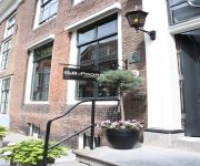
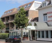
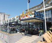
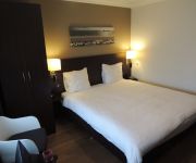
Looking for a place to stay? we compiled a list of available hotels close to the map centre further down the page.
When in this area, you might want to pay a visit to some of the following locations: Middelburg, Eeklo, Tielt, Oudenaarde and Sint-Niklaas. To further explore this place, just scroll down and browse the available info.
Local weather forecast
Todays Local Weather Conditions & Forecast: 8°C / 46 °F
| Morning Temperature | 7°C / 45 °F |
| Evening Temperature | 8°C / 46 °F |
| Night Temperature | 6°C / 43 °F |
| Chance of rainfall | 0% |
| Air Humidity | 71% |
| Air Pressure | 1027 hPa |
| Wind Speed | Moderate breeze with 9 km/h (6 mph) from North |
| Cloud Conditions | Overcast clouds, covering 97% of sky |
| General Conditions | Light rain |
Thursday, 5th of December 2024
7°C (45 °F)
10°C (50 °F)
Moderate rain, strong breeze, overcast clouds.
Friday, 6th of December 2024
9°C (49 °F)
9°C (49 °F)
Moderate rain, strong breeze, overcast clouds.
Saturday, 7th of December 2024
8°C (46 °F)
7°C (44 °F)
Light rain, gale, overcast clouds.
Hotels and Places to Stay
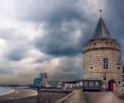
De Gevangentoren Suite
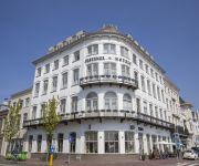
Fletcher Hotel Restaurant Middelburg
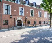
Boutiquehotel The Roosevelt
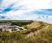
Golden Tulip Strandhotel Westduin
Van der Valk Hotel Middelburg
B&B 't Poorthuys
Piccard
Amadore Hotel Restaurant Arion
Amadore Hotel Restaurant Arneville
Loskade 45
Videos from this area
These are videos related to the place based on their proximity to this place.
A Trip To Sealand Holland
We travled to Sealand in Holland. Enjoy :) Give it a thumbs up if you want me to continue this sort of content :) Previous Video: https://www.youtube.com/watch?v=ZnsGAJwzgWc http://www.daanjord...
Vlissingen In One Minute
Vlissingen is a small coastal town in the province of Zeeland in the Netherlands with around 33000 inhabitants. The old city center has parks, 300 monuments, two yachting harbors and an annual...
Introduction GlobeSoap
We are a Student Company named Globe Soap. We make our own soap to sell, a part of the profit will be donated to Busoga Trust! Check our Facebook for exact dates, when we will be in your city!...
International Program Budi Luhur University
IBMS students 2nd batch study trip to HZ University Netherland.
DVS Marchingband Taptoe Zeeland 2013
De Marchingband van DVS Katwijk met 2 shows op Taptoe Zeeland De show Musical Fantasy en de WMC show Rapsody in Green In de finale het nummer I Vow to Thee My Country gespeeld door de ...
Sea Youth Dag 5
De 5e dag was een drukke dag voor de Jongerenjury: wel 4 films stonden op het programma!
Videos provided by Youtube are under the copyright of their owners.
Attractions and noteworthy things
Distances are based on the centre of the city/town and sightseeing location. This list contains brief abstracts about monuments, holiday activities, national parcs, museums, organisations and more from the area as well as interesting facts about the region itself. Where available, you'll find the corresponding homepage. Otherwise the related wikipedia article.
Scheldt
The Scheldt (French Escaut) is a 350 km long river in northern France, western Belgium and the southwestern part of the Netherlands. Its name is derived from an adjective corresponding to Old English sceald "shallow", Modern English shoal, Low German schol, Frisian skol, and Swedish skäll "thin".
Walcheren
' is a former island in the province of Zeeland in the Netherlands at the mouth of the Scheldt estuary. It lies between the Oosterschelde in the north and the Westerschelde in the south and is roughly the shape of a rhombus. The two sides facing the North Sea consist of dunes; the rest of its coastline is made up of dykes. Middelburg lies at its centre; this city is the provincial capital and Vlissingen 9 km to the south is the main harbour. The third municipality is Veere.
Breskens
Breskens is a harbour town on the Westerschelde in the municipality of Sluis in the province of Zeeland, in the south-western Netherlands. Its population is 4,809. The town is noted for the Visserijfeesten (Fishery Festival), the largest festival in Zeeland. A ferry connection exists between Breskens and Vlissingen. After the opening of the Westerschelde tunnel near Terneuzen in 2003, the ferry now only carries pedestrian and bicycle traffic.
Canal through Walcheren
The Canal through Walcheren in the Netherlands crosses the east of Walcheren. It connects the Westerschelde and the Oosterschelde. The railroad entering Walcheren from the east does not cross this canal, but bends south and runs along it.
Bouches-de-l'Escaut
Bouches-de-l'Escaut (Dutch: Monden van de Schelde) is the name of a département of the First French Empire in the present Netherlands. It is named after the mouth of the river Scheldt (Escaut in French). It was formed in 1810, when the Kingdom of Holland was annexed by France. Its territory corresponds with the present Dutch province Zeeland, minus Zeeuws-Vlaanderen, which was part of the département de l'Escaut. Its capital was Middelburg.
Oost-Souburg
Oost-Souburg is a town in the municipality of Flushing, Netherlands. Oost-Souburg was a separate municipality until 1836, when it merged with West-Souburg to create the new municipality of Oost- en West-Souburg. --- File:StaatslijnF.
Battle of Flushing
The Battle of Flushing was a naval battle of the Eighty Years' War, fought on April 17, 1573 near the city of Flushing, Netherlands. The Spanish fleet was led by Sancho d'Avila, the Dutch fleet by Lieven Keersmaker. The Dutch fleet initially left Flushing, but returned when the Spanish fleet was hit by the city's cannons. Five Spanish ships were seized, but the remainder managed to reach the cities of Middelburg and Arnemuiden.
Brigdamme
Brigdamme is a former hamlet and municipality in the Dutch province of Zeeland. It was a separate municipality until it merged into Sint Laurens in 1816. The hamlet was located south of the village of Sint Laurens, on the road to Middelburg. The hamlet is no longer named on the newest topographical map of the area,. According to the 18th century historian A.J. van der Aa, there was an ancient chapel in Brigdamme, dedicated to Saint Brigitta.
Buttinge en Zandvoort
Buttinge en Zandvoort is a former municipality in the Dutch province of Zeeland, which existed until 1816. In that year, it was made a part of the municipality of Grijpskerke, and it is now part of the municipality of Veere. The only recorded village in the municipality was Buttinge. Zandvoort was a former hamlet between Buttinge and Middelburg. It may have been a larger village in medieval times, but around the middle of the 19th century, there was only a population of about 50 left.
Hoogelande
Hoogelande is a small hamlet in the Dutch province of Zeeland. It is located in the municipality of Veere, about 4 km northwest of Middelburg. Hoogelande was a separate municipality until 1816, when it was annexed by Grijpskerke.
Mariekerke, Netherlands
Mariekerke is a former municipality in the Dutch province of Zeeland. The municipality was formed in a merger of Aagtekerke, Grijpskerke and Meliskerke in 1966, and existed until 1997 when it merged into the municipality of Veere. The municipality was named after the former village of Mariekerke, which is now a hamlet named Klein Mariekerke.
Nieuw- en Sint Joosland
Nieuw- en Sint Joosland is a village in the Dutch province of Zeeland. It is located in the municipality of Middelburg, about 3 km southwest of that city. Nieuw- en Sint Joosland was a separate municipality between 1816 and 1966. It was created in a merger of Nieuwland and Sint Joosland.
Nieuwland, Zeeland
Nieuwland is a former municipality in the Dutch province of Zeeland. It existed until 1816, when it was merged with Sint Joosland to form the new municipality of Nieuw- en Sint Joosland. Nieuwland is also the former name of the current village of Nieuw- en Sint Joosland.
Ritthem
Ritthem is a village in the Dutch province of Zeeland. It is located in the municipality of Vlissingen, about 4 kilometres east of the city. Ritthem was a separate municipality until 1966, when it was merged with Vlissingen.
Sint Joosland
Sint Joosland is a former municipality in the Dutch province of Zeeland. It existed until 1816, when it was merged with Nieuwland to form the new municipality of Nieuw- en Sint Joosland. The municipality consisted of a single polder southeast of the current village of Nieuw- en Sint Joosland.
Sint Laurens
Sint Laurens is a village in the Dutch province of Zeeland. It is located in the municipality of Middelburg, about 3 km north of the city. Sint Laurens was a separate municipality until 1966, when it was merged with Middelburg.
Valkenisse, Walcheren
Valkenisse is a former municipality in the Dutch province of Zeeland, on the former island of Walcheren. Valkenisse was created in 1966 in a merger of Biggekerke, Koudekerke and Zoutelande, and existed until 1997, when it was merged into Veere. The municipality was named after the two hamlets Groot-Valkenisse and Klein-Valkenisse.
West-Souburg
West-Souburg is a village in the Dutch province of Zeeland. It is part of the municipality of Vlissingen and now almost completelat surrounded by suburbs of the city of Vlissingen. Once one of the most important settlements on the Zeeland island of Walcheren, West-Souburg is now a very small place that some consider nothing more than a suburb of Vlissingen.
Huis der Boede
Huis der Boede is a country house near Koudekerke in the Dutch province of Zeeland, erected in 1745 for J. van Mandere, burgmaster of Vlissingen. For its design he commissioned the Antwerp architect and sculptor Jan Pieter van Baurscheit the Younger.
Zeeland Library
The Zeeland Library (Zeeuwse Bibliotheek), located at Kousteensedijk 7, Middelburg in the Netherlands, is the official library of the province of Zeeland and is also the official academic library of the Roosevelt Academy.
List of shipwrecks in 1910
The list of shipwrecks in 1910 includes all ships sunk, foundered, grounded, or otherwise lost during 1910.
De Kromme Watergang
De Kromme Watergang is a restaurant located in Slijkplaat, Hoofdplaat in the Netherlands. It is a fine dining restaurant that was awarded one Michelin star in the period 2005-2011. Much to their surprise, they were rewarded two Michelin stars in 2012. GaultMillau awarded the restaurant 18.5 out of 20 points in its guide for 2013. De Kromme Watergang is a member of Les Patrons Cuisiniers.
Oostkerk, Middelburg
The Oostkerk is a Protestant church in Middelburg. The church can be easily spotted on the Middelburg horizon by its characteristic round dome.
Slijkplaat
Slijkplaat is a hamlet in the Dutch province of Zeeland. It is located in the municipality of Sluis. The hamlet exists of two streets (one name) and 28 houses. Restaurant De Kromme Watergang (two Michelin stars) is located in the village.
Het Groot Paradijs
Het Groot Paradijs was a restaurant located in Middelburg, in the Netherlands. It was a fine dining restaurant that was awarded one Michelin star in the period 1996-2002 and 2007. Owner and head chef of Het Groot Paradijs was Ferdie Dolk. In the first star period, 1996-2002, Ron Henderikse was head chef. The restaurant closed down in 2007, with the owners opening a new restaurant in Domburg. The restaurant is housed in a Rijksmonument.


