Safety Score: 3,3 of 5.0 based on data from 9 authorites. Meaning please reconsider your need to travel to Netherlands.
Travel warnings are updated daily. Source: Travel Warning Netherlands. Last Update: 2024-08-13 08:21:03
Explore Randenbroek
The district Randenbroek of Amersfoort in Gemeente Amersfoort (Provincie Utrecht) with it's 7,131 inhabitants Randenbroek is located in Netherlands about 27 mi south-east of Amsterdam, the country's capital.
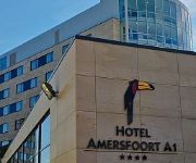
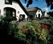
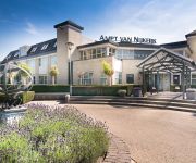
If you need a place to sleep, we compiled a list of available hotels close to the map centre further down the page.
Depending on your travel schedule, you might want to pay a visit to some of the following locations: Utrecht, Lelystad, 's-Hertogenbosch, Arnhem and Amsterdam. To further explore this place, just scroll down and browse the available info.
Local weather forecast
Todays Local Weather Conditions & Forecast: 7°C / 45 °F
| Morning Temperature | 6°C / 43 °F |
| Evening Temperature | 6°C / 42 °F |
| Night Temperature | 3°C / 37 °F |
| Chance of rainfall | 0% |
| Air Humidity | 71% |
| Air Pressure | 1020 hPa |
| Wind Speed | Fresh Breeze with 13 km/h (8 mph) from South |
| Cloud Conditions | Overcast clouds, covering 94% of sky |
| General Conditions | Light rain |
Wednesday, 4th of December 2024
6°C (42 °F)
5°C (40 °F)
Light rain, light breeze, overcast clouds.
Thursday, 5th of December 2024
5°C (41 °F)
8°C (47 °F)
Moderate rain, fresh breeze, overcast clouds.
Friday, 6th of December 2024
9°C (48 °F)
7°C (44 °F)
Heavy intensity rain, fresh breeze, broken clouds.
Hotels and Places to Stay
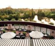
Van der Valk Hotel Leusden Amersfoort
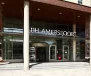
NH Amersfoort
Mercure Hotel Amersfoort Centre
Best Western Amersfoort
Fletcher Hotel Restaurant Amersfoort
Van der Valk Hotel Amersfoort A1
Bilderberg Hotel de Klepperman
Golden Tulip Ampt van Nijkerk
de Tabaksplant Stadhotel
Campanile - Amersfoort
Videos from this area
These are videos related to the place based on their proximity to this place.
Amersfoort (Zo mooi is Amersfoort)
Een stadswandeling door oud Amersfoort. Beginnend bij de Koppelpoort en via het Spui door de Krommestraat naar de binnenstad. Hier zien we de markt op het Hof en de Kamperbinnenpoort. Via de...
Spoorparade wagenwerkplaats Amersfoort ( 175 jaar spoor in 2014 )
Op de wagenwerkplaats in Amersfoort was van 16 t/m 21 oktober 2014 de spoorparade . Dit in verband met de viering van 175 jaar spoor in Nederland . Met een treinparade van de diverse ...
Euro Rails 154 - Jubilea in Amersfoort - Eeklo en Siegen
In deze film hebben we 3 jubilea bezocht die in 2011 plaats vonden. We beginnen op 12 november in Amersfoort, waar het 60-jarig bestaan van de Serie 1200 werd gevierd met de 8 laatste rij of...
de treinparade vanaf een overdekte tribune tijdens de Spoorparade in Amersfoort
de treinparade vanaf een overdekte tribune tijdens de Spoorparade (16-21 oktober 2014 ) in Amersfoort; een spektakel van historische treinen 3 maal per dag (11:00; 13:00 en 15:00 uur)
Museumminuten Aflevering 2: Opvang in Amersfoort
Tentoonstelling 'Belgen op de vlucht' in Museum Flehite.
Fietser zwaar gewond na aanrijding Leusden
LEUSDEN - Op de Heiligenbergerweg in Leusden is dinsdagmorgen een fietser geschept door een automobilist. Een traumahelikopter werd ingezet. Het slachtoffer is ter plaatse gereanimeerd en ...
Videos provided by Youtube are under the copyright of their owners.
Attractions and noteworthy things
Distances are based on the centre of the city/town and sightseeing location. This list contains brief abstracts about monuments, holiday activities, national parcs, museums, organisations and more from the area as well as interesting facts about the region itself. Where available, you'll find the corresponding homepage. Otherwise the related wikipedia article.
Geography of the Netherlands
The geography of the European part of Netherlands is in that much of its land has been reclaimed from the sea and is below sea level, protected by dikes. Another factor that has influenced its physical appearance is that the country is among the most densely populated on Earth. It is ranked 15th overall on that scale, but is behind only three countries having a population over 10 million. Consequently, the Netherlands is highly urbanised.
Nijkerk
Nijkerk is a municipality and a city in the middle of the Netherlands, in the province of Gelderland.
Doorn
Doorn is a town in the municipality of Utrechtse Heuvelrug in the central Netherlands, in the province of Utrecht. On 1 January 2008 the town had 10,052 inhabitants.
Maarn
Maarn is a town in the Dutch province of Utrecht. It is a part of the municipality of Utrechtse Heuvelrug, and is located about 10 km east of Zeist. In 2001, the town of Maarn had 4,071 inhabitants. The built-up area of the town was 1.26 km², and contained 1,793 residences. Until 2006, Maarn was a separate municipality, covering both Maarn and Maarsbergen. Maarn is a small village in the heart of the Utrechtse Heuvelrug, a protected nature reserve in the Netherlands.
Koppelpoort
The Koppelpoort is a medieval gate in the Dutch town Amersfoort. Completed around 1425, the gate combines land- and water-gates, and is part of the second city wall of Amersfoort, which was constructed between 1380 and 1450.
De Glind
De Glind is a small village near Barneveld in the middle of Netherlands, in the province Gelderland. De Glind Digitaal Website
Hooglanderveen
Hooglanderveen is a village in the Dutch province of Utrecht. It is a part of the municipality of Amersfoort, and lies about 4 km northeast of Amersfoort. It is notable for the presence of a large catholic church. Formerly, the village of Hooglanderveen was located outside of the city limits of Amersfoort, but the new residential areas of Nieuwland and Vathorst now mean that Hooglanderveen will be surrounded by the city. In 2001, the town of Hooglanderveen had 1442 inhabitants.
Soestduinen
Soestduinen is a town in the Dutch province of Utrecht. It is a part of the municipality of Soest, and lies about 3 km south of Soest. In 2001, the town of Soestduinen had 113 inhabitants. The built-up area of the town was 0.07 km², and contained 45 residences.
Eembrugge
Eembrugge is a small village on the river Eem, east of Baarn. It received city rights in 1300. Eembrugge is partially in the municipality of Eemnes, partially in Baarn.
Spakenburg
Spakenburg is a Dutch village north of Bunschoten. Spakenburg is formally called Bunschoten-Spakenburg since its fusion with Bunschoten. The village lies south of the IJsselmeer in the municipality Bunschoten, Utrecht. It is one of the few places left in the Netherlands where some women still wear local traditional clothes. In the 20th century, the two villages have grown quickly, and since about 1965 they form one single town, officially named Bunschoten.
Soesterberg Royal Netherlands Air Force Base
Soesterberg Air Base was a Royal Netherlands Air Force military airbase located in Soesterberg, 14 kilometres east-northeast of Utrecht. It was first established as an airfield in 1911, and in 1913, the Dutch Army bought the field and established the Army Aviation Division. For almost 40 years, United States Air Force facilities at Soesterberg, named Camp New Amsterdam was a major front line USAFE airbase during the Cold War.
Grebbe line
The Grebbe Line was a forward defence line of the Dutch Water Line, based on inundation. The Grebbe Line ran from the Grebbeberg in Rhenen northwards until the IJsselmeer.
Dutch Cavalry Museum
The Dutch Cavalry Museum is located in the centre of The Netherlands in the city of Amersfoort. The museum is hosted in two large buildings at the Bernhardkazerne army barracks. The collection contains small objects, like uniforms, firearms, silver, paintings, scale models, etc. , and larger objects, like vehicles, armoured cars, tanks and related equipment, that were or still are in use with the cavalry of the Royal Dutch Army.
Asschat
Asschat is a hamlet in the municipality Leusden, in the Dutch province of Utrecht. The hamlet is separated from the village of Leusden in the west by the Valleikanaal canal, and it borders the hamlet Snorrenhoef in the east. The name Asschat (1696) derives from af-schede, afscheiding: partition, indicating an old border. The family Scholten van Aschat is named after the hamlet.
Nieuwland, Amersfoort
Nieuwland is a district in the Dutch city Amersfoort. The project finished end 2001 when the area with 4500 houses was completed.
The Mondriaan House
The Mondriaan House is a museum in Amersfoort, the Netherlands, in the house where Piet Mondriaan was born in 1872. The museum lies in the historical centre of Amersfoort. The building of the Christian primary school, where the father of Mondriaan was headmaster, has also been incorporated in the museum building. In 1994, the house and the school were opened as a library and documentation centre.
Flehite
Museum Flehite is the historical museum of Amersfoort and Eemland in the Netherlands. The museum was founded in 1880 by the "Oudheidkundige Vereniging Flehite" (Archeological Association Flehite) (1878). In 1890, the museum moved to the first of the current three-part building on the Breestraat (Breestreet). Since 1976, the museum has been managed by a separate organization.
DierenPark Amersfoort
DierenPark Amersfoort is a 10-hectare zoo located on the West side of Amersfoort, in the province of province of Utrecht, on the edge of the bunch area Birkhoven, in the Netherlands.
Utrecht Hill Ridge
Utrecht Hill Ridge is a ridge of low sandhills that stretches in a direction from southeast to northwest over the Dutch province of Utrecht and over a part of North Holland. The total length of the region is about 50 km. It covers an area of approximately 23.000 ha. The part of the ridge in North Holland is commonly called “Het Gooi”. On the southeastern side the ridge rises sharply from the valley of the Nederrijn (“Lower Rhine”).
Intres B.V
Intres B.V. (International Retail Support) is a Dutch retail organisation, established in Hoevelaken. The company provides various services to owners of shops and is franchisor of such brands as Intersport, Livera and Libris. Intres B.V. is 100th in the list of Dutch companies in terms of income and number of employees for 2005 and 2006. The activities of Intres can be divided into four divisions: Fashion, Living, Intersport Netherlands and Media.
Militaire Luchtvaart Museum
The Militaire Luchtvaart Museum is located at Kamp van Zeist near the former Soesterberg Airforce base. It is the official museum of the Royal Netherlands Air Force. During 2006 it was decided by the Ministry of Defence to merge three military museums in the Netherlands into one Defence Museum, to be located at the former Soesterberg Airforce base. Delivery of the new museum is foreseen for late 2012.
Heiligenberg (Leusden)
The Heiligenberg is an estate near the Dutch town of Leusden. The estate is located on a 12 meter high hill, the "Heiligenberg" (Holy Mountain), which dates from the last ice age, about 10,000 years ago. On this hill, then known as Hohorst, bishop Ansfridus of Utrecht founded a small abbey around the year 1000. The abbey was moved to the city of Utrecht around 1030, but the Heiligenberg remained in their possession until 1592. In 1637, the house became an estate.
Tresoar
Tresoar (Friesian for "treasure") is the short name for the Frysk Histoarysk en Letterkundich Sintrum ("Friesian History and Literature Center") in Leeuwarden. Tresoar manages digital archives about Friesland and its literature. There is a study room open to the public, and most catalogs are online and free to access.
Mariënhof
Mariënhof was a restaurant located in Amersfoort, in the Netherlands. It was a fine dining restaurant that was awarded one Michelin star in the period 1996-2001. Head chef of Mariënhof was Jon Sistermans. The restaurant ended due to the transfer of ownership of the former monastery from insurance company "Amersfoortse Verzekeringen" to the "Van den Tweel Horeca Groep". The new owners changed course and wanted the restaurant to leave the fine dining and move into a lower class.
De Saffraan
De Saffraan is a restaurant located in Amersfoort in the Netherlands. It is a fine dining restaurant that was awarded one Michelin star in the period 2010–present. GaultMillau awarded the restaurant 15 out of 20 points. Owner and head chef of De Saffraan is Kars van Wechem. The restaurant is located in a 100 year old clipper named "Hoop op Welvaart", which is moored at at quay of Kleine Koppel in Amersfoort. The clipper is completely renovated and adjusted to its role as restaurant.


