Safety Score: 3,3 of 5.0 based on data from 9 authorites. Meaning please reconsider your need to travel to Netherlands.
Travel warnings are updated daily. Source: Travel Warning Netherlands. Last Update: 2024-08-13 08:21:03
Delve into Princenhof
The district Princenhof of Bovenkarspel in Gemeente Stede Broec (Provincie Noord-Holland) is a subburb in Netherlands about 26 mi north-east of Amsterdam, the country's capital town.
If you need a hotel, we compiled a list of available hotels close to the map centre further down the page.
While being here, you might want to pay a visit to some of the following locations: Lelystad, Amsterdam, Heiloo, Heemskerk and Utrecht. To further explore this place, just scroll down and browse the available info.
Local weather forecast
Todays Local Weather Conditions & Forecast: 9°C / 48 °F
| Morning Temperature | 8°C / 46 °F |
| Evening Temperature | 8°C / 46 °F |
| Night Temperature | 8°C / 46 °F |
| Chance of rainfall | 4% |
| Air Humidity | 52% |
| Air Pressure | 1011 hPa |
| Wind Speed | Fresh Breeze with 14 km/h (9 mph) from South-East |
| Cloud Conditions | Few clouds, covering 20% of sky |
| General Conditions | Light rain |
Tuesday, 19th of November 2024
4°C (40 °F)
7°C (45 °F)
Heavy intensity rain, high wind, near gale, overcast clouds.
Wednesday, 20th of November 2024
8°C (46 °F)
6°C (44 °F)
Light rain, high wind, near gale, overcast clouds.
Thursday, 21st of November 2024
2°C (35 °F)
7°C (45 °F)
Rain and snow, strong breeze, overcast clouds.
Hotels and Places to Stay
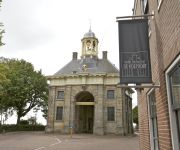
Hotel De Koepoort
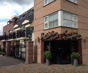
SuyderSee Hotel
Restinn Andijk
Het Wapen van Enkhuizen
Shire Wellness B&B
Du Passage
Restinn Oosterleek
Videos from this area
These are videos related to the place based on their proximity to this place.
Peony weeding - www.peonyshop.com
Peony Nursery & Peony Shop Scholten-Keeman Peony Nursery Scholten-Keeman is a mail order Peony nursery with over 200 Peony varieties, world wide delivery. Peony Shop nowadays solely ...
Aprilia rs 125 gp-1 replica ride
short funride city / open road. everything on the bike is Stock, im not planning to tune it, im planning to sell it before summer and get a bigger bike. some trafficlights / Railroad time...
Het Streekbos van Boven (Bovenkarspel, Noord-Holland, The Netherlands)
Shot with a DJI Phantom 2 Vision+.
Boogie Woogie Voorjaars Cup 2009 Bart en Katinka!
Boogie Woogie Van der Linden Cup 2009 in Grootebroek. Bart en Katinka van Boogie World Amsterdam werden 2e in de klasse Boogie 3.
Simokos H1 vs VCC'92 H1 - vrijdag 1 november 2013
Vrijdag 1 november heeft Heren 1 een wedstrijd gespeeld tegen Simokos Heren 1. Deze wedstrijd is in zijn geheel opgenomen en terug te zien op YouTube.
Krabbie Krab op School! Mijn naam is Haas
This drawing will be used into our webApp Mr. Crab at School!
ICM in Bovenkarspel - Flora.
Sinds kort vind je hier ook Koplopers. Als IC van Enkhuizen naar Amersfoort.
Libra, B_gO & Brandon - Een nieuw begin (Project Nana)
Rapworkshop @ Grootebroek/Bovenkarspel JC Inventas & Project Nana Thema: Nieuwjaar Muziek/Beat: Glenn Milly Deelnemers: Joey Geelen, Vincent Bunschoten en Brandon Gonzalez...
Traumahelikopter Bovenkarspel-Grootebroek
Traumahelikopter stijgt op bij station Bovenkarspel-Grootebroek.
Videos provided by Youtube are under the copyright of their owners.
Attractions and noteworthy things
Distances are based on the centre of the city/town and sightseeing location. This list contains brief abstracts about monuments, holiday activities, national parcs, museums, organisations and more from the area as well as interesting facts about the region itself. Where available, you'll find the corresponding homepage. Otherwise the related wikipedia article.
IJsselmeer
IJsselmeer is a shallow artificial lake of 1100 km² in the central Netherlands bordering the provinces of Flevoland, North Holland and Friesland, with an average depth of 5 to 6 m. The IJsselmeer is the largest lake in Western Europe. The IJsselmeer is a freshwater lake fed through the Ketelmeer by the river IJssel, which gives it its name. It is mainly fed by water from the Rhine since the IJssel is a branch of it.
Zuiderzee
The Zuiderzee was a shallow bay of the North Sea in the northwest of the Netherlands, extending about 100 km (60 miles) inland and at most 50 km (30 miles) wide, with an overall depth of about 4 to 5 metres (13–16 feet) and a coastline of about 300 km (200 miles). It covered 5,000 km . Its name means "southern sea" in Dutch, indicating that the origin of the name can be found in Friesland to the north of the Zuiderzee.
Hoorn
Hoorn is a municipality and a town in the Netherlands, in the province of North Holland. It is located on the IJsselmeer, 35 kilometres north of Amsterdam, and acquired city rights in 1357. Hoorn has 70,196 inhabitants . The area of the municipality is 52.49 km² (32.62 km² consists of water, mainly the Markermeer), and consists of the following villages and/or districts: Blokker, Hoorn, Zwaag, and parts of Bangert and De Hulk.
Venhuizen
' is a town in the north-western Netherlands, in the province of North Holland and the region of West-Frisia, in the municipality of Drechterland. Venhuizen was a separate municipality until 1 January 2006, when it was merged with the existing municipality of Drechterland. It was decided to call the new municipality Drechterland. On a map of the Hollands Noorderkwartier from 1288 is Venhuizen mentioned as Veenhusen. The name could be referring to houses at or in the fen.
Bovenkarspel
Bovenkarspel is a town in the municipality of Stede Broec in the Dutch province of North Holland. Until 1979, it was a separate municipality.
Schellinkhout
Schellinkhout is a very small town located in the municipality of Drechterland, North Holland at the border of the IJsselmeer, about 3 km southeast of Hoorn in West-Frisia. It received city rights in 1402. Schellinkhout was a separate municipality until 1970, when it was merged with Venhuizen. www. geschiedenisschellinkhout. nl
Westwoud
Westwoud is a town in the Netherlands. It is located in the province of North Holland, the region of West Friesland, and the municipality of Drechterland, about 4 km northeast of Hoorn. He received city rights in 1414. It was a separate municipality between 1817 and 1979, when it became a part of Bangert.
Zwaag
Zwaag is a town in the Netherlands. It is located in the municipality of Hoorn, the province of North Holland and the region of West Friesland. On January 1, 2007, Zwaag had 3214 inhabitants.
Martinus College
Martinus College is a secondary school in Grootebroek in the northwest Netherlands. It combines both lower and upper secondary education under the principle of "2 under 1 roof". All forms of secondary education are available, including LWO (leerwegondersteunend onderwijs), Higher General Secondary Education, and gymnasium. The school attracts students from other towns including Andijk, Venhuizen, Wervershoof, Hoogkarspel, Bovenkarspel, Hem, Enkhuizen, Hoorn, and Westwoud.
Zuiderzeemuseum
The Zuiderzeemuseum is a museum located on the Wierdijk in Enkhuizen, Netherlands devoted to preserving Enkhuizen's cultural heritage as well as the maritime history of the Zuiderzee, and since 1932, the IJsselmeer. Open year-round, it consists of an "inside" and an "outside" museum, though the "outside" museum is only open in the summer.
Lutjebroek
Lutjebroek is a village in the Netherlands. It is part of the municipality of Stede Broec. Lutjebroek has a population of just over 2000 people. In colloquial Dutch, Lutjebroek has become synonymous with "any insignificant speck on the map". This is probably due to the comical sound of the name: the Dutch word luttel is akin to the English word "little" and broek is Dutch for "pants". However, broek as used in Lutjebroek and other Dutch geographical names means swamp.
Blokker, North Holland
Blokker is a village in the Netherlands, in the province of North Holland and the region of West-Frisia. It consists of two parts: Westerblokker in the municipality of Hoorn, and Oosterblokker in Drechterland. Until 1979, Blokker was a separate municipality. The village is primarily known in The Netherlands because in 1964 The Beatles gave their two only concerts on Dutch soil there.
Battle on the Zuiderzee
The Battle on the Zuiderzee (October 11, 1573) was a naval battle during the Eighty Years' War in which a Dutch fleet destroyed a larger and better-equipped Spanish fleet on the Zuiderzee.
Grootebroek
Grootebroek is a town in the Dutch province of North Holland. It is located in the municipality of Stede Broec. Grootebroek was a separate municipality until 1979. The town is called Grootebroek after a large swamp in the area; in Dutch, "groote" means "large" and "broek" means "swamp". The most common meaning of "broek" in present-day Dutch is "pants", leading to some hilarity about the town's name. Grootebroek is located next to Lutjebroek, "small swamp".
Wijdenes
Wijdenes is a village in the Dutch province of North Holland. It is located in the municipality of Drechterland and the region of West-Frisia. Wijdenes was a separate municipality between 1817 and 1970, when it was merged with Venhuizen.
Westfries Museum
The Westfries Museum is a museum of regional history established in the Dutch city of Hoorn. It was opened on 10 January 1880 and has been established in a monumental building dating to 1632. This building originally belonged to the Gecommitteerde Raden van West-Friesland en het Noorderkwartier, as a part of the Staten van Holland en West-Friesland, and later became a court. Until 1932 part of the building housed the kanton's court and part its museum.
Enkhuizen railway station
Enkhuizen is a terminus railway station in Enkhuizen, the Netherlands. The station opened on the 6th June 1885 and is located at the end of the Zaandam–Enkhuizen railway. The station and services are operated by Nederlandse Spoorwegen. The station has a nearby ferry departure point with a ferry to Stavoren.
Markermeer
The Markermeer is a 700 km lake in the central Netherlands in between North Holland, Flevoland and its larger sibling, the IJsselmeer. A shallow lake at some 3 to 5 m in depth, it is named after the small former island, now peninsula, of Marken that lies within it. The southwest side of the lake that begins where the IJ once emptied into the Zuiderzee is known as the IJmeer. The Markermeer was not originally intended to remain a lake.
Pilot Polder Andijk
The pilot Polder Andijk, or Test Polder Andijk, Proefpolder Andijk in Dutch, is a polder established in 1926 - 1927 in the Zuiderzee near the village of Andijk. The aim of this prototype is to study the embankments and agriculture for future polders in the Zuiderzee Works. In 1929, the pilot polder was inaugurated by Queen Wilhelmina of the Netherlands.
1999 Bovenkarspel legionellosis outbreak
The Bovenkarspel legionellosis outbreak began on 25 February 1999 in Bovenkarspel, the Netherlands, and was one of the largest outbreaks of legionellosis in history. With at least 32 dead and 206 severe infections it was the deadliest legionellosis outbreak since the original 1976 outbreak in Philadelphia, USA. Between 19 and 28 February 1999, the Westfriese Flora took place in Bovenkarspel, one of the largest indoor flower exhibitions in the world (now the Holland Flowers Festival).
Oosterdijk, Enkhuizen
Oosterdijk is a village located on the IJsselmeer in the northern part of the municipality Enkhuizen, in the Dutch province of North Holland. Oosterdijk borders the village Andijk. The lighthouse De Ven is located in Oosterdijk.


