Safety Score: 3,3 of 5.0 based on data from 9 authorites. Meaning please reconsider your need to travel to Netherlands.
Travel warnings are updated daily. Source: Travel Warning Netherlands. Last Update: 2024-08-13 08:21:03
Explore Hoorn 80
The district Hoorn 80 of Hoorn in Gemeente Hoorn (Provincie Noord-Holland) is located in Netherlands about 20 mi north-east of Amsterdam, the country's capital.
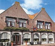
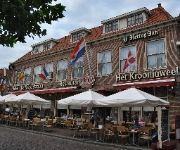
If you need a place to sleep, we compiled a list of available hotels close to the map centre further down the page.
Depending on your travel schedule, you might want to pay a visit to some of the following locations: Amsterdam, Lelystad, Heiloo, Heemskerk and Haarlem. To further explore this place, just scroll down and browse the available info.
Local weather forecast
Todays Local Weather Conditions & Forecast: 4°C / 40 °F
| Morning Temperature | 3°C / 37 °F |
| Evening Temperature | 5°C / 41 °F |
| Night Temperature | 9°C / 49 °F |
| Chance of rainfall | 10% |
| Air Humidity | 90% |
| Air Pressure | 1013 hPa |
| Wind Speed | Strong breeze with 21 km/h (13 mph) from North |
| Cloud Conditions | Overcast clouds, covering 100% of sky |
| General Conditions | Moderate rain |
Sunday, 24th of November 2024
14°C (57 °F)
15°C (58 °F)
Moderate rain, strong breeze, overcast clouds.
Monday, 25th of November 2024
10°C (50 °F)
8°C (47 °F)
Light rain, strong breeze, overcast clouds.
Tuesday, 26th of November 2024
9°C (49 °F)
6°C (43 °F)
Light rain, fresh breeze, scattered clouds.
Hotels and Places to Stay
Van der Valk Hotel Hoorn
De Magneet
Hotel De Keizerskroon
Hotel Petit Nord
Hotel Oostereiland - Gevangenis Hotel
Videos from this area
These are videos related to the place based on their proximity to this place.
[cabinerit] A train driver's view: Hoorn Kersenboogerd - Hoofddorp Midden, SLT, 03-Feb-2015.
This is a train cabin ride from Hoorn Kersenboogerd to Hoofddorp Midden in a SLT. See what the train drivers sees and experience the railroad tracks in a whole new way. The movie is unedited,...
[cabinerit] A train driver's view: Hoorn Kersenboogerd - Amsterdam Sloterdijk, SLT, 22-Mar-2015.
This is a train cabin ride from Hoorn Kersenboogerd to Amsterdam Sloterdijk in a SLT. See what the train drivers sees and experience the railroad tracks in a whole new way. I couldn't record...
Crossfit Hoorn Beach Workout
Drone View Recording of the CrossFit Hoorn Beach WOD 16 July 2014 Drone View -- (http://stageview.nl) Edit: Thierry Liefting & Niels Schilder Drone: Ruud Liefting Camera: Thierry Liefting...
[cabinerit] A train driver's view: Hoorn Kersenboogerd - Hoofddorp Midden, SLT, 07-Mar-2015.
This is a train cabin ride from Hoorn Kersenboogerd to Hoofddorp Midden in a SLT. See what the train drivers sees and experience the railroad tracks in a whole new way. The movie is unedited,...
Jumper Jumper A. en W. Ordelman - Hoorn Kersenboogerd 2013
Jumper Jumper A. en W. Ordelman - Hoorn Kersenboogerd 2013.
Sloot, beschoeiing, Hoorn ~ Trench shoring
Trench shoring is the process of bracing the walls of a trench to prevent collapse. This vid features the replacement / repair work on trench shores, Hoorn, Holland. Onderhoudswerk aan beschoeiin...
Truckrun Venhuizen 2014 ~ Hoorn
Zondagmiddag 28 september 2014, de Truckrun rijdt door Hoorn. Dit is de tweede colonne. Scheldeweg / Oosterscheldeweg, Kersenboogerd Hoorn iPhone recorded. Part 1 (Andijk) ...
Oefening 5.1 schouder mobilisatie exorotatie vanuit 45 graden
Oefening ter verbetering van de beweeglijk van de schouder.
Koopwoning: Breitnerhof 113, HOORN
Goed onderhouden eengezinswoning gelegen op een rustige locatie in woonwijk "Kersenboogerd". De woning (bouwjaar 2000) is gelegen op een perceel van 117 m2 eigen grond en heeft een ...
Koopwoning: Breitnerhof 113, HOORN NH
Goed onderhouden eengezinswoning gelegen op een rustige locatie in woonwijk "Kersenboogerd". De woning ( bj. 2000) is gelegen op een perceel van 117 m2 eigen grond met een vrijstaande ...
Videos provided by Youtube are under the copyright of their owners.
Attractions and noteworthy things
Distances are based on the centre of the city/town and sightseeing location. This list contains brief abstracts about monuments, holiday activities, national parcs, museums, organisations and more from the area as well as interesting facts about the region itself. Where available, you'll find the corresponding homepage. Otherwise the related wikipedia article.
Edam, North Holland
Edam is a city in the northwest Netherlands, in the province of North Holland. Combined with Volendam, Edam forms the municipality of Edam-Volendam. Approximately 7,380 people live in Edam. The entire municipality of Edam-Volendam has 28,492 inhabitants. The name Edam originates from a dam on the little river E or IJe where the first settlement was located and which was therefore called IJedam. Edam is famous as the original source of the cheese with the same name.
Hoorn
Hoorn is a municipality and a town in the Netherlands, in the province of North Holland. It is located on the IJsselmeer, 35 kilometres north of Amsterdam, and acquired city rights in 1357. Hoorn has 70,196 inhabitants . The area of the municipality is 52.49 km² (32.62 km² consists of water, mainly the Markermeer), and consists of the following villages and/or districts: Blokker, Hoorn, Zwaag, and parts of Bangert and De Hulk.
Venhuizen
' is a town in the north-western Netherlands, in the province of North Holland and the region of West-Frisia, in the municipality of Drechterland. Venhuizen was a separate municipality until 1 January 2006, when it was merged with the existing municipality of Drechterland. It was decided to call the new municipality Drechterland. On a map of the Hollands Noorderkwartier from 1288 is Venhuizen mentioned as Veenhusen. The name could be referring to houses at or in the fen.
West Friesland (region)
For the historical region also named West Friesland, see West Friesland (historical region) West Friesland is a contemporary region in the northwestern Netherlands, in the province of North Holland.
Bovenkarspel
Bovenkarspel is a town in the municipality of Stede Broec in the Dutch province of North Holland. Until 1979, it was a separate municipality.
Schellinkhout
Schellinkhout is a very small town located in the municipality of Drechterland, North Holland at the border of the IJsselmeer, about 3 km southeast of Hoorn in West-Frisia. It received city rights in 1402. Schellinkhout was a separate municipality until 1970, when it was merged with Venhuizen. www. geschiedenisschellinkhout. nl
Westwoud
Westwoud is a town in the Netherlands. It is located in the province of North Holland, the region of West Friesland, and the municipality of Drechterland, about 4 km northeast of Hoorn. He received city rights in 1414. It was a separate municipality between 1817 and 1979, when it became a part of Bangert.
Zwaag
Zwaag is a town in the Netherlands. It is located in the municipality of Hoorn, the province of North Holland and the region of West Friesland. On January 1, 2007, Zwaag had 3214 inhabitants.
Steamtrain Hoorn Medemblik
The Museumstoomtram Hoorn Medemblik is a heritage railway in the Netherlands. It runs from Hoorn to Medemblik, a distance of about 20km.
Volendam
Volendam is a town in North Holland in the Netherlands, in the municipality of Edam-Volendam. The town has about 22,000 inhabitants (November 2007).
Twisk
Twisk is a village in the Dutch province of North Holland. It is a part of the municipality of Medemblik, and lies about 10 km north of Hoorn. Twisk was a separate municipality until 1979, when the new municipality of Noorder-Koggenland was created. In 2001, the small village centre of Twisk had 398 inhabitants. The built-up area of the village was 0.07 km², and contained 159 residences. Most of the population of Twisk lives outside the centre, along the road between Opperdoes and Abbekerk.
Martinus College
Martinus College is a secondary school in Grootebroek in the northwest Netherlands. It combines both lower and upper secondary education under the principle of "2 under 1 roof". All forms of secondary education are available, including LWO (leerwegondersteunend onderwijs), Higher General Secondary Education, and gymnasium. The school attracts students from other towns including Andijk, Venhuizen, Wervershoof, Hoogkarspel, Bovenkarspel, Hem, Enkhuizen, Hoorn, and Westwoud.
Lutjebroek
Lutjebroek is a village in the Netherlands. It is part of the municipality of Stede Broec. Lutjebroek has a population of just over 2000 people. In colloquial Dutch, Lutjebroek has become synonymous with "any insignificant speck on the map". This is probably due to the comical sound of the name: the Dutch word luttel is akin to the English word "little" and broek is Dutch for "pants". However, broek as used in Lutjebroek and other Dutch geographical names means swamp.
Kras Stadion
Kras Stadion is a multi-purpose stadium in Volendam, Netherlands. It is currently used mostly for football matches and is the home stadium of FC Volendam. The stadium is able to hold 6,984 people and was built in 1975.
Zuidermeer
Zuidermeer is a town in the Dutch province of North Holland. It is a part of the municipality of Wester-Koggenland, and lies about 6 km west of Hoorn. The statistical area "Zuidermeer", which also can include the surrounding countryside, has a population of around 480.
Blokker, North Holland
Blokker is a village in the Netherlands, in the province of North Holland and the region of West-Frisia. It consists of two parts: Westerblokker in the municipality of Hoorn, and Oosterblokker in Drechterland. Until 1979, Blokker was a separate municipality. The village is primarily known in The Netherlands because in 1964 The Beatles gave their two only concerts on Dutch soil there.
Grootebroek
Grootebroek is a town in the Dutch province of North Holland. It is located in the municipality of Stede Broec. Grootebroek was a separate municipality until 1979. The town is called Grootebroek after a large swamp in the area; in Dutch, "groote" means "large" and "broek" means "swamp". The most common meaning of "broek" in present-day Dutch is "pants", leading to some hilarity about the town's name. Grootebroek is located next to Lutjebroek, "small swamp".
Scharwoude, Langendijk
Scharwoude is a former municipality in the Dutch province of North Holland. It existed between 1812 and 1817, when it was divided into two municipalities: Noord-Scharwoude and Zuid-Scharwoude.
Wijdenes
Wijdenes is a village in the Dutch province of North Holland. It is located in the municipality of Drechterland and the region of West-Frisia. Wijdenes was a separate municipality between 1817 and 1970, when it was merged with Venhuizen.
Westfries Museum
The Westfries Museum is a museum of regional history established in the Dutch city of Hoorn. It was opened on 10 January 1880 and has been established in a monumental building dating to 1632. This building originally belonged to the Gecommitteerde Raden van West-Friesland en het Noorderkwartier, as a part of the Staten van Holland en West-Friesland, and later became a court. Until 1932 part of the building housed the kanton's court and part its museum.
Markermeer
The Markermeer is a 700 km lake in the central Netherlands in between North Holland, Flevoland and its larger sibling, the IJsselmeer. A shallow lake at some 3 to 5 m in depth, it is named after the small former island, now peninsula, of Marken that lies within it. The southwest side of the lake that begins where the IJ once emptied into the Zuiderzee is known as the IJmeer. The Markermeer was not originally intended to remain a lake.
Pilot Polder Andijk
The pilot Polder Andijk, or Test Polder Andijk, Proefpolder Andijk in Dutch, is a polder established in 1926 - 1927 in the Zuiderzee near the village of Andijk. The aim of this prototype is to study the embankments and agriculture for future polders in the Zuiderzee Works. In 1929, the pilot polder was inaugurated by Queen Wilhelmina of the Netherlands.
De Oude Rosmolen
De Oude Rosmolen is a former restaurant located in Hoorn in the Netherlands. It was a fine dining restaurant that was awarded one Michelin stars in the period 1986-1989 and two Michelin stars is the period 1990-2000. The head chef was Constant Fonk. The restaurant was located in a 17th century building that once contained a bakery with its own mill. The mill was driven by a horse, which gave the building its name "Rosmolen" .
Volendam New Year's fire
The Volendam New Year's fire was a café fire in the Dutch town of Volendam in the 2000-2001 New Year's night. The fire began early on New Year's Day 2001 and caused the death of 14 young people. There were in all 241 people admitted to hospital, 200 of which suffered serious burns.
1999 Bovenkarspel legionellosis outbreak
The Bovenkarspel legionellosis outbreak began on 25 February 1999 in Bovenkarspel, the Netherlands, and was one of the largest outbreaks of legionellosis in history. With at least 32 dead and 206 severe infections it was the deadliest legionellosis outbreak since the original 1976 outbreak in Philadelphia, USA. Between 19 and 28 February 1999, the Westfriese Flora took place in Bovenkarspel, one of the largest indoor flower exhibitions in the world (now the Holland Flowers Festival).


!['[cabinerit] A train driver's view: Hoorn Kersenboogerd - Hoofddorp Midden, SLT, 03-Feb-2015.' preview picture of video '[cabinerit] A train driver's view: Hoorn Kersenboogerd - Hoofddorp Midden, SLT, 03-Feb-2015.'](https://img.youtube.com/vi/GLJHCTMAuJ4/mqdefault.jpg)
!['[cabinerit] A train driver's view: Hoorn Kersenboogerd - Amsterdam Sloterdijk, SLT, 22-Mar-2015.' preview picture of video '[cabinerit] A train driver's view: Hoorn Kersenboogerd - Amsterdam Sloterdijk, SLT, 22-Mar-2015.'](https://img.youtube.com/vi/ag8rSPOoI2g/mqdefault.jpg)

!['[cabinerit] A train driver's view: Hoorn Kersenboogerd - Hoofddorp Midden, SLT, 07-Mar-2015.' preview picture of video '[cabinerit] A train driver's view: Hoorn Kersenboogerd - Hoofddorp Midden, SLT, 07-Mar-2015.'](https://img.youtube.com/vi/ay3PmLdyCeU/mqdefault.jpg)


