Safety Score: 3,3 of 5.0 based on data from 9 authorites. Meaning please reconsider your need to travel to Netherlands.
Travel warnings are updated daily. Source: Travel Warning Netherlands. Last Update: 2024-08-13 08:21:03
Discover Weteringbrug
Weteringbrug in Gemeente Haarlemmermeer (Provincie Noord-Holland) with it's 370 citizens is a city in Netherlands about 15 mi (or 24 km) south-west of Amsterdam, the country's capital city.
Local time in Weteringbrug is now 04:28 PM (Thursday). The local timezone is named Europe / Amsterdam with an UTC offset of one hour. We know of 10 airports in the vicinity of Weteringbrug, of which 5 are larger airports. The closest airport in Netherlands is Amsterdam Airport Schiphol in a distance of 8 mi (or 13 km), North-East. Besides the airports, there are other travel options available (check left side).
There are several Unesco world heritage sites nearby. The closest heritage site in Netherlands is Seventeenth-Century Canal Ring Area of Amsterdam inside the Singelgracht in a distance of 14 mi (or 23 km), North-East. We discovered 7 points of interest in the vicinity of this place. Looking for a place to stay? we compiled a list of available hotels close to the map centre further down the page.
When in this area, you might want to pay a visit to some of the following locations: Haarlem, Amsterdam, Heemskerk, The Hague and Heiloo. To further explore this place, just scroll down and browse the available info.
Local weather forecast
Todays Local Weather Conditions & Forecast: 6°C / 43 °F
| Morning Temperature | 5°C / 40 °F |
| Evening Temperature | 5°C / 40 °F |
| Night Temperature | 5°C / 41 °F |
| Chance of rainfall | 1% |
| Air Humidity | 41% |
| Air Pressure | 998 hPa |
| Wind Speed | Moderate breeze with 12 km/h (8 mph) from South-East |
| Cloud Conditions | Overcast clouds, covering 98% of sky |
| General Conditions | Rain and snow |
Friday, 22nd of November 2024
6°C (43 °F)
5°C (41 °F)
Rain and snow, fresh breeze, overcast clouds.
Saturday, 23rd of November 2024
5°C (41 °F)
6°C (42 °F)
Moderate rain, fresh breeze, overcast clouds.
Sunday, 24th of November 2024
12°C (54 °F)
14°C (58 °F)
Light rain, fresh breeze, overcast clouds.
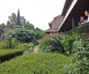
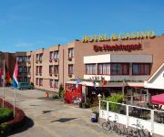
Hotels and Places to Stay
Van der Valk Hotel Schiphol A4
Van der Valk Hotel Avifauna
Novotel Amsterdam Schiphol Airport
De Nachtegaal
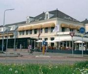
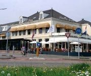
Hotel Restaurant de Beurs
Hotel Restaurant de Beurs
Crowne Plaza AMSTERDAM - SCHIPHOL
Hyatt Place Amsterdam Airport
NH Amsterdam Schiphol Airport
Bastion Hotel Amsterdam Airport
Videos from this area
These are videos related to the place based on their proximity to this place.
Bintang: Weekend Camping Trip
Weekend trip starting in Rotterdam and passing Capelle a/d IJssel, Gouda, Boskoop, Alphen a/d Rijn, Kager Plassen, Leiden, Den Haag, Rijswijk, Delft, Rotterdam.
23 LION CARS DAF CITYBUSSEN
Deze Lion Cars(Toys)Daf Citybus nr 38, zoals ie officieel heet.... is in vele kleuren op de markt verschenen en met veel verschillende "Busbedrijfsnamen" op de zijkanten. Uiteraard is er hier...
Gelede oftewel Harmonica bussen
Een aantal Connexxion gelede bussen op een rijtje... en nog enkele anderen.En dan gaan ze nog rijden ook......
mijn Lesney legertje
Zo`n 90 miniatuur autootjes van Lesney, wat later Matchbox ging heten. Waarvan de oudste (jeep)in 1955 is gemaakt. De meeste in `58 en `59.
Ongeluk vrijdag 13 februari splitsing A4 met de A44 9 auto's ketting-botsing voor aquaduct
Ongeluk vrijdag 13 februari splitsing A4 met de A44 9 auto's ketting-botsing voor aquaduct.
Lesney tafel dorp
Oude Lesney- matchbox modellen(serie 1-75) uitgestald in een zelfgemaakt dorp op tafel. En daar maak je dan een vogelvlucht overheen met je camera.
Oorlog aan de schouw in Oude wetering. Met Lesney Cars.
Marlon van Egmond en Jan van der Heide(beide toevallig aanwezig) maakten deze film over de "oorlogshandelingen" die plaats vonden in Oude Wetering op zaterdag19 feb. 2011. De getoonde ...
Natuurijs van Oude Wetering naar Buitenkaag, 10 februari 2012
Vanaf het Braassemermeer kom ik op de Oude Wetering maar eerst moet ik langs een veerpont klunen. Op de Ringvaart van de Haarlemmermeerpolder schaats ik eerst richting de Westeinder Plassen.
Schaatsen op de Ringvaart bij Oude Wetering
Schaatsen op de Ringvaart van de Haarlemmermeerpolder bij Oude Wetering (Kanaalweg). Op de achtergrond de Googermolen. Gefilmd met een Canon EOS 500D.
orgelen: oeps
In Oude Wetering(Nederland)staat de oudste Remonstrantse kerk van Nederland(1645)met een heel erg oud kerkorgel(1841)en ik mocht er even op spelen.Nou dan maak je er gauw ff een filmpje van.
Videos provided by Youtube are under the copyright of their owners.
Attractions and noteworthy things
Distances are based on the centre of the city/town and sightseeing location. This list contains brief abstracts about monuments, holiday activities, national parcs, museums, organisations and more from the area as well as interesting facts about the region itself. Where available, you'll find the corresponding homepage. Otherwise the related wikipedia article.
Holland
Holland Holland is a region in the western part of the Netherlands. The term Holland is also frequently used as a pars pro toto to refer to the whole of the Netherlands. This usage is generally accepted but disliked by part of the Dutch population, especially in the other parts of the Netherlands. From the 10th to the 16th century, Holland proper was a unified political region within the Holy Roman Empire, a county ruled by the Counts of Holland.
Roelofarendsveen
Roelofarendsveen is a town in the Dutch province of South Holland. It is a part of the municipality of Kaag en Braassem, and lies about 10 km east of Leiden. The town Roelofarendsveen and the village Oude Wetering have merged to form one built-up area. The statistical districts covering these two towns have a population of around 10,950. \t\t \t\t\tBij Roelofarendsveen, molen foto2 2009-10-25 15.34.
Navigable aqueduct
Navigable aqueducts (sometimes called water bridges) are bridge structures that carry navigable waterway canals over other rivers, valleys, railways or roads. They are primarily distinguished by their size, carrying a larger cross-section of water than most water-supply aqueducts. Although Roman aqueducts were sometimes used for transport, aqueducts were not generally used until the 17th century when the problems of summit level canals had been solved and modern canal systems started to appear.
Burgerveen
Burgerveen is a hamlet in the Dutch province of North Holland. It is a part of the municipality of Haarlemmermeer, and lies about 7 km south of Hoofddorp. In 2001, the hamlet of Burgerveen had 215 inhabitants. The built-up area of the town was 0.06 km², and contained 90 residences. The wider statistical area of Burgerveen has a population of around 300.
Leimuiden
Leimuiden is a village in the Dutch province of South Holland. It is located about 9 km south of the town of Hoofddorp, in the municipality of Kaag en Braassem. Leimuiden was a separate municipality until 1991, when it became part of Jacobswoude. The village was part of North Holland until 1865.
Rijnsaterwoude
Rijnsaterwoude is a village in the Dutch province of South Holland. It is located about 6 km north of the town of Alphen aan den Rijn, in the municipality of Kaag en Braassem. Rijnsaterwoude was a separate municipality until 1991, when it became part of Jacobswoude.
Oude Wetering
Oude Wetering is a village in the Dutch province of South Holland. It is located in the municipality of Kaag en Braassem, east of the town of Roelofarendsveen. A bridge connects the village to the village of Weteringbrug in the Haarlemmermeer.
Meerewijck
Meerewijck is the name of a recreation and living quarter in the Dutch province of South Holland. It is a part of the municipality of Kaag en Braassem, and is situated about 12 km south-west of Amsterdam. Meerewijck consists of about 100 semi-bungalows which are grouped around a marina at the Ringvaart. Via the Ringvaart, several lakes such as the Braassemer Meer, the Westeinderplassen, and the Kagerplassen can be reached by boat within minutes.


