Safety Score: 3,3 of 5.0 based on data from 9 authorites. Meaning please reconsider your need to travel to Netherlands.
Travel warnings are updated daily. Source: Travel Warning Netherlands. Last Update: 2024-08-13 08:21:03
Delve into Oud-Diemen
The district Oud-Diemen of Diemen in Gemeente Diemen (Provincie Noord-Holland) with it's 35 habitants Oud-Diemen is a district located in Netherlands a little south-east of Amsterdam, the country's capital town.
In need of a room? We compiled a list of available hotels close to the map centre further down the page.
Since you are here already, you might want to pay a visit to some of the following locations: Amsterdam, Utrecht, Haarlem, Heemskerk and Heiloo. To further explore this place, just scroll down and browse the available info.
Local weather forecast
Todays Local Weather Conditions & Forecast: 7°C / 45 °F
| Morning Temperature | 6°C / 43 °F |
| Evening Temperature | 6°C / 42 °F |
| Night Temperature | 4°C / 40 °F |
| Chance of rainfall | 1% |
| Air Humidity | 67% |
| Air Pressure | 1020 hPa |
| Wind Speed | Moderate breeze with 11 km/h (7 mph) from South |
| Cloud Conditions | Overcast clouds, covering 100% of sky |
| General Conditions | Light rain |
Wednesday, 4th of December 2024
6°C (43 °F)
5°C (42 °F)
Light rain, light breeze, overcast clouds.
Thursday, 5th of December 2024
6°C (42 °F)
9°C (48 °F)
Light rain, fresh breeze, overcast clouds.
Friday, 6th of December 2024
9°C (48 °F)
7°C (45 °F)
Heavy intensity rain, fresh breeze, overcast clouds.
Hotels and Places to Stay
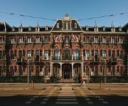
Breitner House
Golden Tulip Amsterdam Riverside
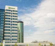
Holiday Inn AMSTERDAM - ARENA TOWERS
The Manor Amsterdam
Jaz Amsterdam
Hotel V Fizeaustraat
Amadi Panorama Hotel
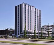
Courtyard Amsterdam Arena Atlas
Lloyd Hotel & Cultural Embassy
Holiday Inn Express AMSTERDAM - ARENA TOWERS
Videos from this area
These are videos related to the place based on their proximity to this place.
Sinterklaas Intocht Diemen, Nederland
Sinterklaasje kom maar binnen! Diemen, zaterdag 17 november -- Sinterklaas is weer in Diemen. De Sint en zijn 600 Pieten werden massaal verwelkomd. Duizenden kinderen, papa's, mama's, opa's...
Bicycle Trip: Kanaaldijk in Diemen to Panamalaan/Parallelweg in Amsterdam [UMBDA part 7]
Bicycle Trip: Kanaaldijk in Diemen to Panamalaan/Parallelweg in Amsterdam [UMBDA part 7] This is part X (of 8) of the bicycle trip from the city center of Utrecht to the city center of Amsterdam...
Koopwoning: Martin Luther Kinglaan 216, DIEMEN
Schitterend verbouwd appartement op 2 loopminuten van treinstation Diemen (Centraal). Het appartement ligt op de derde verdieping en heeft drie slaapkamers. Volledig verbouwd. Alle kamers zijn...
Sinterklaas Intocht Diemen 2, Nederland
This Saturday, November 17, Sinterklaas (St. Nicholas), the patron saint of all children and the main figure of the Dutch holiday season,made his much-anticipated annual arrival in Gemeentehuis...
IJzel op de tramdraden bij Diemen Sniep
IJzel op de bovenleiding van de tramdraden op het eindpunt van tram 9 bij Diemen Sniep, op 14/2/2013. Ik was helaas te laat om de vorige tram te filmen, die maakte nog iets meer vonkjes.
Videos provided by Youtube are under the copyright of their owners.
Attractions and noteworthy things
Distances are based on the centre of the city/town and sightseeing location. This list contains brief abstracts about monuments, holiday activities, national parcs, museums, organisations and more from the area as well as interesting facts about the region itself. Where available, you'll find the corresponding homepage. Otherwise the related wikipedia article.
Piet Hein Tunnel
The Piet Hein Tunnel is a 1.9 km long tunnel under an inlet of the IJsselmeer in Amsterdam, the Netherlands. It provides a road link running east-west between the city center and the A10 ring-road, and since May 2005 also provides a tram link between the Amsterdam Centraal railway station and Haveneiland, IJburg.
Centrum Wiskunde & Informatica
The Centrum Wiskunde & Informatica is a research center in the field of mathematics and theoretical computer science. It is located at the Science Park Amsterdam.
Amsterdam-Zuidoost
Amsterdam-Zuidoost (Amsterdam-Southeast) is one of seven boroughs (stadsdelen) of the city of Amsterdam. It consists of four residential areas—Bijlmermeer, Venserpolder, Gaasperdam and Driemond—as well as the Amstel III/Bullewijk Business Park and the ArenA Boulevard area. Amsterdam-Zuidoost has approximately 86,000 inhabitants, living in some 38,000 houses.
Bijlmermeer
The Bijlmermeer or colloquially Bijlmer is one of the neighbourhoods that form the Amsterdam Zuidoost ('Amsterdam South-East') borough (or "stadsdeel") of Amsterdam, Netherlands. To many people, the Bijlmer designation is used to refer to Amsterdam Zuidoost and Diemen Zuid as a pars pro toto. The other neighbourhoods in Amsterdam Zuidoost are Gaasperdam, Bullewijk, Venserpolder and Driemond.
De Meer Stadion
De Meer Stadion is the name of the former stadium of AFC Ajax. It was opened in 1934 as a result of the club's former stadium being too small. Upon completion, it could hold 22,000 spectators, but accommodating up to 29,500 at its maximum. Increasing safety requirements gradually reduced this number to 19,000.
AMOLF
AMOLF, also known by its full name as FOM Institute AMOLF is one of the three research institutes operated by the Dutch Foundation for Fundamental Research on Matter, also known as FOM. The institute is one of the leading research institute in Europe in the field of physics and biological physics. It focuses on two main research themes: nanophotonics and physics of biomolecular systems.
Enneüs Heerma Bridge
The Enneüs Heerma Bridge is a bridge in the Netherlands which connects the new urban district of IJburg, built on seven artificial islands in IJ Lake, with the isle of Zeeburg, a borough on the eastern edge of Amsterdam, the capital of the Netherlands. The bridge is named after Enneüs Heerma, the late Christian Democrat, alderman and Secretary of State of the Netherlands.
Jaap Eden baan
The Jaap Eden baan is an ice rink. It is located in the Watergraafsmeer, a neighbourhood in the east of Amsterdam. The rink is named after the famous Dutch Ice Skater Jaap Eden. It contains a 400-metre lane and Jaap Edenhal. The hall is the home of the semi-professional team, Amsterdam G's, of the NIJB Eredivisie, and the amateur Amstel Tijgers of the Eerste Divisie.
Watergraafsmeer
The Watergraafsmeer is a polder in the Netherlands. It was reclaimed in 1629. In the 17th and 18th centuries, there were many buitenplaatsen in the Watergraafsmeer, though nowadays only one, Frankendael, remains. Since 1921, the Watergraafsmeer is part of the city of Amsterdam and its rural character has all but disappeared. It is located in the stadsdeel Oost/Watergraafsmeer. The most important streets in the Watergraafsmeer are the Middenweg and the Kruislaan.
Zeeburg
Zeeburg is a former borough of Amsterdam. It had 52,701 residents (January 2009) and an area of 19.31 km². The construction of new islands to the east called IJburg made it the most rapidly growing borough of Amsterdam. On 1 May 2010 Zeeburg merged with the borough of Amsterdam-Oost.
IJburg
IJburg is a residential neighbourhood currently (2013) under construction in the east of Amsterdam. It is situated in the IJ Lake and is being built on artificial islands which have been raised from the lake. Administratively, IJburg was until 2010 part of the Zeeburg borough of Amsterdam, which in that year was merged into the Oost (East) borough.
Science Park Amsterdam
Science Park Amsterdam is a science park in stadsdeel Oost/Watergraafsmeer in Amsterdam, The Netherlands, with accommodations for science and business and housing. Science Park Amsterdam focusses on IT and life sciences. Among the knowledge-based institutions present at the science park there are the University of Amsterdam, several research institutes, and related companies. Two of the colocations of the Amsterdam Internet Exchange are at the institutes SARA and NIKHEF at the science park.
Schellingwoude
Schellingwoude is a former village in the Dutch province of North Holland. It was located in the municipality of Amsterdam, on the northern border of the IJ. It is now a neighbourhood of the city of Amsterdam. Schellingwoude was a separate municipality between 1817 and 1857, when it was merged with Ransdorp.
Amsterdamse Poort (shopping centre)
The Amsterdamse Poort is a shopping centre in the Amsterdam borough Amsterdam Zuidoost stadsdeel. It was opened in 1987. This shopping centre is the largest in Amsterdam. It is located near the Amsterdam Bijlmer ArenA railway station and the ArenA Boulevard. In the shopping centre there is a location for the Tickets & Service room for the railway station. There are also 225 shops. \tAmsterdamse Poort \t\t \t\t\tAmsterdamse Poort 01 PM07. jpg \t\t\t \t\t\t \t\t \t\t \t\t\tAmsterdamse Poort 05 PM07.
NIKHEF
NIKHEF is an acronym for Nationaal Instituut voor Kernfysica en Hoge-Energiefysica (National Institute for Nuclear and High energy physics). Nowadays this acronym is not used anymore and the name is changed to Nationaal instituut voor subatomaire fysica (National Institute for Subatatomic Physics). The name Nikhef is preserved to maintain international name reputation (now only with a capital N).
El Al Flight 1862
On 4 October 1992, El Al Flight 1862, a Boeing 747 cargo plane of the Israeli airline El Al, crashed into the Groeneveen and Klein-Kruitberg flats in the Bijlmermeer (colloquially "Bijlmer") neighbourhood of Amsterdam, the Netherlands. For the location in the Bijlmermeer, the crash is known in Dutch as the "Bijlmerramp" ("Bijlmer disaster"). A total of 43 people were killed, including the plane's crew of three, a non-revenue passenger in a jump seat, and 43 people on the ground.
Flevopark
Flevopark is a park located in the Indische Buurt, in the eastern portion of the city of Amsterdam, in the Dutch province of Noord-Holland. This park was given concrete form in 1908. The naturalist Jac. P. Thijsse envisioned a park between the Jewish Cemetery and the Nieuwe Diep. The expropriation procedure began in 1914, and from 1921 there was money available to obtain the land suitable for building the park. In 1928, the construction of the park began. The park officially opened in 1931.
Betondorp
Betondorp is a neighborhood of Amsterdam, Netherlands.
Rieteilanden
Rieteilanden is a neighborhood of Amsterdam, Netherlands.
Venserpolder
Venserpolder is a neighborhood of Amsterdam, Netherlands.
Jewish Cemetery of Diemen
The Jewish Cemetery of Diemen, or Joodse Begraafplaats Diemen in Diemen, is owned by the Jewish community of Amsterdam, which is a subsection of the "Nederlands Israëlitisch Kerkgenootschap". It came into use in 1914 when the older Jewish cemetery in Amsterdam Zeeburg reached its limit. In 1925 it was split by a train line. The cemetery can still be seen today by train passengers travelling eastwards from Amsterdam.
Ganzenhoef metro station
Ganzenhoef is an Amsterdam Metro station in Amsterdam, Netherlands.
Kraaiennest metro station
Kraaiennest is an Amsterdam Metro station in Amsterdam, Netherlands.
Verrijn Stuartweg metro station
Verrijn Stuartweg is an Amsterdam Metro station in Amsterdam, Netherlands.
Venserpolder metro station
Venserpolder is an Amsterdam Metro station in Amsterdam, Netherlands.





!['Bicycle Trip: Kanaaldijk in Diemen to Panamalaan/Parallelweg in Amsterdam [UMBDA part 7]' preview picture of video 'Bicycle Trip: Kanaaldijk in Diemen to Panamalaan/Parallelweg in Amsterdam [UMBDA part 7]'](https://img.youtube.com/vi/E7-uWgEN-XM/mqdefault.jpg)


