Safety Score: 3,3 of 5.0 based on data from 9 authorites. Meaning please reconsider your need to travel to Netherlands.
Travel warnings are updated daily. Source: Travel Warning Netherlands. Last Update: 2024-08-13 08:21:03
Discover Julianadorp
Julianadorp in Gemeente Den Helder (Provincie Noord-Holland) is a place in Netherlands about 36 mi (or 58 km) north of Amsterdam, the country's capital city.
Current time in Julianadorp is now 04:29 PM (Thursday). The local timezone is named Europe / Amsterdam with an UTC offset of one hour. We know of 11 airports near Julianadorp, of which 5 are larger airports. The closest airport in Netherlands is De Kooy Airport in a distance of 3 mi (or 5 km), North-East. Besides the airports, there are other travel options available (check left side).
There are several Unesco world heritage sites nearby. The closest heritage site in Netherlands is Droogmakerij de Beemster (Beemster Polder) in a distance of 25 mi (or 40 km), South. We encountered 1 points of interest in the vicinity of this place. If you need a hotel, we compiled a list of available hotels close to the map centre further down the page.
While being here, you might want to pay a visit to some of the following locations: Heiloo, Heemskerk, Haarlem, Amsterdam and Lelystad. To further explore this place, just scroll down and browse the available info.
Local weather forecast
Todays Local Weather Conditions & Forecast: 6°C / 43 °F
| Morning Temperature | 6°C / 43 °F |
| Evening Temperature | 6°C / 43 °F |
| Night Temperature | 6°C / 43 °F |
| Chance of rainfall | 7% |
| Air Humidity | 58% |
| Air Pressure | 997 hPa |
| Wind Speed | Strong breeze with 21 km/h (13 mph) from South-East |
| Cloud Conditions | Overcast clouds, covering 100% of sky |
| General Conditions | Moderate rain |
Friday, 22nd of November 2024
7°C (45 °F)
8°C (47 °F)
Light rain, strong breeze, overcast clouds.
Saturday, 23rd of November 2024
8°C (46 °F)
8°C (46 °F)
Moderate rain, high wind, near gale, overcast clouds.
Sunday, 24th of November 2024
13°C (55 °F)
14°C (57 °F)
Moderate rain, high wind, near gale, overcast clouds.
Hotels and Places to Stay
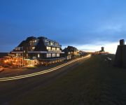
Grand Hotel Beatrix
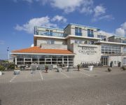
Fletcher Badhotel Callantsoog
Hotel Den Helder
Forest Hotel
de Horn
Hotel 't Zwaantje
Wienerhof
Videos from this area
These are videos related to the place based on their proximity to this place.
Minecraft: Modpack Survival | Village Helpen | Aflevering #6
Welkom op SmokeyGames! Vandaag is het: Minecraft: PM - ModPack Survival | Village Helpen | Aflevering #6 Abonneer: http://bit.ly/SGAbonneer ▻ Weetje van de dag: ▻ Video gemaakt door:...
Let's Play: Minecraft | SG Survival | Village | Deel #51
Welkom op SmokeyGames! Vandaag is het: Let's Play: Minecraft | SG Survival | Village | Deel #51 Wat zou hier onder nou staan? ▻ Video gemaakt door: ...
LittleCraft #5 - De Nether In?!?
Welkom op SmokeyGames! Vandaag is het: LittleCraft #5 - De Nether In?!? Wat zou hier onder nou staan? ▻ Video gemaakt door: http://www.youtube.com/user/DhrSmokeyGames Vind je mijn video's.
Let's Play: Minecraft | SG Survival | De Buit!! | Dag #43
Welkom op SmokeyGames! Vandaag is het: Let's Play: Minecraft | SG Survival | De Buit!! | Dag #43 Wat zou hier onder nou staan? ▻ Video gemaakt door: http://www.youtube.com/user/DhrSmokeyGames...
DROWNING SIMULATOR
Welkom op SmokeyGames! Vandaag is het: DROWNING SIMULATOR Wat zou hier onder nou staan? ▻ Weetje van de dag: ▻ Video gemaakt door: http://www.youtube.com/user/DhrSmokeyGames Ik.
Minecraft: Modpack Survival | W00t | Aflevering #1
Welkom op SmokeyGames! Vandaag is het:Minecraft: PM-ModPack Survival | W00t | Aflevering #1 Abonneer: http://bit.ly/SGAbonneer ▻ Weetje van de dag: ▻ Video gemaakt door: http://www.youtu...
Hoe Trainen Wij? - SG Vlog #69
Welkom op SmokeyGames! Vandaag is het: Hoe Trainen Wij? - SG Vlog #69 Abonneer: http://bit.ly/SGAbonneer ▻ Weetje van de dag: ▻ Video gemaakt door: ...
Minecraft Tutorials ~ Deel 1 ~ Skeleton of Zombie spawner
Welkom op SmokeyGames! Vandaag is het: Wat zou hier onder nou staan? ▻ Weetje van de dag: ▻ Video gemaakt door: http://www.youtube.com/user/DhrSmokeyGames Ik heb ook twitter! Hier...
Microfoon arm + Nieuwe Cam SG Vlog #64
Thanks to bram :) Welkom op SmokeyGames! Vandaag is het: Microfoon arm + Nieuwe Cam SG Vlog #64 Wat zou hier onder nou staan? ▻ Weetje van de dag: ▻ Video gemaakt door: http://www.youtu ...
Videos provided by Youtube are under the copyright of their owners.
Attractions and noteworthy things
Distances are based on the centre of the city/town and sightseeing location. This list contains brief abstracts about monuments, holiday activities, national parcs, museums, organisations and more from the area as well as interesting facts about the region itself. Where available, you'll find the corresponding homepage. Otherwise the related wikipedia article.
De Kooy Airfield
De Kooy Airfield (Dutch: Vliegveld De Kooy) is an airfield 2.9 NM south of Den Helder, the Netherlands, named after the nearby hamlet De Kooy. It serves as both a civilian airport under the name Den Helder Airport and a naval airport under the name Maritiem Vliegkamp De Kooy (Dutch for Maritime Aviation Site De Kooy).
Blauwe Keet
Blauwe Keet was a hamlet in the Dutch province of North Holland. It is a part of the municipality of Den Helder, and lies about 7 km south of the Den Helder city centre. The hamlet was demolished in 1987. The hamlet was founded by the diggers of the nearby North Holland Canal in the early 19th century. Its name, "Blue Cabin", refers to the cabin from which the construction of the canal was directed.


