Safety Score: 3,3 of 5.0 based on data from 9 authorites. Meaning please reconsider your need to travel to Netherlands.
Travel warnings are updated daily. Source: Travel Warning Netherlands. Last Update: 2024-08-13 08:21:03
Delve into De Aker
The district De Aker of Amsterdam in Gemeente Amsterdam (Provincie Noord-Holland) is a subburb in Netherlands and is a district of the nations capital.
If you need a hotel, we compiled a list of available hotels close to the map centre further down the page.
While being here, you might want to pay a visit to some of the following locations: Haarlem, Heemskerk, Heiloo, Utrecht and The Hague. To further explore this place, just scroll down and browse the available info.
Local weather forecast
Todays Local Weather Conditions & Forecast: 6°C / 43 °F
| Morning Temperature | 4°C / 39 °F |
| Evening Temperature | 4°C / 39 °F |
| Night Temperature | 4°C / 40 °F |
| Chance of rainfall | 0% |
| Air Humidity | 42% |
| Air Pressure | 998 hPa |
| Wind Speed | Moderate breeze with 10 km/h (6 mph) from South-East |
| Cloud Conditions | Overcast clouds, covering 99% of sky |
| General Conditions | Rain and snow |
Friday, 22nd of November 2024
6°C (42 °F)
4°C (39 °F)
Rain and snow, fresh breeze, overcast clouds.
Saturday, 23rd of November 2024
4°C (40 °F)
5°C (42 °F)
Moderate rain, fresh breeze, overcast clouds.
Sunday, 24th of November 2024
12°C (54 °F)
14°C (57 °F)
Light rain, fresh breeze, overcast clouds.
Hotels and Places to Stay
Sheraton Amsterdam Airport Hotel and Conference Center
Amsterdam Apartments - Slotervaart Area
Ramada Amsterdam Airport Schiphol
XO HOTELS COUTURE
Steigenberger Airport Amsterdam
Mercure Hotel Amsterdam West
Hilton Amsterdam Airport Schiphol
Villa Monte Dana Amsterdam Airport
CORENDON VITALITY HOTEL AMS
Artemis
Videos from this area
These are videos related to the place based on their proximity to this place.
Journey - We Need You
A Journey Dance Project about Jesus being the Light of this World. John 1:4,5 "In Him was life, and the life was the light of men. And the light shines in the darkness, and the darkness...
Fast Festive Holiday Lights (11.29.13 - Day 1247)
Festive holiday lights, I like them! Even if they're up at a fastfood restaurant!! ;) Daily videos: Amsterdam, The Netherlands, Belgium & more! Longest running daily show from The Netherlands...
Vliegveld De Aker
Opname starts vliegtuigen vanaf Zwanenburgbaan (36C) noorderlijk vlak over de huizen van de Aker te Amsterdam-Osdorp. Ze dienen meer dan 1 KM verderop over de Lutkemeer polder te gaan.
Koopwoning: Noorderakerweg 100, AMSTERDAM
TE KOOP - VRIJSTAANDE VILLA ALGEMEEN DE MEEST VERRASSENDE, ONDER ARCHITECTUUR GEBOUWDE, VRIJSTAANDE VILLA met aan DRIE ZIJDEN WATER, een ruime GARAGE van 26 ...
Koopwoning: Pieter Calandlaan 574, AMSTERDAM
U KUNT DEZE WONING OOK (OP AFSPRAAK) OP ZATERDAG BEZICHTIGEN! Dit 3 kamer appartement is prettig en zeer centraal gelegen. Het bevindt zich op de vijfde verdieping van het moderne en ...
Koopwoning: M. Gandhilaan 67, Amsterdam
Licht, ruim en netjes verzorgd 3- kamer appartement (ca. 80 m2) gelegen op de tweede verdieping in de gewilde wijk De Aker. Het appartement, met balkon op het zuidwesten, is gelegen in een...
Man doodgeschoten aan de Wolbrantskerkweg in Amsterdam-Osdorp liquidatie
Video: Mizzle Media © 2015 http://www.mizzlemedia.nl AMSTERDAM Een nog onbekende man is vannacht op de Wolbrantskerkweg in Osdorp doodgeschoten. Hij werd rond 02.30 uur op straat ...
Autospuit Osdorp (2008) - Brandweer Amsterdam
Autospuit en ladder Osdorp onderweg naar een woningbrand aan de Baden Powellweg in Amsterdam (2008). Thanks to Iljin de Jong.
Autospuit Osdorp (2010) - Brandweer Amsterdam
Autospuit Osdorp rukt uit voor een brandgerucht aan de Anton Holzelsingel in Amsterdam (2010). Met dank aan Iljin de Jong.
Autospuit Osdorp (2010) - Brandweer Amsterdam
Autospuit Osdorp onderweg naar assistentie politie aan de Pieter Calandlaan in Amsterdam (2010). Met dank aan Iljin de Jong.
Videos provided by Youtube are under the copyright of their owners.
Attractions and noteworthy things
Distances are based on the centre of the city/town and sightseeing location. This list contains brief abstracts about monuments, holiday activities, national parcs, museums, organisations and more from the area as well as interesting facts about the region itself. Where available, you'll find the corresponding homepage. Otherwise the related wikipedia article.
Amsterdam Airport Schiphol
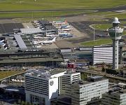
Amsterdam Airport Schiphol is the Netherlands' main international airport, located 20 minutes southwest of Amsterdam, in the municipality of Haarlemmermeer. The airport's official English name, Amsterdam Airport Schiphol, reflects the original Dutch word order (Luchthaven Schiphol). The airport used to have the IATA code of SPL, which has fallen into disuse and has been replaced by AMS.
Zwanenburg
Zwanenburg is a town in the Dutch province of North Holland. It is a part of the municipality of Haarlemmermeer, and lies about 11 km west of Amsterdam. Zwanenburg has a population of around 7,670.
Boesingheliede
Boesingheliede is a hamlet in the Dutch province of North Holland. It is a part of the municipality of Haarlemmermeer, and lies about 12 km west of Amsterdam. Boesingheliede has a population of around 140.
Badhoevedorp
Badhoevedorp is a town in the Dutch province of North Holland. It is a part of the municipality of Haarlemmermeer, and lies on the other side of the Ringvaart of Amsterdam. Badhoevedorp has a population of around 11,370. Notable residents include Björn Ottenheim of the band zZz, former Dutch national team footballer Marco van Basten, Jack van Gelder, Tonny Eyk and Toon van Driel.
Nieuwe Meer
Nieuwe Meer is a hamlet in the Dutch province of North Holland. It is a part of the municipality of Haarlemmermeer, and lies about 8 km southwest of Amsterdam. Nieuwe Meer has a population of around 410. Nieuwe Meer is originally the name of the adjacent small lake which lies within Amsterdam city borders.
Sloten, Amsterdam
Sloten is a village in the Dutch province of North Holland. It is a part of the municipality of Amsterdam, and lies about 6 km west of the city centre. Sloten was a separate municipality until 1921. During the 1928 Summer Olympics, it hosted the rowing events.
Halfweg
Halfweg is a town in the Dutch province of North Holland. It is a part of the municipality of Haarlemmerliede en Spaarnwoude, and lies about 8 km east of Haarlem. Its name, which translates as "halfway," comes from its location approximately halfway between Haarlem and Amsterdam. The statistical area "Halfweg", which also can include the surrounding countryside, has a population of around 2330.
Slotervaart (former borough)
Slotervaart is a former stadsdeel of Amsterdam, it has 48.540 inhabitants (2008) and an area of 11.14 km². As of 2010, Slotervaart is part of the newly formed stadsdeel Nieuw-West. Slotervaart has a significant immigrant population; 33% of the inhabitants are from Morocco, 21% are from Turkey, and 5% are from Suriname. In 2007, Slotervaart youngsters burned cars and threw stones at the police after a stabbing accident at the Allebeplein, where the police killed a Moroccan boy.
Houtrijk en Polanen
Houtrijk en Polanen is a former municipality in the Dutch province of North Holland. It existed from 1817 to 1863, when it was merged with Haarlemmerliede en Spaarnwoude. Houtrijk en Polanen was the area on the south side of the former IJ Bay between Haarlem and Amsterdam, around the town of Halfweg.
Haarlemmertrekvaart
The Haarlemmertrekvaart [ˌhaːrlɛmərˈtrɛkfaːrt ˌhaːrlɛmərˈtrɛkfaːrt] (Haarlem's Tow-Canal) is a canal between Amsterdam and Haarlem in the province of North Holland, the Netherlands. It was dug in 1631, making it the oldest tow-canal in Holland. Travel on such canals was historically done by barges (or trekschuit in Dutch) which were towed by animals (and sometimes by man-power) on a path along the canal's edge.
Atradius
Atradius is a trade credit insurer. The company, rated ‘A’ (excellent) outlook stable by AM Best (September 2012)and 'A3' by Moody's (October 2012) had a turnover of approximately €1.6 billion in 2011. Atradius insures an estimated €465 billion of trade around the globe each year. Atradius holds information on over 100 million businesses used to make over 20,000 credit limit decisions each day.
Osdorp
Osdorp is neighbourhood of Amsterdam, the Netherlands. A larger area was, from 1981 until 2010, a stadsdeel (borough) of Amsterdam and in 2010 was merged into the new borough of Amsterdam Nieuw-West.
Dijkgraafplein
The Dijkgraafplein is a square in Amsterdam-Osdorp in the Netherlands, lying at the end of Tussen Meer. The square is named after the office of dijkgraaf (the chairman of a waterboard) in 1962. The Dijkgraafplein lies in the neighborhood that is now known as 'De Sharpen' and where many street are named after waterways. Since 1962 tramline 17 terminates on this square. From 1971 tram line 1 also began here.
Amsterdam Nieuw-West
Amsterdam Nieuw-West is a borough (stadsdeel) comprising the most western parts of the city of Amsterdam, Netherlands. As a borough it was created in 2010 through a merger of the three former boroughs Osdorp, Geuzenveld-Slotermeer and Slotervaart. Most of the residential neighborhoods were built after 1950 under the project Westelijke Tuinsteden. Centrally located is a park, Sloterpark, with a lake (Sloterplas).
De Aker
De Aker is a neighborhood of Amsterdam, Netherlands.
Nieuw Sloten
Nieuw Sloten is a neighborhood of Amsterdam, Netherlands.
Oostoever
Oostoever is a neighborhood of Amsterdam, Netherlands.
Slotermeer
Slotermeer is a neighborhood of Amsterdam, Netherlands.
Slotervaart (neighborhood)
Slotervaart (Tuinstad Slotervaart) is a neighborhood in the far western part of Amsterdam, Netherlands. It was designed as a garden city (tuinstad). The area is named after the canal Slotervaart. The first houses were built in 1955. Just outside the residential area there is a hospital, the Slotervaartziekenhuis (since 1976), and the Netherlands Cancer Institute (NKI) (since 1979).
Geuzenveld
Geuzenveld (garden city) is a neighborhood of Amsterdam, Netherlands.
Westelijke Tuinsteden
Westelijke Tuinsteden is a neighborhood of Amsterdam, Netherlands.
Gemeenlandshuis Zwanenburg
. The Gemeenlandshuis Zwanenburg on the Haarlemmerstraatweg in Halfweg is a former Gemeenlandshuis of the Hoogheemraadschap van Rijnland designed by Pieter Post and built 1645-1648. Today it is part of Sugar City.
Amsterdam Aletta Jacobslaan railway station
Amsterdam Aletta Jacobslaan was a planned railway station in Amsterdam, Netherlands. The station was to be built on the Amsterdam–Schiphol railway on the site of the current Henk Sneevlietweg—a station on the Amsterdam Metro.
Henk Sneevlietweg metro station
Henk Sneevlietweg is a railway station in Amsterdam, Netherlands. The station—which is part of the Amsterdam Metro network—is located in the suburb of Nieuw-West and is served by line 50 services. Henk Sneevlietweg opened on May 28, 1997. The station is elevated above street level on a railway embankment. The station is named after the street on which its main entrance is located which, in turn, is named after Dutch politician Henk Sneevliet.
Jan van Galenstraat metro station
Jan van Galenstraat metro station is a station of the Amsterdam metro 50 (Ringlijn). It was opened on May 28, 1997. Near the station is the Sint Lucas Andreas Hospital and the Sports Hall Jan van Galen.


