Safety Score: 3,3 of 5.0 based on data from 9 authorites. Meaning please reconsider your need to travel to Netherlands.
Travel warnings are updated daily. Source: Travel Warning Netherlands. Last Update: 2024-08-13 08:21:03
Explore Kroonstad
The district Kroonstad of Delfzijl in Gemeente Delfzijl (Provincie Groningen) is located in Netherlands about 108 mi north-east of Amsterdam, the country's capital.
If you need a place to sleep, we compiled a list of available hotels close to the map centre further down the page.
Depending on your travel schedule, you might want to pay a visit to some of the following locations: Hinte, Emden, Wirdum, Juist and Bunde. To further explore this place, just scroll down and browse the available info.
Local weather forecast
Todays Local Weather Conditions & Forecast: 5°C / 40 °F
| Morning Temperature | 3°C / 37 °F |
| Evening Temperature | 4°C / 39 °F |
| Night Temperature | 3°C / 38 °F |
| Chance of rainfall | 7% |
| Air Humidity | 82% |
| Air Pressure | 994 hPa |
| Wind Speed | Fresh Breeze with 14 km/h (9 mph) from North-East |
| Cloud Conditions | Scattered clouds, covering 47% of sky |
| General Conditions | Rain and snow |
Saturday, 23rd of November 2024
4°C (39 °F)
5°C (41 °F)
Moderate rain, strong breeze, overcast clouds.
Sunday, 24th of November 2024
11°C (53 °F)
13°C (56 °F)
Moderate rain, strong breeze, overcast clouds.
Monday, 25th of November 2024
12°C (53 °F)
9°C (48 °F)
Moderate rain, strong breeze, overcast clouds.
Hotels and Places to Stay
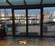
DE BOEGSCHROEF
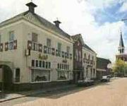
Het Wapen van Leiden
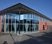
Hotel Appartementen Klaver Vier
Videos from this area
These are videos related to the place based on their proximity to this place.
Hoog water in de Haven van Delfzijl...... 6 dec 2013..deel 2
6 december 2013 De Haven kades van Delfzijl stonden vandaag tegen 12.00 uur weer onder water, het waterpeil is donderdagnacht hoger gekomen dan verwacht. Om half twee bereikte het water het.
26-10-2014. Zeemijlenloop, Delfzijl, The Netherlands
26-10-2014. Zeemijlenloop, Delfzijl, The Netherlands Dit is een wedstrijd over 3 en 6 zeemijlen. De opnamen zijn gemaakt in de 1ste ronde. Deze video is gemaakt door Frans Scheuneman uit ...
Big Fire in Delfzijl Harbour [Dec 2014]
A warehouse full of wooden pallets and paper went up in flames on December 20th in Delfzijl (Netherlands). The next day it was still burning. The fire-fighters are letting it burn out and concentra...
Muziekfestival Delfzijl 2013 (4) afmars!
Muziekfestival Delfzijl 2013 op het Vennenplein met ruim 500 muzikanten.
Vloeddeur dicht vanwege hoogwater Delfzijl
Op 11 januari 2015 moest de vloeddeur van Delfzijl twee keer dicht vanwege de hoge waterstand.
Radiomodems voor rioolbeheer gemeente Delfzijl
De gemeente Delfzijl had een aantal gemalen die bij hoogwater situaties in de buitendijkse havens niet veilig te bedienen waren. De installaties kunnen nu op afstand geblokkeerd worden om te...
Taptoe Vennenplein 9 juni 2014 Pinksteren in Delfzijl
Taptoe op Vennenplein op 9 juni 2014 tijdens Pinksteren in Delfzijl met Showband Jong Marum.
#Taptoe #ShowbandMarum @Delfzijl tijdens #Pinksterfeesten #2014 op het #Vennenplein
Taptoe met Showband Marum in Delfzijl op het Vennenplein tijdens de Pinksterfeesten 9 juni 2014.
Videos provided by Youtube are under the copyright of their owners.
Attractions and noteworthy things
Distances are based on the centre of the city/town and sightseeing location. This list contains brief abstracts about monuments, holiday activities, national parcs, museums, organisations and more from the area as well as interesting facts about the region itself. Where available, you'll find the corresponding homepage. Otherwise the related wikipedia article.
Delfzijl
Delfzijl is a municipality and city in the northeast of the Netherlands. It is situated on the left bank of the river Ems estuary, which forms the border with Germany.
Scheemda
Scheemda is a former municipality and a town in the northeastern Netherlands. Since January 1, 2010 it forms a part of Oldambt.
Slochteren
Slochteren is a municipality in the northeastern Netherlands. The municipality can be characterized as a chain of small villages dividing a mostly agricultural landscape. Having an agricultural background for at least a thousand years, the community houses for the most part commuters to nearby towns like Hoogezand, Groningen and Delfzijl. The mansion Fraeylemaborg (a small 'castle', the oldest parts of which are dated in the Middle Ages) is located in Slochteren.
Eemshaven
Eemshaven is a seaport in Groningen, Netherlands. In 1968, the Dutch government declared the Ems estuary to be an economic key region. One of the key developments for the region was the construction of a seaport called Eemshaven. The port was officially opened by Her Majesty Queen Juliana in 1973. In 2007, one of its main activities is the projected construction of an LNG terminal and ongoing plans for the building of a biodiesel factory as well as a nuclear power plant.
NorNed
NorNed is a 580-kilometre long HVDC submarine power cable between Feda in Norway and the seaport of Eemshaven in the Netherlands, which interconnects both countries' electricity grids. It is the longest submarine power cable in the world. Budgeted at €550 million, and completed at a cost of €600m, the NorNed cable is a bipolar HVDC link with a voltage of ±450 kV and a capacity of 700 MW.
Hellum
Hellum is a small town in the municipality Slochteren. It has approximately 600 inhabitants. It has the oldest church in the municipality, which was built in approximately the year 1100.
Farmsum
Farmsum is a town in the Dutch province of Groningen. It is a part of the municipality of Delfzijl. The statistical area "Farmsum", which may include the surrounding countryside, has a population of around 2,510.
Bierum
Bierum is a village in the Dutch province of Groningen. It is a part of the municipality of Delfzijl, and lies about 27 km northeast of Groningen. Bierum was a separate municipality until 1990, when it was merged with Delfzijl. In 2001, the village of Bierum had 610 inhabitants. The built-up area of the village was 0.20 km², and contained 225 residences. The statistical area "Bierum", which also includes the surrounding countryside, has a population of around 1240.
Holwierde
Holwierde is a town in the Dutch province of Groningen. It is a part of the municipality of Delfzijl, and lies about 26 km northeast of Groningen. In 2001, the town of Holwierde had 813 inhabitants. The built-up area of the town was 0.27 km², and contained 323 residences. The statistical area "Holwierde", which also can include the peripheral parts of the village, as well as the surrounding countryside, has a population of around 1040.
Spijk, Groningen
Spijk is a town in the Dutch province of Groningen. It is a part of the municipality of Delfzijl, and lies about 26 kilometres (16 mi) northeast of Groningen. In 2001, the town of Spijk had 1132 inhabitants. The built-up area of the town was 0.50 km, and contained 475 residences. The statistical area "Spijk", which also can include the peripheral parts of the village, as well as the surrounding countryside, has a population of around 1250.
Zeerijp
Zeerijp is a village north of city of Groningen. Its most striking building is its medieval brick church with detached bell tower. Formerly dedicated to John the Baptist, now it is a Dutch Reformed church. Also there is a famous organ inside the church, a Faber organ. Because there are so few inhabitants, Zeerijp has no shops, but there is a primary school 'De Wilgenstee' and a cafe. Also, there is a famous mill, 'de Leeuw'. There is also a gold and silver smith, Van Hulsen.
Midwolda
Midwolda is a village in the Dutch province of Groningen. It is located in the municipality of Scheemda, about 7 km northwest of Winschoten. Midwolda was a separate municipality until 1990, when it was merged with Scheemda.
Nieuwolda
Nieuwolda is a village in the Dutch province of Groningen. It is located in the municipality of Scheemda, about 9 km southeast of Delfzijl. Nieuwolda was a separate municipality until 1990, when it was merged with Scheemda.
Noordbroek
Noordbroek is a village in the Dutch province of Groningen. It is located in the municipality of Menterwolde, about 8 km northeast of Hoogezand. Noordbroek was a separate municipality until 1965, when it became part of Oosterbroek.
Siddeburen
Siddeburen is a village in the Dutch province of Groningen. It is located in the municipality of Slochteren, about 10 km southwest of Delfzijl. Siddeburen was a separate municipality until 1826, when it was merged with Slochteren.
't Zandt
't Zandt should not be confused with villages named 't Zand. 't Zandt is a village in the Dutch province of Groningen. It is located in the municipality of Loppersum. 't Zandt was a separate municipality until 1990, when it was merged with Loppersum. The municipality covered the villages 't Zandt, Zeerijp, Leermens, Eenum and Oosterwijwerd, and the hamlets Zijldijk, Kolhol, Korendijk and 't Zandstervoorwerk.
Oostwold Airport
Oostwold Airport, also known as Groningen Airport Oostwold, is a small general aviation airport in Oostwold, a village in municipality of Scheemda in the province of Groningen in the Netherlands. The airport is 3 NM north of the city and municipality of Winschoten. The airport is limited by the Dutch aviation authorities to 4,800 aircraft movements a year (an aircraft movement being either a take-off or a landing) and has limited and irregular opening hours.
't Waar
't Waar is a village in the Dutch province of Groningen. It is located in the municipality of Scheemda, just north of the village of Nieuw-Scheemda.
Rysum
Rysum is a village located 15 kilometers west of Emden in the region of East Frisia, Germany. It is home to the Rysum organ, one of the earliest pipe organs in playable condition.
Rysum organ
The Rysum organ in Rysum Church in Rysum, north Germany, is the oldest instrument of its kind in northern Europe that still largely has its original pipes. It is also one of the oldest playable church organs in the world alongside those in Sion, Kiedrich and Ostönnen. It was originally built in 1457 and rebuilt in 1513. After undergoing several other modifications through the years it was restored to its 1513 condition by Jürgen Ahrend and Gerhard Brunzema in 1959.
Zijldijk
Zijldijk is a village in the municipality of Loppersum, Groningen, the Netherlands. Zijldijk has about 250 inhabitants. It is located along the N46 road between the city of Groningen and the Eemshaven seaport.
Loquard
Loquard is an old village, now part of Krummhörn in Ostfriesland in the modern nation-state of Germany. It is part of the Aurich rural governmental district of the state of Lower Saxony. It is a traditionally Lutheran village.
Knockster Tief
Knockster Tief is a river of Lower Saxony, Germany.
Wirdum, Groningen
Wirdum is a small rural village in the province of Groningen in the Netherlands. It is situated close to the Damsterdiep - a channel connecting the city of Groningen to Delfzijl - on two artificial dwelling hills, known locally as 'Wierden'. As of 2010, Wirdum had a population of 310.
International Police Caps Collection
The International Police Caps Collection is a permanent exhibition of an international collection of police hats in the former railwaystation of the Slochteren Woldjerspoor in Slochteren. The collection is owned by the Department of the Groningen International Police Association. Besides the nearly 1500 different police hats from over 220 countries, there are also including several police uniforms, handcuffs and police badges to admire.


!['Big Fire in Delfzijl Harbour [Dec 2014]' preview picture of video 'Big Fire in Delfzijl Harbour [Dec 2014]'](https://img.youtube.com/vi/KMGtn37NbWQ/mqdefault.jpg)


