Safety Score: 3,3 of 5.0 based on data from 9 authorites. Meaning please reconsider your need to travel to Netherlands.
Travel warnings are updated daily. Source: Travel Warning Netherlands. Last Update: 2024-08-13 08:21:03
Discover Zonnemaat
The district Zonnemaat of Zevenaar in Gemeente Zevenaar (Provincie Gelderland) with it's 4,250 citizens Zonnemaat is a subburb in Netherlands about 58 mi south-east of Amsterdam, the country's capital city.
If you need a hotel, we compiled a list of available hotels close to the map centre further down the page.
While being here, you might want to pay a visit to some of the following locations: Kranenburg, Arnhem, Kleve, Weeze and Uedem. To further explore this place, just scroll down and browse the available info.
Local weather forecast
Todays Local Weather Conditions & Forecast: 14°C / 58 °F
| Morning Temperature | 11°C / 51 °F |
| Evening Temperature | 16°C / 61 °F |
| Night Temperature | 14°C / 58 °F |
| Chance of rainfall | 4% |
| Air Humidity | 66% |
| Air Pressure | 1007 hPa |
| Wind Speed | Strong breeze with 19 km/h (12 mph) from North |
| Cloud Conditions | Overcast clouds, covering 100% of sky |
| General Conditions | Moderate rain |
Monday, 25th of November 2024
15°C (59 °F)
8°C (47 °F)
Moderate rain, strong breeze, overcast clouds.
Tuesday, 26th of November 2024
8°C (46 °F)
8°C (46 °F)
Light rain, moderate breeze, overcast clouds.
Wednesday, 27th of November 2024
10°C (49 °F)
7°C (44 °F)
Moderate rain, fresh breeze, overcast clouds.
Hotels and Places to Stay
Duiven bij Arnhem A12
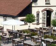
Sandton Hotel de Roskam
Campanile - Zevenaar Arnhem
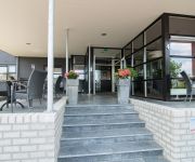
Hotel Gieling
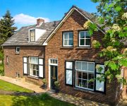
Bed & Breakfast Slaap
Buitengoed de Panoven
Videos from this area
These are videos related to the place based on their proximity to this place.
Rogier Jurcka en Vincent Dijs in Muziekcafé De Lantaern te Zevenaar op 28-02-2015
Elke zaterdag live muziek in Muziekcafé De Lantaern te Zevenaar. Voor een actueel programmaoverzicht, ga naar: http://www.delantaern.nl/ . Optreden van Rogier Jurcka en Vincent Dijs in Muziekcaf...
Henk Smit en Bart e o Cornelis in Muziekcafé De Lantaern te Zevenaar op 28-02-2015
Elke zaterdag live muziek in Muziekcafé De Lantaern te Zevenaar. Voor een actueel programmaoverzicht, ga naar: http://www.delantaern.nl/ . Optreden van Henk Smit en Bart e/o Cornelis in Muziekcaf.
The Estate in De Lantaern te Zevenaar op 20-09-2014
Elke zaterdag live muziek in De Lantaern te Zevenaar. Voor een actueel programmaoverzicht, ga naar: http://www.delantaern.nl/ . Optreden van The Estate in De Lantaern te Zevenaar op 20-09-2014.
The Woods - Daan Boshoven in De Lantaern te Zevenaar op 10-01-2015
Elke zaterdag live muziek in De Lantaern te Zevenaar. Voor een actueel programmaoverzicht, ga naar: http://www.delantaern.nl/ . Optreden van The Woods - Daan Boshoven in De Lantaern te ...
Vivanne Ebben in De Lantaern te Zevenaar op 26-10-2013
Elke zaterdag live muziek in De Lantaern te Zevenaar. Voor een actueel programmaoverzicht, ga naar: http://www.delantaern.nl/ . Optreden van Vivanne Ebben in De Lantaern te Zevenaar op ...
The Jars in De Lantaern te Zevenaar op 24-01-2015 [3]
Elke zaterdag live muziek in De Lantaern te Zevenaar. Voor een actueel programmaoverzicht, ga naar: http://www.delantaern.nl/ . Optreden van The Jars in De Lantaern te Zevenaar op 24-01-2015.
David Fitzpatrick in De Lantaern te Zevenaar op 14-02-2015
Elke zaterdag live muziek in De Lantaern te Zevenaar. Voor een actueel programmaoverzicht, ga naar: http://www.delantaern.nl/ . Optreden van David Fitzpatrick in De Lantaern te Zevenaar op ...
10-10-10; commutertrains, Nahverkehr, Buurtspoorweg, en ICE, station Zevenaar
http://nl.wikipedia.org/wiki/Station_Zevenaar http://www.stationsweb.nl/station.asp?station=zevenaar lichtgewichttrein articulated passenger railcar Nahverkehrs-Dieseltriebwagen dieselmekanisk...
Armen Oganes in De Lantaern te Zevenaar op 25-01-2012
Elke zaterdag live muziek in De Lantaern te Zevenaar. Voor een actueel programmaoverzicht, ga naar: http://www.delantaern.nl/ . Optreden van Armen Oganes in De Lantaern te Zevenaar op ...
Just Listen in De Lantaern te Zevenaar op 15-11-2014
Elke zaterdag live muziek in De Lantaern te Zevenaar. Voor een actueel programmaoverzicht, ga naar: http://www.delantaern.nl/ . Optreden van Just Listen in De Lantaern te Zevenaar op 15-11-2014.
Videos provided by Youtube are under the copyright of their owners.
Attractions and noteworthy things
Distances are based on the centre of the city/town and sightseeing location. This list contains brief abstracts about monuments, holiday activities, national parcs, museums, organisations and more from the area as well as interesting facts about the region itself. Where available, you'll find the corresponding homepage. Otherwise the related wikipedia article.
Angerlo
Angerlo is a village in the municipality of Zevenaar, in the eastern Netherlands. It is located about 2 km south of Doesburg. Until 1 January 2005, Angerlo was an independent municipality, with a population of about 5000. This municipality included the villages of Bahr, Giesbeek and Lathum, and the hamlets of Bevermeer and Bingerden.
Didam
Didam is a town in the Dutch province of Gelderland. It is located in the municipality of Montferland, about 18 km east of Arnhem. Didam was a separate municipality until 2005, when it merged with Bergh to create the new municipality of Montferland.
Duiven
Duiven is a municipality and a town in the eastern Netherlands. Duiven's name can be translated into English to mean "pigeons" or "doves". Although the coat of arms and logo of the municipality feature pigeons, the name is etymologically related to "dunes" . The flag of the municipality of Duiven was granted and adopted on the 25th of June, 1954.
Millingen aan de Rijn
Millingen aan de Rijn is a municipality and a town in the eastern Netherlands.
Rheden
' is a municipality and a town in the eastern Netherlands.
Zevenaar
' is a municipality and a city in the eastern Netherlands, near the border with Germany.
Pannerdens Kanaal
The Pannerdens Kanaal (Pannerden Canal) is a canal in the Netherlands that was dredged between 1701 and 1709 to cut off a large, shallow bend of river Rhine and so improve river traffic and water regulation. The canal, now indistinguishable from a "real" river, forks off north from river Waal a few kilometres past the point where the Bijlands Kanaal, a similar canal dug to cut off a Waal bend, ends.
Oude Rijn (Gelderland)
Oude Rijn ("Old Rhine") is the name of a long former bend in river Rhine in the Dutch province of Gelderland. In summer the bend became too shallow to be navigable, and so between 1701 and 1709 was cut off from the main waterway near the town of Lobith and replaced by the Pannerdens Kanaal. After the bend was dammed-up at Tolkamer, the Oude Rijn received little water from the Rhine proper. Instead, most of its inflow now comes from the small river Wild.
Bijlands Kanaal
The Bijlands Kanaal (Bijland Canal) is a canal in the Dutch province of Gelderland, near the Dutch-German border. It is currently by far the most important river-stretch of the Rhine when that major river enters the Netherlands. It was dug between 1773 and 1776 to cut off a large bend in river Waal to improve water regulation. This bend, and comparable waters, are currently only minor streams. They are known as the minor Oude Waal and De Bijland, and the larger Oude Rijn.
Lobith
Lobith is a village in the Dutch province of Gelderland. It is located in the municipality of Rijnwaarden. Traditionally, it is said that the Rhine enters the Netherlands at Lobith, although in reality, this happens about 4 km further upstream, near Spijk. Lobith was a separate municipality for a short while between 1 March 1817 and 1 January 1818, when it became a part of Herwen en Aerdt.
Doornenburg
Doornenburg is a village south of Huissen in the municipality of Lingewaard, Gelderland, the Netherlands. It has a population of 2797 (as of 1 January 2006). Doornenburg Castle is located near the village.
Pannerden
Pannerden is a village in the Dutch province of Gelderland. It is located in the municipality of Rijnwaarden. Pannerden was a separate municipality from 1818 to 1985, when it became a part of the new municipality of Rijnwaarden.
Oude IJssel
Oude IJssel, literally old IJssel, or Issel is a river in Germany and the Netherlands approximately 80 km long. It is a right tributary of the river IJssel. Oude IJssel means "Old IJssel" in Dutch; the Oude IJssel was the upper course of the IJssel until the connection with the Rhine was dug, possibly in the Roman era.
Kapel, Gelderland
Kapel is a hamlet in the Dutch province of Gelderland. It is located in the municipality of Lingewaard, about 1 km north of the town of Gendt.
Fort Pannerden
Fort Pannerden is a disused military fort situated near the village of Pannerden in the southeast of the Netherlands. In November 2006, it became the focus of national news stories because a group of squatters were evicted in a large-scale operation by police, helped by the army. Later on in the same month, it was resquatted.
Herwen
Herwen is a village in the Dutch province of Gelderland. It is located in the municipality of Rijnwaarden. Herwen was a separate municipality until 1818, when the area was divided between the new municipality of Herwen en Aerdt and Pannerden.
Herwen en Aerdt
Herwen en Aerdt is a former municipality in the Dutch province of Gelderland. It existed from 1818 to 1985, when it became part of the new municipality of Rijnwaarden. The municipality covered the villages Herwen and Aerdt, and the surrounding area.
Helhoek, Gelderland
Helhoek is a hamlet in the Dutch province of Gelderland. It is located in the municipality of Duiven, between the towns of Duiven and Zevenaar.
Babberich
Babberich is a village in the Dutch province of Gelderland. It is located in the municipality Zevenaar, about 3 km southeast of the centre of Zevenaar. Babberich has about 2000 inhabitants. The football team SV Babberich is based here.
Bahr, Netherlands
Bahr is a hamlet and former Knight banneret in the Dutch province of Gelderland. It is located in the municipality Zevenaar, about 3 km southeast of Rheden. According to the 19th century historian A.J. van der Aa, it had about 170 inhabitants in the middle of the 19th century. The large castle "Bahr" was located here, until it was demolished after a siege in 1495.
Biljoen Castle
Castle Biljoen lies between the Veluwe and the IJssel near Velp. This Noble House from the 16th century was rebuilt by Alexander van Spaen (1619–1692) into the present day castle with four equal corner towers.
Doornenburg Castle
Castle Doornenburg is a Dutch castle from the 13th century. The castle is located in the eastern part of Gelderland, near the village of Doornenburg. It contains a front-castle and a main castle, which are connected through a small wooden bridge. It is one of the biggest and best preserved castles in the Netherlands. Originally the castle was a fortified manor built in the 9th century, under the name Villa Dorenburc. In the 13th century it was converted into a modest castle.
Bimmen
Bimmen is a village of the town of Kleve, in the district of Kleve in the west of the federal state of North Rhine-Westphalia, Germany. The tiny village has an area of 2.09 km² and a population of about 170. Bimmen is situated on the left or south bank of the Rhine and borders the Dutch village of Millingen aan de Rijn in the province of Gelderland.
Martinikerk (Doesburg)
The Martinikerk (also Sint Martinuskerk or Hervormde kerk) is a church in Doesburg, in the Netherlands. The church's tower is the 8th highest in the Netherlands at 94 metres .
De Buitenmolen, Zevenaar
The Buitenmolen (Outer mill) is a tower mill in Zevenaar, the Netherlands which was restored to working order in 1970. The mill was built in the beginning of the sixteenth century and is listed as a Rijksmonument, number 40427.




!['The Jars in De Lantaern te Zevenaar op 24-01-2015 [3]' preview picture of video 'The Jars in De Lantaern te Zevenaar op 24-01-2015 [3]'](https://img.youtube.com/vi/l7yoUG10QgA/mqdefault.jpg)


