Safety Score: 3,3 of 5.0 based on data from 9 authorites. Meaning please reconsider your need to travel to Netherlands.
Travel warnings are updated daily. Source: Travel Warning Netherlands. Last Update: 2024-08-13 08:21:03
Delve into Merm
The district Merm of Elst in Gemeente Overbetuwe (Provincie Gelderland) is a subburb in Netherlands about 52 mi south-east of Amsterdam, the country's capital town.
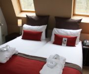
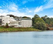
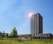
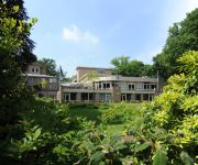
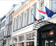
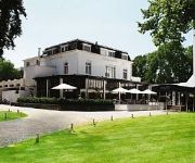
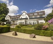
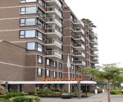
If you need a hotel, we compiled a list of available hotels close to the map centre further down the page.
While being here, you might want to pay a visit to some of the following locations: Arnhem, Kranenburg, Kleve, Weeze and Uedem. To further explore this place, just scroll down and browse the available info.
Local weather forecast
Todays Local Weather Conditions & Forecast: 4°C / 39 °F
| Morning Temperature | 2°C / 35 °F |
| Evening Temperature | 5°C / 41 °F |
| Night Temperature | 7°C / 44 °F |
| Chance of rainfall | 5% |
| Air Humidity | 87% |
| Air Pressure | 1016 hPa |
| Wind Speed | Fresh Breeze with 14 km/h (9 mph) from North |
| Cloud Conditions | Overcast clouds, covering 100% of sky |
| General Conditions | Moderate rain |
Sunday, 24th of November 2024
13°C (55 °F)
14°C (57 °F)
Moderate rain, fresh breeze, overcast clouds.
Monday, 25th of November 2024
12°C (54 °F)
9°C (48 °F)
Moderate rain, strong breeze, overcast clouds.
Tuesday, 26th of November 2024
10°C (49 °F)
7°C (44 °F)
Light rain, moderate breeze, overcast clouds.
Hotels and Places to Stay
Fletcher Doorwerth - Arnhem
NH Arnhem Rijnhotel
Van der Valk Hotel Nijmegen-Lent
Fletcher Parkhotel Val Monte
Hotel De Gulden Waagen
Fletcher Erica Hotel – Restaurant
De Bilderberg
Amrath Belvoir
Manna
Best Western Haarhuis
Videos from this area
These are videos related to the place based on their proximity to this place.
Truckrun Lingewaard 2014 passing through Elst
Missed the few trucks passing by, but still an impressive sight. Truckrun Lingewaard 2014 passing through Elst on 27 September. Truckrun has special guests on board. We missed the first few trucks.
P+R Parkeergarage Elst
Op 12 december 2015 is door Continental Car Parks de P+R parkeergarage in Elst opgeleverd. De parkeergarage met circa 600 parkeerplaatsen is gerealiseerd in opdracht van NS Stations. Inmiddels.
Presentatie Herenboerderij Hucht te Elst (zalencentrum)
Een verjaardag, een reünie, een huwelijksjubileum of een vrijgezellenactiviteit. Er zijn zoveel goede redenen te bedenken om een feest te geven. Bij Herenboerderij De Hucht te Elst zorgen...
Pagani productions @hobma rc modelbouw show elst 4-6-2011 part 1
International rc model show With lots of diffrent kind of rc models Copyright pagani productions 2011-2199 Wouter van Helden All rights reserved 2011 pagani productions.
SAM Elst 1e race 350cc onboard 2014
Sam TT van Elst in de 1e race 350cc. Onboard Yamaha RD 350 YPVS cupracer. 22 juni 2014, 22-06-2014.
SAM 3 uren van Elst compilatie 21 Juni 2014
SAM 3 uren van Elst compilatie 21 Juni 2014, 21-06-2014 Filmed by; Elwin Moes.
SAM Elst 1e race zijspannen onboard 2014
SAM Elst onboard in de 1e race van de zijspannen op een Yamaha RD 350 YPVS sidecar nr.17. 22 juni 2014 22-06-2014.
Treinen op station Elst
Een kort bezoekje aan dit station tussen Nijmegen en Arnhem levert al gauw een veelheid aan treinen op, van NSR en Arriva. Het nieuwe kopspoor is bijna klaar.Ik heb deze video gemaakt met het...
Heinz Elst
De brandweer van Elst is dinsdag uitgerukt vanwege een dreigend ongeval op het terrein van Heinz in Elst. De grote stalen pijp op het fabrieksterrein dreigde om te vallen en kon daarbij op...
Videos provided by Youtube are under the copyright of their owners.
Attractions and noteworthy things
Distances are based on the centre of the city/town and sightseeing location. This list contains brief abstracts about monuments, holiday activities, national parcs, museums, organisations and more from the area as well as interesting facts about the region itself. Where available, you'll find the corresponding homepage. Otherwise the related wikipedia article.
Lingewaard
' is a municipality in the eastern Netherlands. It is located in the most eastern part of the Betuwe. It was formed in 2001 as a merger between Bemmel, Gendt and Huissen. The municipality was initially named Bemmel after the largest former municipality but later renamed in a referendum. "Lingewaard" itself is a population centre, but an artificial name favoured my the majority of the voters. The municipality lies in between of the cities of Nijmegen and Arnhem, where most inhabitants work.
Bemmel
Bemmel is a village in Gelderland in the municipality of Lingewaard. It was previously a municipality of its own, but in 2001 it merged with Huissen and Gendt. Bemmel lies between two major cities; Arnhem and Nijmegen, and is thus bordered by the rivers Rhine and Waal. It has a population of 12,189 (1 January 2006).
John Baskeyfield
John "Jack" Daniel Baskeyfield VC (18 November 1922 – 20 September 1944) was an English recipient of the Victoria Cross, the highest award for gallantry in the face of the enemy that can be awarded to members of the British and Commonwealth armed forces. Born in 1922, Baskeyfield initially became a butcher but was called up to the army in 1942.
Huissen
Huissen is a town in Gelderland, Netherlands and has about 17,000 inhabitants. It is located at the Nederrijn, in the area between Arnhem and Nijmegen Huissen is part of the municipality of Lingewaard. It was an independent municipality until 2001, when it merged with Gendt and Bemmel to form Lingewaard. Huissen was first mentioned in 814 as Hosenheim. It received city rights in 1314. The city was part of the Duchy of Cleves and became Dutch in 1816.
Oosterbeek
Oosterbeek is a village in the eastern Netherlands. It is located in the municipality of Renkum, Gelderland, about 5 km west of Arnhem. The oldest part of the village of Oosterbeek is the Benedendorp (Lower Village), on the northern bank of the river Rhine. Parts of the church now known as the Hervormde Kerk (Reformed Church) date back to the second half of the 10th century.
Valburg
Valburg is a village in the Dutch province of Gelderland. It is located in the municipality of Overbetuwe, about 10 km northwest of Nijmegen. Valburg was a separate municipality until 2001, when it became part of Overbetuwe. \t\t \t\t\tValburg, kerk2 foto2 2011-05-02 10.35. jpg \t\t\t Valburg, church Jacobuskerk \t\t\t \t\t \t\t \t\t\tValburg, kerk1 foto3 2011-01-16 11.38. jpg \t\t\t Valburg, Dutch Reformed church \t\t\t \t\t \t\t \t\t\t2006-06-20 15.07 Valburg, molen. JPG \t\t\t Valburg, windmill: Nieuw Leven
Driel
Driel is a town in the municipality of Overbetuwe, approximately four kilometers southwest of Arnhem on the south bank of the Rhine, in the Netherlands.
GelreDome
The GelreDome is a football stadium in the city of Arnhem, in the Netherlands. It serves as the home of the football club Vitesse. It was opened on 25 March 1998, featuring a retractable roof, as well as a convertible pitch, that can be retracted, when unused during concerts or other events held at the stadium, and a climate control system. It has a maximum capacity of 34,000. It was also one of the venues for the Euro 2000 tournament held in the Netherlands and Belgium.
Elst, Gelderland
Elst is a town in the municipality of Overbetuwe in the Dutch province of Gelderland. Elst is situated in the Betuwe, between the cities of Nijmegen and Arnhem. Elst has 21,130 inhabitants. Elst is famous for its Roman temples, which are situated under the Saint Werenfried church. Elst was a separate municipality until 2001, when it became a part of Overbetuwe. H. J. Heinz Company's sauce factory for the European market is located south of the town centre.
Rijkerswoerd
Rijkerswoerd is a new city district in Arnhem, Netherlands, located in the southeastern part of the city between the 'Huissensedijk, A325 / Nijmeegseweg' and the community of Elst. The city district consists of four neighbourhoods: Rijkerswoerd-East, Rijkerswoerd-Middle, Rijkerswoerd-West and 'de Overmaat', where various enterprises are located. Rijkerswoerd is surrounded on three sides by a 'buffer' zone and fields.
Valkhof museum
The Valkhof museum is an archaeology and art museum in Nijmegen, Netherlands. The museum has existed since 1999, created as a merger between the G.M. Kam museum of archaeology and the Commanderie van St. Jan museum of classical and modern art. The museum's collection includes a large and important collection of local Roman archaeological finds and art (mostly modern). The Museum stands on the edge of the Valkhof park, site of a Roman army camp and a citadel built by Charlemagne.
Stadsregio Arnhem Nijmegen
Stadsregio Arnhem Nijmegen (English: City-region Arnhem Nijmegen) is the name of the metropolitan area consisting of the Dutch cities of Nijmegen and Arnhem, plus the bordering municipalities of Beuningen, Doesburg, Duiven, Groesbeek, Heumen, Lingewaard, Millingen aan de Rijn, Montferland, Mook en Middelaar, Overbetuwe, Renkum, Rheden, Rijnwaarden, Rozendaal, Ubbergen, Westervoort, Wijchen, and Zevenaar. All but one are in the province of Gelderland.
Velorama
The Velorama (Dutch: Nationaal fietsmuseum Velorama) is the only bicycle museum in the Netherlands. It is located at the Waalkade in the city of Nijmegen. The museum was founded in 1981 from the private collection of G.F. Moed. In three storeys it shows about 250 exhibits from nearly two centuries. The Velorama owns a large collection of bicycle literature and also preserves the historic archive of the Dutch bicycle manufacturer Gazelle.
Aam
Aam is a hamlet in the Dutch province of Gelderland. It is located in the municipality of Overbetuwe, about 1 km east of the town of Elst.
Elden, Netherlands
Elden is a village in the Dutch province of Gelderland. It is located in the municipality of Arnhem, about 4 km southwest of the city centre. Elden was a separate municipality between 1813 and 1818, when it was merged with Elst. The village of Elden, on the south side of the Rhine, has now been completely surrounded by suburbs of the city of Arnhem.
Lent, Gelderland
Lent is a village in the Dutch province of Gelderland. It is located in the municipality of Nijmegen, about 2 km north of that city, on the north bank of the Waal river. Lent was a separate municipality until 1818, when it was merged with Elst. Lent has a large influx of foreign students studying abroad at Radboud University Nijmegen living in a facility (Griftdijk) run by the Short Stay Housing Nijmegen (SSHN).
Loenen en Wolferen
Loenen en Wolferen is a former municipality in the Dutch province of Gelderland. It existed from 1818 to 1854, when it became a part of Valburg. The area is now part of the municipality of Overbetuwe. The municipality covered the two hamlets of Loenen and Wolferen.
Lijnden, Gelderland
Lijnden is a hamlet in the Dutch province of Gelderland. It is located in the municipality of Overbetuwe, about 2 km west of the town of Elst.
Baal, Netherlands
Baal is a hamlet in the Dutch province of Gelderland. It is located in the municipality of Lingewaard, about 1 km northeast of Bemmel, and located 1 kilometer north of Haalderen and is therefore part of Haalderen. According to the 19th century historian A.J. van der Aa, it had about 60 inhabitants in the middle of the 19th century.
't Zand, Nijmegen
't Zand is a hamlet in the Dutch province of Gelderland, in the municipality of Nijmegen.
St. Anna Street
St. Annastreet is a street in the Dutch city of Nijmegen. The name is derived from the hamlet St. Anna, named after a chapel devoted to Saint Anne The street functions as one of the major traffic arteries into Nijmegen and sets the stage for the arrival on the last day of the International Four Days Marches Nijmegen. For this occasion, the street is renamed Via Gladiola.
Waalbrug
The Waalbrug is an arch bridge over the Waal River in Nijmegen, Gelderland, the Netherlands. The full length of the Waalbrug is 604 metres, the middle of the arch being about 65 metres high. The arch itself is 244.1 metres long and was the longest arch in Europe at the time of construction.
Nijmegen railway bridge
The Nijmegen railway bridge is a Truss bridge spanning the River Waal, connecting the city of Nijmegen to the town of Lent in the Netherlands.
Stratemakerstoren
The Stratemakerstoren is an early 16th century bastion on the Waalkade in the Dutch town Nijmegen. It is a rijksmonument (national heritage site) and since 1995, it houses a museum. The Stratemakerstoren is located on the edge of the river Waal, at the foot of the Valkhof at Nijmegen. This bastion was a part of the fortifications of Nijmegen, built in or before 1526.
Concertgebouw de Vereeniging
Concertgebouw de Vereeniging is a concert hall in Nijmegen, Netherlands. The hall was officially opened in 1915, and is built in a nixture of the Art Nouveau and Art Deco styles. It has a capacity of 1,800. Many notable artists such as Whitesnake have performed there. It is a designated Rijksmonument, numbered 523000.


