Safety Score: 3,3 of 5.0 based on data from 9 authorites. Meaning please reconsider your need to travel to Netherlands.
Travel warnings are updated daily. Source: Travel Warning Netherlands. Last Update: 2024-08-13 08:21:03
Discover Holthuizen
Holthuizen in Gemeente Montferland (Provincie Gelderland) is a town in Netherlands about 61 mi (or 99 km) south-east of Amsterdam, the country's capital city.
Current time in Holthuizen is now 12:15 AM (Friday). The local timezone is named Europe / Amsterdam with an UTC offset of one hour. We know of 10 airports near Holthuizen, of which 4 are larger airports. The closest is airport we know is Niederrhein Airport in Germany in a distance of 24 mi (or 38 km). The closest airport in Netherlands is Twenthe Airport in a distance of 38 mi (or 38 km), South. Besides the airports, there are other travel options available (check left side).
There are several Unesco world heritage sites nearby. The closest heritage site in Netherlands is Rietveld Schröderhuis (Rietveld Schröder House) in a distance of 44 mi (or 71 km), West. We discovered 5 points of interest in the vicinity of this place. Looking for a place to stay? we compiled a list of available hotels close to the map centre further down the page.
When in this area, you might want to pay a visit to some of the following locations: Kleve, Kranenburg, Arnhem, Uedem and Weeze. To further explore this place, just scroll down and browse the available info.
Local weather forecast
Todays Local Weather Conditions & Forecast: 3°C / 38 °F
| Morning Temperature | 0°C / 33 °F |
| Evening Temperature | 2°C / 35 °F |
| Night Temperature | 1°C / 35 °F |
| Chance of rainfall | 7% |
| Air Humidity | 75% |
| Air Pressure | 998 hPa |
| Wind Speed | Moderate breeze with 11 km/h (7 mph) from North-East |
| Cloud Conditions | Overcast clouds, covering 92% of sky |
| General Conditions | Snow |
Friday, 22nd of November 2024
4°C (40 °F)
3°C (38 °F)
Moderate rain, fresh breeze, scattered clouds.
Saturday, 23rd of November 2024
4°C (40 °F)
5°C (42 °F)
Moderate rain, fresh breeze, overcast clouds.
Sunday, 24th of November 2024
11°C (52 °F)
12°C (54 °F)
Moderate rain, fresh breeze, overcast clouds.
Hotels and Places to Stay
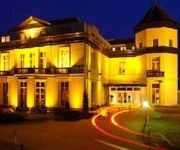
Fletcher Landgoed Avegoor
Campanile - Zevenaar Arnhem
Videos from this area
These are videos related to the place based on their proximity to this place.
Bosuil - Uil - Owl - Hibou - Eule - フクロウ - coruja - búho - сова - gufo - Harry Völker
Uilskuiken Z.O. Veluwezoom. Foto's en nachtelijke filmopname met roepende uilen.
Loil 1968 Otten
Loil in het jaar 1968, selectie van bewoners en buurtschap "Klein Amerika" gemeente Didam. Fam. Jan Otten.
Survivalrun Loil 12-05-2013
Ingrid en Mika nemen de 32ste en laatste hindernis van de Survivalrun. http://survivalloil.nl/
Sjanté The Passion 2013
Compilatie van de voorstelling vol passie met muziek en zang van Sjanté in de kerk van Loil.
Snotapen - The Road To Zeeland part 2 (deel 1 / 3)
Carnavalsgroep De Snotapen uit Loil vierde in 2008 haar 11-jarig jubileum en deed dit jaar in drie optochten mee: Loil, Angerlo en die in het Brabantse Zeeland. De hele weg er naar toe is op...
Vendelhulde
Zaterdag 10 november 2012. St. Martinus Feest Schutterij St. Martinus Greffelkamp. Onderscheiding Medaille van Verdienste der Federatie met Oorkonde voor Hans Buiting. Onderscheiding Zilveren...
Spoorwegovergang Didam/ Level Crossing, Railroad Crossing
De stoptreinen naar Doetinchem en Arnhem stopt/vertrekt van/op station Didam The Regional Rails to Doetinchem and Arnhem enters en leaves Didam railway station.
Spoorwegovergang Didam/ Level Crossing, Railroad Crossing
De stoptrein naar Winterswijk stopt op station Didam, en er vertrekt een stoptrein naar Arnhem The Regional Rails to Winterswijk and Arnhem enters en leaves Didam railway station.
Spoorwegovergang Didam/ Level Crossing, Railroad Crossing
De stoptrein naar Winterswijk komt binnen op station Didam The Regional Rail to Winterswijk enters Didam railway station.
Spoorwegovergang Didam/ Level Crossing, Railroad Crossing
De stoptrein naar Doetinchem passeert de Dijksestraat The Regional Rail to Doetinchem passes the Dijksestraat.
Videos provided by Youtube are under the copyright of their owners.
Attractions and noteworthy things
Distances are based on the centre of the city/town and sightseeing location. This list contains brief abstracts about monuments, holiday activities, national parcs, museums, organisations and more from the area as well as interesting facts about the region itself. Where available, you'll find the corresponding homepage. Otherwise the related wikipedia article.
Didam
Didam is a town in the Dutch province of Gelderland. It is located in the municipality of Montferland, about 18 km east of Arnhem. Didam was a separate municipality until 2005, when it merged with Bergh to create the new municipality of Montferland.
Nieuw-Dijk
Nieuw-Dijk is a small village in the municipality of Montferland in the Dutch province of Gelderland, close to Germany, with a population of approximately 1600 people. Nieuw-Dijk has its own Roman Catholic parish church and primary school, both named for Saint Anthony of Padua. In 1926 a local football club was established, called the Sprinkhanen ("Grasshoppers"). The village also has a shooting club(schutterij). There are activities for children such as Schuttersfeest and the Elfstratentocht.
Nieuw-Wehl
Nieuw-Wehl is a village in the eastern Netherlands, about 10 km west of Doetinchem. It has a population of about 500. Before 1 January 2005, it was part of the municipality of Wehl, along with neighboring village Wehl. After the division, Nieuw-Wehl joined the municipality of Doetinchem. In 1925, a Roman Catholic church was built.
Beek, Montferland
Beek is a village in the Dutch province of Gelderland. It is located in the municipality Montferland, about 5 km southeast of Didam. Beek has a population of about 2020 inhabitants: 1410 in the village itself, and 610 in the surrounding countryside.
Loerbeek
Loerbeek is a little place in The Netherlands, near the German border. It's close too Beek and Nieuw-Dijk. There's a big forest called, Bergherbos, where people can walk, mountainbike and ride horse.


