Safety Score: 3,3 of 5.0 based on data from 9 authorites. Meaning please reconsider your need to travel to Netherlands.
Travel warnings are updated daily. Source: Travel Warning Netherlands. Last Update: 2024-08-13 08:21:03
Delve into Zandheuvel
Zandheuvel in Gemeente Lingewaard (Provincie Gelderland) is located in Netherlands about 56 mi (or 90 km) south-east of Amsterdam, the country's capital town.
Current time in Zandheuvel is now 08:10 PM (Thursday). The local timezone is named Europe / Amsterdam with an UTC offset of one hour. We know of 10 airports close to Zandheuvel, of which 5 are larger airports. The closest is airport we know is Niederrhein Airport in Germany in a distance of 21 mi (or 34 km). The closest airport in Netherlands is Eindhoven Airport in a distance of 38 mi (or 34 km), South-East. Besides the airports, there are other travel options available (check left side).
There are several Unesco world heritage sites nearby. The closest heritage site in Netherlands is Rietveld Schröderhuis (Rietveld Schröder House) in a distance of 36 mi (or 59 km), West. We encountered 5 points of interest near this location. If you need a hotel, we compiled a list of available hotels close to the map centre further down the page.
While being here, you might want to pay a visit to some of the following locations: Arnhem, Kranenburg, Kleve, Weeze and Uedem. To further explore this place, just scroll down and browse the available info.
Local weather forecast
Todays Local Weather Conditions & Forecast: 4°C / 39 °F
| Morning Temperature | 0°C / 33 °F |
| Evening Temperature | 2°C / 35 °F |
| Night Temperature | 1°C / 35 °F |
| Chance of rainfall | 7% |
| Air Humidity | 72% |
| Air Pressure | 999 hPa |
| Wind Speed | Moderate breeze with 10 km/h (6 mph) from North-East |
| Cloud Conditions | Overcast clouds, covering 91% of sky |
| General Conditions | Snow |
Friday, 22nd of November 2024
5°C (40 °F)
3°C (38 °F)
Moderate rain, fresh breeze, scattered clouds.
Saturday, 23rd of November 2024
4°C (40 °F)
5°C (42 °F)
Moderate rain, fresh breeze, overcast clouds.
Sunday, 24th of November 2024
11°C (52 °F)
12°C (54 °F)
Moderate rain, fresh breeze, overcast clouds.
Hotels and Places to Stay
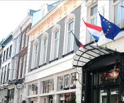
Hotel De Gulden Waagen
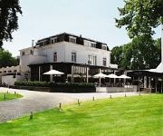
Fletcher Erica Hotel – Restaurant
Hotel Holthurnische Hof Nijmegenl
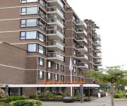
Amrath Belvoir
Duiven bij Arnhem A12
Van der Valk Hotel Nijmegen-Lent
Mercure Hotel Nijmegen Centre
Manna
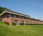
Fletcher Parkhotel Val Monte
Fletcher Gelderse Poort Hotel – Restaurant
Videos from this area
These are videos related to the place based on their proximity to this place.
Teeterboard Show at the Dutch Acrobatic Festival 2012
This video shows Sylvain and Sokrates of CIE BAM performing a teeterboard show. The material was filmed at the Dutch Acrobatics Convention 2012 in Bemmel. The show is about to boys falling...
Gasballon Nimbus scheurt open. Ooij (Nijmegen) 6 mei 1975
Tijdens het dertigjarig bevrijdingsfeest in 1975 slingerde de "Nimbus" PH-BVH van de Haagsche Ballonclub zo hard, dat de scheurbaan moest worden opengetrokken. Gelukkig draaide de super-8 ...
Riverboats river Waal, Holland #02
Scheepvaart op rivier Waal, laag water. Dutch River Waal is a major river which serves as the main waterway connecting Rotterdam harbor and the Ruhrgebiet in Germany. It is the main distributary...
Minecraft Pvp Team Practice Diamond VS Archer
Ons server ip: playmcgames.net Onze website: playmcgames.net ✪ ✓ opneem software: Dxtory,bandicam ✓ Software waarmee ik edit: Adobe Première Pro • Headset: Logitech...
Joop & Ellen Groenen, Koerier 48
Koerier 48 Joop & Ellen Groenen, Ooy ( bij Nijmegen) Met slechts zestien weduwnaars en sinds kort enkele weduwduivinnen is Joop al jaren de te kloppen man op vitesse en midfond in kring ...
special Minecraft speed build #1 mc games server
Speed build door JasperJH. server ip: mcgames.join-srv.net opneem software: Dxtory Software waarmee ik edit: Adobe Première Pro Headset: Logitech g430 7.1 surround Toetsenbord: Logitech g15...
DB Schenker BR189 met Kalktrein bij Huissen-Pannenhuis
(NL) Zaterdag 12 oktober tegen 18.00u. passeerde deze kalktrein ter hoogte van Huissen-Pannenhuis. De grijze bewolking was de aankondiging van een lange rege...
Videos provided by Youtube are under the copyright of their owners.
Attractions and noteworthy things
Distances are based on the centre of the city/town and sightseeing location. This list contains brief abstracts about monuments, holiday activities, national parcs, museums, organisations and more from the area as well as interesting facts about the region itself. Where available, you'll find the corresponding homepage. Otherwise the related wikipedia article.
Lingewaard
' is a municipality in the eastern Netherlands. It is located in the most eastern part of the Betuwe. It was formed in 2001 as a merger between Bemmel, Gendt and Huissen. The municipality was initially named Bemmel after the largest former municipality but later renamed in a referendum. "Lingewaard" itself is a population centre, but an artificial name favoured my the majority of the voters. The municipality lies in between of the cities of Nijmegen and Arnhem, where most inhabitants work.
Bemmel
Bemmel is a village in Gelderland in the municipality of Lingewaard. It was previously a municipality of its own, but in 2001 it merged with Huissen and Gendt. Bemmel lies between two major cities; Arnhem and Nijmegen, and is thus bordered by the rivers Rhine and Waal. It has a population of 12,189 (1 January 2006).
Angeren
Angeren is a village in the Netherlands in the municipality of Lingewaard. It has a population of 2,851 (1 January 2009), and is located in the very eastern tip of the Betuwe, 2 km to the south of Huissen, between the cities of Arnhem and Nijmegen. Angeren is first mentioned as Angrina in a document dated 814 or 815. By 1160 Angeren was an independent parish. During the Middle Ages, Angeren grew to a village with a village square, a fortification ('Het Roode Wald') and a flour mill.
Kapel, Gelderland
Kapel is a hamlet in the Dutch province of Gelderland. It is located in the municipality of Lingewaard, about 1 km north of the town of Gendt.
Ooij en Persingen
Ooij en Persingen is a former municipality in the Dutch province of Gelderland. It existed until 1818, when it was merged with Ubbergen. It is named after the two villages Ooij and Persingen.
Baal, Netherlands
Baal is a hamlet in the Dutch province of Gelderland. It is located in the municipality of Lingewaard, about 1 km northeast of Bemmel, and located 1 kilometer north of Haalderen and is therefore part of Haalderen. According to the 19th century historian A.J. van der Aa, it had about 60 inhabitants in the middle of the 19th century.


