Safety Score: 3,3 of 5.0 based on data from 9 authorites. Meaning please reconsider your need to travel to Netherlands.
Travel warnings are updated daily. Source: Travel Warning Netherlands. Last Update: 2024-08-13 08:21:03
Delve into Dichteren
The district Dichteren of Doetinchem in Gemeente Doetinchem (Provincie Gelderland) is a district located in Netherlands about 65 mi south-east of Amsterdam, the country's capital town.
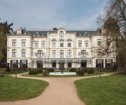
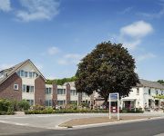
In need of a room? We compiled a list of available hotels close to the map centre further down the page.
Since you are here already, you might want to pay a visit to some of the following locations: Kleve, Uedem, Kranenburg, Weeze and Arnhem. To further explore this place, just scroll down and browse the available info.
Local weather forecast
Todays Local Weather Conditions & Forecast: 4°C / 40 °F
| Morning Temperature | 4°C / 39 °F |
| Evening Temperature | 3°C / 37 °F |
| Night Temperature | 4°C / 39 °F |
| Chance of rainfall | 0% |
| Air Humidity | 89% |
| Air Pressure | 1027 hPa |
| Wind Speed | Gentle Breeze with 8 km/h (5 mph) from East |
| Cloud Conditions | Overcast clouds, covering 99% of sky |
| General Conditions | Light rain |
Thursday, 5th of December 2024
5°C (41 °F)
7°C (44 °F)
Light rain, fresh breeze, overcast clouds.
Friday, 6th of December 2024
8°C (47 °F)
7°C (44 °F)
Heavy intensity rain, strong breeze, overcast clouds.
Saturday, 7th of December 2024
6°C (43 °F)
6°C (43 °F)
Light rain, gale, overcast clouds.
Hotels and Places to Stay
Hotel Villa Ruimzicht
Stadshotel De Graafschap
Hotel de Uitkijk
Videos from this area
These are videos related to the place based on their proximity to this place.
Flinke hagelbui trekt over Doetinchem 23-05-2012
Een flinke hagelbui met onweer en harde windvlagen trekt over Doetinchem met sommige hagelstenen van het formaat pingpongbal! Arme KOI in de vijver....zij worden bekogeld! 23 mei 2012 rond ...
DSGN4U 3D interieurontwerper: Vrijstaande woning met thuiskantoor Doetinchem
http://www.DSGN4U.nl Onze 3D interieuradvies animaties zijn op een hoog realistisch niveau. U krijgt op deze manier een duidelijk beeld van uw nieuwe interieur en verrassingen achteraf zijn...
1st Test Shore-line SFA Bikepark (HD)
1st test new shore -line build during the dark winter evenings. Nice to see that everythings on his place. Now build the rest of the skinny sector at the and of the line. Also a cross line...
Onweer / noodweer / shelfcloud / time-lapse / thunderstorm / 15 juli 2010 / regen / bliksem / HD
Het noodweer van woensdag 14 juli 2010 dat over Doetinchem (Achterhoek) trok.
Mvv uit @ stadion De Vijverberg
Na de wedstrijd mvv - de graafschap wachten zo'n 70 De Graafschap supporters de spelersbus op bij het stadion. Zodra die arriveren barst er een feestje los.
Slingeland naar Tanzania
5 Medisch specialisten vertrekken vrijdag naar Tanzania om daar artsen te helpen bij complexe operaties. Chirug Lemson en tropenarts in opleiding van Hennik vertellen over hun komende reis.
Videos provided by Youtube are under the copyright of their owners.
Attractions and noteworthy things
Distances are based on the centre of the city/town and sightseeing location. This list contains brief abstracts about monuments, holiday activities, national parcs, museums, organisations and more from the area as well as interesting facts about the region itself. Where available, you'll find the corresponding homepage. Otherwise the related wikipedia article.
Bergh
Bergh is a former municipality in the Dutch province of Gelderland. The municipality included the villages of 's-Heerenberg, Zeddam, and Stokkum. In 2005, it merged with Didam to form the new municipality of Montferland.
Doetinchem
Doetinchem is a city and municipality in the east of the Netherlands. It is situated along the Oude IJssel (Old IJssel) river in a part of the province of Gelderland called the Achterhoek . The municipality has 56,275 inhabitants (January 1, 2012) and has an area of 79.67 km² (of which 0.57 km² is water). This makes Doetinchem the largest town (by population) in the Achterhoek. On 1 January 2005, a municipal reorganization merged the neighbouring municipality of Wehl into Doetinchem.
Hummelo en Keppel
Hummelo en Keppel is a former municipality in the Dutch province of Gelderland. It was created in 1818, when the municipalities of Hummelo and Keppel merged, and existed until 2005, when the area became a part of the new municipality of Bronckhorst.
Wehl
Wehl is a town in the eastern Netherlands, about 5 km west of Doetinchem. Wehl was a part of Prussia until 1808, when it was joined to the Netherlands. In those years it was officially a part of Zeddam. Wehl became an independent municipality in 1813, when it was given back to Prussia; in 1816, it returned to the Netherlands. It remained an independent municipality until the municipal reorganization on 1 January 2005, when Wehl became part of the larger neighbouring municipality of Doetinchem.
Wisch, Gelderland
Wisch is a former municipality in the Dutch province of Gelderland. The municipality was created in 1818, in a merger of Terborg and Varsseveld, and existed until 2005, when it became a part of the new municipality of Oude IJsselstreek. Besides the villages of Terborg and Varsseveld, the municipalities also covered the villages and hamlets Bontebrug, Heelweg-Oost, Heelweg-West, Silvolde, Sinderen, and Westendorp.
Zelhem
Zelhem is a village in the Dutch province of Gelderland. It has approximately 11.000 inhabitants. Zelhem is located in the municipality of Bronckhorst, about 7 km northeast of Doetinchem. Zelhem was a separate municipality until 2005, when it became a part of Bronckhorst. The municipality used to cover an area of 81.89 km².
's-Heerenberg
's-Heerenberg is a city on the Dutch-German border, in the Province of Gelderland, Netherlands. It is located about 5 km north of the German Emmerich, and about 12 km south of Doetinchem. It received city rights in 1379. 's-Heerenberg is the location of one the most important castles of the Netherlands: Huis Bergh. The Huis Bergh contains a panel of the Archangel Gabriel from the famous altar piece Maestà by Duccio.
Terborg
Terborg is a village in the Dutch province of Gelderland, in the east of the Netherlands. It is located in the municipality of Oude IJsselstreek. The village lies about 7 km southeast of Doetinchem. The population is about 4600 inhabitants. Terborg is situated on the river the Oude IJssel. In the centre of the little city lies Castle Wisch, founded in the 13th century (the name "Terborg" means "by the castle"). In the southeast is a nature reserve called the Paasberg ("Easter Mountain").
Villa Bouchina
Villa Bouchina was the parsonage of the Christian Reformed Church in the City of Doetinchem, Province of Gelderland. From February 27 until April 21, 1943, it was used temporarily to house nine Jews, including three children, who were known as Mussert Jews. Anton Mussert was the head of the Dutch Nazi Party, the NSB. A number of Jews had joined the NSB which initially was not antisemitic. Once war broke out that changed and all Jews were removed from NSB ranks.
De Vijverberg
De Vijverberg (English: The Pond Hill) is the football stadium of the football club De Graafschap from Doetinchem. It has a capacity of 12,600 seats. The name is derived from a hotel with the same name, which stood on the present location of the stadium. Because of all the ponds that had to be filled up, the name Vijverberg arose. The stadium, which was built in 1954, was renovated in 1970, with the construction of the Vijverberg-, Groenendaal- and Spinnenkop stands and the light installation.
Laag-Keppel
Laag-Keppel is a small village with Town privileges (since 1404) between Doetinchem and Doesburg. Situated along the main thoroughfare between these two larger cities, there is heavy traffic moving through at all times. Laag Keppel has an estimated 594 residents. However, the peaceful neighbourhood this has provided has attracted many young couples looking to raise children in this forested area, surrounded by farmlands.
Ambt Doetinchem
Ambt Doetinchem is a former municipality in the Dutch province of Gelderland. It consisted of the countryside surrounding the city of Doetinchem, which belonged to the separate municipality of Stad Doetinchem. Ambt Doetinchem was a separate municipality between 1818 and 1920, when it merged with Stad Doetinchem.
Etten, Netherlands
Etten is a village in the Dutch province of Gelderland. It is located in the municipality of Oude IJsselstreek, 7 km southeast of Doetinchem. Etten was a separate municipality until 1818, when it was merged with Gendringen.
Keppel, Netherlands
Keppel is a former municipality in the Dutch province of Gelderland, consisting of the villages of Laag-Keppel and Hoog-Keppel. It existed until 1818, when it merged with Hummelo to form the new municipality of Hummelo en Keppel.
Stad Doetinchem
Stad Doetinchem is a former municipality in the Dutch province of Gelderland. It consisted of the city of Doetinchem and its immediate surroundings. The larger surrounding countryside was a separate municipality, called Ambt Doetinchem. Stad Doetinchem existed until 1920, when it merged with Ambt Doetinchem to form a single municipality Doetinchem.
Zeddam
Zeddam is a village in the Dutch province of Gelderland. It is located in the municipality of Montferland, about 7 km south of Doetinchem. Zeddam was a separate municipality until 1821, when it was merged with Bergh.
Nieuw-Wehl
Nieuw-Wehl is a village in the eastern Netherlands, about 10 km west of Doetinchem. It has a population of about 500. Before 1 January 2005, it was part of the municipality of Wehl, along with neighboring village Wehl. After the division, Nieuw-Wehl joined the municipality of Doetinchem. In 1925, a Roman Catholic church was built.
Azewijn
Azewijn is a small village in the Dutch province of Gelderland. It is located in the municipality Montferland, about 3 km east of the town of 's-Heerenberg. Azewijn has about 800 inhabitants. The main part of the village is also known as "Groot-Azewijn" (Greater Azewijn), in contrast with the hamlet "Klein-Azewijn" (Lesser Azewijn) about 1 km to the north.
Beek, Montferland
Beek is a village in the Dutch province of Gelderland. It is located in the municipality Montferland, about 5 km southeast of Didam. Beek has a population of about 2020 inhabitants: 1410 in the village itself, and 610 in the surrounding countryside.
Gaanderen
Gaanderen is a village in the Dutch province of Gelderland. It is located in the municipality of Doetinchem. The number of inhabitants is around 5700.
Huis Bergh
Huis Bergh is a castle in 's-Heerenberg and is one of the largest castles in the Netherlands. It gives its name to the Land van den Bergh and was previously owned by the counts van Bergh.
Loerbeek
Loerbeek is a little place in The Netherlands, near the German border. It's close too Beek and Nieuw-Dijk. There's a big forest called, Bergherbos, where people can walk, mountainbike and ride horse.
Slangenburg Castle
Slangenburg Castle is a castle in the municipality of Doetinchem in the province of Gelderland in the Netherlands. The castle is located in the forest of the same name between the towns of Varsseveld and Doetinchem, about 5 kilometers from the latter. Slangenburg Castle was constructed in the Late Medieval period. In the 17th century the castle became the property of General Frederik Johan van Baer, also known as General Slangenburg, who rebuilt it for residential purposes.
Plantage (Amsterdam)
Plantage (Amsterdam) is a neighborhood of Amsterdam, Netherlands. More information about the neighborhood: De Plantage Amsterdam.
Grafelijke Korenmolen, Zeddam
The Grafelijke Korenmolen van Zeddam (Countships grainmill of Zeddam) is a tower mill in Zeddam, the Netherlands which has been restored to working order. The mill may have been built before 1441, making it the oldest windmill in existence in the Netherlands. It is listed as Rijksmonument number 9290.


