Safety Score: 3,3 of 5.0 based on data from 9 authorites. Meaning please reconsider your need to travel to Netherlands.
Travel warnings are updated daily. Source: Travel Warning Netherlands. Last Update: 2024-08-13 08:21:03
Delve into Beinum
The district Beinum of Doesburg in Gemeente Doesburg (Provincie Gelderland) is a subburb in Netherlands about 58 mi south-east of Amsterdam, the country's capital town.
If you need a hotel, we compiled a list of available hotels close to the map centre further down the page.
While being here, you might want to pay a visit to some of the following locations: Kleve, Arnhem, Kranenburg, Uedem and Weeze. To further explore this place, just scroll down and browse the available info.
Local weather forecast
Todays Local Weather Conditions & Forecast: 14°C / 58 °F
| Morning Temperature | 14°C / 57 °F |
| Evening Temperature | 10°C / 50 °F |
| Night Temperature | 8°C / 47 °F |
| Chance of rainfall | 4% |
| Air Humidity | 71% |
| Air Pressure | 1001 hPa |
| Wind Speed | Strong breeze with 18 km/h (11 mph) from North |
| Cloud Conditions | Overcast clouds, covering 100% of sky |
| General Conditions | Moderate rain |
Tuesday, 26th of November 2024
8°C (46 °F)
7°C (45 °F)
Light rain, moderate breeze, overcast clouds.
Wednesday, 27th of November 2024
10°C (49 °F)
7°C (44 °F)
Moderate rain, fresh breeze, overcast clouds.
Thursday, 28th of November 2024
9°C (49 °F)
4°C (40 °F)
Light rain, fresh breeze, clear sky.
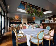
Hotels and Places to Stay
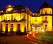
Fletcher Landgoed Avegoor
Villa Veertien
Campanile - Zevenaar Arnhem
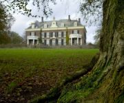
Landgoed Rhederoord
Herberg De Gouden Leeuw
Chalethotel Polysport
Buitengoed de Panoven
Videos from this area
These are videos related to the place based on their proximity to this place.
Stappen in Doesburg
Een nieuw initiatief om zich bewust te maken hoeveel men eigenlijk elke dag beweegt. Marcel Teunissen en Ward Terpstra geven uitleg over een leuk en speels concept waaraan men in Doesburg kan ...
kerstmarkt Doesburg 2014
Impressie van de kerstmarkt gehouden in Doesburg. Op zaterdag 6 december 2014. Bijna 140 kramen in de historische binnenstad trokken veel bezoekers. Er is zelfs sprake van de grootste kerstmarkt.
Circus Bossle in Doesburg
Het is weer lang geleden dat een heus circus in Doesburg zijn tent opzet. Op de Turfhaven staat sinds vandaag het Circus Bossle die van woensdag tot en met zondag voorstellingen geeft. DoesburgTV ...
Zwembad Doesburg 20 jaar
Zondag 7 september zal in het Doesburgse Zwembad "Den Helder" het feit worden gevierd dat ze 20 jaar bestaan. Een dag vol met publieksactiviteiten waaraan voor een gereduceerd tarief van slechts ...
Glazenhuis Doesburg
Donderdag 4 december was er een infoavond in de Wetelaar over het te organiseren Glazenhuis Doesburg. Een actie in het kader van Serius Request van 3 FM waar de organisatie met veel ...
Es Klok Carillon Doesburg
De stichting Carillon Doesburg is vandaag een werving actie gestart om eindelijk, na vele jaren, het Doesburgse carillon compleet te maken met een Es klok. 40.000 euro moet er worden ingezameld...
Doesburg Bruist
Op zaterdag 19 april was er een muziekconcours georganiseerd in het hartje van de binnenstad. Tussen 11.00 -- 16.00 uur konden kinderen en jongeren in de leeftijd van 8 tot 18 jaar op straat...
rondje Doesburg 14 december
In dit rondje Doesburg: kerstmarkt op de Ooi en kerstboom drive-in bij Only for men.
Historische muurschilderingen in Doesburg ontdekt .
In het pand van Doesburger Karel Welter zijn tijdens de verbouwing een aantal fraaie muurschilderingen tevoorschijn gekomen. Volgens deskundige uit de 17 e eeuw. Of deze bijzondere beelden...
Fotografica markt Doesburg 2014
Voor de 20 maal was de binnenstad van Doesburg weer overvol van liefhebbers en en verzamelaars van fototoestellen lenzen apparatuur en alles wat er maar bij hoort. maar liefst 130 kramen die...
Videos provided by Youtube are under the copyright of their owners.
Attractions and noteworthy things
Distances are based on the centre of the city/town and sightseeing location. This list contains brief abstracts about monuments, holiday activities, national parcs, museums, organisations and more from the area as well as interesting facts about the region itself. Where available, you'll find the corresponding homepage. Otherwise the related wikipedia article.
Angerlo
Angerlo is a village in the municipality of Zevenaar, in the eastern Netherlands. It is located about 2 km south of Doesburg. Until 1 January 2005, Angerlo was an independent municipality, with a population of about 5000. This municipality included the villages of Bahr, Giesbeek and Lathum, and the hamlets of Bevermeer and Bingerden.
Didam
Didam is a town in the Dutch province of Gelderland. It is located in the municipality of Montferland, about 18 km east of Arnhem. Didam was a separate municipality until 2005, when it merged with Bergh to create the new municipality of Montferland.
Hummelo en Keppel
Hummelo en Keppel is a former municipality in the Dutch province of Gelderland. It was created in 1818, when the municipalities of Hummelo and Keppel merged, and existed until 2005, when the area became a part of the new municipality of Bronckhorst.
Rheden
' is a municipality and a town in the eastern Netherlands.
Steenderen
Steenderen is a former municipality and a town in the eastern Netherlands.
Wehl
Wehl is a town in the eastern Netherlands, about 5 km west of Doetinchem. Wehl was a part of Prussia until 1808, when it was joined to the Netherlands. In those years it was officially a part of Zeddam. Wehl became an independent municipality in 1813, when it was given back to Prussia; in 1816, it returned to the Netherlands. It remained an independent municipality until the municipal reorganization on 1 January 2005, when Wehl became part of the larger neighbouring municipality of Doetinchem.
Zevenaar
' is a municipality and a city in the eastern Netherlands, near the border with Germany.
Nieuw-Dijk
Nieuw-Dijk is a small village in the municipality of Montferland in the Dutch province of Gelderland, close to Germany, with a population of approximately 1600 people. Nieuw-Dijk has its own Roman Catholic parish church and primary school, both named for Saint Anthony of Padua. In 1926 a local football club was established, called the Sprinkhanen ("Grasshoppers"). The village also has a shooting club(schutterij). There are activities for children such as Schuttersfeest and the Elfstratentocht.
Bronkhorst
Bronkhorst is a village in the municipality of Bronckhorst, Gelderland, the Netherlands. Technically, it is a city (see below) and with only 171 inhabitants (2006), it is one of the smallest cities in the Netherlands.
Oude Rijn (Gelderland)
Oude Rijn ("Old Rhine") is the name of a long former bend in river Rhine in the Dutch province of Gelderland. In summer the bend became too shallow to be navigable, and so between 1701 and 1709 was cut off from the main waterway near the town of Lobith and replaced by the Pannerdens Kanaal. After the bend was dammed-up at Tolkamer, the Oude Rijn received little water from the Rhine proper. Instead, most of its inflow now comes from the small river Wild.
Dieren
Dieren is a town in the eastern Netherlands. It is located in Rheden, Gelderland, between Zutphen and Arnhem, on the bank of the IJssel. Dieren was a separate municipality until 1818, when it became a part of Rheden. A steam railway connect Dieren and Apeldoorn via Beekbergen, operated by the Veluwsche Stoomtrein Maatschappij. The Gazelle bicycle factory is located in Dieren.
Oude IJssel
Oude IJssel, literally old IJssel, or Issel is a river in Germany and the Netherlands approximately 80 km long. It is a right tributary of the river IJssel. Oude IJssel means "Old IJssel" in Dutch; the Oude IJssel was the upper course of the IJssel until the connection with the Rhine was dug, possibly in the Roman era.
Laag-Keppel
Laag-Keppel is a small village with Town privileges (since 1404) between Doetinchem and Doesburg. Situated along the main thoroughfare between these two larger cities, there is heavy traffic moving through at all times. Laag Keppel has an estimated 594 residents. However, the peaceful neighbourhood this has provided has attracted many young couples looking to raise children in this forested area, surrounded by farmlands.
Keppel, Netherlands
Keppel is a former municipality in the Dutch province of Gelderland, consisting of the villages of Laag-Keppel and Hoog-Keppel. It existed until 1818, when it merged with Hummelo to form the new municipality of Hummelo en Keppel.
Veldhuizen, Gelderland
Veldhuizen is a hamlet in the Dutch province of Gelderland. It is located in the municipality of Zevenaar, on the border with Germany, about 7 km southeast of the town of Zevenaar.
Helhoek, Gelderland
Helhoek is a hamlet in the Dutch province of Gelderland. It is located in the municipality of Duiven, between the towns of Duiven and Zevenaar.
Nieuw-Wehl
Nieuw-Wehl is a village in the eastern Netherlands, about 10 km west of Doetinchem. It has a population of about 500. Before 1 January 2005, it was part of the municipality of Wehl, along with neighboring village Wehl. After the division, Nieuw-Wehl joined the municipality of Doetinchem. In 1925, a Roman Catholic church was built.
Laag-Soeren
Laag-Soeren is a village in the Dutch province of Gelderland. It is located about 4 km northwest of Dieren, in the municipalities of Rheden and Brummen. The largest part of the village lies in Rheden.
Babberich
Babberich is a village in the Dutch province of Gelderland. It is located in the municipality Zevenaar, about 3 km southeast of the centre of Zevenaar. Babberich has about 2000 inhabitants. The football team SV Babberich is based here.
Bahr, Netherlands
Bahr is a hamlet and former Knight banneret in the Dutch province of Gelderland. It is located in the municipality Zevenaar, about 3 km southeast of Rheden. According to the 19th century historian A.J. van der Aa, it had about 170 inhabitants in the middle of the 19th century. The large castle "Bahr" was located here, until it was demolished after a siege in 1495.
Beek, Montferland
Beek is a village in the Dutch province of Gelderland. It is located in the municipality Montferland, about 5 km southeast of Didam. Beek has a population of about 2020 inhabitants: 1410 in the village itself, and 610 in the surrounding countryside.
Loerbeek
Loerbeek is a little place in The Netherlands, near the German border. It's close too Beek and Nieuw-Dijk. There's a big forest called, Bergherbos, where people can walk, mountainbike and ride horse.
Plantage (Amsterdam)
Plantage (Amsterdam) is a neighborhood of Amsterdam, Netherlands. More information about the neighborhood: De Plantage Amsterdam.
Martinikerk (Doesburg)
The Martinikerk (also Sint Martinuskerk or Hervormde kerk) is a church in Doesburg, in the Netherlands. The church's tower is the 8th highest in the Netherlands at 94 metres .
De Buitenmolen, Zevenaar
The Buitenmolen (Outer mill) is a tower mill in Zevenaar, the Netherlands which was restored to working order in 1970. The mill was built in the beginning of the sixteenth century and is listed as a Rijksmonument, number 40427.


