Safety Score: 3,3 of 5.0 based on data from 9 authorites. Meaning please reconsider your need to travel to Netherlands.
Travel warnings are updated daily. Source: Travel Warning Netherlands. Last Update: 2024-08-13 08:21:03
Discover Elderveld
The district Elderveld of De Pas in Gemeente Arnhem (Provincie Gelderland) is a district in Netherlands about 50 mi south-east of Amsterdam, the country's capital city.
Looking for a place to stay? we compiled a list of available hotels close to the map centre further down the page.
When in this area, you might want to pay a visit to some of the following locations: Arnhem, Kranenburg, Kleve, Weeze and Uedem. To further explore this place, just scroll down and browse the available info.
Local weather forecast
Todays Local Weather Conditions & Forecast: 4°C / 39 °F
| Morning Temperature | 1°C / 34 °F |
| Evening Temperature | 5°C / 41 °F |
| Night Temperature | 6°C / 43 °F |
| Chance of rainfall | 5% |
| Air Humidity | 87% |
| Air Pressure | 1016 hPa |
| Wind Speed | Fresh Breeze with 14 km/h (9 mph) from North |
| Cloud Conditions | Overcast clouds, covering 100% of sky |
| General Conditions | Moderate rain |
Sunday, 24th of November 2024
13°C (55 °F)
14°C (57 °F)
Moderate rain, fresh breeze, overcast clouds.
Monday, 25th of November 2024
12°C (53 °F)
8°C (47 °F)
Moderate rain, strong breeze, overcast clouds.
Tuesday, 26th of November 2024
9°C (49 °F)
7°C (44 °F)
Light rain, moderate breeze, overcast clouds.
Hotels and Places to Stay
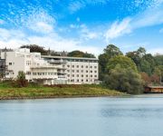
NH Arnhem Rijnhotel
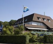
Best Western Haarhuis
Groot Warnsborn
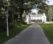
De Bilderberg
Hotel Papendal
Van der Valk Hotel Arnhem
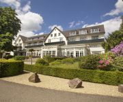
Bilderberg Wolfheze
Fletcher Doorwerth - Arnhem
Het Wapen van Elst
Linge Hotel Elst
Videos from this area
These are videos related to the place based on their proximity to this place.
The Oosterbeek perimeter, Arnhem, Netherlands.
The final act of Operation Market Garden in September 1944 was the evacuation of the surviving British and Polish paratroopers from the Oosterbeek perimeter (called Operation Berlin). In...
De Vaart - Vierbeek College Oosterbeek, 19-12-2014
Ik heb deze video gemaakt met het videobewerkingsprogramma van YouTube (http://www.youtube.com/editor)
Jagerspad 18 Oosterbeek
Voor meer informatie: http://www.funda.nl/koop/oosterbeek/huis-47269540-jagerspad-18/
Koopwoning: Backerstraat 17, OOSTERBEEK
In gezellig woonwijk, nabij het centrum van Oosterbeek, sfeervol helft van een dubbel jaren '30 woonhuis met speels aangelegde tuin, berging (voormalige garage) en parkeergelegenheid op eigen...
blikseminslag in Oosterbeek
grote consternatie in de Wijnand van Arnhemweg in Oosterbeek de bliksem was ingeslagen, de electriciteit lag er uit en er werd een gaslucht geroken gelukkig was de brandweer snel ter plaatse...
Koopwoning: Vogelweg 20, OOSTERBEEK
In Oosterbeek Â?? Laag vindt u deze karakteristieke VRIJSTAANDE WONING (1921) met atelier/studio, provisiekelder en een fraai aangelegde tuin op een perceel van 410m2.Deze goed ...
Koopwoning: Bildersweg 16, OOSTERBEEK
In een rustige en kindvriendelijke wijk van Oosterbeek-Laag vindt u deze ruime en sfeervolle 2/1 KAPWONING met 7 kamers, uitgebouwde garage, zonnige tuin en fraai uitzicht over weilanden. Deze...
Videos provided by Youtube are under the copyright of their owners.
Attractions and noteworthy things
Distances are based on the centre of the city/town and sightseeing location. This list contains brief abstracts about monuments, holiday activities, national parcs, museums, organisations and more from the area as well as interesting facts about the region itself. Where available, you'll find the corresponding homepage. Otherwise the related wikipedia article.
Battle of Arnhem
The Battle of Arnhem was a famous Second World War military engagement fought in and around the Dutch towns of Arnhem, Oosterbeek, Wolfheze, Driel and the surrounding countryside from 17–26 September 1944. After sweeping through France and Belgium in the summer of 1944, the Allies were poised to enter the Netherlands.
John Baskeyfield
John "Jack" Daniel Baskeyfield VC (18 November 1922 – 20 September 1944) was an English recipient of the Victoria Cross, the highest award for gallantry in the face of the enemy that can be awarded to members of the British and Commonwealth armed forces. Born in 1922, Baskeyfield initially became a butcher but was called up to the army in 1942.
Oosterbeek
Oosterbeek is a village in the eastern Netherlands. It is located in the municipality of Renkum, Gelderland, about 5 km west of Arnhem. The oldest part of the village of Oosterbeek is the Benedendorp (Lower Village), on the northern bank of the river Rhine. Parts of the church now known as the Hervormde Kerk (Reformed Church) date back to the second half of the 10th century.
Driel
Driel is a town in the municipality of Overbetuwe, approximately four kilometers southwest of Arnhem on the south bank of the Rhine, in the Netherlands.
Yssel-Supérieur
Yssel-Supérieur was the name of a département of the First French Empire in the present Netherlands. It was named after the river IJssel. It was formed in 1810, when the Kingdom of Holland was annexed by France. Its territory corresponded with part of the present Dutch province Gelderland. Its capital was Arnhem.
GelreDome
The GelreDome is a football stadium in the city of Arnhem, in the Netherlands. It serves as the home of the football club Vitesse. It was opened on 25 March 1998, featuring a retractable roof, as well as a convertible pitch, that can be retracted, when unused during concerts or other events held at the stadium, and a climate control system. It has a maximum capacity of 34,000. It was also one of the venues for the Euro 2000 tournament held in the Netherlands and Belgium.
Elst, Gelderland
Elst is a town in the municipality of Overbetuwe in the Dutch province of Gelderland. Elst is situated in the Betuwe, between the cities of Nijmegen and Arnhem. Elst has 21,130 inhabitants. Elst is famous for its Roman temples, which are situated under the Saint Werenfried church. Elst was a separate municipality until 2001, when it became a part of Overbetuwe. H. J. Heinz Company's sauce factory for the European market is located south of the town centre.
KEMA Toren
KEMA Toren is a 149-metre broadcasting tower built of reinforced concrete at Arnhem, Netherlands. It was built in 1969 by KEMA for communicating between high voltage substations throughout the Netherlands. It is now used for public radio and TV broadcasting. It is also known as TenneT Toren, after TenneT, the present owner of the tower.
Netherlands Open Air Museum
The Netherlands Open Air Museum is an open air museum and park located near Arnhem with antique houses, farms and factories from different parts of the Netherlands.
Rijkerswoerd
Rijkerswoerd is a new city district in Arnhem, Netherlands, located in the southeastern part of the city between the 'Huissensedijk, A325 / Nijmeegseweg' and the community of Elst. The city district consists of four neighbourhoods: Rijkerswoerd-East, Rijkerswoerd-Middle, Rijkerswoerd-West and 'de Overmaat', where various enterprises are located. Rijkerswoerd is surrounded on three sides by a 'buffer' zone and fields.
Bilderberg Hotel
The Hotel de Bilderberg is a hotel in Oosterbeek in the Netherlands where the Bilderberg Group first met in 1954. The hotel gave its name both to the Group and those who participate in its activities (Bilderbergers). It is owned and operated by the Bilderberg hotel chain, which runs 20 hotels in the Netherlands.
Stadsregio Arnhem Nijmegen
Stadsregio Arnhem Nijmegen (English: City-region Arnhem Nijmegen) is the name of the metropolitan area consisting of the Dutch cities of Nijmegen and Arnhem, plus the bordering municipalities of Beuningen, Doesburg, Duiven, Groesbeek, Heumen, Lingewaard, Millingen aan de Rijn, Montferland, Mook en Middelaar, Overbetuwe, Renkum, Rheden, Rijnwaarden, Rozendaal, Ubbergen, Westervoort, Wijchen, and Zevenaar. All but one are in the province of Gelderland.
Royal Burgers' Zoo
Royal Burgers' Zoo is a 45-hectare zoo in Arnhem, the Netherlands, and is one of the biggest zoos in the country. Arnhem is a city that lies within the Veluwe, a nature park in the east of the Netherlands. The zoo is popular with both Dutch and German people, and receives about 1.5 million visitors annually.
Arnhem train accident
In the Arnhem train accident of 21 November 2006 near Arnhem, Netherlands a cargo train driver failed to stop for a red signal and collided almost head-on into a passenger train which was about to enter the railway station, injuring 61, one of them severely. The passenger train was a local train from Zutphen to Nijmegen. The cargo train was hauling containers with computer equipment from Rotterdam to the German border.
Aam
Aam is a hamlet in the Dutch province of Gelderland. It is located in the municipality of Overbetuwe, about 1 km east of the town of Elst.
Doorwerth
Doorwerth is a village in the Dutch province of Gelderland. It is located in the municipality of Renkum, about 8 km west of Arnhem.
Elden, Netherlands
Elden is a village in the Dutch province of Gelderland. It is located in the municipality of Arnhem, about 4 km southwest of the city centre. Elden was a separate municipality between 1813 and 1818, when it was merged with Elst. The village of Elden, on the south side of the Rhine, has now been completely surrounded by suburbs of the city of Arnhem.
Lijnden, Gelderland
Lijnden is a hamlet in the Dutch province of Gelderland. It is located in the municipality of Overbetuwe, about 2 km west of the town of Elst.
St Eusebius' Church, Arnhem
St. Eusebius church also known as the Eusebiuskerk or the Grote Kerk, at 93 metres is the largest church, and the largest building in Arnhem, The Netherlands. It is named after the 4th-century saint Eusebius, Bishop of Vercelli. Notably the building contains an elevator that was added to the church in 1994, which allows visitors to travel to the top of the spire and view the city of Arnhem from its highest point.
Arnhem railway station
Arnhem is a railway station located in Arnhem, the Netherlands. The station was opened on 14 May 1845 and is located on the Rhijnspoorweg (Amsterdam - Emmerich), the Arnhem–Leeuwarden railway and the Arnhem–Nijmegen railway. The station opened at the same time as the Rhijnspoorweg. The station is the main station of Arnhem, and at present, has around 40,000 passengers that use the station per day, this makes it the 9th busiest station in the Netherlands.
John Frost Bridge
John Frost Bridge (John Frostbrug in Dutch) is the road bridge over the Lower Rhine at Arnhem, in the Netherlands. The bridge is named after Major-General John Dutton Frost (1912–1993), who commanded the British forces that reached and defended the bridge during the Battle of Arnhem in September, 1944. The bridge was made more famous by the 1977 film A Bridge Too Far, although a different bridge was used for the film.
Arnhem Oosterbeek War Cemetery
The Arnhem Oosterbeek War Cemetery, more commonly known as the Airborne Cemetery, is a military cemetery in Oosterbeek, near Arnhem, the Netherlands. It was established in 1945 and is home to 1759 graves from the Second World War. Most of the men buried in the cemetery were Allied servicemen killed in the Battle of Arnhem, an Allied attempt to cross the Rhine in 1944, or in the liberation of the city the following year.
National Sports Centre Papendal
The National Sports Centre Papendal is the national sports development centre of the Netherlands, located in the Veluwe woods 8 kilometres from Arnhem.
Spinnenkop Openluchtmuseum, Arnhem
The spinnenkop of the Netherlands Open Air Museum in Arnhem is a small drainage mill originally located near Gorredijk, Friesland, Netherlands. It is a hollow post windmill that has been restored to working order.
Mijn Genoegen, Arnhem
Mijn Genoegen (English: My Pleasure) is a paltrok mill in the Netherlands Open Air Museum in Arnhem, Gelderland, Netherlands which has been restored to working order. As are all Dutch paltrok mills, it is a wind-powered sawmill.


