Safety Score: 3,3 of 5.0 based on data from 9 authorites. Meaning please reconsider your need to travel to Netherlands.
Travel warnings are updated daily. Source: Travel Warning Netherlands. Last Update: 2024-08-13 08:21:03
Explore IJzerlo
IJzerlo in Gemeente Aalten (Provincie Gelderland) is located in Netherlands about 78 mi (or 125 km) south-east of Amsterdam, the country's capital.
Local time in IJzerlo is now 02:49 AM (Friday). The local timezone is named Europe / Amsterdam with an UTC offset of one hour. We know of 12 airports in the wider vicinity of IJzerlo, of which 5 are larger airports. The closest is airport we know is Niederrhein Airport in Germany in a distance of 26 mi (or 42 km). The closest airport in Netherlands is Twenthe Airport in a distance of 30 mi (or 42 km), South-West. Besides the airports, there are other travel options available (check left side).
There are several Unesco world heritage sites nearby. The closest heritage site is Zollverein Coal Mine Industrial Complex in Essen in Germany at a distance of 35 mi (or 56 km). The closest in Netherlands is Schokland and Surroundings in a distance of 61 mi (or 56 km), South-East. We found 1 points of interest in the vicinity of this place. If you need a place to sleep, we compiled a list of available hotels close to the map centre further down the page.
Depending on your travel schedule, you might want to pay a visit to some of the following locations: Wesel, Huenxe, Alpen, Borken and Sonsbeck. To further explore this place, just scroll down and browse the available info.
Local weather forecast
Todays Local Weather Conditions & Forecast: 4°C / 39 °F
| Morning Temperature | 0°C / 33 °F |
| Evening Temperature | 3°C / 38 °F |
| Night Temperature | 3°C / 37 °F |
| Chance of rainfall | 4% |
| Air Humidity | 82% |
| Air Pressure | 1001 hPa |
| Wind Speed | Fresh Breeze with 17 km/h (10 mph) from East |
| Cloud Conditions | Scattered clouds, covering 35% of sky |
| General Conditions | Moderate rain |
Saturday, 23rd of November 2024
4°C (40 °F)
5°C (41 °F)
Moderate rain, fresh breeze, overcast clouds.
Sunday, 24th of November 2024
12°C (53 °F)
11°C (52 °F)
Moderate rain, fresh breeze, overcast clouds.
Monday, 25th of November 2024
11°C (52 °F)
8°C (47 °F)
Moderate rain, strong breeze, overcast clouds.
Hotels and Places to Stay
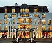
Residenz
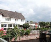
Krasemann
Kamperschroer
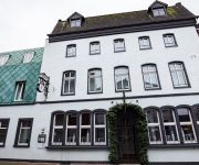
Stadthotel Kolping
Landhaus zur Issel
Am Wintergarten
Europa-Haus Bocholt
Videos from this area
These are videos related to the place based on their proximity to this place.
Autocross Aalten 2014
Aalten - In het weekend van 10 en 11 mei organiseerde de Stichting Sportevenementen Aalten de jaarlijkse autocross. Deze vond dit weekend plaats op de locatie aan de Essinkweg van de familie...
Brommercross Aalten 30 Juni 2012 , Preview
Brommercross 30 Juni 2012, aan de Heegtweg te Aalten Automaten , Standaard , Superklasse.
Spoorwegovergang Aalten Level / Railroad Crossing
De Syntus stoptrein naar Winterswijk vertrekt vanaf station Aalten The Syntus' Regional Rail to Winterswijk leaves Aalten railway station.
Paastoertocht Aalten 2008
De 1e Paastoertocht van ATB-team Aalten, 24 maart 2008, opgenomen met de Oregon Scientific Action Cam ATC2K.
Achterhoek2020-bijeenkomst in Aalten, 28 jan.'15
Drie deelnemers aan de Achterhoek 2020-bijeenkomst vertellen hoe zij de avond hebben beleefd in College Schaersvoorde in Aalten.
Brommercross Aalten 30 Juni 2012 , Long Version
BrommerCross , heegtweeg Aalten 30 juni 2012 handcam. 4:58 springbult 9:45.
SEL Chemie Aalten 28 10 1994
Brinkman & Germeraad_SKUM_Klein Poelhuis Winterswijk_TEST SCHUIM BLUSSING bij SEL Chemie Aalten 28-10-1994.
Spoorwegovergang Aalten Level / Railroad Crossing
De Syntus stoptrein naar Arnhem komt binnen in station Aalten The Syntus' Regional Rail to Arnhem enters Aalten railway station.
Spoorwegovergang Aalten Level / Railroad Crossing
De Syntus stoptrein naar Arnhem passeert de Nijverheidsweg The Syntus' Regional Rail to Arnhem passes the Nijverheidsweg.
Spoorwegovergang Aalten Level / Railroad Crossing
De Syntus stoptrein naar Winterswijk passeert het Plein Zuid The Syntus' Regional Rail to Winterswijk passes the Southern Square.
Videos provided by Youtube are under the copyright of their owners.
Attractions and noteworthy things
Distances are based on the centre of the city/town and sightseeing location. This list contains brief abstracts about monuments, holiday activities, national parcs, museums, organisations and more from the area as well as interesting facts about the region itself. Where available, you'll find the corresponding homepage. Otherwise the related wikipedia article.
Aalten
Aalten is a municipality and a village in the eastern Netherlands. The former municipalities of Bredevoort (1818) and Dinxperlo (2005) have been merged with Aalten. Notable inhabitants of Aalten include Angus Young, guitarist of the Australian rock band AC/DC, and Robert Gesink, a professional road bicycle racer. During World War II, 51 of Aalten's 85 Jews were hidden by local non-Jews, and thereby survived the war.
De Heurne
De Heurne is a village in the municipality of Aalten, near Dinxperlo in the eastern Netherlands. The village contains a Protestant church and a school. At the beginning of the 20th century, De Heurne had its own train station, on the Varsseveld - Dinxperlo railway line. Although the station has closed, the building is still there. According to CBS, the village had a population of 1,009 inhabitants as at 1 January 2008. Revenues in the village are mainly from the agricultural sector.
Heurne
Heurne is a neighbourhood in the municipality of Aalten, near Aalten in the eastern Netherlands with a population of around 500 inhabitants. Heurne has a villagecentre, "D'n Heurnsen Tref" and is known of the border crossing Heurne-Hemden. Across the Heurne lies the Hamelandroute. Heurne does not have a centre, only a few stores at the border crossing. To avoid confusion with De Heurne, Heurne is locally known as" Aaltense Heurne"
IJzerlo
IJzerlo is a neighbourhood in the municipality of Aalten, between Aalten and Dinxperlo in the in the eastern Netherlands with a population of around 160 inhabitants. Ijzerlo enjoys some notoriety for its annual Farm & Country Fair, the Easter fire and the provision of outdoor play.
Bocholter Aa
Bocholter Aa is a river of North Rhine-Westphalia, Germany, and of the Netherlands. Its last part, before joining the Oude IJssel, is called Aa-strang in Dutch.


