Safety Score: 3,3 of 5.0 based on data from 9 authorites. Meaning please reconsider your need to travel to Netherlands.
Travel warnings are updated daily. Source: Travel Warning Netherlands. Last Update: 2024-08-13 08:21:03
Touring Berenbroek
Berenbroek in Gemeente Geldrop-Mierlo (North Brabant) with it's 45 residents is a town located in Netherlands about 70 mi (or 112 km) south-east of Amsterdam, the country's capital place.
Time in Berenbroek is now 06:41 PM (Friday). The local timezone is named Europe / Amsterdam with an UTC offset of one hour. We know of 10 airports nearby Berenbroek, of which 5 are larger airports. The closest airport in Netherlands is Eindhoven Airport in a distance of 10 mi (or 16 km), West. Besides the airports, there are other travel options available (check left side).
There are several Unesco world heritage sites nearby. The closest heritage site in Netherlands is Rietveld Schröderhuis (Rietveld Schröder House) in a distance of 47 mi (or 76 km), North-West. Also, if you like the game of golf, there are several options within driving distance. We collected 4 points of interest near this location. Need some hints on where to stay? We compiled a list of available hotels close to the map centre further down the page.
Being here already, you might want to pay a visit to some of the following locations: Heeze, 's-Hertogenbosch, Kranenburg, Selfkant and Waldfeucht. To further explore this place, just scroll down and browse the available info.
Local weather forecast
Todays Local Weather Conditions & Forecast: 2°C / 36 °F
| Morning Temperature | 1°C / 34 °F |
| Evening Temperature | 4°C / 39 °F |
| Night Temperature | 3°C / 37 °F |
| Chance of rainfall | 2% |
| Air Humidity | 96% |
| Air Pressure | 1001 hPa |
| Wind Speed | Fresh Breeze with 15 km/h (9 mph) from East |
| Cloud Conditions | Broken clouds, covering 65% of sky |
| General Conditions | Light rain |
Saturday, 23rd of November 2024
4°C (39 °F)
8°C (47 °F)
Light rain, fresh breeze, overcast clouds.
Sunday, 24th of November 2024
14°C (58 °F)
14°C (58 °F)
Light rain, fresh breeze, overcast clouds.
Monday, 25th of November 2024
12°C (54 °F)
9°C (49 °F)
Moderate rain, fresh breeze, overcast clouds.
Hotels and Places to Stay
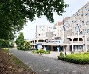
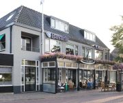
Carlton De Brug
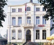
Golden Tulip West-Ende
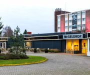
City Resort Hotel Helmond
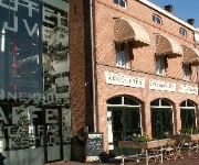
Nijver
NH Geldrop
Hotel 't Anker Mierlo
de Collse Hoeve
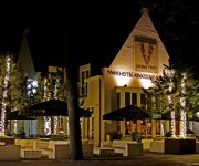
Parkhotel Auberge Vincent
De Gouden Leeuw
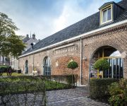
De Brabantse Kluis
Videos from this area
These are videos related to the place based on their proximity to this place.
Memore Uitvaartverzorging introductie
Samen zorgen we er voor dat de uitvaart aansluit bij de persoonlijke wensen. De wensen van mensen worden zelden vastgelegd, hiervoor heeft Memore een soort w...
Carolus Borromeus College Helmond 2014: Sponsorloop
Op vrijdag 3 oktober 2014 vierden wij de opening van ons nieuwe schoolgebouw. In de ochtend hebben onze leerlingen de vlaggen met het nieuwe logo gehesen, ballonnen losgelaten en een ...
27 maart 2011 - Mierlo - Grote brand industrieterrein
MIERLO - Aan de Nijverheidsweg in het Brabantse Mierlo was zondagmorgen rond 01.15 uur een grote brand uitgebroken op een bedrijventerrein. Meerdere korpsen uit de regio waren ter ...
Mierlo 13-04-2012
Op vrijdag de 13e heb ik de overweg op de vaarleseweg nabij Mierlo bezocht voor wat foto's en filmpjes van Goederentreinen. Wat voor bijgelovige mensen een pechdag is, was het voor mij een...
Solidscreen 1
Solidscreen 415+455*262cm ingebouwd in een verandadak Fa Vereiken zonweringen & Luxaflex raamdecoraties Helmond, Breedijk 5b 5705cj www.vereiken.com luxaflex@vereiken.com Tel: ...
Videos provided by Youtube are under the copyright of their owners.
Attractions and noteworthy things
Distances are based on the centre of the city/town and sightseeing location. This list contains brief abstracts about monuments, holiday activities, national parcs, museums, organisations and more from the area as well as interesting facts about the region itself. Where available, you'll find the corresponding homepage. Otherwise the related wikipedia article.
Mierlo
Mierlo is a town in the southern Netherlands, in the municipality of Geldrop-Mierlo, North Brabant. Until 2004, it was a separate municipality with an area of 18.09 km . Mierlo is home to a few interesting buildings, for example the old Council house and the Windmill in the centre of the village. Sports clubs in Mierlo are Mifano and the Hockey Club. Mierlo also has a zoo (Dierenrijk), a hotel (Carlton De Brug) and two campsites ('t Wolfsven and De Sprink).
Geldrop
Geldrop is a town in the Dutch province of North Brabant. It is located in the municipality of Geldrop-Mierlo. Geldrop was a separate municipality until 2004, when it merged with Mierlo. Mainly to keep out of the municipality of Eindhoven. It is also known for having a neighbourhood with streets named after characters from the works of JRR Tolkein.
Aarle-Rixtel
Aarle-Rixtel is a town in the Dutch municipality of Laarbeek in North Brabant. It lies about 4 km north of Helmond. Since 1997 the castle Croy is part of Aarle-Rixtel. Until 1997, Aarle-Rixtel was a separate municipality.
Stiphout
Stiphout is a village in the Dutch province of North Brabant. It is located in the municipality of Helmond, about 2km west of the centre of that city. The town is mentioned for the first time in 1155 as 'Villa Stilpot' and in 2005 the village celebrated their 850th anniversary. It is famous for its "Bavaria Profronde" which occurs every year and attracts around 50.000 visitors. Stiphout was a separate municipality until 1968, when it became part of Helmond.
Brandevoort
The district of Brandevoort lies south-west of the city centre of Helmond, between Helmond, Mierlo, Geldrop and Nuenen. This area has been designated by the government as a growth area. Building on this former farm land started around 1997 and will continue until completed or full build-out scheduled for 2017. In total around 18,000 people will find their home in Brandevoort in 6,000 houses and apartments.
Mierlo War Cemetery
Mierlo War Cemetery is a Commonwealth field of honor at 68 Geldropseweg, east of the Dutch village of Mierlo. The field came into existence in the spring of 1945, around the end of World War II. Most victims buried there died in the period September to November 1944, mostly in the region south and west of the river Meuse and, more to the west, during fighting for the Scheldt estuary. The graves are arranged in 8 sections (numbered 1 to 8) with 6 or 7 rows in each section (A to F or G).


