Safety Score: 3,3 of 5.0 based on data from 9 authorites. Meaning please reconsider your need to travel to Netherlands.
Travel warnings are updated daily. Source: Travel Warning Netherlands. Last Update: 2024-08-13 08:21:03
Delve into Lauradorp
The district Lauradorp of Ubach over Worms in Landgraaf (Limburg) with it's 3,170 habitants Lauradorp is a district located in Netherlands about 112 mi south-east of Amsterdam, the country's capital town.
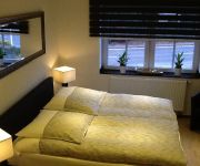
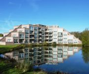
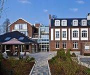
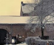
In need of a room? We compiled a list of available hotels close to the map centre further down the page.
Since you are here already, you might want to pay a visit to some of the following locations: UEbach-Palenberg, Gangelt, Aachen, Selfkant and Heinsberg. To further explore this place, just scroll down and browse the available info.
Local weather forecast
Todays Local Weather Conditions & Forecast: 2°C / 36 °F
| Morning Temperature | 0°C / 32 °F |
| Evening Temperature | 2°C / 35 °F |
| Night Temperature | 1°C / 34 °F |
| Chance of rainfall | 1% |
| Air Humidity | 82% |
| Air Pressure | 1005 hPa |
| Wind Speed | Fresh Breeze with 17 km/h (10 mph) from North-East |
| Cloud Conditions | Overcast clouds, covering 85% of sky |
| General Conditions | Snow |
Saturday, 23rd of November 2024
4°C (40 °F)
7°C (44 °F)
Light rain, fresh breeze, overcast clouds.
Sunday, 24th of November 2024
12°C (54 °F)
12°C (54 °F)
Light rain, strong breeze, overcast clouds.
Monday, 25th of November 2024
10°C (50 °F)
9°C (48 °F)
Moderate rain, strong breeze, overcast clouds.
Hotels and Places to Stay
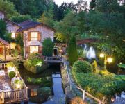
Brommler Mühle
Brunssummerheide
Mercator-Hotel
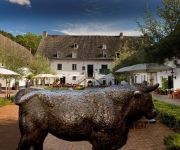
Hotel Restaurant Schinvelder Hoeve
Le Moulin Du Roc
Golden Tulip Parkstad Zuid Limburg
Hotel SnowWorld & Conference
WinselerHof
Fletcher Kasteelhotel Erenstein
Abdij Rolduc
Videos from this area
These are videos related to the place based on their proximity to this place.
Green Day @ Pinkpop Static Age
Green Day @ Pinkpop festival, Landgraaf, Nederland Zaterdag 29 mei 2010 Static Age.
SUNP0007
Deel 5 van de reportage van het 2de Spectaculum Romanum op zaterdag 9 augustus 2014 in Rimburg, gemeente Landgraaf en Stadt Ubach-Palenberg. Hier in het bijzonder het Romeinse legerkamp.
Landgraaf Optoch 2014, deel 03.
Deel 3 van de reportage betreffende de 13de Landgraafoptoch, die op Carnavalsdinsdag 4 maart 2014 door de kernen Schaesberg en Nieuwenhagen trok. Locatie Dor...
mc lets play part 1 (dutch)
1ste video van het kanaal naja geniet ervan en er komen zeker meer :D misschien op een ander kanaal maar er komen meer.
BernerCal 2014: Inspired by nature
De Berner kalender siert al 20 jaar garages, werk- en bouwplaatsen door heel Europa! Speciaal voor deze gelegenheid reisde lifestyle fotograaf Christian Holzknecht af naar Kroatië, waar een...
Green Day @ Pinkpop Longview
Green Day @ Pinkpop festival, Landgraaf, NL Zaterdag 29 mei 2010 "Longview"
Kinder Carnaval Eygelshoven 2013 (HD en 3D)
Beelden vanuit het Socioproject te Eygelshoven gemeente Kerkrade van de kinder Carnaval. De beelden worden zoals afgesproken zonder geluid gepresenteerd. Nederlandtopvideo.punt.nl heeft ...
Reportage schoolzwemkampioenschappen Landgraaf 2012 ook in 3D te zien.wmv
De schooljeugd groep 3 t/m 8 hebben de laatste weken keihard getraind om de schoolkampioenschappen te zwemmen in zwembad in de Bende te landgraaf. In een bijna 45 minuten reportage kunt u ...
Videos provided by Youtube are under the copyright of their owners.
Attractions and noteworthy things
Distances are based on the centre of the city/town and sightseeing location. This list contains brief abstracts about monuments, holiday activities, national parcs, museums, organisations and more from the area as well as interesting facts about the region itself. Where available, you'll find the corresponding homepage. Otherwise the related wikipedia article.
Kerkrade
Kerkrade is a town and a municipality in the southeastern Netherlands. It is the western half of the divided region and de facto city, taken together with the eastern half, the German town of Herzogenrath. The original name of the undivided municipality under the Holy Roman Empire was Herzogenrath. The two towns, including outlying suburban settlements, have a population approaching 100,000.
Pinkpop Festival
Pinkpop Festival, or Pinkpop for short, is a festival held at Landgraaf, Netherlands. It is held annually on the Pentecost weekend (Pinksteren in Dutch, hence the name). In 1970, the first festival took place in Geleen, now part of municipality Sittard-Geleen and was held on the Monday following that weekend. Pinkpop is the longest running annual music festival in the world.
Eygelshoven
Eygelshoven is a small village near the town of Kerkrade in the southeast of the Netherlands, close to the German and Belgian borders. It has two former coal mines, Laura and Julia, which were named after the wives of the two owners. Both pits closed in 1974. Local soccer clubs are also named after the former coal mines. Eygelshoven has a small former church from the sixteenth century, which stands on top of a hill. In 1922, another church was built.
Allied Joint Force Command Brunssum
Joint Force Command Brunssum (JFC-B) is the NATO military command based in Brunssum, Netherlands. JFC-B reports to Supreme Headquarters Allied Powers Europe (SHAPE) based at Casteau, Belgium. It is one of three operational level commands in the NATO command structure, the others being Allied Joint Force Command Naples, Italy and Allied Joint Command Lisbon, Portugal. JFC-B also serves as the NATO higher headquarters for the International Security Assistance Force in Afghanistan.
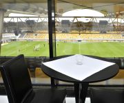
Parkstad Limburg Stadion
The Parkstad Limburg Stadion is a football stadium in Kerkrade, completed in 2000. With a present day capacity of 19.979 seats, the stadium was officially opened on August 15, 2000 with a friendly between Roda JC and Real Zaragoza (2–2). It is the home stadium of football club Roda JC Kerkrade from the Netherlands. In 2005 the Parkstad Limburg Stadion was the hosting stadium for the opening match and the semi-finals of the FIFA World Youth Championship Netherlands 2005.
Ubach over Worms
Ubach over Worms is a former municipality located in the southeast of the Netherlands, in the province of Limburg. In 1982 it was incorporated into the new municipality of Landgraaf along with Schaesberg and Nieuwenhagen. The German name for this part of Landgraaf is "Waubach". It is believed that the latter name derives from Waldbach, which is German for "woodland creek", referring to the local Worm stream. This name is said to have later corrupted into Waubach.
Glaspaleis
The Glaspaleis is a modernist building in Heerlen, Netherlands, built in 1935. Formerly a fashion house and department store, Schunck, it is now the cultural centre of the city. The original name is Modehuis Schunck (Schunck Fashion House), but it was soon nicknamed Glaspaleis, which is now the official name. The architectural style is largely according to what is in the Netherlands known as het Nieuwe Bouwen, which corresponds roughly to Modernism, Bauhaus and International style.
Bernardinuscollege
Bernardinuscollege is a comprehensive school in Heerlen, the Netherlands. The school was founded by Franciscan monks in 1911 as ‘Sint-Bernardinus, R.K. Hoogere Burgerschool met 3-jarige cursus’ (‘Saint Bernardinus, R.C. Higher Citizenschool with 3-year course’), because of the need for education in the wake of the blooming mining industry. In September 1913 the first students arrived.
Gemeentelijk Sportpark Kaalheide
The Gemeentelijk Sportpark Kaalheide is a stadium situated in Kerkrade, Netherlands. It is the former stadium of Roda JC, who since 2000 play in the Parkstad Limburg Stadion.
NATO Air Base Geilenkirchen
NATO Air Base Geilenkirchen (E-3A Component) is located near Geilenkirchen, Germany. It is the Main Operating Base of the NATO E-3A Component, one of two operational elements of the NATO Airborne Early Warning & Control Force.
Rolduc
Rolduc is the name of a medieval abbey in Kerkrade, the Netherlands, which is now a Roman Catholic seminary and an affiliated conferencing center.
RAF Geilenkirchen
The former Royal Air Force Station Geilenkirchen, more commonly known as RAF Geilenkirchen, was a Royal Air Force military air field in the North Rhine-Westphalia region of Germany, built by the British who used the facility mainly as an airfield for RAF fighter squadrons from May 1953 until 21 January 1968.
Parkstad Limburg
Parkstad Limburg is a collaboration between seven municipalities. They work together to improve public services, transport and housing on a regional level. This collaboration started in 1999.
Schelmentoren
The Schelmentoren in Heerlen is a Medieval Building that has served as a defendable living tower for the Here van Are (sometimes called the counts van Ahr-Hochstaden) and their successors. As part of the Landsfort Herle, it served as a prison tower. It is believed to be built on command of Theoderich van Are. What is certain is that the building existed in the 12th century.
Grasbroek
Grasbroek is a former mining colony located north of the centrum of Heerlen and served the mine Oranje-Nassau I. Grasbroek houses the Patronaatsgebouw, build in 1920 it is one of the earliest examples of Amsterdam School outside Amsterdam. Besides being in a state of disrepair all almost all original elements remain. Currently it is being restored, restoringcost around 3,500,000 euros
Molenberg
Molenberg (literally Millhill) is a former mining colony in the south-western part of Heerlen, southeastern Netherlands. When work started in 1913 it was called Molenbergpark (Millhillpark). The mining colony was created to house mining executives (alongside the slope of the hill, towards the centre of Heerlen), engineers (alongside the mean road), and miners.
Pancratiuskerk
The Pancratiuskerk is a Roman Catholic church in Heerlen in the Netherlands.
Landsfort Herle
Landsfort Herle was a fortification with moat in, what now is, the centre of Heerlen, Netherlands (roughly the current Pancratiusplein), it was probably built by the counts van Ahr-Hochstaden (also referd to as Here van Are) The name Landsfort (‘fort of the land’) comes from the fact that the fortification come under the responsibility of the land.
Monseigneur Schrijnen Retreat House
The Monseigneur Schrijnen Retreat House was designed by the famed architect Frits Peutz (best known for the Glaspaleis) in 1932, and named after the 18th bishop of Roermond Laurentius Josephus Antonius Hubertus Schrijnen (Venlo 30 July 1861 - Roermond 26 March 1932). It is located at the top of one of the steepest hills in Heerlen next to the Molenberg and surrounded by the Aambos (a forest). It is one of the biggest buildings designed by Peutz.
Oliemolen, Heerlen
The Oliemolen (literally Oilmill) is a 16th-century watermill located at the foot of a steep hill in the Aambos, Heerlen in the Netherlands. The name already tells us much about its function, extracting oil, but this was not always the case, it first function as a volmolen (a mill to press wool). The mill is fed by the Caumerbeek. A copy, dating to May 31, 1710, of the original deed exists, indicating the mill was founded on May 9, 1502, commissioned by the family Van Scheasberg.
Former V&D Heerlen
The former V&D in Heerlen was designed by Frits Peutz (best known for the Glaspaleis) in 1958 as part of the store chain Vroom & Dreesmann (located in Heerlen since 1920). The interior design was done by Mr. Kober and his daughter Marcia and the builders were E. Joosten and L. Reumkens. The director in Heerlen was Adrianus Merkx. The building was relatively different for Heerlen, although used to modern architecture, this building was described as skyscraper like (10 storeys high).
Nieuwenhagen
Nieuwenhagen is a former village in the Dutch province of Limburg. It is now a part of the municipality of Landgraaf. Nieuwenhagen was a separate municipality until 1982, when it became a part of Landgraaf.
Rimburg
Rimburg is a village in the Dutch province of Limburg. It is located in the municipality of Landgraaf, on the German border. Rimburg was a separate municipality until 1887, when it was merged with Ubach over Worms.
Schaesberg
Schaesberg is a town in the municipality of Landgraaf in the Dutch province of Limburg. Schaesberg was a separate municipality until 1982, when it merged with Nieuwenhagen and Ubach over Worms to form the new municipality Landgraaf.
Herzogenrath station
Herzogenrath station is the most important railway station in the city of Herzogenrath, Städteregion Aachen, NRW, Germany. Here, the lines to Sittard via Landgraaf and Heerlen and to Stolberg, both part of the regional Euregiobahn network, branch from the main line from Aachen to Mönchengladbach. The station is in the area of the Aachen transport association (Aachener Verkehrsverbund, AVV) and linked to an adjacent bus station and a Park-and-ride parking deck.


