Safety Score: 3,3 of 5.0 based on data from 9 authorites. Meaning please reconsider your need to travel to Netherlands.
Travel warnings are updated daily. Source: Travel Warning Netherlands. Last Update: 2024-08-13 08:21:03
Delve into Thuserhof
Thuserhof in Gemeente Roermond (Limburg) is located in Netherlands about 96 mi (or 154 km) south-east of Amsterdam, the country's capital town.
Current time in Thuserhof is now 11:21 PM (Thursday). The local timezone is named Europe / Amsterdam with an UTC offset of one hour. We know of 11 airports close to Thuserhof, of which 5 are larger airports. The closest is airport we know is Geilenkirchen Airport in Germany in a distance of 15 mi (or 25 km). The closest airport in Netherlands is Maastricht Aachen Airport in a distance of 22 mi (or 25 km), South. Besides the airports, there are other travel options available (check left side).
There are several Unesco world heritage sites nearby. The closest heritage site is Aachen Cathedral in Germany at a distance of 28 mi (or 46 km). The closest in Netherlands is Rietveld Schröderhuis (Rietveld Schröder House) in a distance of 73 mi (or 46 km), South. We encountered 3 points of interest near this location. If you need a hotel, we compiled a list of available hotels close to the map centre further down the page.
While being here, you might want to pay a visit to some of the following locations: Waldfeucht, Heinsberg, Bruggen, Niederkruchten and Gangelt. To further explore this place, just scroll down and browse the available info.
Local weather forecast
Todays Local Weather Conditions & Forecast: 11°C / 52 °F
| Morning Temperature | 9°C / 49 °F |
| Evening Temperature | 10°C / 50 °F |
| Night Temperature | 10°C / 49 °F |
| Chance of rainfall | 0% |
| Air Humidity | 71% |
| Air Pressure | 1028 hPa |
| Wind Speed | Gentle Breeze with 7 km/h (5 mph) from South |
| Cloud Conditions | Broken clouds, covering 54% of sky |
| General Conditions | Light rain |
Friday, 15th of November 2024
11°C (52 °F)
6°C (42 °F)
Sky is clear, light breeze, clear sky.
Saturday, 16th of November 2024
9°C (48 °F)
7°C (45 °F)
Scattered clouds, gentle breeze.
Sunday, 17th of November 2024
8°C (47 °F)
5°C (41 °F)
Moderate rain, moderate breeze, overcast clouds.
Hotels and Places to Stay
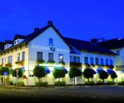
Fletcher Landhotel Bosrijk Roermond
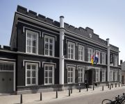
Het Arresthuis
Haus Wilms
Effeld Landhaus
Effelder Bürgerstube
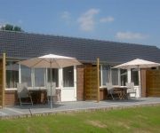
B&B ROODBEEKERHOF
Dux Hotel Deluxe
Hotel Roermond
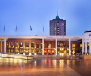
Van der Valk TheaterHotel De Oranjerie
Kasteel Daelenbroeck Romantik Hotel
Videos from this area
These are videos related to the place based on their proximity to this place.
Voorm LTS Roermond Clevers Asbestsanering
Asbestverwijdering in het voormalig LTS gebouw: Dr. Cuijpersschool aan de Sint Odgerusstraat in roermond.
LIAG NIEKEE ROERMOND
Vmbo Niekee te Roermond, ontwerp door Erik Schotte LIAG architecten en Bouwadviseurs. Voor meer informatie ga naar www.liag.nl.
Meters maken! tijdens 1e Athletics Champs bij Swift Roermond
Meters maken! tijdens 1e Athletics Champs bij Swift Roermond Slowmo van alle deelnemers zowel pupillen A als Pupillen B. Aafke Bens Abel Welten Adil El Quaoui Alice Leijssen Anke...
Noodweer In Roermond,Maasniel 2010
It Was In Summer To 2010-6-28 's been awhile ago, but still ff refi. The wind was super strong 180 Kmh Created by Franco Penders.
ATB Toertocht 2012 Extreme Swalmen
In 2012 hebben we weer een schitterende toertocht voor jullie uitgezet, geniet van de 35 of 52 km.
Pagani Productions@First test Merida Big Seven 100 Mountainbike 2 10 2014
First test of my new Merida Big Seven 100 Moutainbike Boukoul-Swalmen 2 10 2014 Copyright Pagani productions 2014-2199 Wouter van Helden All rights Reserved 2014 Pagani Productions.
mini-optreden van Jan Aerdts en zien Cowboys
Op zaterdag 26 januari 2013 werd op kasteelboerderij "Zuidewijk Spick" te Boukoul het promotiefilmpje van Jan Aerdts en zien Cowboys opgenomen. Jan Aerdts en zien Cowboys zijn één van de...
De verjaring - Boukoul
'De Verjaring' is een 100 minuten durende Nederlandse tv-film uit 1980 met in de hoofdrol Kees Brusse die de rol van Casper de Lange speelt. Casper heeft in Amsterdam in de 2e wereldoorlog...
Achter de schermen van KVW Roermond-Noord 2008
Een kijkje achter de schermen van KVW Roermond-Noord 2008. Kijk voor meer informatie op www.kvwroermondnoord.nl of http://kvwroermondnoord.hyves.nl/
Videos provided by Youtube are under the copyright of their owners.
Attractions and noteworthy things
Distances are based on the centre of the city/town and sightseeing location. This list contains brief abstracts about monuments, holiday activities, national parcs, museums, organisations and more from the area as well as interesting facts about the region itself. Where available, you'll find the corresponding homepage. Otherwise the related wikipedia article.
Operation Blackcock
Operation Blackcock was the code name for the clearing of the Roer Triangle formed by the towns of Roermond, Sittard and Heinsberg. It was conducted by the British Second Army in January 1945 between 14 and 26 January 1945. The objective was to drive the German 15th Army back across the Rivers Rur and Wurm and move the frontline further into Germany.
Asenray
Asenray is a town in the Dutch province of Limburg. It is a part of the municipality of Roermond, and lies about 3 km east of Roermond. In 2001, Asenray had 354 inhabitants. The built-up area of the town was 0.1 km², and contained 139 residences.
Boukoul
Boukoul is a town in the Dutch province of Limburg. It is a part of the municipality of Swalmen, and is situated about 5 km northeast of Roermond. In 2001, Boukoul counted 818 inhabitants. The built-up area of the town was 0.23 km², and contained 322 residences.
Montfort, Netherlands
Montfort is a town in the Dutch province of Limburg. Montfort has about 3,000 inhabitants. It lies about 8 km south of Roermond. It received city rights in 1271. It renowned for ruins of Castle Montfort, built in the thirteenth century. Until 1991, Montfort was a separate municipality. Since then, it had been a part of Posterholt which was later renamed to Ambt Montfort. Since 1 January 2007, Montfort has been part of the municipality of Roerdalen.
Maasniel
Maasniel is a neighbourhood of Roermond in the Dutch province of Limburg. It is located east of the city centre. Maasniel used to be a separate village. It was a separate municipality until 1959, when it was merged with Roermond.
Melick en Herkenbosch
Melick en Herkenbosch is a former municipality in the Dutch province of Limburg. It covered the villages of Melick and Herkenbosch. In 1991, the municipality merged with Vlodrop, and in 1993, it changed its name to Roerdalen.
Roertunnel
The Roertunnel is a 2.45 km long land tunnel in Roermond, Netherlands. Currently it is the longest land tunnel for road traffic in the Netherlands and upon final completion, it will be compliant to the 2014 safety standard for tunnels in the Netherlands. The tunnel is a part of the A73-south highway, connecting the A73-north in Venlo to the A2 near Echt.


