Safety Score: 3,3 of 5.0 based on data from 9 authorites. Meaning please reconsider your need to travel to Netherlands.
Travel warnings are updated daily. Source: Travel Warning Netherlands. Last Update: 2024-08-13 08:21:03
Discover Paarlo
Paarlo in Gemeente Roerdalen (Limburg) with it's 20 citizens is a place in Netherlands about 98 mi (or 158 km) south-east of Amsterdam, the country's capital city.
Current time in Paarlo is now 05:39 PM (Thursday). The local timezone is named Europe / Amsterdam with an UTC offset of one hour. We know of 11 airports near Paarlo, of which 5 are larger airports. The closest is airport we know is Geilenkirchen Airport in Germany in a distance of 13 mi (or 20 km). The closest airport in Netherlands is Maastricht Aachen Airport in a distance of 20 mi (or 20 km), South. Besides the airports, there are other travel options available (check left side).
There are several Unesco world heritage sites nearby. The closest heritage site is Aachen Cathedral in Germany at a distance of 26 mi (or 41 km). The closest in Netherlands is Rietveld Schröderhuis (Rietveld Schröder House) in a distance of 75 mi (or 41 km), South. Also, if you like playing golf, there is an option about 27 mi (or 44 km). away. We encountered 3 points of interest in the vicinity of this place. If you need a hotel, we compiled a list of available hotels close to the map centre further down the page.
While being here, you might want to pay a visit to some of the following locations: Waldfeucht, Heinsberg, Gangelt, Selfkant and Bruggen. To further explore this place, just scroll down and browse the available info.
Local weather forecast
Todays Local Weather Conditions & Forecast: 11°C / 52 °F
| Morning Temperature | 9°C / 49 °F |
| Evening Temperature | 10°C / 50 °F |
| Night Temperature | 10°C / 49 °F |
| Chance of rainfall | 0% |
| Air Humidity | 71% |
| Air Pressure | 1028 hPa |
| Wind Speed | Gentle Breeze with 7 km/h (5 mph) from South |
| Cloud Conditions | Broken clouds, covering 54% of sky |
| General Conditions | Light rain |
Friday, 15th of November 2024
11°C (52 °F)
6°C (42 °F)
Sky is clear, light breeze, clear sky.
Saturday, 16th of November 2024
9°C (48 °F)
7°C (45 °F)
Scattered clouds, gentle breeze.
Sunday, 17th of November 2024
8°C (47 °F)
5°C (41 °F)
Moderate rain, moderate breeze, overcast clouds.
Hotels and Places to Stay
Haus Wilms
Effelder Bürgerstube
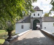
Kasteel Daelenbroeck Romantik Hotel
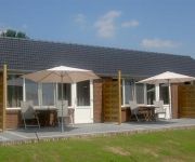
B&B ROODBEEKERHOF
Hotel Roermond
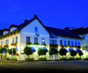
Fletcher Landhotel Bosrijk Roermond
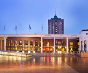
Van der Valk TheaterHotel De Oranjerie
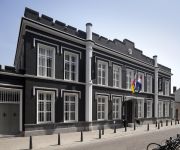
Het Arresthuis
de Oolderhof
Effeld Landhaus
Videos from this area
These are videos related to the place based on their proximity to this place.
Voorm LTS Roermond Clevers Asbestsanering
Asbestverwijdering in het voormalig LTS gebouw: Dr. Cuijpersschool aan de Sint Odgerusstraat in roermond.
Kinderkleding Different-Kidz
Kinderkleding winkel en webwinkel. Moderne kinderkleding, nieuwste trends. Different-Kidz in Posterholt, Limburg, Holland.
Syma X1 - First flight through the garden
My first flight with the quadcopter Syma X1. Sorry for the poor quality. I bound the camera around my neck so I could use both my hands. Enjoy :-)
Phantom FPV (First Person View) over Herkenbosch
Phantom FPV Lipo: 3 cell 4500 mah Transmitter: Spektrum Dx6i Camera:Rollei Outdoor (HD) Pilot: Marcel R. Co pilots: Robert K , Richard P. (ground cams)
Roermond Vuurwerk 2013 / 2014
Mooi vuurwerk boven Roermond gefilmd vanaf twaalf hoog op de Donderberg.
'De Argeloze Fietser versus MegaMan' Roermond Swingt!.wmv
Roermond Swingt! De Argeloze Fietser wordt van zijn weg geblazen door de MegaMan. Tv commercial voor TV VOX, Productie: Jolige Jonges Inc. featuring: 'De Argeloze Fietser' - JJJJ...
Videos provided by Youtube are under the copyright of their owners.
Attractions and noteworthy things
Distances are based on the centre of the city/town and sightseeing location. This list contains brief abstracts about monuments, holiday activities, national parcs, museums, organisations and more from the area as well as interesting facts about the region itself. Where available, you'll find the corresponding homepage. Otherwise the related wikipedia article.
Sint Odiliënberg
Sint Odiliënberg is a small village in central Limburg, in the Netherlands, east of the river Maas in the Roer valley. It is one of the six villages in the municipality of Roerdalen. Standing on a hill is a Romanesque basilica with two towers dating from the eleventh century. Next to the basilica is a 10th century chapel, originally the parish church. Until 1991, Sint Odiliënberg was a separate municipality.
Operation Blackcock
Operation Blackcock was the code name for the clearing of the Roer Triangle formed by the towns of Roermond, Sittard and Heinsberg. It was conducted by the British Second Army in January 1945 between 14 and 26 January 1945. The objective was to drive the German 15th Army back across the Rivers Rur and Wurm and move the frontline further into Germany.
Roskam, Netherlands
Roskam is a small village in the Dutch municipality of Ambt Montfort. It is located between the larger towns of Posterholt and Sint Odiliënberg.
Montfort, Netherlands
Montfort is a town in the Dutch province of Limburg. Montfort has about 3,000 inhabitants. It lies about 8 km south of Roermond. It received city rights in 1271. It renowned for ruins of Castle Montfort, built in the thirteenth century. Until 1991, Montfort was a separate municipality. Since then, it had been a part of Posterholt which was later renamed to Ambt Montfort. Since 1 January 2007, Montfort has been part of the municipality of Roerdalen.
Melick en Herkenbosch
Melick en Herkenbosch is a former municipality in the Dutch province of Limburg. It covered the villages of Melick and Herkenbosch. In 1991, the municipality merged with Vlodrop, and in 1993, it changed its name to Roerdalen.
Posterholt
Posterholt is a village in the Dutch province of Limburg. It is located in the municipality of Roerdalen. Posterholt merged with the municipalities Montfort and Sint Odiliënberg in 1991, and the new municipality changed its name to Ambt Montfort three years later. Together with a few other villages in the region it has also an active local history association. This association is situated in St. Odiliënberg. Heemkunde vereniging Roerstreek
Reutje
'Reutje or 't Reutje is a small village in Dutch Limburg. It belongs to the municipality of Roerdalen. It lies a few km from Sint Odiliënberg. The village has 4 streets and 300 inhabitants. There is a small café 'Bie Tiel' and a big fanfare, Sint Wiro. Reutje also has its own song: Träötje mien Landj, composed by Wiel Janssen and Pièrre Bonné.
Roertunnel
The Roertunnel is a 2.45 km long land tunnel in Roermond, Netherlands. Currently it is the longest land tunnel for road traffic in the Netherlands and upon final completion, it will be compliant to the 2014 safety standard for tunnels in the Netherlands. The tunnel is a part of the A73-south highway, connecting the A73-north in Venlo to the A2 near Echt.






!['Der alte Dampfhammer :-D [ Heinsberg ]' preview picture of video 'Der alte Dampfhammer :-D [ Heinsberg ]'](https://img.youtube.com/vi/-vd3W5D-mGk/mqdefault.jpg)


