Safety Score: 3,3 of 5.0 based on data from 9 authorites. Meaning please reconsider your need to travel to Netherlands.
Travel warnings are updated daily. Source: Travel Warning Netherlands. Last Update: 2024-08-13 08:21:03
Discover Kaumeshoek
Kaumeshoek in Gemeente Peel en Maas (Limburg) is a town in Netherlands about 84 mi (or 136 km) south-east of Amsterdam, the country's capital city.
Current time in Kaumeshoek is now 02:38 AM (Wednesday). The local timezone is named Europe / Amsterdam with an UTC offset of one hour. We know of 10 airports near Kaumeshoek, of which 5 are larger airports. The closest is airport we know is Niederrhein Airport in Germany in a distance of 20 mi (or 32 km). The closest airport in Netherlands is Eindhoven Airport in a distance of 26 mi (or 32 km), North-East. Besides the airports, there are other travel options available (check left side).
There are several Unesco world heritage sites nearby. The closest heritage site is Aachen Cathedral in Germany at a distance of 40 mi (or 64 km). The closest in Netherlands is Rietveld Schröderhuis (Rietveld Schröder House) in a distance of 62 mi (or 64 km), South. We discovered 2 points of interest in the vicinity of this place. Looking for a place to stay? we compiled a list of available hotels close to the map centre further down the page.
When in this area, you might want to pay a visit to some of the following locations: Bruggen, Waldfeucht, Niederkruchten, Heinsberg and Selfkant. To further explore this place, just scroll down and browse the available info.
Local weather forecast
Todays Local Weather Conditions & Forecast: 13°C / 55 °F
| Morning Temperature | 7°C / 45 °F |
| Evening Temperature | 10°C / 50 °F |
| Night Temperature | 8°C / 46 °F |
| Chance of rainfall | 0% |
| Air Humidity | 69% |
| Air Pressure | 1030 hPa |
| Wind Speed | Light breeze with 3 km/h (2 mph) from North-East |
| Cloud Conditions | Broken clouds, covering 50% of sky |
| General Conditions | Scattered clouds |
Thursday, 7th of November 2024
12°C (54 °F)
7°C (44 °F)
Sky is clear, light breeze, clear sky.
Friday, 8th of November 2024
14°C (57 °F)
9°C (48 °F)
Sky is clear, light breeze, clear sky.
Saturday, 9th of November 2024
15°C (59 °F)
9°C (49 °F)
Sky is clear, light breeze, clear sky.
Hotels and Places to Stay
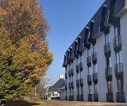
Tulip Inn Sevenum
Hotel Antiek Helden
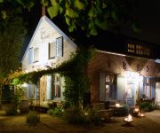
Gasterie Lieve Hemel
Videos from this area
These are videos related to the place based on their proximity to this place.
zwem disco beringerzand 2012 07 24
een Limburgse Zwem-Disco op camping Beringerzand, eerst de kleintjes tot 8 jaar, na 20.30 uur de grotere kids. een echte disco, DJ Ad zorgt voor de muziek. Super gezellig !
IHF PANNINGEN 2014
Opname van de stationaire stoomzagerij-straat op het IHF te Panningen. Opname datum 27 juli 2014. Voice Over / interviews: Geert Balduk Productie / Regie: Gerard Rabeling.
2010 07 24 Panningen Demonstrationen lichtaartse kloppers
Vorführungen beim 31. Historischen Festival in Panningen (Teil 3 von 4) Am Samstag (am folgenden Tag hatten sie bereits einen Auftritt bei einer anderen Veranstaltung) zeigten Gäste aus...
FLB2 lost one propeller in the water
Because of the plants under water, I lost one propeller. We can still operate it though.
Bolinder-Munktell in den Niederlanden
Gesehen auf dem 35. Internationaal Historische Festival. Mehr auf www.oldtimertrecker.de.
2010_07_24 Panningen Traktoren 1
Schlepper beim 31. Historischen Festival in Panningen (Teil 1 von 2) -------------- Ruiterterrein De Vosberg, Ninnesweg 176, NL 5981 PD Panningen De HMT (Historische Motoren en Tractoren...
One Man More - Naive (Kepèl Open Air 2009)
One Man More - Naive van The Kooks op Kepèl Open Air 2009.
Netstorm Mission 2
The second mission of Netstorm: Islands at war. This time whitout text,and again whitout sound, because i dont know why my recorder dont whant to record it. and always keep visitting www.nestor...
double steam engine plowing
Plowing with two locomobiles during the steam festival on June 25, 2010 at Panningen.
Videos provided by Youtube are under the copyright of their owners.
Attractions and noteworthy things
Distances are based on the centre of the city/town and sightseeing location. This list contains brief abstracts about monuments, holiday activities, national parcs, museums, organisations and more from the area as well as interesting facts about the region itself. Where available, you'll find the corresponding homepage. Otherwise the related wikipedia article.
Beringe
Beringe is a town in the Dutch province of Limburg. It is a part of the municipality of Helden, and lies about 15 km west of Venlo. In 2001, Beringe had 1286 inhabitants. The built-up area of the town was 0.34 km², and contained 472 residences.
Egchel
Egchel is a town in the Dutch province of Limburg. It is a part of the municipality of Helden, and lies about 14 km north of Roermond. In 2001, Egchel had 535 inhabitants. The built-up area of the town was 0.18 km², and contained 191 residences.
Panningen
Panningen is a town in the Dutch province of Limburg. Before the 2010 municipal redivision, when Panningen became a part of the newly formed municipality of Peel en Maas, it was part of Helden. It's nearest city Venlo lies about 13 km eastwards. In 2001, Panningen had 11908 inhabitants. The built-up area of the town was 3.38 km², and contained 4523 residences.


