Safety Score: 3,3 of 5.0 based on data from 9 authorites. Meaning please reconsider your need to travel to Netherlands.
Travel warnings are updated daily. Source: Travel Warning Netherlands. Last Update: 2024-08-13 08:21:03
Explore Hoogcruts
Hoogcruts in Eijsden-Margraten (Limburg) with it's 80 inhabitants is a city in Netherlands about 118 mi (or 190 km) south of Amsterdam, the country's capital.
Local time in Hoogcruts is now 10:36 AM (Friday). The local timezone is named Europe / Amsterdam with an UTC offset of one hour. We know of 10 airports in the vicinity of Hoogcruts, of which 5 are larger airports. The closest airport in Netherlands is Maastricht Aachen Airport in a distance of 10 mi (or 16 km), North. Besides the airports, there are other travel options available (check left side).
There are several Unesco world heritage sites nearby. The closest heritage site is Aachen Cathedral in Germany at a distance of 11 mi (or 17 km). The closest in Netherlands is Rietveld Schröderhuis (Rietveld Schröder House) in a distance of 95 mi (or 17 km), East. Also, if you like golfing, there are multiple options in driving distance. We found 2 points of interest in the vicinity of this place. If you need a place to sleep, we compiled a list of available hotels close to the map centre further down the page.
Depending on your travel schedule, you might want to pay a visit to some of the following locations: Maastricht, Aachen, Selfkant, Gangelt and UEbach-Palenberg. To further explore this place, just scroll down and browse the available info.
Local weather forecast
Todays Local Weather Conditions & Forecast: 10°C / 50 °F
| Morning Temperature | 8°C / 47 °F |
| Evening Temperature | 6°C / 44 °F |
| Night Temperature | 5°C / 40 °F |
| Chance of rainfall | 0% |
| Air Humidity | 66% |
| Air Pressure | 1028 hPa |
| Wind Speed | Light breeze with 4 km/h (2 mph) from North |
| Cloud Conditions | Clear sky, covering 8% of sky |
| General Conditions | Sky is clear |
Saturday, 16th of November 2024
8°C (47 °F)
6°C (44 °F)
Scattered clouds, gentle breeze.
Sunday, 17th of November 2024
8°C (46 °F)
5°C (42 °F)
Moderate rain, moderate breeze, overcast clouds.
Monday, 18th of November 2024
6°C (44 °F)
6°C (42 °F)
Moderate rain, moderate breeze, scattered clouds.
Hotels and Places to Stay
Romantik Parkhotel Het Gulpdal
Best Western Hotel Slenaken
Saillant Hotel Gulpenerland
Creusen
Landgoed Altembrouck
Kasteel Wittem
Klein Zwitserland
Groot Welsden
Blanckthys Hotel Voeren
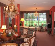
Het Binnenhof
Videos from this area
These are videos related to the place based on their proximity to this place.
de Bronnenwandeling - Voeren (2012)
Deze video toont een fragment van 'de Bronnenwandeling - Voeren 2012' welke door Vlaanderen Vakantieland in 2012 verkozen is tot mooiste wandelroute van Vlaanderen ... Meer info op ...
De Helenahoeve Slenaken: ambachtelijk ijs en homemade ijshoorntjes
Het ambachtelijk maken van ijshoorntjes bij de Helenahoeve in Slenaken - Zuid-Limburg. Copenhagen cones home made.
BMW C1 Club Meeting 2012 in Nederland
22 days 6.000 klm BMW C1 Wiliams 125cc 30 May 2012 Patra Greece -- Ancona Italy With Boat 31 May 2012 Padova Italy 1 June 2012 Insburg Austria 2 ...
Na de 3-0 van Nederland tegen Italie, EK 2008
Na de 3-0 van Nederland tegen Italie, in de groepswedstrijd op het EK 2008, bij Eetcafé Boonaparte in Slenaken. Dit filmpje in normale afspeelsnelheid: http://nl.youtube.com/watch?v=tedGFvhIMPw.
Common Hogweed (Heracleum sphondylium) - 2013-07-13
Heracleum sphondylium, common names hogweed or common hogweed, is a herbaceous perennial or biennial plant of the family Apiaceae, native to Europe and Asia. It is an umbelliferous plant, in...
Endurance Event Zuid-Limburg
Paardenwedstrijd achter mijn tuin. Doorgang Gulp (beek) in Waterop. (wit huisje is te huur)
Videos provided by Youtube are under the copyright of their owners.
Attractions and noteworthy things
Distances are based on the centre of the city/town and sightseeing location. This list contains brief abstracts about monuments, holiday activities, national parcs, museums, organisations and more from the area as well as interesting facts about the region itself. Where available, you'll find the corresponding homepage. Otherwise the related wikipedia article.
Banholt
Banholt is a village in the Dutch province of Limburg. It is part of the municipality of Eijsden-Margraten and lies about 10 km southeast of Maastricht. In 2001, Banholt had 582 inhabitants. The built-up area of the village was 0.13 km², and contained 224 residences.
Terhorst
Terhorst is a little hamlet of 33 houses and part of the village of Banholt, which is in the municipality of Margraten in the province of Limburg. In the middle of the village, Terhorst has its own little chapel built in 1949 and every year in August there is the traditional annual Chapel party (kapelfeest). There are several old farmhouses originally built in the 18th century and is a popular area for walking.
Mheer
Mheer is a village in the Dutch province of Limburg. It is located in the municipality of Eijsden-Margraten and about 12 km southeast of Maastricht. Mheer was a separate municipality until 1982, when it was merged with Margraten. The municipality also covered Banholt and Terhorst.
Noorbeek
Noorbeek is a village in the Dutch province of Limburg. It is located in the municipality of Eijsden-Margraten and about 12 km southeast of Maastricht. Noorbeek is one of the southernmost villages of the Netherlands. Noorbeek was a separate municipality until 1982, when it was merged with Margraten.
Slenaken
Slenaken is a village in the Dutch province of Limburg. It is located in the municipality of Gulpen-Wittem, and is one of the southernmost villages of the Netherlands. Slenaken was a separate municipality until 1982, when it was merged with Wittem.
Voer
The Voer is a small river in Belgium and the Netherlands. It is a right-bank tributary to the river Meuse. It has three (creek-) tributaries of its own: the Veurs, the Noor and the Beek. The source of the Voer is near the village of Sint-Pieters-Voeren in the Belgian province of Limburg. The river crosses the Belgian-Dutch border between 's-Gravenvoeren and Mesch, and flows into the river Meuse at Eijsden. The Voer's total length is about 12 kilometres .
Reijmerstok
Reijmerstok is a village in the municipality Gulpen-Wittem in the Dutch province of Limburg. It lies southwest of Gulpen and counts about 600 inhabitants. In the village several half timbered houses can be found. There also is a viaduct, which was part of the tramline between the Dutch city of Maastricht and the German city of Aachen that was in use from 1925 until 1938. Near Reijmerstok hops are grown for the Gulpener Brewery.
Gulp River
Gulp River is a small river in the north eastern part of Belgium and the south-eastern part of The Netherlands. It's an about 22 kilometres long, and fast streaming. It is a strongly meandering side stream of the Geul river. From its source in Henri-Chapelle, a village of the Welkenraedt municipality in the Belgian province of Liège it runs in a northwestern direction across the Dutch border, after which it flows into the Geul.


