Safety Score: 4,6 of 5.0 based on data from 9 authorites. Meaning it is not safe to travel Myanmar.
Travel warnings are updated daily. Source: Travel Warning Myanmar. Last Update: 2024-08-13 08:21:03
Discover Mandalay
Mandalay in Mandalay District (Mandalay Region) with it's 1,208,099 citizens is a place in Myanmar about 154 mi (or 248 km) north of Nay Pyi Taw, the country's capital city.
Current time in Mandalay is now 04:19 PM (Sunday). The local timezone is named Asia / Yangon with an UTC offset of 6.5 hours. We know of 8 airports near Mandalay, of which one is a larger airport. The closest airport in Myanmar is Mandalay International Airport in a distance of 20 mi (or 32 km), South. Besides the airports, there are other travel options available (check left side).
There is one Unesco world heritage site nearby. It's Pyu Ancient Cities in a distance of 38 mi (or 61 km), North-West. If you need a hotel, we compiled a list of available hotels close to the map centre further down the page.
While being here, you might want to pay a visit to some of the following locations: Sagaing, Taunggyi, Magway, Nay Pyi Taw and Hakha. To further explore this place, just scroll down and browse the available info.
Local weather forecast
Todays Local Weather Conditions & Forecast: 27°C / 80 °F
| Morning Temperature | 20°C / 67 °F |
| Evening Temperature | 28°C / 82 °F |
| Night Temperature | 22°C / 71 °F |
| Chance of rainfall | 0% |
| Air Humidity | 54% |
| Air Pressure | 1013 hPa |
| Wind Speed | Light breeze with 4 km/h (2 mph) from South-East |
| Cloud Conditions | Clear sky, covering 4% of sky |
| General Conditions | Sky is clear |
Monday, 18th of November 2024
27°C (80 °F)
22°C (72 °F)
Sky is clear, light breeze, clear sky.
Tuesday, 19th of November 2024
27°C (80 °F)
23°C (74 °F)
Sky is clear, light breeze, clear sky.
Wednesday, 20th of November 2024
26°C (79 °F)
23°C (74 °F)
Sky is clear, light breeze, clear sky.
Hotels and Places to Stay
SEDONA HOTEL MANDALAY
Hilton Mandalay
Mandalay Hotel by the Red Canal
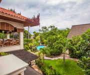
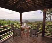
Popa Mountain Resort
MANDALAY CITY HOTEL
Videos from this area
These are videos related to the place based on their proximity to this place.
Myanmar Mandalay (Highlights) Hill Part 17
Mandalay Myanmar Mandalay is the second-largest city and the last royal capital of Burma. Located 445 miles (716 km) north of Yangon on the east bank of the Irrawaddy River, the city has a...
Myanmar 2012- Boat trip from Mandalay to Bagan (1145)
Boat trip from Mandalay to Bagan in Myanmar (Burma)
Myanmar Mandalay to Mingun Part 13
Mandalay is the second-largest city and the last royal capital of Burma. Located 445 miles (716 km) north of Yangon on the east bank of the Irrawaddy River, the city has a population of one...
Myanmar Mandalay U bein Bridge Part 16
U Bein Bridge-Mandalay: U Bein Bridge is a crossing that spans the Taungthaman Lake near Amarapura in Myanmar. The 1.2-kilometre (0.75 mi) bridge was built around 1850 and is believed to be...
Burma / Myanmar - Mandalay - Pagodas and Bagaya Kyaung Monastery
1. Mahamuni Pagode - 2. Bagaya Kyaung Monastery - 3. Kuthodaw Pagode (Größtes Buch der Welt) - 4. U Min Thone Pagode (Sagaing Hill)
Mandalay Myanmar , Initiation of Novicehood / Shin pyu Ceremony in Burma
For a Burmese boy, this is the most important ceremony. It is obligatory to be initiated, as he is not considered a good Buddhist until he has gone through this procedure, to become a novice...
Наводнение в Мандалае / Flooding: disaster and fun on the street in Mandalay
Flooding after rain. People, trishaw, truck, car, bicycles and boat on the main street in Mandalay, Burma. Rush hour! Rain season. Disaster and a lot of fun! Do not worry. Be happy! в сезон...
MYANMAR - Asia - Working in Mandalay
The products of the traditional trade in Burma are still objects of art: marble buddha images and gold leaf. The work has already been adapted a bit to modern times, but the working environment...
Mandalay hotels
Visit: http://www.toprecommendedhotels.com/EN/2076/recommended-hotels-in-mandalay.html Discover Top Recommended Hotels in Mandalay & Book up to 70% off.
Mandalay Hill Temple and Surrounds, Burma
Video of temple and surrounds at Mandalay Hill, Mandalay, Burma.
Videos provided by Youtube are under the copyright of their owners.
Attractions and noteworthy things
Distances are based on the centre of the city/town and sightseeing location. This list contains brief abstracts about monuments, holiday activities, national parcs, museums, organisations and more from the area as well as interesting facts about the region itself. Where available, you'll find the corresponding homepage. Otherwise the related wikipedia article.
Mandalay University
Mandalay University is a public liberal arts university located in Mandalay, Myanmar. Formerly an affiliate of Rangoon University, Mandalay University is the second oldest university in the country, and the largest university in Upper Myanmar. The university offers bachelor's and master's degree programs in common liberal arts, sciences and law disciplines.
University of Medicine, Mandalay
The University of Medicine, Mandalay (formerly Institute of Medicine, Mandalay), located in Mandalay is one of four medical universities in Myanmar. The university offers Bachelor of Medicine, Bachelor of Surgery (M.B.B.S. ) degrees and graduate studies degrees in medical science. The university is one of the most selective in the country, and accepts approximately 600 students annually based solely on their matriculation (college entrance exam) scores.
Basic Education High School No. 8 Mandalay
Basic Education High School No. 8 Mandalay (Burmese: အခြေခံ ပညာ အထက်တန်း ကျောင်း အမှတ် မန္တလေး; formerly, St. Joseph's Convent School) is a public high school in downtown Mandalay, Myanmar. The all-girls school offers classes from kindergarten to Tenth Standard to about 3600 students.
Mandalay District
Mandalay District is a district of the Mandalay Division in central Myanmar. Though the district used to consist of two cities, Mandalay and Amarapura, today, with the urban sprawl of Mandalay capturing Amarapura and Patheingyi, the district and the city of Mandalay are one and the same.
Bahtoo Stadium
Bahtoo Memorial Stadium is a multi-purpose stadium, located in downtown Mandalay, Myanmar. The 17,000 seat stadium is the largest stadium in Upper Myanmar, and the home stadium of Yadanabon FC of the Myanmar National League (MNL). The stadium is the Upper Myanmar venue for MNL Cup football matches. Bahtoo Stadium also hosts other local and regional football tournaments. It was the venue for the 2006 Myanmar Grand Royal Challenge Cup, an international football tournament.
Mandalay Central Railway Station
Mandalay Central Railway Station, located in downtown Mandalay, is one of the largest rail stations in Myanmar. The station is Upper Myanmar's gateway to the 3,126-mile (5,031 km) national rail network. It is the terminus of the main rail line from Yangon and the starting point of branch lines to Pyin U Lwin (Maymyo), Lashio, Monywa, Pakokku, Kalay, Gangaw, and to the north, Shwebo, Kawlin, Naba, Kanbalu, Mohnyin, Hopin, Mogaung and Myitkyina.
Zegyo Market
Zegyo Market, located in downtown Mandalay, is the oldest and most important market in Mandalay.
National Highway 3 (Burma)
|} National Highway 3 (NR3) is one of the most important highways of central-eastern Burma. It connects Mandalay to Muse on the border with China. The highway is fed by the National Highway 1 at Mandalay at {{#invoke:Coordinates|coord}}{{#coordinates:21|58|58|N|96|5|14|E| | |name= }} coming form the south and 26th Street from the west.
Naypyidaw Union Territory
Naypyidaw Union Territory (Burmese: နေပြည်တော် ပြည်တောင်စုနယ်မြေ, also spelt Naypyitaw) is an administrative division in central Burma (Myanmar). The Union Territory encompasses the administrative capital of Burma, Naypyidaw.
National Highway 31 (Burma)
National Highway 31 is a major highway of central/northeastern Burma. It starts in Mandalay at the rim of the Mandalay Palace area from National Highway 3 at {{#invoke:Coordinates|coord}}{{#coordinates:21|58|59|N|96|5|3|E| | |name= }} and ends in Waingmaw/Myitkyina in Kachin State at {{#invoke:Coordinates|coord}}{{#coordinates:25|21|1|N|97|26|8|E| | |name= }}.


