Safety Score: 3,0 of 5.0 based on data from 9 authorites. Meaning we advice caution when travelling to Morocco.
Travel warnings are updated daily. Source: Travel Warning Morocco. Last Update: 2024-08-13 08:21:03
Discover Ighir -n- Bou ’Ali
Ighir -n- Bou ’Ali in Béni Mellal-Khénifra is a city in Morocco about 133 mi (or 214 km) south of Rabat, the country's capital city.
Local time in Ighir -n- Bou ’Ali is now 11:42 AM (Friday). The local timezone is named Africa / Casablanca with an UTC offset of one hour. We know of 8 airports in the vicinity of Ighir -n- Bou ’Ali, of which one is a larger airport. The closest airport in Morocco is Ouarzazate Airport in a distance of 81 mi (or 130 km), South. Besides the airports, there are other travel options available (check left side).
There are several Unesco world heritage sites nearby. The closest heritage site in Morocco is Medina of Marrakesh in a distance of 52 mi (or 84 km), South-East. Looking for a place to stay? we compiled a list of available hotels close to the map centre further down the page.
When in this area, you might want to pay a visit to some of the following locations: Tabia, Taounza, Oulad Ayad, Azilal and Ouaoula. To further explore this place, just scroll down and browse the available info.
Local weather forecast
Todays Local Weather Conditions & Forecast: 22°C / 72 °F
| Morning Temperature | 13°C / 56 °F |
| Evening Temperature | 21°C / 69 °F |
| Night Temperature | 18°C / 65 °F |
| Chance of rainfall | 0% |
| Air Humidity | 26% |
| Air Pressure | 1013 hPa |
| Wind Speed | Gentle Breeze with 8 km/h (5 mph) from North-West |
| Cloud Conditions | Broken clouds, covering 67% of sky |
| General Conditions | Broken clouds |
Saturday, 16th of November 2024
26°C (78 °F)
20°C (68 °F)
Sky is clear, fresh breeze, clear sky.
Sunday, 17th of November 2024
27°C (81 °F)
19°C (66 °F)
Scattered clouds, gentle breeze.
Monday, 18th of November 2024
28°C (82 °F)
23°C (73 °F)
Overcast clouds, gentle breeze.
Hotels and Places to Stay
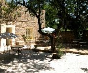
Riad Dar Fatna
Videos from this area
These are videos related to the place based on their proximity to this place.
OUZOUD (Cascades)-Prov.Azilal- MAROC -شلالات أوزود - إقليم أزيلال
Les cascades d'Ouzoud sont des chutes d'eau situées au Maroc. À 120 km de Beni Mellal et 150 km de Marrakech, elles constituent une attraction touristique importante. Nées de l'oued Ouzoud,...
Cascades Ouzoud randonnee - ouzoud marrakech Voyager
Randonnée au Cascades Ouzoud avers Vallée Ait Bougummaz. De la source de AIN ASSERDUN aux cascades d'OUZOUD , vous découvrirez les falaises de MOUDJ ,vous traverserez l'oued AL ABID ...
les cascades d'ouzoud-شلالات اوزود
my blog: http://alami-al.blogspot.com/ Les cascades d'Ouzoud sont parmi les plus beau site du Moyen Atlas. Ce site est situé à environ 150 km de Marrakech, au Nord-Est de la ville. Vous...
Camping Zebra - Cascades d'Ouzoud
After many thousands of km throughout Morocco from north to south , from East to the West over several years I felt free to recommend very deserving people, places and services for their honesty,...
ASCM.du 25au28 JUIN 2012.Cascades d'Ouzoudtajine local.AFourèr+Bin-el-Ouidane.prt2
Association Sportive de cyclisme MEKNÈS .MAROC" الجمعية الرياضية لسباق الدراجات مكناس" المغرب http://cyclismemaroc.skyrock.com/ http://www.facebook.com/...
Morocco - Ait Attab Water Shortage - Part 2 of 2
We travel on to the top, where the failed pumping project is, then to Ait Larbi to see the severe water problems there. We only need a few thousand euros to get clean drinking water. If...
Permaculture Course Morocco 2010 Pt.1
About the Permaculture Design Certificate Course held at Ait Attab Tribal Region in Morocco in Spring 2010. We're holding an introductory course in French at the end of October just outside...
Permaculture Course Morocco 2010 Pt.2
Showing the water diviner we employed to locate a spot to drill the borehole. Also parts of the Design course, the land where the project is, and thoughts form the students. We're holding...
ملتقى الطرق بمركز ايت اعتاب Ait Attab
ملتقى الطرق بمركز ايت اعتاب Ait Attab الموقع الرسمي لايت اعتاب : aitattab.com.
Videos provided by Youtube are under the copyright of their owners.


