Safety Score: 3,6 of 5.0 based on data from 9 authorites. Meaning please reconsider your need to travel to Mexico.
Travel warnings are updated daily. Source: Travel Warning Mexico. Last Update: 2024-08-13 08:21:03
Delve into Tazbichen
Tazbichen in Tinum (Estado de Yucatán) is a town located in Mexico about 705 mi (or 1,135 km) east of Mexico City, the country's capital town.
Time in Tazbichen is now 07:21 PM (Monday). The local timezone is named America / Merida with an UTC offset of -6 hours. We know of 8 airports closer to Tazbichen, of which one is a larger airport. The closest airport in Mexico is Chichen Itza International Airport in a distance of 11 mi (or 18 km), South-West. Besides the airports, there are other travel options available (check left side).
There are several Unesco world heritage sites nearby. The closest heritage site in Mexico is Pre-Hispanic Town of Uxmal in a distance of 29 mi (or 47 km), South. In need of a room? We compiled a list of available hotels close to the map centre further down the page.
Since you are here already, you might want to pay a visit to some of the following locations: Tinum, Dzitas, Espita, Quintana Roo and Calotmul. To further explore this place, just scroll down and browse the available info.
Local weather forecast
Todays Local Weather Conditions & Forecast: 29°C / 85 °F
| Morning Temperature | 18°C / 64 °F |
| Evening Temperature | 25°C / 77 °F |
| Night Temperature | 20°C / 68 °F |
| Chance of rainfall | 0% |
| Air Humidity | 51% |
| Air Pressure | 1019 hPa |
| Wind Speed | Light breeze with 5 km/h (3 mph) from South-West |
| Cloud Conditions | Few clouds, covering 15% of sky |
| General Conditions | Few clouds |
Tuesday, 26th of November 2024
29°C (85 °F)
21°C (70 °F)
Light rain, light breeze, few clouds.
Wednesday, 27th of November 2024
31°C (87 °F)
21°C (69 °F)
Sky is clear, light breeze, clear sky.
Thursday, 28th of November 2024
30°C (87 °F)
20°C (69 °F)
Sky is clear, light breeze, clear sky.
Hotels and Places to Stay
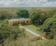
Hacienda San Miguel
Videos from this area
These are videos related to the place based on their proximity to this place.
Iguanas pequeñas peleando en Valladolid, Yucatán o ¿ es Amor Apache? Iguanas fighting
Iguanas pequeñas peleando en Valladolid, Yucatán. Iguanas fighting. Fighting Iguanas. Redes Sociales: https://www.facebook.com/pages/Valladolid-Actual/406116449485325?ref=hl ...
Chinito Uayma 2014- Yozeily Leal y Sergio Canche.
Bailando el chinito Koy Koy al ritmo de las jarana de la Orquesta de Victor Soberanis con mi amiga Yoze. Gracias Adrian por grabar. :)
cleyver yla nueva imagen vuelveme a mentir en vivo2010.avi
excelente rola en vivo concierto tinum yucatan2010.
Mexico, Cenote Samula
Cenote Samula 25.02.2015. Samul Cenote is on the other side of the road about 100 meters from the Cenote X-Keken, about 7km to the south. west of Valladolid.
Cenote ox man (3 veces por el mismo camino), cerca de Valladolid, Yucatán.
Visita al cenote ox man,ubicada en la hacienda San Lorenzo a 10 minutos del centro de Valldolid, Yucatán, el 27 de mayo de 2011. Se muestra un particular avistamiento del pájaro To, según...
Chichen Itza - Mayans Dec. 2012
Chichen Itza shows an advanced civilization, with knowledge in astronomy, mathematics and processing are written language predicts the end of time. What is the truth and who were the Mayans?
Mexiko - Welt der Maya - Chichén Itzá - Pyramide Kukulcan
PMMedia1: Musik by Dreamweaver - Markus Pitzer http://www.dreamweaver.at Die Tempelstadt Chichén Itzá auf der Halbinsel Yucatan wurde um das Jahr 450 gegründet und war in präkolumbischer...
Videos provided by Youtube are under the copyright of their owners.
Attractions and noteworthy things
Distances are based on the centre of the city/town and sightseeing location. This list contains brief abstracts about monuments, holiday activities, national parcs, museums, organisations and more from the area as well as interesting facts about the region itself. Where available, you'll find the corresponding homepage. Otherwise the related wikipedia article.
Uayma
Uayma is a town of 2300 inhabitants located in the center of the Yucatán Peninsula, about 15 kilometers north and west of Valladolid. In colonial times Uayma was a major stop on the El Camino Real between Mérida and Valladolid. The church was built originally by the Spaniards to enforce their culture in Uayma, which was at the time an important Mayan center. Stones from nearby Mayan temples were used to build the church, some of which can be seen on the facade.


