Safety Score: 3,6 of 5.0 based on data from 9 authorites. Meaning please reconsider your need to travel to Mexico.
Travel warnings are updated daily. Source: Travel Warning Mexico. Last Update: 2024-08-13 08:21:03
Explore La Unión
La Unión in Matamoros (Estado de Tamaulipas) is located in Mexico about 456 mi (or 734 km) north of Mexico City, the country's capital.
Local time in La Unión is now 12:09 PM (Thursday). The local timezone is named America / Matamoros with an UTC offset of -6 hours. We know of 8 airports in the wider vicinity of La Unión, of which two are larger airports. The closest airport in Mexico is General Servando Canales International Airport in a distance of 7 mi (or 11 km), South. Besides the airports, there are other travel options available (check left side).
Also, if you like golfing, there are multiple options in driving distance. We found 4 points of interest in the vicinity of this place. If you need a place to sleep, we compiled a list of available hotels close to the map centre further down the page.
Depending on your travel schedule, you might want to pay a visit to some of the following locations: Brownsville, Raymondville, Edinburg, Reynosa and Sarita. To further explore this place, just scroll down and browse the available info.
Local weather forecast
Todays Local Weather Conditions & Forecast: 24°C / 75 °F
| Morning Temperature | 11°C / 52 °F |
| Evening Temperature | 20°C / 69 °F |
| Night Temperature | 18°C / 65 °F |
| Chance of rainfall | 0% |
| Air Humidity | 32% |
| Air Pressure | 1025 hPa |
| Wind Speed | Gentle Breeze with 8 km/h (5 mph) from South-West |
| Cloud Conditions | Clear sky, covering 0% of sky |
| General Conditions | Sky is clear |
Thursday, 21st of November 2024
25°C (76 °F)
19°C (67 °F)
Sky is clear, moderate breeze, clear sky.
Friday, 22nd of November 2024
25°C (76 °F)
22°C (71 °F)
Overcast clouds, moderate breeze.
Saturday, 23rd of November 2024
27°C (81 °F)
24°C (75 °F)
Overcast clouds, fresh breeze.
Hotels and Places to Stay
BW HOTEL PLAZA MATAMOROS
City Express Matamoros
Hilton Villahermosa - Conference Center
Pure All Suites Riviera Maya
Pure Mareazul Riviera Maya
Hotel Alameda Express
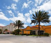
Holiday Inn MATAMOROS
Senses Quinta Avenida By Artisan Adults Only
ROSE GARDEN INN
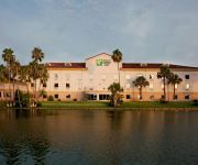
Holiday Inn Express & Suites BROWNSVILLE
Videos from this area
These are videos related to the place based on their proximity to this place.
festival de primavera la granja del tio juan tatiana HD DSCF5881.AVI
festival de primavera 2012 21/marzo bailable 2ºA.
Salud para los Trabajadores GÉNERO Y SALUD, (1/2 SJOIIM-PrevenIMSS)
"GÉNERO Y SALUD Papeles de Género". El SJOIIM ve por la salud de sus agremiados trabajadores, promoviendo videos que el IMSS ha preparado para la distribución entre los afiliados a esta...
Grupo de Danza de las Escuelas Normales Lic. J. Guadalupe Mainero y Rosaura Zapata
Mañanita Mexicana 2011 Escuelas Normales "Lic. J. Guadalupe Mainero" y "Rosaura Zapata"
Salud para los Trabajadores GÉNERO Y SALUD, (2/2 SJOIIM-PrevenIMSS)
"GÉNERO Y SALUD Papeles de Género". El SJOIIM ve por la salud de sus agremiados trabajadores, promoviendo videos que el IMSS ha preparado para la distribución entre los afiliados a esta...
Salud para los Trabajadores GÉNERO Y VIOLENCIA, (1/1 SJOIIM-PrevenIMSS)
El SJOIIM ve por la salud de sus agremiados trabajadores, promoviendo videos que el IMSS ha preparado para la distribución entre los afiliados a esta institución, que en su gran mayoria son...
HURACÀN FUERZA DE LA NATURALEZA
llega la temporada de huracanes y las poblaciones de las ciudades que estan propensas a ser blanco de este fenomeno meteorologico deben de estar preparadas...
ENFERMEDADES QUE TRANSMITEN LAS RATAS
Reportaje sobre las enfermedades mas comunes que transmiten los roedores.
banda de guerrra plomo sec 2 (1er lugar en municipal)
la participacion de la sec 2 la mejor banda de tamaulipas.
Videos provided by Youtube are under the copyright of their owners.
Attractions and noteworthy things
Distances are based on the centre of the city/town and sightseeing location. This list contains brief abstracts about monuments, holiday activities, national parcs, museums, organisations and more from the area as well as interesting facts about the region itself. Where available, you'll find the corresponding homepage. Otherwise the related wikipedia article.
Gateway International Bridge
Gateway International Bridge is one of three international bridges that cross the U.S. -Mexico border between the cities of Brownsville, Texas, and Matamoros, Tamaulipas. It is owned and operated by Cameron County. Over the past century, it has developed the nickname of "The New Bridge" when the bridge was remodeled back in the 20th century. Despite the fact that the Veteran's International Bridge is newer than Gateway, it still retains its nickname.
Brownsville & Matamoros International Bridge
The Brownsville & Matamoros International Bridge, also known as B&M International Bridge, Brownsville-Matamoros International Bridge and Express Bridge, is one of three international bridges that cross the U.S. -Mexico border between the cities of Brownsville, Texas, and Matamoros, Tamaulipas. This international bridge unites the Matamoros–Brownsville Metropolitan Area, which counts with a population of 1,136,995, making it the 4th largest metropolitan area in the Mexico-US border.
Amigoland Mall
Amigoland Mall was an enclosed shopping mall located in Brownsville, Texas. The former mall, which now houses a tech center, is now called the Brownsville ITEC Center. The 647,000-square-foot mall, developed by Melvin Simon & Associates, opened in downtown Brownsville in 1974, with Montgomery Ward, JCPenney (which also featured a JCPenney Supermarket), and Dillard's as anchors. Other early tenants included McCrory Stores, Walgreens, and a two-screen movie theater.
Matamoros Municipality, Tamaulipas
Matamoros is a municipality located in the Mexican state of Tamaulipas.
Battle of Matamoros
The Battle of Matamoros was a naval engagement during the Texas Revolution on April 3, 1836 between one ship of the Mexican Navy and one of the Texas Navy. The Mexican ship was outmaneuvered and repeatedly hit before running aground and abandoned. The Port of Matamoros, also known as LOS BRAZOS DE SANTIAGO, was the Mexican army's primary resupply base for the operations of General Santa Anna, who was finally defeated on April 21, 1836, outside of Houston at the battle of San Jacinto.
United States Court House, Custom House, and Post Office (Brownsville, Texas, 1933)
The former United States Court House, Custom House, and Post Office in Brownsville, Texas, also known as the Old Federal Courthouse, is a former courthouse of the United States District Court for the Southern District of Texas, and currently serves as Brownsville City Hall. Completed in 1931, the building replaced the 1892 U.S. Court House, Custom House, and Post Office of that city, which was razed in 1931. The replacement for the 1931 building was, in turn, completed in 1999.
Brownsville – B&M Port of Entry
The Brownsville B&M Port of Entry opened in 1909 with the completion of the Brownsville & Matamoros International Bridge. The bridge was built to carry trains, horses, wagons and pedestrians. The original bridge could swing open to allow river traffic to pass; however it was a function that was almost never used due to the shallowness of the Rio Grande. The bridge was subtantially renovated in 1953, and a second 4-lane bridge dedicated to northbound traffic was build adjacent to it in 1997.
Brownsville Gateway Port of Entry
The Brownsville Gateway Port of Entry opened in 1926 with the completion of the Gateway International Bridge. The original bridge was a steel arch design, and arches, which have long been used to signify international gateways, were incorporated into the design of the Matamoros Gateway border station in the 1950s. Unfortnately, the steel arch bridge was not well maintained, and it was replaced with two flat deck spans in the late 1970s. All truck traffic has been prohibited since 1999.


