Safety Score: 3,6 of 5.0 based on data from 9 authorites. Meaning please reconsider your need to travel to Mexico.
Travel warnings are updated daily. Source: Travel Warning Mexico. Last Update: 2024-08-13 08:21:03
Delve into Cumbres Madeira
The district Cumbres Madeira of in Estado de Nuevo León is a district located in Mexico about 444 mi north of Mexico City, the country's capital town.
In need of a room? We compiled a list of available hotels close to the map centre further down the page.
Since you are here already, you might want to pay a visit to some of the following locations: Ciudad General Escobedo, Monterrey, Carmen, Abasolo and Garcia. To further explore this place, just scroll down and browse the available info.
Local weather forecast
Todays Local Weather Conditions & Forecast: 29°C / 85 °F
| Morning Temperature | 21°C / 70 °F |
| Evening Temperature | 25°C / 77 °F |
| Night Temperature | 22°C / 71 °F |
| Chance of rainfall | 0% |
| Air Humidity | 25% |
| Air Pressure | 1016 hPa |
| Wind Speed | Light breeze with 5 km/h (3 mph) from South-West |
| Cloud Conditions | Clear sky, covering 0% of sky |
| General Conditions | Sky is clear |
Tuesday, 26th of November 2024
23°C (74 °F)
19°C (66 °F)
Broken clouds, light breeze.
Wednesday, 27th of November 2024
28°C (83 °F)
24°C (75 °F)
Sky is clear, light breeze, clear sky.
Thursday, 28th of November 2024
30°C (86 °F)
16°C (61 °F)
Scattered clouds, gentle breeze.
Hotels and Places to Stay
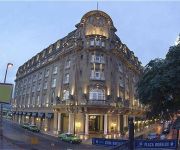
GAMMA MONTERREY GRAN HOTEL ANCIRA
FIESTA INN MONTERREY LA FE
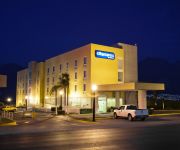
City Express Monterrey Santa Catarina
City Express Plus MTY Sn Jeron
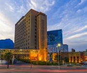
Four Points by Sheraton Galerias Monterrey
Courtyard Monterrey San Jeronimo/Valle
LQ Hotel by La Quinta Monterrey Norte
Hotel Hacienda Cola de Caballo
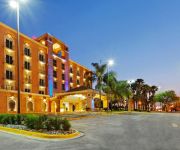
Holiday Inn Express MONTERREY GALERIAS-SN JERONIMO
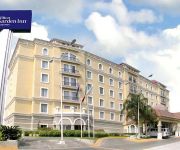
Hilton Garden Inn Monterrey
Videos from this area
These are videos related to the place based on their proximity to this place.
Cerro del Topo 10Ene'12
El recorrido se realizo el Martes 10 de Enero del 2012, y a pesar de las espinas, barrancos, rasguños, raspones, etc. valió la pena; se subió por el nuevo fraccionamiento que estaban construyen...
Golpes en prados del rey - santa catarina Nuevo leon
AKi TOdos GOlpEaNDonoS De Vdd PEro Fue PlanEAdo.
Nay Treviño Campaña Irma Adriana
Participacion de Nay Treviño el dia de ayer 12 de Mayo 2012 en La Fama Santa Catarina en la campaña de la Lic. Irma Adriana Garza a la Alcaldia del Municipio de Santa Catarina.
Silencio (Silence) cortometraje / short film - TRAILER
Realizado por http://www.bnegra.com Silencio, 10 min. México Escrito por / Written by Naivy N. Zamora Sepúlveda. Dirigido por / Directed by Ismael Nava Alejos. Producido por / Produced...
tokio hotel Bill kaulitz cae en los 40 principales
Bill kaulitz cae en los 40 principales que mal :-\
Recorre Longoria Mercado con Batucada
San Pedro Garza García, 06/05/2012 http://www.jorgelongoria.org En medio de una alegre batucada, el arquitecto Jorge Longoria Treviño, candidato ciudadano a la alcaldía de San Pedro Garza...
Monterrey, Mexico
This video is of my last visit to Monterrey, Mexico. What an amazing city to visit!
A que te pongo - Gran Mariachi Viajero
Video musical del gran mariachi viajero, disfrutenlo ahora en HD! Este es el primer videoclip del "Gran Mariachi Viajero" filmado en el restaurante "Hacienda San Angel" los dias 4 y 5 de...
Videos provided by Youtube are under the copyright of their owners.
Attractions and noteworthy things
Distances are based on the centre of the city/town and sightseeing location. This list contains brief abstracts about monuments, holiday activities, national parcs, museums, organisations and more from the area as well as interesting facts about the region itself. Where available, you'll find the corresponding homepage. Otherwise the related wikipedia article.
Estadio Universitario
The Estadio Universitario – nicknamed El Volcan (Spanish for "the volcano") is a football stadium property of the Universidad Autónoma de Nuevo León, located in its premises in San Nicolás de los Garza, Nuevo León in Mexico.
Universidad Autónoma de Nuevo León
The Autonomous University of Nuevo León (Spanish: Universidad Autónoma de Nuevo León, UANL) is a public university with seven campuses across the Northern state of Nuevo León, Mexico. Founded as University of Nuevo León on 25 September 1933, it is the oldest and largest university in the state in terms of student population and it is currently headquartered in San Nicolás de los Garza, a suburb of Monterrey.
Estadio de Béisbol Monterrey
Estadio de Béisbol Monterrey is a baseball stadium in Monterrey, Mexico. It is the home field of the Sultanes Monterrey Mexican League baseball team. It holds 27,000 people, making it the largest baseball stadium in Mexico and the third largest in Latin America.
Universidad de Monterrey
The University of Monterrey is a Roman Catholic institution of higher learning located in Monterrey, Mexico. UDEM was founded by the Daughters of the Immaculate Mary of Guadalupe, the nuns of the Sacred Heart, the Marist Brothers and the La Salle members, supported by an association of Catholic citizens. The idea originated from a recommendation given by the Second Vatican Council to use educational activities in favor of teaching the principles of the catholic doctrine.
Banderas monumentales
The banderas monumentales are a set of monuments located throughout Mexico. They are part of a program started in 1999 under President Ernesto Zedillo that is currently administered by the Secretariat of National Defense (Secretaría de la Defensa Nacional). The main feature of these monuments (though not the biggest, see below) is a giant Mexican flag flying off a 50 meter-high flagpole. The size of the flag was 14.3 by 25 meters and it was flown on a pole that measured 50 meters high.
Mirador del Obispado
The Mirador del Obispado (Bishopric Lookout) is located at the top of the Cerro del Obispado (Bishopric Hill) in the northern city of Monterrey, Mexico. It features the biggest bandera monumental (monumental flag) in Mexico. The hill and the lookout receive their name from the building constructed in the middle of the hill by the end of the 18th century, the Palacio del Obispado (Bishopric Palace).
Cerro del Obispado
The Cerro del Obispado (Spanish for Bishopric Hill) is a famous landmark in the city of Monterrey, Mexico, named after the building constructed in the middle of the hill by the end of the 18th century. The hill is a popular recreational area that includes a public lookout point, a monumental flag, and the famous Bishopric Palace (Palacio del Obispado).
Talleres (Monterrey Metro)
The Talleres Station (aka Terminal Talleres) is a terminal station on Line 1 of the Monterrey Metro. It is located on Ave. Solidaridad and Esquisto St. in the San Bernabé VI neighborhood in Monterrey, Mexico. This station is named after the Metrorrey maintenance shops (talleres) that are located right after the station, and its logo represents a train during maintenance. Although this part of Line 1 was operational from the start, the original terminal of Line 1 was San Bernabé station.
Estadio Gaspar Mass
Estadio Gaspar Mass is an artificial turf stadium in Monterrey, Mexico. It is primarily used for American football and is the home field for the Universidad Autónoma de Nuevo León Auténticos Tigres. It holds 13,500 people.
Ignacio A. Santos School of Medicine
The Ignacio A. Santos School of Medicine of the Monterrey Institute of Technology and Higher Education (ITESM) is a prestigious private medical school founded in 1978 in Monterrey, Mexico, in order to provide medical education, training and to promote reliable biomedical investigation in Mexico with the support of the ITESM research infrastructure.
Puente de la Unidad
Puente de la Unidad or Viaducto de la Unidad is a cable-stayed bridge designed by Óscar Bulnes that crosses the Santa Catarina River and connects the cities of Monterrey and San Pedro Garza García in the Mexican state of Nuevo León. It is part of a circuit called "Circuito La Unidad", which would consist of the interconnection of a series of Avenues.
Galerías Monterrey
Galerías Monterrey was the first shopping mall in Monterrey, Mexico. Founded in 1983 with Liverpool, it has grown to attract upscale fashion stores, restaurants, and movie theaters.
Cerro de las Mitras
Cerro de las Mitras (English: Miter Hill or Miter Mountain), named for its distinctive miter-shaped structures at the very top viewed from the northern side, is another symbol of the landscape of the state of Nuevo León, Mexico. Located in the cities of Monterrey, Santa Catarina and García. Being part of the Cumbres National park by the Mexican government, the mountain is often climbed by hikers. The ascent is considered fairly difficult to complete.
Cerro del Topo Chico
Cerro del Topo Chico is an inactive volcano located in the western portion of the city of San Nicolás de los Garza and within the northern limits of the Monterrey metropolitan area (both cities are in the Mexican state of Nuevo León). The gray areas depicted on the photos are limestone quarries from which raw material is extracted to manufacture cement.
Edison (Monterrey Metro)
The Edison Station is a station on Line 1 of the Monterrey Metro. It is located in Monterrey, Mexico at the intersection of Edison street and Colon Avenue in the Monterrey Centre. It was opened in 1991. This station serves the west side of the downtown area and also the Talleres neighborhood (Colonia Talleres). It is accessible for people with disabilities.
Hospital (Monterrey Metro)
The Hospital Station is a station on Line 1 of the Monterrey Metro. It is located on Simón Bolivar Avenue near the Universidad Autónoma de Nuevo León (UANL) Medical Campus and the University Hospital (Hospital Civil). It was opened in 1991. This station serves the Central Mitras and South Mitras neighborhoods (Colonia Mitras Centro y Mitras Sur), and is accessible for people with disabilities. This station is named after medical facilities nearby, and its logo represents a hospital.
San Bernabé (Monterrey Metro)
The San Bernabé Station (Spanish: Estación San Bernabé) is a station on Line 1 of the Monterrey Metro. It is located in the Solidaridad Avenue and Lic Julio Camelo intersection in Monterrey. This station serves San Bernabé, Loma Linda and Valle de Santa Lucia. It is accessible for people with disabilities. This station is named after the neighborhood in which is located (Colonia San Bernabé), and its logo represents the silhouette of San Bernabé, from which the zone is named after.
Penitenciaría (Monterrey Metro)
The Penitenciaria Station (aka Estación Penitenciaria) is a station on Line 1 of the Monterrey Metro. It is located in Rodrigo Gomez Avenue in Monterrey near the State Criminal Courthouses and one of the State Jail Houses (Penitenciarias). It was opened in 1991. This station serves the Simón Bolivar neighborhood (Colonia Simón Bolivar) and also to Valle Morelos. It is accessible for people with disabilities.
Unidad Modelo (Monterrey Metro)
The Unidad Modelo Station (Spanish: Estación Unidad Modelo) is a station on Line 1 of the Monterrey Metro. It is located on Aztlán Avenue in Monterrey in the heart of the heavy populated Unidad Modelo neighborhood. This station is accessible for people with disabilities. This station is named after the neighborhood it is located in, and its logo represents the houses that are located in the zone.
Aztlán (Monterrey Metro)
The Aztlán Station (aka Estación Aztlán) is a station on Line 1 of the Monterrey Metro. This station is located on Aztlán Avenue in Monterrey. This station serves the heavy populated Aztlán, Nueva Galicia and Valle del Topo Chico neighborhoods, there's an IMSS hospital, a supermarket, and several stores near the station. It is accessible for people with disabilities. This station is named after Aztlán Avenue, and its logo represents an Aztec pyramid since Aztlán is a legendary aztec city.
Alfonso Reyes (Monterrey Metro)
The Alfonso Reyes Station (aka Estación Alfonso Reyes) is a station on Line 1 of the Monterrey Metro. It is located in the intersection of Rodrigo Gomez and Alfonso Reyes Avenues in Monterrey, México. It was opened in 1991. This station serves the Nueva Morelos and Central neighborhoods (Colonias Nueva Morelos y Central). It is accessible for people with disabilities.
Mitras (Monterrey Metro)
The Mitras Station (aka Estación Mitras) is a station on Line 1 of the Monterrey Metro. It is located in the intersection of Simón Bolívar and Ruiz Cortinez Avenues in Monterrey, México. It was opened in 1991. This station serves the Mitras Norte and Bernardo Reyes neighborhoods (Colonias Mitras Norte y Bernardo Reyes). It is accessible for people with disabilities. This station is named after the Mitras neighborhood, and its logo represents the Cerro de las Mitras (Miter Hill).
Simón Bolívar (Monterrey Metro)
The Simón Bolívar Station (aka Estación Simón Bolívar) is a station on Line 1 of the Monterrey Metro. It is located on Simón Bolivar Avenue, and was opened in 1991. This station serves the Central Mitras neighborhood (Colonia Mitras Centro), it is accessible for people with disabilities. This station is named after Simón Bolivar Avenue, and its logo represents a stylized head shot of Simón Bolivar, one of the Liberators of Spanish South America.
Calzada del Valle/Calzada San Pedro
Calzada del Valle and Calzada San Pedro, is a beautiful three lane intersecting gardened boulevards inside the exclusive area of San Pedro Garza García, a suburb of the larger metropolitan city of Monterrey, Nuevo León, Mexico. Some of the most exclusive shops, apartment buildings and business offices are located throughout the avenue. The walkway in the boulevard is great for exercising, walking or marathons. Parades usually take place during Easter and Christmas through the calzada.
2011 Monterrey casino attack
The 2011 Monterrey casino attack was a narcoterrorist attack that took place in city of Monterrey, Nuevo León, in the country of Mexico, on 25 August 2011. Government sources revealed that 52 people were killed, but the Blog del Narco mention that 61 bodies were eventually found after a few days. In addition, this terrorist attack left over a dozen injured, and over 35 trapped for several hours before the Mexican forces arrived at the place a few minutes after the incident.


