Safety Score: 3,6 of 5.0 based on data from 9 authorites. Meaning please reconsider your need to travel to Mexico.
Travel warnings are updated daily. Source: Travel Warning Mexico. Last Update: 2024-08-13 08:21:03
Explore Cazadores Juarenses
The district Cazadores Juarenses of in Estado de Chihuahua is located in Mexico about 967 mi north-west of Mexico City, the country's capital.
If you need a place to sleep, we compiled a list of available hotels close to the map centre further down the page.
Depending on your travel schedule, you might want to pay a visit to some of the following locations: El Paso, Las Cruces, Alamogordo, Sierra Blanca and Deming. To further explore this place, just scroll down and browse the available info.
Local weather forecast
Todays Local Weather Conditions & Forecast: 15°C / 59 °F
| Morning Temperature | 11°C / 51 °F |
| Evening Temperature | 18°C / 64 °F |
| Night Temperature | 14°C / 57 °F |
| Chance of rainfall | 0% |
| Air Humidity | 20% |
| Air Pressure | 1024 hPa |
| Wind Speed | Light breeze with 4 km/h (2 mph) from South |
| Cloud Conditions | Clear sky, covering 0% of sky |
| General Conditions | Sky is clear |
Friday, 22nd of November 2024
17°C (62 °F)
15°C (59 °F)
Scattered clouds, light breeze.
Saturday, 23rd of November 2024
19°C (65 °F)
16°C (61 °F)
Sky is clear, gentle breeze, clear sky.
Sunday, 24th of November 2024
18°C (65 °F)
16°C (61 °F)
Sky is clear, moderate breeze, clear sky.
Hotels and Places to Stay
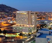
Hotel Paso Del Norte Autograph Collection
HOTEL LUCERNA CIUDAD JUAREZ
FIESTA INN CIUDAD JUAREZ
DoubleTree by Hilton El Paso Downtown
ISTAY HOTEL CIUDAD JUAREZ
BEST WESTERN SUNLAND PARK INN
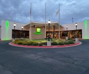
Holiday Inn EL PASO WEST – SUNLAND PARK
Hotel Suites el Paseo
Courtyard El Paso Downtown/Convention Center
Hotel Santa Fe
Videos from this area
These are videos related to the place based on their proximity to this place.
Southwest Airlines B737-700 Take off from El Paso Intl
Flight Information: Aircraft: Boeing 737-700 Airline: Southwest Airlines Seat:15F Departed: 8:34AM 6/4/2012 Arrival: 9:17AM 6/4/2012 Origin: El Paso Intl (KELP),Gate B5 Destination:Phoenix...
Carpet Cleaning El Paso | Does Stanley Steemer Do The Best Carpet Cleaning In El Paso TX
http://advantagecarpetcleaningep.com/el-paso-tx/ Does Stanley Steemer Do The Best Carpet Cleaning El Paso Most people think about Stanley Steemer when it comes to there carpet cleaning.
Auto Repair Mechanic El Paso Tx (915) 258-1590 | Best Auto Repair Mechanic In El Paso TX
(915) 258-1590 Auto Repair Mechanic El Paso Tx | Best Auto Repair Mechanic In El Paso TX. Contact Adam and let him know you saw his video on Youtube to get Special Pricing. 6354 N. Mesa. Mesa.
United Express CRJ-200 Night Landing in El Paso Intl
Flight Information: Aircraft: Canadair Regional Jet CRJ-200 Airline: United Express Flight: UA 5236 Seat: 12A Departed: 8:43PM 12/4/2012 (Delay) Arrival: 10:01PM 12/4/2012 (Delay) Origin:...
Baseball Camps El Paso Fernando Rodriguez
Baseball Camp in El Paso at THE BASE with Fernando Rodriguez of the Oakland A's.
taxi El Paso tx (915)532-2626 Checker Taxi Cab services
Our El Paso Taxi Service and El Paso Airport car service is one that many people choose because we are the best. Call for an El Paso taxi (915)532-2626 or visit us online http://checkertaxielpas...
El Paso Chiropractors - Eastside - Meet Dr.Thomas Georges
El Paso Chiropractors - Eastside - Meet Dr.Thomas Georges Meet Dr. Thomas Georges Georges Chiropractic & Wellness Center Meet Dr. Georges -(915) 592-3333 http://www.drtomgeorges.com/ ...
C&M Tires, El Paso TX Tire Dealers (915)590-8509
C & M Tires and Wheels in El Paso, TX is your one stop general tire dealer. Located at 10009 Montana Ave, El Paso, TX 79925 this used and new tire dealer offers the quality tires at discount...
Videos provided by Youtube are under the copyright of their owners.
Attractions and noteworthy things
Distances are based on the centre of the city/town and sightseeing location. This list contains brief abstracts about monuments, holiday activities, national parcs, museums, organisations and more from the area as well as interesting facts about the region itself. Where available, you'll find the corresponding homepage. Otherwise the related wikipedia article.
University of Texas at El Paso
The University of Texas at El Paso (UTEP) is a four-year state university, and is a component institution of the University of Texas System. Its campus is located on the banks of the Rio Grande river in El Paso, Texas. The school was founded in 1914 as The Texas State School of Mines and Metallurgy, and a mineshaft still exists on the mountainous desert campus. It became Texas Western College in 1949, and The University of Texas at El Paso in 1967.
Sun Bowl Stadium
The Sun Bowl is an outdoor football stadium, on the campus of the University of Texas at El Paso. It is home to the UTEP Miners of Conference USA, and the late December college football bowl game, the Hyundai Sun Bowl. The stadium was opened in 1963 and has a current seating capacity of 51,500. The land on which the stadium sits was originally donated by the university to El Paso County, Texas, who built the stadium for the school and the Sun Bowl game.
Downtown El Paso
Downtown El Paso is the central business district of El Paso, Texas.
Cathedral Parish of Saint Patrick (El Paso, Texas)
The Cathedral Parish of St Patrick is the seat of the Roman Catholic Diocese of El Paso, Texashttp://www. catholic-hierarchy. org/diocese/delpa. html. It is located at 1118 N. Mesa St. north of the downtown area. This see is vacant as the previous bishop, His Excellency, the Most Reverend Armando Xavier Ochoa, was named as prelate of the Roman Catholic Diocese of Fresno, California on 1 December 2011 http://press. catholica. va/news_services/bulletin/news/28474.
Don Haskins Center
The Don Haskins Center is the home of UTEP Miners men's and women's basketball. The 'Don', as it is known by local residents, is located in the heart of El Paso, Texas. In addition to hosting sporting events, the Don is also used by many area schools, such as El Paso Community College, for graduation and commencement ceremonies.
XHCJH-TV
XHCJH (Channel 20) is the Ciudad Juárez television station that is owned and operated by TV Azteca. The station is an affiliate of Azteca 7.
Union Depot (El Paso)
The El Paso Union Depot, also known as El Paso Union Passenger Depot, was designed by architect Daniel Burnham, who also designed Washington D.C. Union Station. It was built between 1905 and 1906 and was added to the National Register of Historic Places in 1971. Currently served by Amtrak's Texas Eagle and Sunset Limited. El Paso City buses stop nearby.
O. T. Bassett Tower
The O. T. Bassett Tower is an Art Deco skyscraper located at 303 Texas Avenue in Downtown El Paso, Texas. It was built by Charles N. Bassett, who named it in honor of his father. The tower was designed by Trost & Trost and completed in 1930, making it one of Henry Trost's last commissions. It was briefly the tallest building in the city but was surpassed later the same year by the Hilton Hotel.
Anson Mills Building
The Anson Mills Building is an historic building located at 303 North Oregon Street in El Paso, Texas. The Building stands on the original site of the 1832 Ponce de León ranch. Anson Mills hired Henry C. Trost of the Trost & Trost architectural firm to design and construct the building. Trost was the area's foremost pioneer in the use of reinforced concrete.
Kidd Field
Kidd Field is an athletic facility used primarily by UTEP in El Paso, TX. Constructed for its then-primary use as a football field in 1938, it was the site of the Sun Bowl until 1963 when Sun Bowl Stadium opened. Kidd Field is used for track and field meets today. Kidd Field cost $2,000 to build, and El Paso holds an annual Easter festival there.
Memorial Gymnasium (University of Texas at El Paso)
Memorial Gym is a 5,200 seat multi-purpose arena in El Paso, Texas. It was home to the Texas Western College Miners basketball teams until the Don Haskins Center, then known as the Special Events Center, opened in 1976, by which time Texas Western had changed its name to the current University of Texas at El Paso. Memorial Gym was the home court of the 1966 Texas Western basketball team that won the NCAA title, using five black starters to defeat Adolph Rupp's all-white Kentucky squad.
El Paso High School
El Paso High School is the oldest operating high school in El Paso, Texas and is part of the El Paso Independent School District. It serves the West-Central section of the city, roughly west of the Franklin Mountains and north of Interstate 10 to the vicinity of Executive Center Boulevard. It is fed by Wiggs Middle School, into which the three elementary schools in its feeder pattern, Lamar, Mesita, and Vilas, graduate.
University Field (UTEP)
University Field is the on-campus soccer stadium at the University of Texas at El Paso. The small stadium only seats 500 spectators, but room can be made for more if needed. It was built in 1996.
Chavez Theatre
Abraham Chavez Theatre, known simply as the Chavez Theatre, is a 2,500-seat concert hall located in El Paso, Texas. It is adjacent to the Williams Convention Center. Its exterior resembles a sombrero and features a three-story glass main entrance. The Abraham Chavez Theatre is named after Maestro Abraham Chavez who was the longtime conductor of the El Paso Symphony.
Williams Convention Center
Judson F. Williams Convention Center, better known as the Civic Center, is located on Santa Fe Street in downtown El Paso, Texas, adjacent to the Abraham Chavez Theatre. It was expanded in 2002 and now features 80,000 square feet of columnless exhibit space (divided into three halls) with seating for up to 8,000 people. The convention center also has three lobbies totalling 38,300 square feet, including a 23,000-square-foot main lobby, plus 14,900 square feet of meeting space.
Montgomery Building (El Paso, Texas)
The Montgomery Building is the last surviving false-front structure and the oldest existing business building in the City of El Paso, Texas.
Cathedral High School (El Paso, Texas)
Cathedral High School is a private, Catholic high school for boys, in El Paso, Texas. It is located in the Roman Catholic Diocese of El Paso which owns and administers the school. Its mission is to "Teach minds and touch hearts".
XHEM-FM
XHEM is a Mexican radio station licensed to Ciudad Juárez. It carries a Spanish language CHR format and is located at 103.5 MHz. The station is known as "Planeta" and serves Ciudad Juárez and the U.S. cities of El Paso, Texas, and Las Cruces, New Mexico. The station was established in 2000 and plays pop music in English and Spanish to a target audience of people 12 to 35 years of age.
El Paso Museum of Art
Founded in 1959, The El Paso Museum of Art (EPMA) is located in downtown El Paso, Texas. First accredited in 1972, it is the only accredited art museum within a 250 mile radius and serves approximately 100,000 visitors per year. A new building was completed in 1998.
Stanton Street Bridge
The Good Neighbor International Bridge, commonly known as the Stanton Street Bridge, is an international bridge connecting the United States-Mexico border cities of El Paso, Texas, and Ciudad Juárez, Chihuahua across the Rio Grande (Río Bravo). The bridge is also known as "Friendship Bridge", "Puente Río Bravo" and "Puente Ciudad Juárez-Stanton El Paso". The Good Neighbor International Bridge is a five lane bridge with 4 lanes for south bound traffic and one for north bound traffic.
Paso del Norte International Bridge
The Paso del Norte International Bridge is an international bridge which crosses the Rio Grande (Río Bravo) connecting the United States-Mexico border cities of El Paso, Texas, and Ciudad Juárez, Chihuahua. The bridge is also known as "Paso del Norte Bridge", "Santa Fe Street Bridge", "Puente Benito Juárez", "Puente Paso del Norte" and "Puente Juárez-Santa Fe". The Paso del Norte International Bridge is a four-lane bridge for northbound non-commercial traffic only.
Chase Tower (El Paso)
Chase Tower is an office building located in El Paso, Texas, United States.
Railroad and Transportation Museum of El Paso
Railroad and Transportation Museum of El Paso is a railroad museum in El Paso, Texas, United States.
El Paso Stanton Street Port of Entry
The El Paso Stanton Street Port of Entry, located at the Good Neighbor International Bridge is limited to processing passenger vehicles that are enrolled in the SENTRI program. It is open from 6:00 AM - midnight weekdays, and 8:00 AM - midnight Saturdays and Sundays. Since its reconstruction in 1967 as part of the Chamizal Treaty between the US and Mexico, the Good Neighbor International Bridge (known locally as the Stanton Street Bridge) was dedicated to southbound traffic. In 1998, the U.S.
El Paso PDN Port of Entry
The El Paso Paso del Norte (PDN) Port of Entry, is among the United States' busiest border crossings. More than 10 million people enter the US from Mexico each year at this location. Upon arrival, the admissibility of each person is determined by an agent of Customs and Border Protection (CBP). Frequently the vehicle and/or possessions of those entering the US are inspected by CBP in an effort to prevent contraband from being brought into the US.


