Safety Score: 3,0 of 5.0 based on data from 9 authorites. Meaning we advice caution when travelling to Mauritius.
Travel warnings are updated daily. Source: Travel Warning Mauritius. Last Update: 2024-08-13 08:21:03
Delve into Le Marres
Le Marres in Savanne District is located in Mauritius about 18 mi (or 29 km) south of Port Louis, the country's capital town.
Current time in Le Marres is now 08:10 PM (Thursday). The local timezone is named Indian / Mauritius with an UTC offset of 4 hours. We know of 3 airports close to Le Marres. The closest airport in Mauritius is Sir Seewoosagur Ramgoolam International Airport in a distance of 14 mi (or 22 km), East. Besides the airports, there are other travel options available (check left side).
There are two Unesco world heritage sites nearby. The closest heritage site in Mauritius is Aapravasi Ghat in a distance of 40 mi (or 65 km), North. If you need a hotel, we compiled a list of available hotels close to the map centre further down the page.
While being here, you might want to pay a visit to some of the following locations: Souillac, Rose Belle, Tamarin, Quartier Militaire and Port Louis. To further explore this place, just scroll down and browse the available info.
Local weather forecast
Todays Local Weather Conditions & Forecast: 23°C / 73 °F
| Morning Temperature | 21°C / 70 °F |
| Evening Temperature | 22°C / 72 °F |
| Night Temperature | 22°C / 72 °F |
| Chance of rainfall | 7% |
| Air Humidity | 91% |
| Air Pressure | 1008 hPa |
| Wind Speed | Fresh Breeze with 14 km/h (9 mph) from North |
| Cloud Conditions | Overcast clouds, covering 89% of sky |
| General Conditions | Moderate rain |
Friday, 22nd of November 2024
25°C (77 °F)
22°C (71 °F)
Light rain, moderate breeze, few clouds.
Saturday, 23rd of November 2024
25°C (77 °F)
21°C (70 °F)
Light rain, gentle breeze, few clouds.
Sunday, 24th of November 2024
23°C (74 °F)
21°C (70 °F)
Light rain, gentle breeze, scattered clouds.
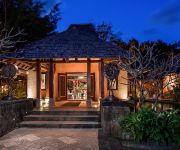
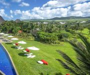
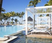
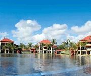
Hotels and Places to Stay
Shanti Maurice Resort & Spa
Sofitel So Mauritius
Heritage Le Telfair Golf & Spa Resort
Outrigger Mauritius Resort & Spa
The St. Regis Mauritius Resort
Tamassa Resort - All Inclusive
Tamassa produced by LUX*
Ambre Mauritius - All Inclusive - Adults Only
Heritage The Villas
Heritage Awali Golf & Spa Resort
Videos from this area
These are videos related to the place based on their proximity to this place.
Quad túra a mauritiusi Frederica Nemzeti Rezervátumban - DERTOUR Luxury
Quad túra az Indiai-óceánon, Mauritius szigetén. Kapcsolódó beszámolónk: http://www.dertourluxury.hu/uton/indiai-ocean/mauritius_a_dodok_foldje.
Riding the Parakeet Trail
Mountain biking the parakeet trail in mauritius, an island in the indian ocean.
EPIC MOMENT with a Monkey and its little cute baby
like and share for jesus 'sake please help to get 10k subscribers plzzzzzz follow me on twitter here a ...
île maurice cascade chamarel
île maurice cascade chamarel Photos et vidéos sur : http://www.alexandre-hamon.com/#/mes-albums/!/folder/2440952/
Mauritius - Nationalpark Black River Gorges
http://www.freudenthal.biz/mauritius/ - Wanderung am Black River durch den Wald von Macchabee, Eindrücke vom Nationalpark mit dem Alexandra-Wasserfall auf Mauritius. Über den Link kommt Ihr...
National park Black River Gorges, Mauritius
National park Black River Gorges, Mauritius http://miph.ru/2013/03/13/national-park-black-river-gorges-mauritius/
Le piton de la Riviere Noire à l'Ile Maurice
La randonnée pour aller au sommet : http://www.ile-maurice.tv/Le-Piton-de-la-Riviere-Noire_a50.html Toute l'Ile Maurice sur http://www.ile-maurice.tv.
Le point du vue des Gorges (Gorges Viewpoint)
Faites une halte au Gorges Viewpoint : http://www.ile-maurice.tv/Gorges-Viewpoint-Le-point-de-vue-des-gorges_a52.html dans le parc national des Gorges de la Rivière Noire, le panorama en...
354 Mauritius Botanical walk, Le Petrin to valley River Noir
These amateur shots were taken as an annex of a botanical photography in January, 2005. Down on foot from Le Petrin, 700-800 meters altitude. Photo and video list (fragment): 1: Highland-shrub...
Ile Maurice - Le Plateau Central-2 - Cascades et terre des sept couleurs
Tourisme sur l'Ile Maurice - Plateau central - Cascades de Chamarel - Terre des sept couleurs.
Videos provided by Youtube are under the copyright of their owners.
Attractions and noteworthy things
Distances are based on the centre of the city/town and sightseeing location. This list contains brief abstracts about monuments, holiday activities, national parcs, museums, organisations and more from the area as well as interesting facts about the region itself. Where available, you'll find the corresponding homepage. Otherwise the related wikipedia article.
Savanne District
Savanne is a district of Mauritius, situated in the south of the island. The district has an area of 244.8 km2 and the population estimate was at 70,471 as at 31 December 2010. The southern part of the island is one of the most scenic and unspoilt.
Ganga Talao
Ganga Talao or Grand Bassin is a crater lake situated in a secluded mountain area in the district of Savanne, deep in the heart of Mauritius. It is about 1800 feet above sea level. It was discovered by inhabitants of the town of Triolet and not Terre-Rouge as recent intentionally wrong informations tend to support. It is considered the most sacred Hindu place in Mauritius There is a temple dedicated to Lord Shiva and other Gods including Hanuman, Lakshmi, and others along the Grand Bassin.
Montagne Cocotte
Montagne Cocotte is a 771 metre tall mountain peak in Mauritius. It is located in the far south of the island nation, in the Savanne District and in the Black River Gorges National Park.


