Safety Score: 4,0 of 5.0 based on data from 9 authorites. Meaning please reconsider your need to travel to Martinique.
Travel warnings are updated daily. Source: Travel Warning Martinique. Last Update: 2024-08-13 08:21:03
Discover Camp de Balata-Tourtet
Camp de Balata-Tourtet in Martinique (Martinique) is a city in Martinique a little north of Fort-de-France, the country's capital city.
Local time in Camp de Balata-Tourtet is now 06:36 PM (Sunday). The local timezone is named America / Martinique with an UTC offset of -4 hours. We know of 8 airports in the vicinity of Camp de Balata-Tourtet. The closest airport in Martinique is Martinique Aimé Césaire International Airport in a distance of 8 mi (or 12 km), South-East. Besides the airports, there are other travel options available (check left side).
There are two Unesco world heritage sites nearby. The closest heritage site is Morne Trois Pitons National Park in Dominica at a distance of 48 mi (or 78 km). Also, if you like golfing, there is an option about 10 mi (or 16 km). away. We discovered 1 points of interest in the vicinity of this place. Looking for a place to stay? we compiled a list of available hotels close to the map centre further down the page.
When in this area, you might want to pay a visit to some of the following locations: Schoelcher, Fort-de-France, Gros Islet, Berekua and Soufriere. To further explore this place, just scroll down and browse the available info.
Local weather forecast
Todays Local Weather Conditions & Forecast: 27°C / 80 °F
| Morning Temperature | 24°C / 76 °F |
| Evening Temperature | 26°C / 78 °F |
| Night Temperature | 24°C / 75 °F |
| Chance of rainfall | 5% |
| Air Humidity | 71% |
| Air Pressure | 1012 hPa |
| Wind Speed | Light breeze with 3 km/h (2 mph) from North-West |
| Cloud Conditions | Overcast clouds, covering 94% of sky |
| General Conditions | Light rain |
Sunday, 17th of November 2024
27°C (81 °F)
24°C (75 °F)
Moderate rain, light breeze, broken clouds.
Monday, 18th of November 2024
27°C (80 °F)
24°C (75 °F)
Light rain, gentle breeze, overcast clouds.
Tuesday, 19th of November 2024
26°C (79 °F)
24°C (75 °F)
Moderate rain, light breeze, scattered clouds.
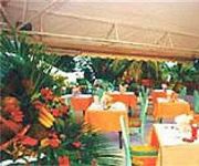
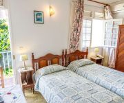
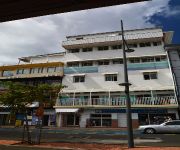
Hotels and Places to Stay
Simon Hotel
Le Marouba
SQUASH-KARIBEA HOTELS
Hotel L'Imperatrice
VALMENIERE-KARIBEA HOTELS
Centre International de Sejour Martinique Centre International de Séjour Martinque
Les chambres d'hotes de la Villa Cayol
Résidence Plocus
Fort Savane
Bayfront Hotel
Videos from this area
These are videos related to the place based on their proximity to this place.
Martinique Maison de Balata Location Fort de France.wmv
http://www.locations-vue-turquoise.com/index.php?p=maison_de_balata Location Martinique Maison de Balata Fort de France, 3 chambres, Piscine voir aussi http://www.vue-turquoise.com.
[Martinique] Ligne de bus 102 MOZAIK : Fort-de-France à Schoelcher
Roadmovie depuis la ligne 102 en Martinique du réseau MOZAIK, de nuit en Janvier 2012. La vidéo commence à Fort-de-France, pour s'arrêter à Schoelcher, entre le Campus et le complexe cinéma...
[Martinique] Roadmovie ligne 100 Mozaïk : Schoelcher - Fort-de-France
Roadmovie pris en Janvier 2012 depuis la ligne 100 du réseau Mozaïk en Martinique, entre les villes de Schoelcher et Fort-de-France. Vidéo prise depuis un Agora S Euro 3.
Plongee sur le pont du Nahoon-martinique
video de notre plongée sur l'epave du Nahoon. Cette fois ci, nous sommes sur le pont de l'epave, coulee en 1994.
Troubadours Chanté Noël 2012 Schoelcher Martinique Part 4
Troubadours Chanté Noël 2012 Schoelcher Martinique petites recette de noel bakwa nwel 2012 au marigot décembre 2012 de 22h à 5h00 boissons cochon roussi -riz Champagne et puis rhum pour...
RAID 113 DIDIER 1ère partie ville de Schoelcher
Salut amis raideurs, le raid 113 du 12 janvier 2014 à Schoelcher restera dans les mémoires; en effet rivières et boues étaient au rendez-vous; ce fut un bon début pour beaucoup d'entre...
Journée d'orientation active à Schoelcher
Ils étaient près de 5000 lycéens martiniquais à franchir le site du campus de Schoelcher, la plupart pour la première fois de leur vie. Lors de cette journée d'information et d'orientation...
Videos provided by Youtube are under the copyright of their owners.
Attractions and noteworthy things
Distances are based on the centre of the city/town and sightseeing location. This list contains brief abstracts about monuments, holiday activities, national parcs, museums, organisations and more from the area as well as interesting facts about the region itself. Where available, you'll find the corresponding homepage. Otherwise the related wikipedia article.
Carbet Mountains
The Carbet Mountains (French: Pitons Du Carbet, or Carbet Nails) are a massif of volcanic origin on the Caribbean island of Martinique. The Carbet Mountains occupy an 80 km long path through the centre of the island, and include some of its highest peaks, though Martinique's highest point Mount Pelée is not part of the range. The mountains are a popular tourist site and hiking and climbing destination.
Fond-Zombi
Fond-Zombi (or Quartier Fond Zombi) is a populated place in the arrondissement of Fort-de-France on Martinique.


!['[Martinique] Ligne de bus 102 MOZAIK : Fort-de-France à Schoelcher' preview picture of video '[Martinique] Ligne de bus 102 MOZAIK : Fort-de-France à Schoelcher'](https://img.youtube.com/vi/pVUbncj_HHE/mqdefault.jpg)
!['[Martinique] Roadmovie ligne 100 Mozaïk : Schoelcher - Fort-de-France' preview picture of video '[Martinique] Roadmovie ligne 100 Mozaïk : Schoelcher - Fort-de-France'](https://img.youtube.com/vi/jHYLSAQ8h14/mqdefault.jpg)


