Safety Score: 3,0 of 5.0 based on data from 9 authorites. Meaning we advice caution when travelling to Malta.
Travel warnings are updated daily. Source: Travel Warning Malta. Last Update: 2024-08-13 08:21:03
Delve into Ħal-Lew
The district Ħal-Lew of Żurrieq in Iż-Żurrieq is a district located in Malta a little south-west of Valletta, the country's capital town.
In need of a room? We compiled a list of available hotels close to the map centre further down the page.
Since you are here already, you might want to pay a visit to some of the following locations: Qrendi, Safi, Mqabba, Kirkop and Luqa. To further explore this place, just scroll down and browse the available info.
Local weather forecast
Todays Local Weather Conditions & Forecast: 20°C / 68 °F
| Morning Temperature | 20°C / 68 °F |
| Evening Temperature | 20°C / 68 °F |
| Night Temperature | 20°C / 68 °F |
| Chance of rainfall | 0% |
| Air Humidity | 64% |
| Air Pressure | 1014 hPa |
| Wind Speed | Strong breeze with 19 km/h (12 mph) from South-East |
| Cloud Conditions | Overcast clouds, covering 99% of sky |
| General Conditions | Overcast clouds |
Friday, 22nd of November 2024
21°C (71 °F)
20°C (68 °F)
Light rain, strong breeze, clear sky.
Saturday, 23rd of November 2024
18°C (64 °F)
17°C (62 °F)
Light rain, strong breeze, clear sky.
Sunday, 24th of November 2024
16°C (61 °F)
16°C (61 °F)
Broken clouds, fresh breeze.
Hotels and Places to Stay
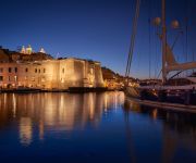
IBB Cugo Gran Macina Grand Harbour
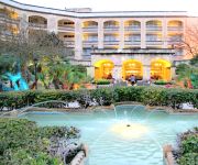
Corinthia Palace Hotel
Phoenicia Malta
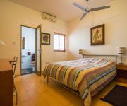
Holiday Apartments Malta Valletta
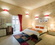
Valletta Merisi Suites
Park Lane
Harbour View Host Family Bed & Breakfast
Julesy's BnB
Osborne
Barrakka Suites
Videos from this area
These are videos related to the place based on their proximity to this place.
Santa Katerina Zurrieq 2012 - Marc taz-Zghazagh
Izzanznet opra gdida ohra fil-kullana ta' armar li jzejjen Misrah ir-Repubblika fil-festa ta' Santa Katerina VM gewwa z-Zurrieq.
Magic In The Sky Mount Carmel Fireworks Zurrieq 2014 ....... part 4
Magic In The Sky Mount Carmel Fireworks Zurrieq 2014....... part 4.
Triple Album | Banda Queen Victoria A.D.1865 , Żurrieq
Il-Banda Queen Victoria, fl-okkażjoni tal-150 sena mit-twaqqif tagħha bħalha l-ewwel banda Żurrieqija, qiegħdha tippublika Triple Album storiku. It-3 Compact Discs jinkludu: 1) sett...
Holiday Villa Rental on Malta, 3 bedrooms Luxury Accommodation Lettings R280
A most exceptional 3 bedroom Designer Bungalow Country Holiday Villa in Malta to rent with 3 bedrooms offering private self catering villa holiday rental accomodation. Fully Equipped Kitchen,...
Ultramacro Underwater Videography at night. Zurrieq, Malta
A short sequence of a baby (approx. two or three days old) long-armed-white-spotted octopus trying to camouflage on the seafloor and a bobtail squid burying itself in the sand, shoveling sand...
Zurrieq - Sirens (U/15s) - Promo
Mission Accomplished. The game ended 5-1 for us! Thank you for watching this video! :)
Videos provided by Youtube are under the copyright of their owners.
Attractions and noteworthy things
Distances are based on the centre of the city/town and sightseeing location. This list contains brief abstracts about monuments, holiday activities, national parcs, museums, organisations and more from the area as well as interesting facts about the region itself. Where available, you'll find the corresponding homepage. Otherwise the related wikipedia article.
Malta
Malta Listen/ˈmɒltə/, officially the Republic of Malta (Maltese: Repubblika ta' Malta), is a Southern European country consisting of an archipelago situated in the centre of the Mediterranean, 80 km south of Sicily, 284 km east of Tunisia and 333 km north of Libya. Gibraltar lies 1,755 km to the west and Alexandria 1,508 km to the east. Malta covers just over 316 km in land area, making it one of the world's smallest states. It is also one of the most densely populated countries worldwide.
Malta (island)
The island of Malta is the largest of the three major islands that constitute the Maltese archipelago. Malta is in the middle of the Mediterranean Sea directly south of Italy and north of Libya. The area is 246 km² (95 square miles). The capital is Valletta, largest city is Qormi and the largest locality is Birkirkara.
Għar Dalam
Għar Dalam (pronounced ar dàlam in Maltese and meaning "Cave of Darkness") is a prehistorical cul de sac located on the outskirts of Birżebbuġa, Malta containing the bone remains of animals that were stranded and subsequently became extinct on Malta at the end of the Ice age. It has lent its name to the Għar Dalam phase in Maltese prehistory.
Medavia
Medavia (Mediterranean Aviation Co. Ltd) is an airline based in Luqa, Malta. It operates ad hoc charters and long term leases mainly in North Africa supporting the oil industry and the provision of VIP charters. Its main bases are Malta International Airport and Tripoli International Airport, Libya. Medavia has around 170 employees (as of 2007).
Battle of Malta
The Battle of Malta took place on 8 July 1283 in the entrance to the Grand Harbour, the principal harbor of Malta, when a galley fleet commanded by Roger of Lauria defeated a fleet of Angevin galleys commanded by William Cornut and Bartholomew Bonvin. Cornut was killed. Charles of Salerno, in the absence of his father, had sent the Provençal fleet to relieve the besieged garrison of Malta, which was trapped in the Castello del Mare (the "Castle of the Sea", now known as Fort St.
Spencer Monument
The Spencer Monument is a restored obelisk monument on the way to Valletta, in Blata l-Bajda, Malta, erected for the Honorable Sir Robert Spencer, captain of HMS Madagascar who died aboard his ship in Malta in 1830. The monument was struck by lightning and suffered considerable damage, however it was recently restored back to its original glory.
Hypogeum of Ħal-Saflieni
The Hypogeum of Paola, Malta, literally meaning "underground" in Greek, is a subterranean structure dating to the Saflieni phase (3000-2500 BC) in Maltese prehistory. Thought to be originally a sanctuary, it became a necropolis in prehistoric times, as proven by the remains of more than 7,000 individuals that have been discovered during the course of the excavation. It is the only prehistoric underground temple in the world.
Ħaġar Qim
Ħaġar Qim (English: Standing/Worshipping Stones) is a megalithic temple complex found on the Mediterranean island of Malta, dating from the Ġgantija phase (3600-3200 BC). The Megalithic Temples of Malta are among the most ancient religious sites on Earth, described by the World Heritage Sites committee as "unique architectural masterpieces. " In 1992 UNESCO recognized Ħaġar Qim and four other Maltese megalithic structures as World Heritage Sites.
RAF Luqa
Royal Air Force Luqa was a flying station and location of RAF Mediterranean Command headquarters of the Royal Air Force on the island of Malta during World War II. Particularly during the Siege of Malta from 1941 to 1943, RAF Luqa was a very important base for British Commonwealth forces fighting against Italy and Germany for naval control of the Mediterranean and for ground control of North Africa.
Mnajdra
Mnajdra is a megalithic temple complex found on the southern coast of the Mediterranean island of Malta. Mnajdra is approximately 500 metres from the Ħaġar Qim megalithic complex. Mnajdra was built around the fourth millennium BCE; the Megalithic Temples of Malta are among the most ancient religious sites on Earth, described by the World Heritage Sites committee as "unique architectural masterpieces.
Fort Benghisa
Fort Benghisa is a fortification on the island of Malta. It stands on high ground on the seaward face of Benghisa point, the southern arm of Marsaxlokk Bay. It is a Polygonal fort and was built by the British. The fort was the last polygonal fort built in Malta, built in 1909. The gatehouse, and the shoreward ditch are in fair repair.
Hibernians Ground
Hibernians Stadium is a multi-use stadium in Paola, Malta. The Hibernians football ground was inaugurated on 9 November 1986. Hibernians became the first Maltese club to have their own football pitch. Nonetheless, Hibernians play most of their league matches in the National Stadium in Ta' Qali, since nearly all the Maltese Premier League matches are played there. The ground is used by Hibernians for their everyday training sessions.
Xarolla Windmill
The Xarolla Windmill at Żurrieq, Malta is one of the windmills constructed by the Knights of Malta in the villages and towns of Malta. In 1674 Grand Master Nicolas Cotoner built five windmills around Malta. One of these was the windmill built in Nigret, Zurrieq, known as Tal-Qaret. In 1724, Grand Master Antonio Manoel de Vilhena built another windmill next to it, known as Ta' Marmara, which was the surname of the first person to work in the same windmill, Luret Marmara.
Royal Malta Yacht Club
The Royal Malta Yacht Club (RMYC) is a yacht club in the island of Malta.
Infetti Ground
Infetti Ground is a football pitch in Birkirkara, a town located in the centre of Malta. The ground has a capacity of 2,500. It is currently used mostly for football matches and athletics training. It is the home stadium of Birkirkara F.C. The name Infetti means infected in Italian. In the past centuries these fields - which had in recent years been developed into a sport complex - served as a grave yard for victims that had died with the plague.
Hamrija Tower
Ħamrija Tower is a fortification that the Knights of Malta built on the island of Malta (recently reconstructed). It is a watchtower, one of 13 such towers that Grand Master Martin de Redin ordered built. The tower was constructed in 1659 as the 12th tower in the series of de Redin towers and the last on Malta's South Western Coast. The nearest tower in the chain is the Wardija Tower to the south-east.
Tarxien Temples
The Tarxien Temples are an archaeological complex in Tarxien, Malta. They date to approximately 3150 BC. The site was accepted as a UNESCO World Heritage Site in 1980 along with the other Megalithic temples on the island of Malta.
Ħal Far
Ħal Far, is one of the main industrial estates in Malta. It is at the southern extreme of Malta, between the localities of Birżebbuġa, Safi and Żurrieq. In the past, Ħal Far housed the RAF Hal Far airfield, which was known as HMS Falcon when in the service of the Royal Navy. The runway can still be seen and driven on, leading the Maltese to use for drag car racing. Parts of the airfield including the hangar have been converted into a refugee camp for illegal immigrants.
St Philip's Hospital
St Philip's Hospital is a 100-bedded capacity hospital located in Santa Venera.
Bubaqra
Bubaqra is a small, rural area in Zurrieq, in the south-east of Malta. It is situated between the zones of Nigret and Hal-Far. Has a population of 2,000 people. Even though it is one of the oldest areas in this village, many new buildings are being constructed and this area is searched most by newly-weds who come to live in this quiet, airy area. At the centre of this zone, a small church is situated, dedicated to our Holy Mary.
RAF Hal Far
The RAF Hal Far airfield was the first permanent airfield to be built on Malta. It was opened on 1 April 1929 as HMS Falcon, a Royal Navy base, and was used by Royal Navy air crews. It was transferred to the Maltese Government and redeveloped as from January 1979. It is now closed and one of its runways is used by drag racing enthusiasts. The second runway is now a road leading to an industrial estate which was developed recently.
Um El Faroud
The Um El Faroud was a 10,000 ton Libyan owned single screw motor tanker. Following a gas explosion during maintenance work in 1995, she was scuttled off the coast of Malta as an artificial reef and diving attraction.
Wardija Tower
The Wardija Tower is one of thirteen towers that Grand Master Martin de Redin of the Knights of Malta had built along the coasts of Malta. The tower is between Zurrieq and Hal Far; the nearest tower to it is the Hamrija Tower to the south-east. The Wardija Tower was constructed and finished by June 1659 and was the last tower built. It is smaller than the other de Redin towers although it was armed with 2 cannon and 2 mortars. The tower's actual name was Torre della Guardia di Giorno.
Blue Grotto (Malta)
The Blue Grotto is actually a number of sea caverns on the southern coast of Malta, west of the Wied iz-Żurrieq harbor near the village of Żurrieq. It is located right across the small uninhabited islet of Filfla. Every day from sunrise until about 1 pm a unique sight can be observed here. The location of the cave combined with the sunlight lead to the water mirroring showing numerous shades of blue.
Playmobil Park
Playmobil Park is the world's second largest Playmobil factory, located in Ħal Far in the extreme south of Malta. Although smaller than the Playmobil FunPark headquarters in Zirndorf, some 2 million Playmobils a week are made at the factory which also offers a 45-minute tour of the factory and facilities for children.


