Safety Score: 3,0 of 5.0 based on data from 9 authorites. Meaning we advice caution when travelling to Malta.
Travel warnings are updated daily. Source: Travel Warning Malta. Last Update: 2024-08-13 08:21:03
Explore Tal’ Uai
The district Tal’ Uai of Naxxar in In-Naxxar is located in Malta a little west of Valletta, the country's capital.
If you need a place to sleep, we compiled a list of available hotels close to the map centre further down the page.
Depending on your travel schedule, you might want to pay a visit to some of the following locations: Mosta, Hal Gharghur, Lija, L-Iklin and Balzan. To further explore this place, just scroll down and browse the available info.
Local weather forecast
Todays Local Weather Conditions & Forecast: 18°C / 65 °F
| Morning Temperature | 18°C / 65 °F |
| Evening Temperature | 18°C / 64 °F |
| Night Temperature | 18°C / 65 °F |
| Chance of rainfall | 4% |
| Air Humidity | 63% |
| Air Pressure | 1017 hPa |
| Wind Speed | Fresh Breeze with 17 km/h (11 mph) from South-East |
| Cloud Conditions | Clear sky, covering 7% of sky |
| General Conditions | Moderate rain |
Thursday, 5th of December 2024
16°C (62 °F)
17°C (62 °F)
Moderate rain, fresh breeze, overcast clouds.
Friday, 6th of December 2024
18°C (64 °F)
18°C (64 °F)
Light rain, high wind, near gale, overcast clouds.
Saturday, 7th of December 2024
17°C (62 °F)
19°C (65 °F)
Light rain, fresh breeze, few clouds.
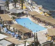
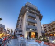
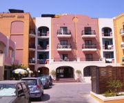
Hotels and Places to Stay
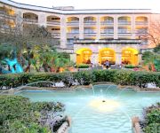
Corinthia Palace Hotel
Seashells Resort at Suncrest
Salini Resort
Canifor Hotel
Palazzin Hotel Malta
Sunny Coast Resort & Spa
db San Antonio Hotel & Spa - All Inclusive
Dolmen Resort Hotel & Spa
Hotel Primera
Sunseeker Holiday Complex
Videos from this area
These are videos related to the place based on their proximity to this place.
Glassblowing at Mdina Glass, Malta - Part One
Viewing a live demonstration of glassblowing making coloured glass wine glasses at Mdina Glass near Mosta in Malta.
Glassblowing at Mdina Glass, Malta - Part Two
Viewing a live demonstration of glassblowing making coloured glass wine glasses at Mdina Glass near Mosta in Malta.
Ghaqda tan-Nar Marija Bambina Naxxar
Part of the mechanised ground fireworks display held on the 07/09/2014 by the Ghaqda tan-Nar Marija Bambina Naxxar, on the eve of the feast in honour of The Maria Bambina which is celebrated...
Naxxar Lions 1st Div Champions
Footage from the Championship decider on Sat 4th May 2013. Naxxar Lions vs. Vittoriasa Stars which game Naxxar won 2-1 and thus apart from getting promoted to the Premier League, Naxxar ...
Good Friday Procession Naxxar, Malta (Part 1)
http://mill-gardjola.blogspot.com/ l-Purcissjoni tal-Gimgha l-Kbira tmur lura hafna snin fit-tradizzjoni. Din il-Purcissjoni jaghmluha rhula tradizzjonali Maltin u Ghawdxin. J'alla dawn...
Festa Naxxar VBC in 3D
Dan huwa video 3D tal-festa 2011 VBC Naxxar. Jekk il-computer jew l-screen tieghek ma jihux 3D izda ghadek nuccali 3D (b' lenti Hamra u ohra Blue) inti tista tara dan il-video 3D ukoll. (Jekk...
Videos provided by Youtube are under the copyright of their owners.
Attractions and noteworthy things
Distances are based on the centre of the city/town and sightseeing location. This list contains brief abstracts about monuments, holiday activities, national parcs, museums, organisations and more from the area as well as interesting facts about the region itself. Where available, you'll find the corresponding homepage. Otherwise the related wikipedia article.
Malta
Malta Listen/ˈmɒltə/, officially the Republic of Malta (Maltese: Repubblika ta' Malta), is a Southern European country consisting of an archipelago situated in the centre of the Mediterranean, 80 km south of Sicily, 284 km east of Tunisia and 333 km north of Libya. Gibraltar lies 1,755 km to the west and Alexandria 1,508 km to the east. Malta covers just over 316 km in land area, making it one of the world's smallest states. It is also one of the most densely populated countries worldwide.
San Anton Palace
San Anton Palace is a palace located in Attard, Malta. It is the official residence of the President of Malta, and is surrounded by both private and public gardens.
Malta (island)
The island of Malta is the largest of the three major islands that constitute the Maltese archipelago. Malta is in the middle of the Mediterranean Sea directly south of Italy and north of Libya. The area is 246 km² (95 square miles). The capital is Valletta, largest city is Qormi and the largest locality is Birkirkara.
Ta' Qali National Stadium
Ta' Qali National Stadium is the national stadium of Malta, and is the home stadium of the Malta national football team. It stages most Maltese Premier League and cup matches, as well as international matches. The stadium seats 17,797 people, and is the largest stadium in Malta.
Rotunda of Mosta
The Church of the Assumption of Our Lady, commonly known as the Rotunda of Mosta or Rotunda of St Marija Assunta (sometimes shortened to as The Mosta Dome) is a Roman Catholic church in Mosta, Malta. It is the third largest unsupported dome in the world. Built in the 19th century on the site of a previous church, it was designed by the Maltese architect Giorgio Grognet de Vassé. Its dome is among the largest in the world, with an internal diameter of 37.2 metres .
University of Malta
The University of Malta (Maltese L-Università ta' Malta) is the highest educational institution in Malta offering undergraduate Bachelor's Degrees, postgraduate Master's Degrees and postgraduate Doctorates. It is a member of the Association of Commonwealth Universities. In post-nominals the university's name is abbreviated as Melit. , a shortened form of Melita (A Latinised form of the Greek Μελίτη).
Battle of Malta
The Battle of Malta took place on 8 July 1283 in the entrance to the Grand Harbour, the principal harbor of Malta, when a galley fleet commanded by Roger of Lauria defeated a fleet of Angevin galleys commanded by William Cornut and Bartholomew Bonvin. Cornut was killed. Charles of Salerno, in the absence of his father, had sent the Provençal fleet to relieve the besieged garrison of Malta, which was trapped in the Castello del Mare (the "Castle of the Sea", now known as Fort St.
San Andrea School
The San Andrea School is a school in Malta. It was founded in 1992 at Sedqa, Independence Avenue, Naxxar by the Parents Foundation of Education (who also founded San Anton School). At the time it was composed of three classes. In 1995, the school was temporarily moved to a block of flats in Din L-Art Ħelwa.
Maltese International Trade Fair Grounds
Maltese International Trade Fair Grounds are located in the heart of Malta in a town called Naxxar. The Trade Fair grounds host countless exhibitions and trade fairs throughout the year that cover a wide variety of subjects from travel to weddings to cars. Maltese International Trade Fair Grounds are known for the international fair which is held every year; an event which most Maltese look forward to and most of the island visits during the two weeks it remains open.
Għallis Tower
Għallis Tower is a small coastal fortification that the Knights of Malta built on the island of Malta. It was originally primarily a watchtower with a garrison consisting of a bombardier and three gunners, who manned a three-pounder iron cannon. Construction took place during 1658 and 1659. The tower formed part of the chain of thirteen de Redin towers constructed during the reign of Grand Master Martin de Redin to allow communication from Gozo to the Knights' base at Grand Harbour.
Qawra Tower
Qawra Tower is a fortification on the island of Malta built by the Knights of Malta in 1637. It is a small fortification, primarily a watchtower. It is also known locally as Fra Ben Tower. To the west it commands the entrance to St. Paul's Bay, to the east Salina Bay along with Għallis Tower. It was built during the reign of Grand Master Giovanni Paolo Lascaris and stands near the tip of Ras il-Qawra (Qawra Point). It is one of five Lascaris towers that he ordered be built.
Flarestar Observatory
Flarestar Observatory is an astronomical observatory owned and operated by International Astronomical Union (IAU). It is located near San Gwann on the island country of Malta, at {{#invoke:Coordinates|coord}}{{#coordinates:35|54|40|N|014|28|15|E| | |name= }}. Its observatory code is 171.
St. Mark's Tower
St. Mark's Tower or Qalet Marku is a fortification on the island of Malta built by the Knights of Malta. It is a small watchtower that stands on Qrejten Point on the north shore of Malta. St. Mark's Tower has sight of Għallis Tower to the west, and Madliena tower to the east. The tower still stands and appears to be in reasonable condition. It was one of the thirteen de Redin towers constructed during the reign of Grand Master Martin de Redin.
Madliena Tower
Madliena Tower is a fortification on the island of Malta built by the Knights of Malta. A watchtower, it stands on high ground above the shore west of Ras L-Irqieqa on the north shore of Malta. Like all other structures dedicated to St. Mary Magdalene it is built on an area of high altitude, in respect to this most important Disciple and Evangelist of Jesus. In fact, the Chaple of Madliena, and the Chaple of Dingli, are on the highest points in Malta, and are still in good condition.
RNH Mtarfa
The Royal Navy Hospital Mtarfa was a British naval hospital in Mtarfa, Malta. It was the main hospital for British Forces in the eastern Mediterranean until the British left the now-independent Malta in 1979. The hospital was commissioned in 1912 as a replacement for the then ageing Valletta Hospital. It was used during World War I to hold injured Australian and New Zealand troops from the failed 1915 landings at Gallipoli.
Madliena
Madliena is a site in Swieqi, Malta, although as from March 2010 the village will have its own administrative council within the Swieqi Local Council. The name is a reference to Mary Magdalene. Traditionally Madliena forms part of Għargħur, however in the 1990s the Central Government decided that it should form part of the new Swieqi locality.
Ta' Qali
Ta' Qali is a village in Malta, a wide open space in the middle of Malta containing the national stadium, Ta' Qali National Park and a national vegetable market which is locally known as the Pitkalija. Shortly before World War II, the area was used to build a military aerodrome and a station for the Royal Air Force (RAF), called RAF "Ta Kali". RAF Ta Kali was operational throughout the war and continued to be used as an RAF airfield until the mid-1950s. Latterly, U.K.
Ta' Ġiorni
Ta' Giorni is one of the subdivisions (informal districts) of St. Julian's, one of the towns in Malta.
Infetti Ground
Infetti Ground is a football pitch in Birkirkara, a town located in the centre of Malta. The ground has a capacity of 2,500. It is currently used mostly for football matches and athletics training. It is the home stadium of Birkirkara F.C. The name Infetti means infected in Italian. In the past centuries these fields - which had in recent years been developed into a sport complex - served as a grave yard for victims that had died with the plague.
Victoria Lines, Malta
The Victoria Lines are a line of fortifications flanked by defensive towers, that spans 12 kilometres along the width of Malta, dividing the north of the island from the more heavily populated south.
Mater Dei Hospital
Mater Dei Hospital is an acute general teaching hospital offering hospital services and specialist services. It is a public hospital located in Msida, Malta.
Burmarrad
Burmarrad is a village in Malta. The main tourist attraction is the San Pawl Milqi zone, where there is a chapel dedicated to St. Paul, built on the remains of a Roman villa thought to be that of St. Publius.
St. Paul's Bay Tower
Not to be confused with the St Pauls Tower, a 101m-tall skyscraper in Sheffield, UK. 50x40pxThis article does not cite any references or sources. Please help improve this article by adding citations to reliable sources. Unsourced material may be challenged and removed. {{#invoke:Coordinates|coord}}{{#coordinates:35|56|58|N|14|24|10|E|type:landmark_region:MT |primary |name= }} St. Paul's Bay Tower is a fortification on the island of Malta, constructed in 1610 overlooking St Paul's Bay.
St. Paul's Cathedral, Mdina
St. Paul's Cathedral is a Roman Catholic cathedral in the city of Mdina, in Malta. It is built on the site where governor Publius was reported to have met Saint Paul following his shipwreck off the Maltese coast.
St Philip's Hospital
St Philip's Hospital is a 100-bedded capacity hospital located in Santa Venera.


