Touring Born
Born in Canton d'Echternach with it's 336 residents is a town located in Luxembourg about 20 mi (or 32 km) north-east of Luxembourg, the country's capital place.
Time in Born is now 11:08 AM (Monday). The local timezone is named Europe / Luxembourg with an UTC offset of one hour. We know of 11 airports nearby Born, of which 4 are larger airports. The closest is airport we know is Bitburg Airport in Germany in a distance of 13 mi (or 22 km). The closest airport in Luxembourg is Luxembourg-Findel International Airport in a distance of 16 mi (or 22 km), North. Besides the airports, there are other travel options available (check left side).
There are several Unesco world heritage sites nearby. The closest heritage site is Roman Monuments, Cathedral of St Peter and Church of Our Lady in Trier in Germany at a distance of 5 mi (or 9 km). The closest in Luxembourg is City of Luxembourg: its Old Quarters and Fortifications in a distance of 20 mi (or 9 km), East. Need some hints on where to stay? We compiled a list of available hotels close to the map centre further down the page.
Being here already, you might want to pay a visit to some of the following locations: Langsur, Rosport, Oberbillig, Trierweiler and Mompach. To further explore this place, just scroll down and browse the available info.
Local weather forecast
Todays Local Weather Conditions & Forecast: 15°C / 58 °F
| Morning Temperature | 13°C / 55 °F |
| Evening Temperature | 11°C / 51 °F |
| Night Temperature | 9°C / 48 °F |
| Chance of rainfall | 8% |
| Air Humidity | 69% |
| Air Pressure | 1008 hPa |
| Wind Speed | Fresh Breeze with 16 km/h (10 mph) from North |
| Cloud Conditions | Overcast clouds, covering 100% of sky |
| General Conditions | Moderate rain |
Tuesday, 26th of November 2024
8°C (47 °F)
5°C (41 °F)
Light rain, gentle breeze, clear sky.
Wednesday, 27th of November 2024
9°C (49 °F)
5°C (42 °F)
Light rain, fresh breeze, overcast clouds.
Thursday, 28th of November 2024
6°C (43 °F)
3°C (37 °F)
Overcast clouds, light breeze.
Hotels and Places to Stay
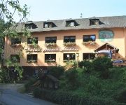
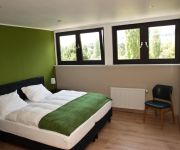
Albachmühle Waldhotel Landgasthof
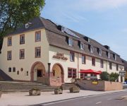
Ralinger Hof Landgasthof
Igeler Säule
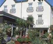
Ambiente
Mühlenthalers Park Hotel
Weingut König Johann Gästezimmer
Kugel
Johannishof Wein-Café & Gästehaus
Videos from this area
These are videos related to the place based on their proximity to this place.
Kurze Luxemburg Tour 2/6 Von Konz zur Fähre nach Oberbillig
GoogleMap: http://goo.gl/maps/BicV6 Fähre »Santa Maria« Oberbillig - Wasserbillig http://www.saar-obermosel.de/radfahren/radfaehre.html Wiki: Oberbillig http://de.wikipedia.org/wiki/Oberbillig...
2015 - Die Cavalcade zu Wasserbillig
Mertert-Wasserbillig (Luxemburg). Auch im Jahre 2015 fand wieder eine Cavalcade in Wasserbillig, einem Ortsteil von Mertert, statt, zum zwölften Mal in der Neuzeit. Die Cavalcade markiert...
Sankta Maria
Die Fähre "Sankta Maria" verkehrt tàglich entsprechend eines Sommer- oder Winterfahrplanes zwischen dem deutschen Ort Oberbillig und der luxemburgischen Stadt Wasserbillig. Die "eiserne Lady"...
Neuwied Luxemburg
Fahrt von Neuwied nach Wasserbillig (Luxemburg) Möchte darauf hinweisen, das ich bei diesem Film, ein anderen Ton als das Orginal verwende! Bin nicht alleine gefahren, und Gespräche gehören...
DeuLux 2012 - Impressionen
Wir bedanken uns beim 1.666 LäuferInnen im Ziel, davon 1.397 im Bitburger 10 km-Hauptlauf. Super, dass ihr uns auch im Regen die Treue gehalten habt! Mehr auf www.deulux-lauf.de.
Unser Langsur - Diashow des CVL
Wir zeigen hier eine Auswahl von Fotos, die in den Jahren 2009 bis 2011 ausschließlich in Langsur, an der Holzbrücke in Langsur-Metzdorf und am Kletterfelsen in Igel-Liersberg in Zusammenhang...
2014 - Impressionen zum Drachenbootrennen in Wasserbillig
Die Szenen sind aufgenommen mit der Lumix GH3 am 6. Juli 2014 in Wasserbillig am Sauerufer und mit iMovie von Apple verarbeitet. Autor: Michael Reichling ©. Veranstalter und Organisator des...
Videos provided by Youtube are under the copyright of their owners.
Attractions and noteworthy things
Distances are based on the centre of the city/town and sightseeing location. This list contains brief abstracts about monuments, holiday activities, national parcs, museums, organisations and more from the area as well as interesting facts about the region itself. Where available, you'll find the corresponding homepage. Otherwise the related wikipedia article.
Wasserbillig
Wasserbillig is a town in the commune of Mertert, in eastern Luxembourg. As of 2005, Wasserbillig has 2,186 inhabitants, which makes it the largest town in Mertert. It lies at the confluence of the rivers Moselle and Sauer, which form the border with Germany at the town. Wasserbillig is the lowest settlement in Luxembourg, at 132 m above sea level. Wasserbillig is home to a large aquarium with tanks of up to 40,000 litres exhibiting fish from around the world in natural surroundings.
Sauer
The Sauer or Sûre is a river in Belgium, Luxembourg and Germany. A left tributary of the river Moselle, its total length is 173 km. Rising near Vaux-sur-Sûre in the Ardennes in southeastern Belgium, the Sauer flows eastwards and crosses the border with Luxembourg near Martelange. It forms the border between Belgium and Luxembourg for 13 km north of Martelange.
Trier-Land
Trier-Land is a Verbandsgemeinde ("collective municipality") in the Trier-Saarburg district, in Rhineland-Palatinate, Germany. It is situated on the border with Luxembourg, north and west of Trier. The seat of the municipality is in Trier, itself not part of the municipality. The Verbandsgemeinde Trier-Land consists of the following Ortsgemeinden ("local municipalities"): Aach Franzenheim Hockweiler Igel Kordel Langsur Newel Ralingen Trierweiler Welschbillig
Born, Luxembourg
Born is a village on the River Sauer in the commune of Mompach, in eastern Luxembourg. It lies on the N10, 14 km south of Echternach and 8 km north of Wasserbillig. Only 5 minutes drive from the E44 motorway from Luxembourg City to Trier, it is popular with tourists and day-trippers who enjoy walking, cycling or fishing along the grassy banks of the river. As of 2001, Born has a population of 340.
Moersdorf
Moersdorf is a small town in the commune of Mompach, in eastern Luxembourg. As of 2005, the town has a population of 293.
Girst
Girst is a village in the commune of Rosport, in eastern Luxembourg. As of 2005, the village had a population of 109.
Wasserbillig Aquarium
The Wasserbillig Aquarium is located in Wasserbillig, a small town in the south west of Luxembourg on the German border. It consists of 15 tanks ranging in size from 300 to 40,000 litres (to US gal), with fish from all five continents in their natural surroundings. Among the more exotic varieties are angelfish, neon tetra, the colourful Japanese koi and percidae from South America. But there are also species from closer to home, including eel, bream, gudgeon, asp, tench and zander.
Born Castle
Born Castle (French: Château de Born) is located in the centre of the little village of Born some 8 km (5 mi) north of Wasserbillig in south-eastern Luxembourg. It has a history dating from 1286 when the Lords of Born lived there. In particular, they were associated with the families of Hattstein, Faust d'Aschaffenbourg and de Villers. Today's castle was built on the old site in the 18th century and is privately owned.


