Safety Score: 4,2 of 5.0 based on data from 9 authorites. Meaning please reconsider your need to travel to Lebanon.
Travel warnings are updated daily. Source: Travel Warning Lebanon. Last Update: 2024-08-13 08:21:03
Discover Srahmoul
Srahmoul in Mohafazat Mont-Liban is a town in Lebanon a little south of Beirut, the country's capital city.
Current time in Srahmoul is now 01:38 AM (Sunday). The local timezone is named Asia / Beirut with an UTC offset of 2 hours. We know of 10 airports near Srahmoul, of which 5 are larger airports. The closest airport in Lebanon is Beirut Rafic Hariri International Airport in a distance of 4 mi (or 7 km), North-West. Besides the airports, there are other travel options available (check left side).
There are several Unesco world heritage sites nearby. The closest heritage site in Lebanon is Anjar in a distance of 23 mi (or 37 km), East. Looking for a place to stay? we compiled a list of available hotels close to the map centre further down the page.
When in this area, you might want to pay a visit to some of the following locations: Baabda, Aaley, Beit ed Dine, Beirut and Jdaidet el Matn. To further explore this place, just scroll down and browse the available info.
Local weather forecast
Todays Local Weather Conditions & Forecast: 22°C / 71 °F
| Morning Temperature | 20°C / 68 °F |
| Evening Temperature | 22°C / 71 °F |
| Night Temperature | 20°C / 69 °F |
| Chance of rainfall | 0% |
| Air Humidity | 64% |
| Air Pressure | 1017 hPa |
| Wind Speed | Light breeze with 4 km/h (3 mph) from East |
| Cloud Conditions | Clear sky, covering 8% of sky |
| General Conditions | Sky is clear |
Sunday, 17th of November 2024
21°C (70 °F)
21°C (70 °F)
Light rain, moderate breeze, clear sky.
Monday, 18th of November 2024
19°C (66 °F)
20°C (67 °F)
Moderate rain, moderate breeze, clear sky.
Tuesday, 19th of November 2024
20°C (67 °F)
20°C (67 °F)
Light rain, moderate breeze, overcast clouds.
Hotels and Places to Stay
Golden Tulip Lili's Resort & Spa
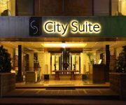
City Suite Aley
Deir al Oumara
Videos from this area
These are videos related to the place based on their proximity to this place.
كيف بدكن يكون المرشح عالانتخابات؟
ساعدونا نلاقي مرشحين ومرشحات بيشبهونا http://www.vote2013.org http://www.facebook.com/vote2013.
Rally Bdadoun Nicolas
Phillip just wake up, he thinks: "Wow, today is my day". He decide to go to his uncle Wassim... And..
Rally Bdadoun Phillip
Phillip just wake up, he thinks: "Wow, today is my day". He decide to go to his uncle Wassim... And..
How to join your village or community on www.baldati.com
Dont' just create an account on www.baldati.com , move on to join as many communities as you like, start by your country , your village , your profession,your NGO, your university.
TVC - Ministry of Tourism
Agency: Impact BBDO, Beirut Brand: Ministry of Tourism Director: Amin Dora DOP: Rachelle Aoun Silver Award, Golden City Gate Awards 2010.
Scared jews يهود جبناء
Scared jews يهود خوافين having the best weapons and still scared from arabs yelling !!!
החינה של דניאל ונריה נתנאל- Jewish Moroccan henna of Danielle & Nerya -7
החינה של דניאל ונריה נתנאל- Jewish Moroccan henna of Danielle & Nerya netanel - "עוגות מרוקאיות" לאירועים : "ללא לערוסה "- "lala la3rosa...
Videos provided by Youtube are under the copyright of their owners.
Attractions and noteworthy things
Distances are based on the centre of the city/town and sightseeing location. This list contains brief abstracts about monuments, holiday activities, national parcs, museums, organisations and more from the area as well as interesting facts about the region itself. Where available, you'll find the corresponding homepage. Otherwise the related wikipedia article.
Aghmeed
Aghmeed, also spelled Aghmide, is a village located about 37km from Beirut, in the governorate of Mount Lebanon, in the Aley District. One can reach Aghmeed through Mdairej Road, Ain Dara and Al Azzounieh. Aghmeed is at an altitude of 1,200 m, close to Mount Barouk, which is famous for its cedar forest. Other villages surrounding Aghmeed are : Al Azzounieh, Ain Dara, Sharoun, Bmuhrein, Alramlieh, Al Mreijat, Nabaa Al Safa and Ain Zhalta.
Kaifun
Kaifun (also transliterated Kafun, Kaifoun) is a medium sized village in the Mount Lebanon Governorate, Aley District, in the Republic of Lebanon. It lies slightly south of the village of Souk El Gharb. It has a stunning view of Beirut and the Mediterranean Sea from the western side and a relaxing view of the mountains on the eastern side. Keifoun is around 700m above sea level and 26 km from central Beirut.
Eastwood College
Eastwood College is a private school in Lebanon. It operates two campuses on the outskirts of Beirut. The first campus, which opened in 1973, is located in Kafarshima, the second in Mansourieh. The schools Motto is "Children, our Purpose and our Future".
Baissour
Baissour is a village in Aley District of Mount Lebanon, 850 metres above sea level, 30 kilometres from Beirut (20 minutes driving) and 7 kilometres from Aley. It shares a border with Aley, Kaifoun, Kabr Shmoon, Majdlaya, and Ainab. Baissour is about 5 minutes from the town of Souq El Gharb which was a frontline during the civil war. Home to many of the Aridi and Maleab families. Baissour has a population of about 12000 citizens and is continually growing and expanding.
Shemlan
Shemlan (also spelled Chemlane, Shimlan) is a village in the Aley District of the Mount Lebanon Governorate in Lebanon, located about 25 km from Beirut.
Aramoun
Aramoun is a village in Aley District in the Mount Lebanon Governorate of Lebanon.
Basateen, Lebanon
Basateen is a village in Aley District in the Mount Lebanon Governorate of Lebanon.
Ain Ksour
Ain Ksour is a village in Aley District, Lebanon. Municipal elections are held every four years. There are two churches in Ain Ksour. One is Saint Peter and Paul's church, which was built around 800 AD, destroyed during the Lebanese civil war, and rebuilt. The other is Saint Elias's church, which is newer, was destroyed during the Lebanese civil war, and is currently being rebuilt. The church plaza has an altitude of 717 m, and is located at 33°44'56.50" N, 35°32'05.00" E.


