Safety Score: 4,2 of 5.0 based on data from 9 authorites. Meaning please reconsider your need to travel to Lebanon.
Travel warnings are updated daily. Source: Travel Warning Lebanon. Last Update: 2024-08-13 08:21:03
Delve into Haï el Knissé
The district Haï el Knissé of Haret Hreïk in Mohafazat Mont-Liban is a subburb in Lebanon a little south of Beirut, the country's capital town.
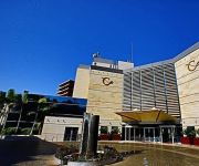
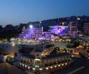
If you need a hotel, we compiled a list of available hotels close to the map centre further down the page.
While being here, you might want to pay a visit to some of the following locations: Beirut, Baabda, Jdaidet el Matn, Aaley and Jounieh. To further explore this place, just scroll down and browse the available info.
Local weather forecast
Todays Local Weather Conditions & Forecast: 19°C / 65 °F
| Morning Temperature | 17°C / 62 °F |
| Evening Temperature | 19°C / 65 °F |
| Night Temperature | 18°C / 64 °F |
| Chance of rainfall | 0% |
| Air Humidity | 39% |
| Air Pressure | 1017 hPa |
| Wind Speed | Light breeze with 4 km/h (3 mph) from North |
| Cloud Conditions | Clear sky, covering 0% of sky |
| General Conditions | Sky is clear |
Wednesday, 4th of December 2024
19°C (67 °F)
18°C (65 °F)
Scattered clouds, moderate breeze.
Thursday, 5th of December 2024
19°C (67 °F)
18°C (65 °F)
Scattered clouds, light breeze.
Friday, 6th of December 2024
20°C (68 °F)
20°C (68 °F)
Sky is clear, light breeze, clear sky.
Hotels and Places to Stay
Golden Tulip Galleria
Coral Beach Hotel and Resort
Kempinski Summerland Hotel & Resort
Regency Palace Hotel
Al Bustan
Assaha Lebanese Traditional Village
Mediterranée
Four Points by Sheraton Le Verdun
Cavalier Hotel
Imperial Suites Hotel
Videos from this area
These are videos related to the place based on their proximity to this place.
Knefet El Karout: A Fine Local Breakfast in Beirut
The Knefeh was in a normal piece of Kaaka and the bun was very well done, thin and not chewy, the perfect holder of the inner sweet filling. The buns were produced that morning and it showed...
Hanna Mitri Ice Cream: Beirut's Finest
I truly doubt that all Lebanese people don't know or have not heard of Hanna Mitri. The one and only Hanna Mitri known for his uniquely fresh ice cream, perfect Maamoul and arrogantly rude...
how to fix windows 7 not genuine free
https://www.google.com.lb/ then you put in the white box download removewat 2.2.5 for windows 7 free after that you go to the second site www.4shared.com/.../WINDOW_7_RemoveWAT2... - ترجم...
Reflections after the war: Martyrs
A short film made at a workshop at the Sadr Foundation in Dahiyeh addressing the effects of the 2006 war.
how to get up to 10000000$ in the sims 1+2+3 100% worcking
download t-search from: http://www.mediafire.com/download/w5n7ay11k6148v8/TSearch.rar.
Landing Beirut
From Paris charles de gaulles to beirut airport. With the new recently delivered A330 of MEA.
412 ARDUINO SENSOR MUSCLE
Muscle Sensor v3 Kit This Sensor takes the electrical signal straight from the muscle and put it into your device. Thanks to shrinking amplifier technology, we can now do exactly that! This...
Videos provided by Youtube are under the copyright of their owners.
Attractions and noteworthy things
Distances are based on the centre of the city/town and sightseeing location. This list contains brief abstracts about monuments, holiday activities, national parcs, museums, organisations and more from the area as well as interesting facts about the region itself. Where available, you'll find the corresponding homepage. Otherwise the related wikipedia article.
Beirut
Beirut is the capital and largest city of Lebanon. As there has been no recent population census, the exact population is unknown; estimates in 2007 ranged from slightly more than 1 million to slightly less than 2 million. Located on a peninsula at the midpoint of Lebanon's Mediterranean coast, it serves as the country's largest and main seaport. The Beirut metropolitan area consists of the city and its suburbs.
1983 Beirut barracks bombing
The Beirut Barracks Bombing occurred during the Lebanese Civil War, when two truck bombs struck separate buildings housing United States and French military forces—members of the Multinational Force in Lebanon—killing 299 American and French servicemen. The organization Islamic Jihad, later known as Hezbollah, claimed responsibility for the bombing. Suicide bombers detonated each of the truck bombs.
Lebanese University
The Lebanese University is the only public institution for higher learning in Lebanon. The university has 17 faculties as of 2006 and serves various cultural, religious, and social groups of students and teachers. The independent university enjoys administrative, academic, and financial freedom. Among its educational goals are creating a unique mix of cultures and providing the basic and necessary education to allow students to enter various professions.
Beirut Arab University
Beirut Arab University (BAU) is a Lebanese private university located in Beirut, Lebanon. It was founded by the Lebanese El-Bir and Ihsan Society in 1960. The university is officially accredited according to article (17) of the Lebanese Higher Education Law issued on 26 December 1961.
Baabda Palace
Baabda Palace is the official residence of the President of Lebanon. Built during the 1960s it is situated on a hill in the mountain town of Baabda overlooking Beirut and the first president to reside here was H.E. President Charles Helou.
Camille Chamoun Sports City Stadium
Camille Chamoun Sports City Stadium is a 47,799 capacity multi-purpose stadium in the Bir Hassan area of Beirut, Lebanon. It is Lebanon's largest stadium. The Sports City Stadium is currently used mostly for football matches and it also has athletics facilities. It was built in 1957 by the Lebanese Ministry of Youth & Fine Arts in the presidency of Camille Chamoun.
Mar Elias refugee camp
Mar Elias is a Palestinian refugee camp in the southwestern part of Beirut, Lebanon. The camp was founded in 1952 by the Mar Elias Greek Orthodox convent and is composed mainly of Christian Palestinians (almost all the rest of the refugee camps contain Muslim Palestinians). It is named after the Christian saint Mar Elias. In 2002 there were 1,406 registered refugees in the camp.
Beirut Municipal Stadium
Beirut Municipal Stadium is a 18,000 capacity multi-purpose stadium in Beirut, Lebanon. It is currently used mostly for football matches and is the home ground of Al Ahed.
Lebanese International University
for the university in Nouakchott see Lebanese International University (Mauritania) for the university in Sana'a see Lebanese International University (Yemen) Lebanese International University 150px {{#invoke:InfoboxImage|InfoboxImage|image=|size=|sizedefault=frameless|alt=}}Motto Towards a better future. Established 2001Type PrivatePresident Abdul Rahim MouradLocation Lebanese flag Beqaa Valley, LebanonCampus UrbanWebsite {{#invoke:URL|url|1=http://www. liu. edu.
Haret Hreik
Haret Hreik is a mixed Shia and Maronite Christian town, in the Dahieh suburbs, south of Beirut, Lebanon. Once an agricultural village, Haret Hreik lost its rural identity due to the wave of refugees from Southern Lebanon who settled in the town and made it another urban neighborhood of Dahieh. Haret Hreik is located northeast of the Rafik Hariri International Airport and north of the towns of Laylake and Bourj Al Brajneh, west of Hadath and south of Chiah.
Chyah
Chiyah (in Arabic الشياح pronounced Ach-Chayyah Syriac: ܫܝܚܐ) is situated in the west region of the Lebanese capital of Beirut. The meaning of its name is vague and many suppositions were found: one saying that it has a Syriac origin (Chyaha) meaning the budding, another one saying that it means the processing of metal (Shewah) another theory is the Arabic origin of the name meaning a kind of tree that is used for silk production (a flourishing industry in this village).
Shatila refugee camp
The Shatila refugee camp (also Chatila refugee camp) is a refugee camp for Palestinian refugees, set up by UNRWA in 1949. The camp is located within the Lebanese capital Beirut. As of December 2003, it housed 12,235 registered refugees. http://www. un. org/unrwa/refugees/lebanon. html It is most widely known as the site of the Sabra and Shatila massacre in September 1982, but also played a significant role in the 1982 Lebanon war and the 1985 to 1987 war of the camps.
Safa Stadium
Safa Stadium is a multi-use stadium in Beirut, Lebanon. It is currently used mostly for football matches and serves as the home for Safa SC Beirut. The stadium has a capacity of 4,000 people.
Collective for Research and Training on Development-Action
The Collective for Research and Training on Development-Action (CRTD. A) is a Lebanon-based non-governmental organization started in July 1999. CRTDA works with partner civil society organizations in Lebanon and across the Arab World primarily in Yemen, Egypt, Syria, Morocco, Tunisia, and Algeria. CRTD.
Hazmiyeh
Hazmiyeh (also Romanized as Hazmiyé, Hazmie, Hasmiyeh, Al Ḩāzimīyah, and El Hâzmîyé) is a town in Mount Lebanon Governorate of Lebanon, and a suburb of Beirut.
Ministry of Social Affairs (Lebanon)
The Ministry of Social Affairs in Lebanon was created in 1993 by Law Number 212 and modified by Law Number 327 and Decree Number 5734. The current Minister of Social Affairs is Wael Abou Faour from the Progressive Socialist Party.
Beirut Air Base
Beirut Air Base is a military base owned by the Lebanese Armed Forces and operated by the Lebanese Air Force. It is located 9 km (5.6 mi) from the city center in the southern suburbs of Beirut, Lebanon. Currently, the Lebanese Air Force occupies part of the west end of the Beirut Rafic Hariri International Airport and has been the base of most of the helicopter force for almost 50 years, which include the Hawker Hunters, Fouga Magisters and other aircraft during certain periods.
Jewish cemetery of Beirut
The Jewish cemetery of Beirut, located close to Sodeco Square, is the only Jewish cemetery in Beirut, capital city of Lebanon. It is also accessible via the Damascus Expressway. Half of the gravestones are broken. It is currently still being used by Lebanese Jews.
Rafik Hariri University Hospital
The Rafik Hariri University Hospital – formerly known as Beirut Governmental University Hospital (BGUH) – is the largest Lebanese public hospital, located on the outskirts of southern Beirut. The hospital's main building has a maximal capacity of 544 hospital beds; it comprises a total of seven floors with three annex buildings a 50 bed hotel and four villas hosting staff dormitories, outpatient clinics and administrative services. The Hospital is affiliated with the Lebanese University.
Lebanese Civil Aviation Authority
The Lebanese Civil Aviation Authority (LCAA) is the civil aviation authority of Lebanon.
American University of Science and Technology
Founded by Hiam Sakr of Ain Ebel, Lebanon, the American University of Science and Technology, in Beirut, Lebanon, an educational institute, was established on 21 March 1994 under the name of AUC (Decree # 4897), as an external degree program with the State University of New York/Empire State College, New York, USA. It later changed its name to American University of Science and Technology.
Antonine University
The Antonine University (UPA) is a Roman Catholic University in Baabda, Lebanon administered by the monks of the Antonine monastery.
Umam Documentation & Research
UMAM Documentation and Research (UMAM D&R) is a nonprofit cultural organization founded in 2004 by Lokman Slim and Monika Borgmann. It is located in Haret Hreik, a town part of the Dahieh Southern suburb of Beirut, Lebanon, that was heavily bombed during the 2006 Lebanon War. UMAM D&R works towards raising awareness of civil violence and war memories in Lebanon.
Timeline of Beirut history
The following is a timeline of the history of Beirut, Lebanon.
Ministry of Education and Higher Education (Lebanon)
The Republic of Lebanon Ministry of Education & Higher Education is a government agency of Lebanon. Its headquarters are in Beirut.


