Safety Score: 4,2 of 5.0 based on data from 9 authorites. Meaning please reconsider your need to travel to Lebanon.
Travel warnings are updated daily. Source: Travel Warning Lebanon. Last Update: 2024-08-13 08:21:03
Discover Haret et Tahta
The district Haret et Tahta of Baïssour in Mohafazat Mont-Liban is a subburb in Lebanon a little south-east of Beirut, the country's capital city.
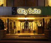
If you need a hotel, we compiled a list of available hotels close to the map centre further down the page.
While being here, you might want to pay a visit to some of the following locations: Aaley, Beit ed Dine, Baabda, Jdaidet el Matn and Beirut. To further explore this place, just scroll down and browse the available info.
Local weather forecast
Todays Local Weather Conditions & Forecast: 15°C / 59 °F
| Morning Temperature | 10°C / 50 °F |
| Evening Temperature | 13°C / 55 °F |
| Night Temperature | 11°C / 52 °F |
| Chance of rainfall | 0% |
| Air Humidity | 54% |
| Air Pressure | 1019 hPa |
| Wind Speed | Gentle Breeze with 7 km/h (4 mph) from East |
| Cloud Conditions | Clear sky, covering 0% of sky |
| General Conditions | Sky is clear |
Friday, 22nd of November 2024
16°C (62 °F)
13°C (56 °F)
Sky is clear, light breeze, clear sky.
Saturday, 23rd of November 2024
18°C (64 °F)
13°C (56 °F)
Sky is clear, light breeze, clear sky.
Sunday, 24th of November 2024
15°C (59 °F)
6°C (43 °F)
Moderate rain, fresh breeze, clear sky.
Hotels and Places to Stay
Golden Tulip Lili's Resort & Spa
City Suite Aley
Deir al Oumara
Videos from this area
These are videos related to the place based on their proximity to this place.
Deir el Qamar Festival 2009
Deir el Qamar Festival 2009, 10th anniversary. For more information http://www.deirelqamarfestival.org.
Rally Bdadoun Nicolas
Phillip just wake up, he thinks: "Wow, today is my day". He decide to go to his uncle Wassim... And..
Daring Zip-Line experience for a first timer.
Daring Zip-Line experience for a first timer. Location: Aley Equi Club Wolves of Lebanon Moutain Adventure Pack!
Videos provided by Youtube are under the copyright of their owners.
Attractions and noteworthy things
Distances are based on the centre of the city/town and sightseeing location. This list contains brief abstracts about monuments, holiday activities, national parcs, museums, organisations and more from the area as well as interesting facts about the region itself. Where available, you'll find the corresponding homepage. Otherwise the related wikipedia article.
Lebanese University
The Lebanese University is the only public institution for higher learning in Lebanon. The university has 17 faculties as of 2006 and serves various cultural, religious, and social groups of students and teachers. The independent university enjoys administrative, academic, and financial freedom. Among its educational goals are creating a unique mix of cultures and providing the basic and necessary education to allow students to enter various professions.
Chouf District
Chouf (also spelled Shouf, Shuf or Chuf, in Arabic جبل الشوف Jebel ash-Shouf) is a historic region of Lebanon, as well as an administrative district in the governorate (mohafazat) of Mount Lebanon. Located south-east of Beirut, the region comprises a narrow coastal strip notable for the Christian town of Damour, and the valleys and mountains of the western slopes of Jabal Barouk, the name of the local Mount Lebanon massif.
Aley
Aley is a picturesque town in Mount Lebanon. It is located 17 km uphill from Beirut, just south of the summer resort of Bhamdoun and north of the strategic town of Souk El Gharb.
Fakhreddine Palace
Fakhreddine II Palace is an 17th century palace in Deir el Qamar in Lebanon. It was built by prince Fakhreddine II in the early 17th century. It houses the Marie Baz Museum, a wax work museum.
Baabda District
Baabda District, sometimes spelled B'abda, is a district (qadaa) in Mount Lebanon, Lebanon, to the south and east of the Lebanon's capital Beirut. The district capital is town of Baabda. The region is also popularly known as Southern Matn, as distinct from Matn District,
Aley District
Aley is a district in Mount Lebanon, Lebanon, to the south-east of the Lebanon's capital Beirut. The capital is Aley. Aley city was previously known as the "bride of the summers" during the 1960 and 70s, when Aley and neighboring Bhamdune were attractive tourist locations for Gulf tourists and Lebanese emigres. During the 1975-1990 Civil War in Lebanon, Aley witnessed several battles around its environs.
Kfarfakoud
Kfarfakoud (Kfarfakud or Kafarfakoud كفرفاقود) is a village in the Chouf district of Lebanon that lies between the valleys of the coastal Lebanese chain of mountains. The name Kfarfakoud (as the names of other villages of Lebanon) has its origins in syriac-aramic language . Historically it is thought that the village was located in the "Khalwat" part of mount Kfarhammil (كفرحمل) and was destroyed totally by an earthquake in the 6th century AD and was rebuilt in its new place.
Aghmeed
Aghmeed, also spelled Aghmide, is a village located about 37km from Beirut, in the governorate of Mount Lebanon, in the Aley District. One can reach Aghmeed through Mdairej Road, Ain Dara and Al Azzounieh. Aghmeed is at an altitude of 1,200 m, close to Mount Barouk, which is famous for its cedar forest. Other villages surrounding Aghmeed are : Al Azzounieh, Ain Dara, Sharoun, Bmuhrein, Alramlieh, Al Mreijat, Nabaa Al Safa and Ain Zhalta.
National Protestant College
The National Protestant College is a Lebanese school that was established by the National Evangelical Union of Lebanon, the oldest indigenous Arabic-speaking Protestant congregation in the Middle East. Originally located in Dbayeh, the building moved during the Lebanese Civil war to West Beirut, near Rue Hamra (Haigazian University). In 1997, NPC moved permanently to Kfarshima. The languages taught at NPC are Arabic, English, and French.
Kfarshima
Kfarshima (also spelled Kfarchima) is a town in the Baabda District of the Mount Lebanon Governorate, southeast of Beirut. Kfarshima is the birthplace of the composer and musician, Philemon Wehbi and the singers Melhem Barakat, and Majida El Roumi. Also the Birthplace of the Philosopher Shibli Shmayyel (Chibli Chemayel). Its was also the hometown for Lebanese singer Issam Rajji.
Kaifun
Kaifun (also transliterated Kafun, Kaifoun) is a medium sized village in the Mount Lebanon Governorate, Aley District, in the Republic of Lebanon. It lies slightly south of the village of Souk El Gharb. It has a stunning view of Beirut and the Mediterranean Sea from the western side and a relaxing view of the mountains on the eastern side. Keifoun is around 700m above sea level and 26 km from central Beirut.
Bsous
Bsous is a village in the Aley District of Mount Lebanon with an estimated population of 6,000. It is located 200 to 730 meters above sea level and 14 kilometres from the capital, Beirut. It is both a summer resort as well as being inhabited during the winter months. This is due to its proximity to Beirut. The name "Bsous" derives from the Syriac.
Beiteddine Palace
Beiteddine Palace is a 19th century palace in Beiteddine, Lebanon. It hosts the annual Beiteddine Festival and the Beiteddine Palace Museum.
Eastwood College
Eastwood College is a private school in Lebanon. It operates two campuses on the outskirts of Beirut. The first campus, which opened in 1973, is located in Kafarshima, the second in Mansourieh. The schools Motto is "Children, our Purpose and our Future".
Deir el Qamar Synagogue
The Deir el Qamar Synagogue, located in Deir el Qamar, a village in south-central Lebanon, is the oldest synagogue in Mount Lebanon. The synagogue was built in the 17th century to serve the local Jewish population, some of whom were part of the immediate entourage of Fakhr-al-Din II. The building is in good condition. It has been shut to the public due to security considerations.
Baissour
Baissour is a village in Aley District of Mount Lebanon, 850 metres above sea level, 30 kilometres from Beirut (20 minutes driving) and 7 kilometres from Aley. It shares a border with Aley, Kaifoun, Kabr Shmoon, Majdlaya, and Ainab. Baissour is about 5 minutes from the town of Souq El Gharb which was a frontline during the civil war. Home to many of the Aridi and Maleab families. Baissour has a population of about 12000 citizens and is continually growing and expanding.
Shemlan
Shemlan (also spelled Chemlane, Shimlan) is a village in the Aley District of the Mount Lebanon Governorate in Lebanon, located about 25 km from Beirut.
Aramoun
Aramoun is a village in Aley District in the Mount Lebanon Governorate of Lebanon.
Basateen, Lebanon
Basateen is a village in Aley District in the Mount Lebanon Governorate of Lebanon.
Qmatiye
Qmatiye is a village in Aley District in the Mount Lebanon Governorate of Lebanon. It lies right beneath the town of Souk El Gharb. It has a small population and is a good tourist attraction in the summer.
Silfaya
Silfaya is a village in Aley District in the Mount Lebanon Governorate of Lebanon.
Ain Traz
The Ain Traz Seminary of the Melkite Greek Catholic Church, located southeast of Beirut, Lebanon, has served various roles during its 200 year history. Given by the El Saad family (originally their residence), it was founded in 1811 by Melkite Patriarch Agapius II Matar, it was first intended as a seminary. After having been looted by the Druze in 1841 and in 1845, it was re-opened in 1870. After the foundation of the Melkite Seminary of St.
Ministry of National Defense (Lebanon)
The Ministry of National Defense is Lebanon's service section for the Lebanese Armed Forces which directs the entire Army. The Ministry is located in Yarzeh, Baabda District, Mount Lebanon. The building which is considered the biggest Ministry building in Lebanon was designed by the French architect André Wogenscky in 1968. The ministry building also houses the Lebanese Military Museum.
Ain Ksour
Ain Ksour is a village in Aley District, Lebanon. Municipal elections are held every four years. There are two churches in Ain Ksour. One is Saint Peter and Paul's church, which was built around 800 AD, destroyed during the Lebanese civil war, and rebuilt. The other is Saint Elias's church, which is newer, was destroyed during the Lebanese civil war, and is currently being rebuilt. The church plaza has an altitude of 717 m, and is located at 33°44'56.50" N, 35°32'05.00" E.
Remhala
Remhala is a village in Aley - Lebanon. Remhala is of syriac etymology meaning a sandy hill. It is situated on a sandy hill, on the shoulder of a valley, surrounded by four mountains. It has a moderate climate and is habitable in winter and summer. Its altitude ranges between 250m above sea level, at Jisr Al-Kadi, to 700m above sea level at Kabreshmoun. Families: Yazbeck – Nassar – Daher – Rizk – Saad – Al Khoury – Raad – Abi Abdallah – Allam – Al Zein.


