Safety Score: 3,0 of 5.0 based on data from 9 authorites. Meaning we advice caution when travelling to Laos.
Travel warnings are updated daily. Source: Travel Warning Laos. Last Update: 2024-08-13 08:21:03
Discover Ban Khoan
Ban Khoan in Khouèng Bokèo is a city in Laos about 3,023 mi (or 4,866 km) east of Jamkhaneh, the country's capital city.
Local time in Ban Khoan is now 11:21 PM (Thursday). The local timezone is named Asia / Bangkok with an UTC offset of 7 hours. We know of 9 airports in the vicinity of Ban Khoan, of which one is a larger airport. The closest is airport we know is Tachileik Airport in Myanmar in a distance of 14 mi (or 22 km). The closest airport in Laos is Ban Huoeisay Airport in a distance of 23 mi (or 22 km), North-West. Besides the airports, there are other travel options available (check left side).
Looking for a place to stay? we compiled a list of available hotels close to the map centre further down the page.
When in this area, you might want to pay a visit to some of the following locations: Chiang Saen, Mae Sai, Doi Luang, Mae Fa Luang and Mae Chan. To further explore this place, just scroll down and browse the available info.
Local weather forecast
Todays Local Weather Conditions & Forecast: 26°C / 79 °F
| Morning Temperature | 17°C / 63 °F |
| Evening Temperature | 20°C / 69 °F |
| Night Temperature | 19°C / 66 °F |
| Chance of rainfall | 1% |
| Air Humidity | 65% |
| Air Pressure | 1014 hPa |
| Wind Speed | Calm with 2 km/h (1 mph) from North-West |
| Cloud Conditions | Clear sky, covering 2% of sky |
| General Conditions | Light rain |
Friday, 22nd of November 2024
27°C (81 °F)
19°C (66 °F)
Light rain, light breeze, clear sky.
Saturday, 23rd of November 2024
27°C (80 °F)
21°C (69 °F)
Light rain, light breeze, clear sky.
Sunday, 24th of November 2024
27°C (81 °F)
19°C (67 °F)
Scattered clouds, light breeze.
Hotels and Places to Stay
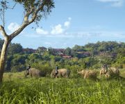
Anantara Golden Triangle Elephant Camp & Resort
Four Seasons Tented Camp
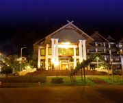
THE IMPERIAL GOLDEN TRIANGLE RESORT
Serene at Chiang Rai
Videos from this area
These are videos related to the place based on their proximity to this place.
A visit to Chiang Saen - Temples and other sights
A visit to the town and several of its temples. January 2012.
Golden Triangle - Thailand, Myanmar & Laos
After our visit to Doi Tung we went to Mae Sai at the Myanmar border, which is Thailand's most northern point. From there we went to the Golden Triangle in Sop Ruak, where we took a boat trip...
En el Vertice del Triangulo de Oro - Tailandia
http://www.youtube.com/user/calicatras La zona denominada Triángulo de Oro de Tailandia está repleta de pequeñas aldeas silenciosas, y rios caudalosos, en una escena salvaje, casi como...
Golden Triangle @ the north of Thailand
The Golden Triangle (สามเหลี่ยมทองคำ Saam Liam Thong Kham) is in Chiang Rai Province, in the far north of Thailand. The English name comes from the meeting of...
Thailand's Golden Triangle
The Golden Triangle is the point where the borders of Thailand, Laos and Burma all meet.
Frontiera terrestre Thailandia - Laos - Myanmar
FRONTIERA TERRESTRE Golden Triangle Ban Sob Ruak - Thailandia Khouan - Laos Questa giornata ha dell'incredibile ! Mi sveglio e con calma ...
ชมพระอาทิตย์ขึ้น ริมแม่น้ำโขง อำเภอเชียงแสน จังหวัดเชียงราย
ชอบบรรยากาศที่นี่จัง ไว้วันหน้าจะมาอีกแน่นอนค่ะ.
Videos provided by Youtube are under the copyright of their owners.
Attractions and noteworthy things
Distances are based on the centre of the city/town and sightseeing location. This list contains brief abstracts about monuments, holiday activities, national parcs, museums, organisations and more from the area as well as interesting facts about the region itself. Where available, you'll find the corresponding homepage. Otherwise the related wikipedia article.
Golden Triangle (Southeast Asia)
The Golden Triangle is one of Asia's two main opium-producing areas. It is an area of around 367,000 square miles that overlaps the mountains of four countries of Southeast Asia: Myanmar, Vietnam, Laos and Thailand. Along with Afghanistan in the Golden Crescent, it has been one of the most extensive opium-producing areas of Asia and of the world since the 1920s.
Ruak River
The Ruak River is a river at the Thai-Burma border. It originates within the hills of the Daen Lao Range, Shan State, and becomes the boundary river between Thailand and Burma at the confluence with the Mae Sai River at the northernmost point of Thailand. It then meanders to the east until it empties into the Mekong River at Ban Sop Ruak, Tambon Wiang, Chiang Saen district, Chiang Rai Province. The boundary section of the river is 26.75 km long.


