Safety Score: 3,1 of 5.0 based on data from 9 authorites. Meaning please reconsider your need to travel to Kenya.
Travel warnings are updated daily. Source: Travel Warning Kenya. Last Update: 2024-08-13 08:21:03
Discover Tayari
The district Tayari of in Mombasa is a district in Kenya about 275 mi south-east of Nairobi, the country's capital city.
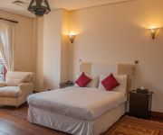
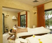
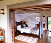
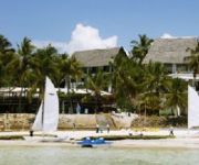
Looking for a place to stay? we compiled a list of available hotels close to the map centre further down the page.
When in this area, you might want to pay a visit to some of the following locations: Mombasa, Kwale, Kilifi, Wete and Tanga. To further explore this place, just scroll down and browse the available info.
Local weather forecast
Todays Local Weather Conditions & Forecast: 31°C / 88 °F
| Morning Temperature | 24°C / 76 °F |
| Evening Temperature | 29°C / 84 °F |
| Night Temperature | 26°C / 79 °F |
| Chance of rainfall | 0% |
| Air Humidity | 60% |
| Air Pressure | 1010 hPa |
| Wind Speed | Moderate breeze with 10 km/h (6 mph) from North-West |
| Cloud Conditions | Broken clouds, covering 61% of sky |
| General Conditions | Light rain |
Monday, 18th of November 2024
31°C (87 °F)
26°C (79 °F)
Light rain, moderate breeze, broken clouds.
Tuesday, 19th of November 2024
31°C (88 °F)
26°C (79 °F)
Light rain, gentle breeze, broken clouds.
Wednesday, 20th of November 2024
30°C (85 °F)
27°C (80 °F)
Light rain, gentle breeze, scattered clouds.
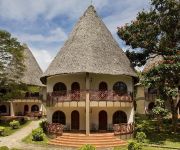
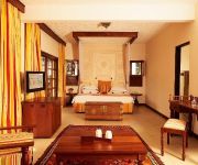
Hotels and Places to Stay
Sun Africa Beach Resort
Diani Reef Grand
NEPTUNE BEACH RESORT
NEPTUNE PALM BEACH RESORT
Voyager Beach Resort Mombasa
Nyali Sun Africa Beach Hotel & Spa
SENTIDO PARADISE
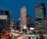
Aloft Seoul Myeongdong
NEPTUNE PARADISE BEACH RES SPA
NEPTUNE VILLAGE RES AND SPA
Videos from this area
These are videos related to the place based on their proximity to this place.
Short touristical visit of Mombasa (Kenya)
(EN) Mombasa is the second-largest city in Kenya. Lying next to the Indian Ocean, it has a major port and an international airport. The city also serves as the centre of the coastal tourism...
Swahili Foods - Mombasa Raha!
Vyakula vya Uswahilini:- Bokoboko, Mabuyu, Achari, Kashata, Tambi, Ndimu, Mapapayu, Samaki, Siki, Masala, Mpunga, Kachumbari, Mchicha, na Mala; Kuruka Blada mtaa wa Mzungu Mchafu; "Hapo ...
Mombasa City Tour - Mombasa Stadtrundfahrt
Come and join us on a excellent tour. Komm und begleite uns zur hervorragenden Rundfahrt.
Mombasa Women's Swimming - Mombasa Raha!
Mapembeni, Rainbow, D.T. Dobie, Ganjoni, Makaburi ya Mbaraki, Star of the Sea, Birika La Wanawake wa Mombasa, Muhogo wa Dhaahir, Mvua ya Mla Leo; Mombasa Old Town; Mombasa Raha!
Kenya 2 - Mombasa Gymkana Cricket Match.flv
The Cokenach Cricket Tour travels on the "Lunatic Express" overnight from Nairobi to Mombasa on the old East Africa Railway. Playing at the Mombasa Gymkana Club in the first of two games in...
Mombasa, Diani Beach... attack of the jellyfish Heatherlindsay's photos around Mombasa, Kenya
Preview of Heatherlindsay's blog at TravelPod. Read the full blog here: http://www.travelpod.com/travel-blog-entries/heatherlindsay/1/1235216340/tpod.html This blog preview was made by TravelPod...
Mamba Village Mombasa (wir Besuchen die Krokodilfarm mit African Bush and Beach Adventures Ltd.)
http://www.kenya-wildlife-safaris.de ; Willkommen bei African Bush & Beach Adventures ! African Bush & Beach Adventures ist in Diani Beach/Kenya zu Hause und Spezialist für Touren und Abenteuer...
Kilifi in Mombasa Old Town - Mombasa Raha!
Mtaa wa Kilifi, Mombasa - Mombasa Raha! "Asiyekujua hakuthamini."
Videos provided by Youtube are under the copyright of their owners.
Attractions and noteworthy things
Distances are based on the centre of the city/town and sightseeing location. This list contains brief abstracts about monuments, holiday activities, national parcs, museums, organisations and more from the area as well as interesting facts about the region itself. Where available, you'll find the corresponding homepage. Otherwise the related wikipedia article.
2002 Mombasa attacks
The 2002 Mombasa attacks refer to terrorist attacks on an Israeli-owned hotel and a plane belonging to an Israeli airline in Mombasa, Kenya on 28 November 2002. An all-terrain vehicle crashed through a barrier outside the Paradise Hotel and blew up, killing 13 and injuring 80. At the same time two surface-to-air missiles fired at an Israeli charter plane. Paradise Hotel was the only Israeli-owned hotel in the Mombasa area.
Fort Jesus
Fort Jesus (Forte Jesus de Mombaça) is a Portuguese fort built in 1591 by order of King Philip I of Portugal (King Philip II of Spain), then ruler of the joint Portuguese and Spanish Kingdoms, located on Mombasa Island to guard the Old Port of Mombasa, Kenya. It was built in the shape of a man (viewed from the air), and was given the name of Jesus.
Mombasa Island
Mombasa Island is a 5 km by 3 km coral outcrop located on Kenya's coast on the Indian Ocean, which is connected to the mainland by a causeway. The city of Mombasa is located on the island. The old town of Mombasa is located at the eastern, seaward end of the island. Kilindini and Port Reitz, the modern deep water harbour and port separates the island from the Kenyan mainland to the south.
Mombasa Marine National Park and Reserve
Mombasa Marine National Park and Reserve is a marine park and national reserve in Mombasa, Kenya. The park is 10 km² (2,500 acres) while the reserve is 200 km² (49,400 acres). It is located on the coast near tourist areas and is a popular beach and snorkeling and diving location. It is the most heavily visited of Kenya's marine parks. It has coral reefs in its waters.
Ngomongo Villages
Ngomongo Villages is a well-known sustainable eco-cultural tourist village located in Mombasa, Kenya. Once a sun baked, arid, barren and rocky base of a former limestone mine, the floor of this quarry was barely five feet above the slightly salty water table. Dr. Frederick Gikandi, a local medical doctor started single handedly to reclaim this quarry by planting 4 acres of eighty different indigenous trees; later followed the easier to grow casuarina trees.
Jumba la Mtwana
Jumba la Mtwana is a former slave port on the Indian Ocean coast of Kenya, lying on the Mtwapa Creek, north of Mombasa. Mostly dating from the fifteenth century, its features include the Mosque by the Sea.
Mombasa Municipal Stadium
Municipal Stadium is a multi-purpose stadium in Mombasa, Kenya. It used mostly for football matches and holds 10,000 people.
Moi International Airport
Moi International Airport, also called Mombasa Airport, is airport located in Mombasa, Coast Province, in a township called Port Reitz, in southeastern Kenya, along the Indian Ocean coast. Its location lies approximately 425 kilometres, by air, southeast of Jomo Kenyatta International Airport, the largest and busiest airport in the country.
Kilindini Harbour
Kilindini Harbour is a large, natural deep-water inlet extending inland from Mombasa, Kenya. It is 25-30 fathoms (45-55 meters) at its deepest center. It serves as the harbour for Mombasa, with a hinterland extending to Uganda and Sudan. Kilindini Harbour is the main part of the Port of Mombasa, the only international seaport in Kenya. It is managed by the Kenya Ports Authority (KPA). Apart from cargo handling, Mombasa is frequented by Cruise ships.
MV Globe Star
The Globe Star was a cargo ship that ran aground on 27 April 1973 along Nyali Reef, just off Mombasa, Kenya. It was carrying 10,000 tons of wheat bound for Karachi, Pakistan. Despite an intensive salvage operation, the vessel broke in half and was abandoned. In November 1973, five personnel involved in a salvage attempt died in hold No. 3 due to gas poisoning while conducting diving operations.
Aga Khan Academy, Mombasa
The Aga Khan Academy, Mombasa is part of a network of schools, called Aga Khan Academies. The Academy offers an education with an emphasis on the humanities.
2007 IAAF World Cross Country Championships
The 35th IAAF World Cross Country Championships were held in Mombasa, Kenya on 24 March 2007. Four races took place, one for men, women, junior men and junior women respectively. All races encompassed both individual and team competition. The short race for men and women that was run between 1998 and 2006 was scrapped and the World Cross Country Championships went back to one-day format.
HMT Gulland (T239)
HMT Gulland was one of a number of Isles class trawlers built for the Royal Navy during the Second World War for a variety of tasks, including anti-submarine patrol. She was launched placed on the disposal list after the war and sold to Belgian owners in March 1946. The following year the ship changed hands and was renamed Henken and two years later sold to Arab Navigation & Transport Co. in Aden and renamed Arab Trader.
Makupa Causeway
The Makupa Causeway is a causeway linking Mombasa island to the Kenyan mainland. The road runs for approximately one and a half miles between the Magongo Circus and Makupa Circus. The causeway dissects Tudor Creek to the east and Port Reitz Creek to the west. The causeway is one of three road links between the island and the Kenyan mainland – the other two being the Nyali Bridge and the Kipevu Causeway.
Tudor Creek
Tudor Creek is one of two main water bodies separating Mombasa Island (and the city of Mombasa) from the Kenyan mainland (the other body being Kilindini Harbour). Before the estuary into the Indian Ocean, the tidal creek passes under the Nyali Bridge, and is bordered to the west by the Makupa Causeway. The source of the river that becomes the creek is near the town of Mariakani, approximately 20 miles north-west of Mombasa.
Moi Avenue (Mombasa)
Moi Avenue is a primary thoroughfare in Mombasa, Kenya. The road runs from west to east from Kilindini to a roundabout with Digo Road, at one time this road was called Kilindini Road, the name was changed in recognition of Kenya's second President Daniel Arap Moi. The road consists of two two-lane carriageways, and like Jomo Kenyatta Avenue, a central median of approximately 3 feet in width, which sometime have flowers planted in them.
Nyali Bridge
The Nyali Bridge is a concrete girder bridge connecting the city of Mombasa on Mombasa Island to the mainland of Kenya. The bridge crosses Tudor Creek to the north-east of the island. The bridge is one of three road links out of Mombasa. The Likoni Ferry provides a third transport link to the island, and is situated at the southern tip. The mainland approach to the bridge serves as a police checkpoint in both directions.
Nyali Bridge (1931)
The Nyali Bridge was a floating pontoon bridge linking Mombasa Island to the Kenyan mainland. The bridge linked the Mzizima district of Mombasa to Nyali, and was built in 1931. In 1980, the bridge was superseded by the New Nyali Bridge (located approximately 0.55 miles to the north), leaving the steel bridge to be dismantled for scrap.
Haller Park
Haller park is the biggest park in Mid-Ferencváros, the 9th district of Budapest, Hungary. It is bordered by Haller utca on the west, Mester utca on the south, Vágóhíd utca on the east and Óbester utca on the north.
Aga Khan Hospital, Mombasa
Established in 1944, the Aga Khan Hospital, Mombasa is part of the Aga Khan Health Services (AKHS). It is a 96-bed acute care facility offering quality cost-effective and value-added health care. The Hospital provides general medical services, specialist clinics and high-tech diagnostic services. It is part of the Aga Khan Health Services international referral system with links to the Aga Khan University Hospital, Nairobi and Aga Khan University Hospital, Karachi.
Mazeras
Mazeras is a township in Coast Province, Kenya, approximately 15 kilometres north-west of Mombasa.
Shanzu
Shanzu is a suburb of Mombasa, Kenya. Shanzu is located in Mombasa, off the Mombasa-Malindi highway. It is an area of tourism, and as such has many beach-front hotels and a go-kart arena.
Bamburi Airport
Bamburi Airport is an airport in Kenya.
Coast Gymkhana Club Ground
Coast Gymkhana Club Ground is a cricket ground in Mombasa, Kenya. The first recorded match held on the ground came in 1999 when a Coast Cricket Association XI played the touring Marylebone Cricket Club. The ground held its first List A match in 2010 when Kenya played the United Arab Emirates. Kenya won the match by 24 runs. The ground is owned by the Coast Gymkhana Club. The club is located roughly a hundred metres from the Mombasa Sports Club, which has hosted One Day Internationals.


