Safety Score: 3,2 of 5.0 based on data from 9 authorites. Meaning please reconsider your need to travel to Jordan.
Travel warnings are updated daily. Source: Travel Warning Jordan. Last Update: 2024-08-13 08:21:03
Discover Umm al Khirwa‘
Umm al Khirwa‘ in Irbid Governorate is a city in Jordan about 49 mi (or 79 km) north-west of Amman, the country's capital city.
Local time in Umm al Khirwa‘ is now 10:18 PM (Saturday). The local timezone is named Asia / Amman with an UTC offset of 2 hours. We know of 10 airports in the vicinity of Umm al Khirwa‘, of which 4 are larger airports. The closest is airport we know is Ben Ya'akov Airport in Israel in a distance of 26 mi (or 42 km). The closest airport in Jordan is King Hussein Air College in a distance of 42 mi (or 42 km), North. Besides the airports, there are other travel options available (check left side).
There are several Unesco world heritage sites nearby. The closest heritage site is Biblical Tels - Megiddo, Hazor, Beer Sheba in Israel at a distance of 24 mi (or 39 km). The closest in Jordan is Um er-Rasas (Kastrom Mefa'a) in a distance of 78 mi (or 39 km), West. We discovered 4 points of interest in the vicinity of this place. Looking for a place to stay? we compiled a list of available hotels close to the map centre further down the page.
When in this area, you might want to pay a visit to some of the following locations: Ash Shunah ash Shamaliyah, Kafr Asad, At Tayyibah, Dayr Abi Sa`id and Fiq. To further explore this place, just scroll down and browse the available info.
Local weather forecast
Todays Local Weather Conditions & Forecast: 23°C / 74 °F
| Morning Temperature | 16°C / 60 °F |
| Evening Temperature | 23°C / 74 °F |
| Night Temperature | 18°C / 65 °F |
| Chance of rainfall | 0% |
| Air Humidity | 35% |
| Air Pressure | 1019 hPa |
| Wind Speed | Gentle Breeze with 7 km/h (5 mph) from West |
| Cloud Conditions | Clear sky, covering 0% of sky |
| General Conditions | Sky is clear |
Sunday, 24th of November 2024
20°C (68 °F)
11°C (52 °F)
Light rain, fresh breeze, scattered clouds.
Monday, 25th of November 2024
14°C (57 °F)
12°C (53 °F)
Scattered clouds, moderate breeze.
Tuesday, 26th of November 2024
13°C (56 °F)
10°C (50 °F)
Light rain, moderate breeze, scattered clouds.
Hotels and Places to Stay
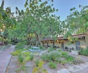
Kibbutz Ashdot Yaacov Ichud
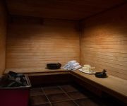
Spa Village
Videos from this area
These are videos related to the place based on their proximity to this place.
Hamat Gader - the hot springs of Gadara the second-largest bath complex in the entire Roman Empire
Zahi Shaked A tour guide in Israel and his camera zahigo25@walla.com 9726905522 tel סיור עם מורה הדרך ומדריך הטיולים צחי שקד 0546905522 My name is Zahi...
Archive Neve Ur תמונות מנוה אור ומפת מקום
יצרתי את הסרטון הזה בעזרת יוצר המצגות של YouTube (http://www.youtube.com/upload)Once upon in Ortal when we built the shelter, archive boxes - "Michal Kibbutzi",
Festicar 2014
Cars, noise, cars, noise, girls, more cars and more noise. The best cars festival of Israel 2014.
BeeInCar: Promo FestiCar 2013
פרומו לסרטון "פאסטי-קאר" בגני חוגה 26.10.2013 GreenBeeTV by Kostya Dorfman Youtube: http://www.youtube.com/user/greenbeetv1 Instagram: http://instagram.com/greenbeetv...
Ashdot Yaacov Ichud Panorama
Ashdot Yaacov Ichud Panorama to the East over the Yarmouk River towards Jordan, the Golan and the Gilad.
Masada, Israel, Middle East, Asia
Masada is an ancient fortification in the Southern District of Israel, on top of an isolated rock plateau (akin to a mesa) on the eastern edge of the Judaean Desert, overlooking the Dead Sea....
الحدود الأردنية الإسرائيلية - هضبة الجولان - بحيرة طبريا
ثواني تجمع مابين الأراضي الفلسطينية المحتلة و الأراضي الأردنية و هضبة الجولان المحتلة و بحيرة طبريا.
Videos provided by Youtube are under the copyright of their owners.
Attractions and noteworthy things
Distances are based on the centre of the city/town and sightseeing location. This list contains brief abstracts about monuments, holiday activities, national parcs, museums, organisations and more from the area as well as interesting facts about the region itself. Where available, you'll find the corresponding homepage. Otherwise the related wikipedia article.
Island of Peace
The Island of Peace is an Israeli-Jordanian park at the confluence of the Jordan River and Yarmouk River, on the border between Israel and Jordan. Pinhas Rutenberg's Naharayim hydroelectric power station can be seen from here.
Island of Peace massacre
The Island of Peace massacre was a Mass murder attack that occurred at the Island of Peace site in Naharayim on March 13, 1997 in which a Jordanian soldier opened fire at a large group of Israeli schoolgirls from the AMIT Fuerst School in Beit Shemesh who were on a class field trip, killing seven of them and injuring six others.


