Safety Score: 2,8 of 5.0 based on data from 9 authorites. Meaning we advice caution when travelling to Japan.
Travel warnings are updated daily. Source: Travel Warning Japan. Last Update: 2024-08-13 08:21:03
Discover Waku
Waku in Shimonoseki Shi (Yamaguchi) is a place in Japan about 507 mi (or 816 km) west of Tokyo, the country's capital city.
Current time in Waku is now 04:06 AM (Wednesday). The local timezone is named Asia / Tokyo with an UTC offset of 9 hours. We know of 10 airports near Waku, of which 3 are larger airports. The closest airport in Japan is Kitakyūshū Airport in a distance of 33 mi (or 53 km), South. Besides the airports, there are other travel options available (check left side).
There are several Unesco world heritage sites nearby. The closest heritage site in Japan is Itsukushima Shinto Shrine in a distance of 82 mi (or 132 km), East. If you need a hotel, we compiled a list of available hotels close to the map centre further down the page.
While being here, you might want to pay a visit to some of the following locations: Shimonoseki, Nagato, Mine, Sanyoonoda and Kitakyushu. To further explore this place, just scroll down and browse the available info.
Local weather forecast
Todays Local Weather Conditions & Forecast: 11°C / 52 °F
| Morning Temperature | 10°C / 50 °F |
| Evening Temperature | 9°C / 49 °F |
| Night Temperature | 10°C / 50 °F |
| Chance of rainfall | 0% |
| Air Humidity | 56% |
| Air Pressure | 1020 hPa |
| Wind Speed | Moderate breeze with 12 km/h (7 mph) from South |
| Cloud Conditions | Few clouds, covering 11% of sky |
| General Conditions | Few clouds |
Thursday, 5th of December 2024
11°C (51 °F)
11°C (52 °F)
Light rain, fresh breeze, broken clouds.
Friday, 6th of December 2024
12°C (53 °F)
10°C (50 °F)
Light rain, fresh breeze, overcast clouds.
Saturday, 7th of December 2024
9°C (49 °F)
8°C (46 °F)
Light rain, strong breeze, overcast clouds.
Hotels and Places to Stay
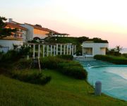
(RYOKAN) Shimonoseki Tsukuno Onsen Hotel Nishinagato Resort
Videos from this area
These are videos related to the place based on their proximity to this place.
角島大橋 - 空中散歩 - Tsunoshima Bridge Shimonoseki city, Yamaguchi Japan. Taken by paramotor.
白い砂浜とエメラルドグリーンの海士ヶ瀬戸をまたぐ橋。 角島との間にある鳩島をあえて迂回させるという景観に配慮したデザインは土木学会デ...
[V0001] 080429 夕暮れ空に染まる海士ヶ瀬戸に架かる日本全国海沿い絶景お気に入り第一位の角島大橋 Japanese country roads; Tsunoshima island Bridge
動画開始地点: 地図拡大表示の中心点 (RECORDING START POINT): Center point of this map http://maps.live.com/default.aspx?v=2&FORM=LMLTCP&cp=34.344499~130.893087&style...
Tsunoshima Bridge (PowerShot S110 timelapse)
Tsunoshima Bridge at Shimonoseki city, Yamaguchi prefecture. Pix on Flickr: http://www.flickr.com/photos/tomosang32jp/sets/72157627719992780/ 角島大橋をcanon S110でタイムラプス撮影...
Tsunoshima : (out of Kyushu) Driving Scenery [角島・山口県下関市豊北町]
Tsunoshima is an island located on northwest of Shimonoseki City, Yamaguchi Prefecture. The island is connected with the mainland(Honshu) by a bridge named Tsunoshima-Ohashi, 1780 meters in...
Drive on Tsunoshima Bridge
Drive on Tsunoshima Bridge, Shimonoseki city. 山口県下関市豊北町「角島大橋」 スマホ固定用のステーにコンデジを取り付けて走行してみたものの、剛性が...
Tsunoshima bridge yamaguchi japan 角島大橋
Tsunoshima Bridge, and when it was built in 2000 it was the longest toll-free bridge in Shimonoseki city, Yamaguchi Japan.
CM TVでおなじみ 角島大橋 観光 食事 灯台 夜景 山口 冬 アクセス
手芸材料小売・卸販売・雑貨販売 http://leche-handmade.com/ 広島 手芸雑貨店「Leche れちぇ」ハンドメイドママの店 【1day1handmade 略して「ワンハン...
[V0500] 長門1:全国海沿いお奨めNo.1の角島大橋から角島周遊で角島灯台へ
動画開始地点: 地図拡大表示の中心点 (RECORDING START POINT): Center point of this map http://maps.live.com/?v=2&cp=34.348614761787715~130.89670347864535&lvl=13&dir=0...
Videos provided by Youtube are under the copyright of their owners.
Attractions and noteworthy things
Distances are based on the centre of the city/town and sightseeing location. This list contains brief abstracts about monuments, holiday activities, national parcs, museums, organisations and more from the area as well as interesting facts about the region itself. Where available, you'll find the corresponding homepage. Otherwise the related wikipedia article.
Agawa Station
Agawa Station is a JR West railway station located in Shimonoseki Yamaguchi Prefecture, Japan.
Kottoi Station
is a JR West railway station located in Shimonoseki city, Yamaguchi Prefecture, Japan. People who disembark at Kottoi Station can take a 20 minute bus ride to Tsunoshima (an island) via the Tsunoshima Bridge, a 1,780 metre long bridge that joins Tsunoshima to the mainland at Hōhoku Town. It was the longest toll free bridge in Japan when it was completed on November 3, 2000.
Tsunoshima
is an island located in the Sea of Japan. Located in the north west of Yamaguchi Prefecture, it is a part of Shimonoseki city. The island has an area of 4.1 square kilometers and has a coastline of 17.1 kilometres . The island consists primarily of basalt, and is a part of the Kita-Nagato Kaigan Quasi-National Park. As of 28 August 2008, the population of Tsunoshima stood at 907.


!['[V0001] 080429 夕暮れ空に染まる海士ヶ瀬戸に架かる日本全国海沿い絶景お気に入り第一位の角島大橋 Japanese country roads; Tsunoshima island Bridge' preview picture of video '[V0001] 080429 夕暮れ空に染まる海士ヶ瀬戸に架かる日本全国海沿い絶景お気に入り第一位の角島大橋 Japanese country roads; Tsunoshima island Bridge'](https://img.youtube.com/vi/rOvFu4061ug/mqdefault.jpg)

!['Tsunoshima : (out of Kyushu) Driving Scenery [角島・山口県下関市豊北町]' preview picture of video 'Tsunoshima : (out of Kyushu) Driving Scenery [角島・山口県下関市豊北町]'](https://img.youtube.com/vi/wZugx_tfUAM/mqdefault.jpg)


!['[V0500] 長門1:全国海沿いお奨めNo.1の角島大橋から角島周遊で角島灯台へ' preview picture of video '[V0500] 長門1:全国海沿いお奨めNo.1の角島大橋から角島周遊で角島灯台へ'](https://img.youtube.com/vi/demxumK-0WQ/mqdefault.jpg)

