Safety Score: 2,8 of 5.0 based on data from 9 authorites. Meaning we advice caution when travelling to Japan.
Travel warnings are updated daily. Source: Travel Warning Japan. Last Update: 2024-08-13 08:21:03
Discover Yokoami
Yokoami in Sumida-ku (Tokyo) is a city in Japan a little east of Tokyo, the country's capital city.
Local time in Yokoami is now 04:13 PM (Friday). The local timezone is named Asia / Tokyo with an UTC offset of 9 hours. We know of 8 airports in the vicinity of Yokoami, of which two are larger airports. The closest airport in Japan is Tokyo International Airport in a distance of 10 mi (or 16 km), South. Besides the airports, there are other travel options available (check left side).
There are several Unesco world heritage sites nearby. The closest heritage site in Japan is Tomioka Silk Mill and Related Sites in a distance of 64 mi (or 102 km), North-West. We discovered 6 points of interest in the vicinity of this place. Looking for a place to stay? we compiled a list of available hotels close to the map centre further down the page.
When in this area, you might want to pay a visit to some of the following locations: Tokyo, Ichikawa-minami, Urayasu, Matsudo and Kawaguchi. To further explore this place, just scroll down and browse the available info.
Local weather forecast
Todays Local Weather Conditions & Forecast: 18°C / 64 °F
| Morning Temperature | 16°C / 61 °F |
| Evening Temperature | 19°C / 67 °F |
| Night Temperature | 18°C / 65 °F |
| Chance of rainfall | 12% |
| Air Humidity | 73% |
| Air Pressure | 1018 hPa |
| Wind Speed | Gentle Breeze with 8 km/h (5 mph) from South-West |
| Cloud Conditions | Overcast clouds, covering 100% of sky |
| General Conditions | Moderate rain |
Saturday, 16th of November 2024
20°C (67 °F)
18°C (65 °F)
Few clouds, moderate breeze.
Sunday, 17th of November 2024
20°C (68 °F)
21°C (71 °F)
Few clouds, fresh breeze.
Monday, 18th of November 2024
10°C (51 °F)
10°C (51 °F)
Light rain, fresh breeze, overcast clouds.
Hotels and Places to Stay
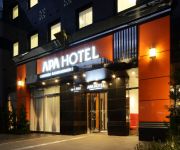
APA Hotel Asakusa Kaminarimon
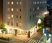
Agora Place Asakusa
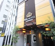
APA Hotel Asakusa Kuramae
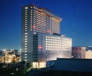
Daiichi Hotel Ryogoku
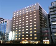
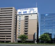
Toyoko Inn Tokyo Akiba Asakusabashi-eki Higashi-guchi
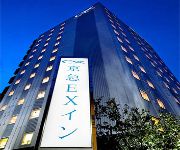
KEIKYU EX INN Asakusabashi-Station
Toyoko Inn Tokyo Ueno Tawaramachi-eki
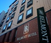
Asakusabashi Belmont Hotel
APA Hotel Ochanomizu-Ekikita
APA Hotel Asakusabashi Ekikita
Videos from this area
These are videos related to the place based on their proximity to this place.
京急600系エアポート快特 都営浅草線東日本橋駅到着
羽田空港発成田空港行きエアポート快特が到着。京成押上線~成田スカイアクセス線はアクセス特急として運転。Tokyo subway Asakusa lines train arrives...
北総9100形 普通印西牧の原行き 都営浅草線 東日本橋駅 到着・発車
都営浅草線 東日本橋駅で 普通印西牧の原行き 北総9100形電車を撮影しました。 Line : Toei Asakusa Line Station : Higashi-Nihonbashi Destination : Inzai-Makinohara...
都営5300形の発着 浅草線 浅草橋駅 普通西馬込行き
都営浅草線 浅草橋駅で 普通西馬込行き 都営5300形電車を撮影しました。 Line : Toei Asakusa Line Station : Asakusabashi Destination : Nishi-Magome Type of Train...
浅草 東京 日本 (Asakusa - Taitō, Tokyo, Japan)
A glimpse around Asakusa near the Asakusa Station in Taitō City, one of the many wards of Tokyo, Japan.
京急600形 特急 京急久里浜行き 都営浅草線 浅草橋駅 Toei Asakusa Line
都営浅草線 浅草橋駅で 京急線直通の特急 京急久里浜行き 京急600形電車を撮影しました。 This train is a Keikyu Line 600 series at Toei Asakusa Line Asakusa-bashi...
【昼間 -Day Time-】 東京・首都高速 Tokyo Metropolitan Expressway 2010.1.24
【6倍速(Speed 6×)】 Sunny Sunday Driving in Japan! 箱崎(Hakozaki)JCT→ 【9号・深川線(No. 9 Fukagawa-Route)】→ 辰巳(Tatsumi)JCT→ 【湾岸線(Bayshore-Route)】→...
Videos provided by Youtube are under the copyright of their owners.
Attractions and noteworthy things
Distances are based on the centre of the city/town and sightseeing location. This list contains brief abstracts about monuments, holiday activities, national parcs, museums, organisations and more from the area as well as interesting facts about the region itself. Where available, you'll find the corresponding homepage. Otherwise the related wikipedia article.
Ryōgoku Kokugikan
, also known as Ryougoku Sumo Hall, is an indoor sporting arena located in the Yokoami neighborhood (bordering to the Ryōgoku neighborhood) of Sumida, one of the 23 wards of Tokyo in Japan, next to the Edo-Tokyo Museum. It is the third building built in Tokyo associated with the name kokugikan. The current building was opened in 1985 and has a capacity of 13,000 people.
Kanda River
The Kanda River stretches 24.6 km from Inokashira Park in Mitaka to the Sumida River under the Ryōgoku Bridge at the boundary of Taitō, Chūō, and Sumida. Its entire length lies within Tokyo, Japan. It drains an area of 105.0 km². The government of Japan classifies it as a Class I river.
Ryōgoku
This article is about the neighborhood. For the sumo wrestlers, see Ryōgoku Yūjirō and Ryōgoku Kajinosuke. Ryōgoku is a neighborhood in Sumida, Tokyo. It is surrounded by various neighborhoods in Sumida, Chūō, and Taitō wards: Yokoami, Midori, Chitose, Higashi Nihonbashi, and Yanagibashi. In 1659, the Ryōgoku Bridge was built, spanning the Sumida River just upstream of its confluence with the Kanda River. Its name, meaning "two provinces," came from its joining Edo and Shimōsa Province.
Ryōgoku Station
Ryōgoku Station is a railway station in Yokoami, Sumida, Tokyo, Japan, operated by East Japan Railway Company (JR East) and Tokyo Metropolitan Bureau of Transportation (Toei).
Edo-Tokyo Museum
The Edo-Tokyo Museum is a museum of the history of Tokyo during the Edo period. It was established in 1993. The main features of the permanent exhibitions are the life-size replica of the Nihonbashi, which was the bridge leading into Edo; the Nakamuraza theatre; and scale models of towns and buildings from the Edo, Meiji and Shōwa periods. The museum is located in Ryōgoku adjacent to the Ryōgoku Kokugikan. It was designed by Kiyonori Kikutake.
Asakusabashi Station
Asakusabashi Station is a subway station on the Toei Asakusa Line operated by the Tokyo Metropolitan Bureau of Transportation, and a railway station above ground level on the Chūō-Sōbu Line at the same site operated by the East Japan Railway Company (JR East). It is located in the Asakusabashi neighborhood of Taitō, Tokyo, Japan. Its number on the Asakusa Line is A-16.
Kuramae Station
Kuramae Station is a subway station on the Toei Asakusa Line and on the Toei Ōedo Line, both operated by the Tokyo Metropolitan Bureau of Transportation. It is located in the Kuramae and Kotobuki neighborhoods of Taitō, Tokyo, Japan. Its number on the Asakusa Line is A-17, and that on the Ōedo Line is E-11. The stations on the two lines do not have an underground connection; still, passengers may transfer between them.
Ekō-in
, also known as Honjo Ekō-in, is a Pure Land Buddhist temple in Ryōgoku, Tokyo. The formal name of the temple is Shoshūzan Muen-ji Ekō-in, reflecting its founding principle of Pariṇāmanā, or the spreading of Amida Buddha's benevolence to all souls of all living creatures.
1894 Meiji Tokyo earthquake
The Meiji Tokyo earthquake was an earthquake which occurred in Tokyo, Japan at 14:04 PM on June 20, 1894. It affected downtown Tokyo and neighboring Kanagawa prefecture, especially the cities of Kawasaki and Yokohama. The Meiji Tokyo earthquake had its epicenter in Tokyo Bay, with a magnitude of 6.6 on the Richter Scale. The depth of the 1894 earthquake has not been determined, but it is thought to have occurred within the subducting Pacific Plate under the Kantō region.
Kuramae Kokugikan
Kuramae Kokugikan was a building situated in the Kuramae neighborhood of Taitō, Tokyo which was built by the Japan Sumo Association and opened in 1950. The Association needed a permanent venue to hold sumo tournaments as the previous, bomb-damaged, Kokugikan had been taken over by occupying Allied forces after World War II. Since then tournaments had been held in various venues including the Meiji Shrine and baseball stadiums.
Ryōgoku Bridge
The Ryōgoku Bridge is a bridge in Tokyo built in 1659 spanning the Sumida River just upstream of its confluence with the Kanda River. Its name, meaning "two provinces," came from its joining Edo (the forerunner of Tokyo in Musashi Province) and Shimōsa Province. The neighborhood at the east end of the bridge, Ryōgoku, derived its name from that of the bridge.
Yokoamicho Park
Yokoamicho Park is a public park in the Yokoami district of Sumida, Tokyo, Japan.


