Safety Score: 2,8 of 5.0 based on data from 9 authorites. Meaning we advice caution when travelling to Japan.
Travel warnings are updated daily. Source: Travel Warning Japan. Last Update: 2024-08-13 08:21:03
Explore Funayama
The district Funayama of Heda in Numazu-shi (Shizuoka) is located in Japan about 73 mi south-west of Tokyo, the country's capital.
If you need a place to sleep, we compiled a list of available hotels close to the map centre further down the page.
Depending on your travel schedule, you might want to pay a visit to some of the following locations: Izu, Numazu, Izunokuni, Mishima and Fuji. To further explore this place, just scroll down and browse the available info.
Local weather forecast
Todays Local Weather Conditions & Forecast: 12°C / 54 °F
| Morning Temperature | 10°C / 50 °F |
| Evening Temperature | 11°C / 53 °F |
| Night Temperature | 11°C / 51 °F |
| Chance of rainfall | 0% |
| Air Humidity | 56% |
| Air Pressure | 1030 hPa |
| Wind Speed | Gentle Breeze with 7 km/h (4 mph) from West |
| Cloud Conditions | Clear sky, covering 6% of sky |
| General Conditions | Sky is clear |
Tuesday, 26th of November 2024
16°C (61 °F)
17°C (63 °F)
Very heavy rain, light breeze, clear sky.
Wednesday, 27th of November 2024
17°C (63 °F)
14°C (57 °F)
Very heavy rain, strong breeze, broken clouds.
Thursday, 28th of November 2024
14°C (58 °F)
11°C (52 °F)
Scattered clouds, strong breeze.
Hotels and Places to Stay
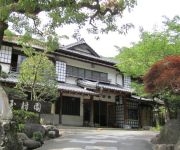
(RYOKAN) Fugakugunjo
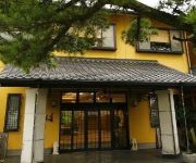
(RYOKAN) Toi Onsen Hotel Miyabi
(RYOKAN) Toi Onsen Suishoutei
(RYOKAN) Toda Onsen Iso Kappo no Yado Yamaichi
(RYOKAN) Gyokushoen Arai
(RYOKAN) Pd Fly Resort House
(RYOKAN) Fujishiro
(RYOKAN) Nishiizu Tohi Yagisawaso
(RYOKAN) Mihama Resuteru
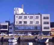
(RYOKAN) Doi Marine Hotel
Videos from this area
These are videos related to the place based on their proximity to this place.
[V0075] 020113 静岡険道17号の駿河湾沿いで左手に富士山を臨みながら進み淡島ロープウェイの脇を通過 Japanese country roads; Heda Surugawan
動画開始地点: 地図拡大表示の中心点 (RECORDING START POINT): Center point of this map http://maps.live.com/default.aspx?v=2&FORM=LMLTCP&cp=34.967096~138.764856&style...
沼津市戸田村諸口神社大例祭鯨突き唄
Chant de la chasse à la baleine au sanctuaire Moroguchi de Heda (ville Numazu), le 4 avril 2007.
西伊豆の桜 Cherry Blossom in Nishi Izu (Shot on RED ONE)
桜の季節の西伊豆では富士山と桜の絶景を見ることができます。 後半の映像は、松崎町那賀川周辺です。 You can see Mount Fuji and cherry blossoms in...
西伊豆土肥温泉旅館 ホテル雅のお風呂|厳選いい宿
厳選いい宿放送記念プランのご予約はこちら http://p.tl/QI00 ▽ホテル雅公式HP http://www.toi-miyabi.com/ ホテル雅は、西伊豆の土肥温泉にあり、愛の...
西伊豆土肥温泉旅館 ホテル雅|厳選いい宿
厳選いい宿放送記念プランのご予約はこちら http://p.tl/QI00 ▽ホテル雅公式HP http://www.toi-miyabi.com/ ホテル雅は、西伊豆の土肥温泉にあり、愛...
土肥ペンション
http://www.vector.co.jp/soft/winnt/amuse/se509375.html http://it-net.ddo.jp/Album/Diving/ohsezaki/2002/ 写真は上記ページにあります。
Videos provided by Youtube are under the copyright of their owners.
Attractions and noteworthy things
Distances are based on the centre of the city/town and sightseeing location. This list contains brief abstracts about monuments, holiday activities, national parcs, museums, organisations and more from the area as well as interesting facts about the region itself. Where available, you'll find the corresponding homepage. Otherwise the related wikipedia article.
Kamo District, Shizuoka
Kamo District, Shizuoka is a rural district located in Shizuoka Prefecture, Japan. As of July 2012, the district has an estimated population of 47,001 and a population density of 97.9 persons per km². The total area was 479.97 km².
Kamo, Shizuoka
Kamo, Shizuoka was a village located in Kamo District, Shizuoka, Japan. On April 1, 2005 Kamo was incorporated into the neighboring city of Nishiizu. At the time of its merger, the village had an estimated population of 3,291 and a density of 83 persons per km². The total area was 39.64 km².
Numazu Station
Numazu Station is an interchange railway station on the Tōkaidō Main Line of Central Japan Railway Company in Numazu, Shizuoka Prefecture, Japan. The station is 126.2 rail kilometers from Tokyo Station.
Fuji River
The Fuji River is a river in Yamanashi and Shizuoka Prefectures of central Japan. It is 128 kilometres long and has a watershed of 3,990 square kilometres . With the Mogami River and the Kuma River, it is regarded as one of the three most rapid flows of Japan. The river arises from Mount Nokogiri in the Akaishi Mountains in northwest Yamanashi as the Kamanashi River, and meets the Fuefuki River at the town of Ichikawamisato. There it changes its name to the Fuji River.
Kano River
The Kano River is a 1st class river in Shizuoka Prefecture of ceniral Japan. It is 46 km long and has a watershed of 853 km². The Kano River rises from Mount Amagi in central Izu Peninsula and follows a generally northern path into Suruga Bay at Numazu. The Izu Peninsula is characterized by heavy rainfall, and the Kano River has a steep gradient with rapid flow and is prone to flooding.
Ōoka Station
Ōoka Station is a railway station on the Gotemba Line of Central Japan Railway Company (JR Central) located in Numazu, Shizuoka, Japan.
Klemzig, South Australia
Klemzig is a suburb of Adelaide in the City of Port Adelaide Enfield. It was the first settlement of German emigrants to Australia in the 19th century and is named after a village called Klemzig near the city of Züllichau in southeastern Brandenburg in the German state of Prussia, where they originated from. That Klemzig is now in western Poland and is now known by the Polish name Klępsk.
Battle of Omosu
The 1580 battle of Omosu was one of many battles fought between the Hōjō and Takeda clans during Japan's Sengoku period. It is distinguished, however, as one of the very few naval battles to be fought in pre-modern Japan. The battle took place off the coast of the Izu peninsula between the navies of Hōjō Ujimasa, the head of the Hōjō, and those of Takeda Katsuyori, the head of the Takeda. While the navies faced off, the land armies of each family advanced towards one another.
Katahama Station
Katahama Station is a railway station in Numazu, Shizuoka Prefecture, Japan, on the Tōkaidō Main Line. It is located 130.3 rail kilometers from Tokyo Station, and is operated by Central Japan Railway Company (JR Central).
Katsuragiyama Ropeway
The Katsuragiyama Ropeway, officially the Katsuragisan Ropeway, is Japanese aerial lift line in Izunokuni, Shizuoka. The line has an official nickname Skyride . This is the only line Katsuragiyama-Panoramapark operates. Opened in 1992, the line climbs Mount Katsuragi with the view of Mount Fuji.
Awashima Kaijō Ropeway
The Awashima Kaijō Ropeway is Japanese aerial lift line in Numazu, Shizuoka, operated by Awashima Marine Park . On Awashima Island, the former deserted island off shore Numazu, Awashima Marine Park developed the resort with the same name, which includes a hotel and a public aquarium. The aerial lift line links Honshū and the island, across the short strait. Opened in 1964, it was the first aerial lift in Japan to go over the sea, and still is the only line to do so.
Shuzenji Romney Railway
The Shuzenji Romney Railway is a 15 gauge pleasure line located in Niji-no-Sato (Rainbow Park) in Izu, Shizuoka, on the Izu Peninsula in Japan. It is based on the English Romney, Hythe & Dymchurch Railway on the English Channel coast in Kent, which opened in 1925. The railway operates using a mixture of steam and diesel locomotives and enclosed saloon carriages.
Kakita River
The Kakita River is a river flowing through the town of Shimizu in the Suntō District, Shizuoka Prefecture, Japan. The Kakita River is a tributary of the Kano River. At only 1.2 km, it is the shortest Class 1 River in Japan. Most of the river's source water comes from springs created by rainfall and melting snow on Mount Fuji. The area around the springs is protected as a park (Kakita River Park by the Shimizu town government.
Numazu Castle
Fragment of the walls from Numazu Castle]] Numazu Castle was a Japanese castle located in the city of Numazu, Shizuoka Prefecture, Japan. It was a hirayama-jō, a castle built on a plains rather than a hill or mountain. During the Edo period, Numazu castle was home to the Mizuno clan, daimyō of Numazu Domain.
Jōren Falls
Jōren Falls is a waterfall in the Yugashima district of Izu city, Shizuoka Prefecture, Japan, in central Izu Peninsula on the upper reaches of the Kano River. It is a Shizuoka Prefectural Natural Monument. It is one of "Japan’s Top 100 Waterfalls", in a listing published by the Japanese Ministry of the Environment in 1990. 40x40px Wikimedia Commons has media related to: Joren Falls
Toi Gold Museum
The Toi Gold Museum is a museum on the subject of gold mining in ancient and modern Japan, which is located next to the Toi gold mine in the city of Toi, Shizuoka, Japan. The museum displays reconstitutions of the manufacturing process for gold during the Tokugawa era, ancient artifacts from the period, explanatory exhibitions about gold processing, and an exhibit of various gold ores from various places throughout Japan.
Mishima-Hirokōji Station
Mishima-Hirokōji Station is a train station of the Izuhakone Railway’s Sunzu Line located in Mishima, Shizuoka Prefecture, Japan. It is 1.3 rail kilometers from the line’s terminus at Mishima Station.
Mishima-Tamachi Station
Mishima-Tamachi Station is a train station of the Izuhakone Railway’s Sunzu Line located in Mishima, Shizuoka Prefecture, Japan. It is 2.0 rail kilometers from the line’s terminus at Mishima Station.
Daiba Station (Shizuoka)
Daiba Station is a train station of the Izuhakone Railway’s Sunzu Line located in an industrial area of Mishima, Shizuoka Prefecture, Japan. It is 5.5 rail kilometers from the line’s terminus at Mishima Station.
Izu-Nitta Station
Izu-Nitta Station is a train station of the Izuhakone Railway’s Sunzu Line located in the town of Kannami, Shizuoka Prefecture, Japan. It is 7.0 rail kilometers from the line’s terminus at Mishima Station.
Baraki Station
Baraki Station is a train station of the Izuhakone Railway’s Sunzu Line located in the city of Izunokuni, Shizuoka Prefecture, Japan. It is 8.5 rail kilometers from the line’s terminus at Mishima Station.
Nirayama Station
Nirayama Station is a train station of the Izuhakone Railway’s Sunzu Line located in the city of Izunokuni, Shizuoka Prefecture, Japan. It is 9.8 rail kilometers from the line’s terminus at Mishima Station. It is located in the former town of Nirayama.
Izu-Nagaoka Station
Izu-Nagaoka Station is a train station of the Izuhakone Railway’s Sunzu Line located in the city of Izunokuni, Shizuoka Prefecture, Japan. It is 11.4 rail kilometers from the line’s terminus at Mishima Station. It is located in the former town of Nirayama.
Takyō Station
Takyō Station is a train station of the Izuhakone Railway’s Sunzu Line located in the city of Izunokuni, Shizuoka Prefecture, Japan. It is 14.2 rail kilometers from the line’s terminus at Mishima Station.
Ōhito Station
Ōhito Station is a train station of the Izuhakone Railway’s Sunzu Line located in the city of Izunokuni, Shizuoka Prefecture, Japan. It is 16.6 rail kilometers from the line’s terminus at Mishima Station.




!['[V0075] 020113 静岡険道17号の駿河湾沿いで左手に富士山を臨みながら進み淡島ロープウェイの脇を通過 Japanese country roads; Heda Surugawan' preview picture of video '[V0075] 020113 静岡険道17号の駿河湾沿いで左手に富士山を臨みながら進み淡島ロープウェイの脇を通過 Japanese country roads; Heda Surugawan'](https://img.youtube.com/vi/zNwwuYF9o9c/mqdefault.jpg)


