Fumoto
in Fujinomiya Shi of Shizuoka, Japan

Noteable things around
Location Summary
Decimal Coordinates (Latitude, Longitude):
35.402 and 138.558 (Lat./Lng.)
Coordinates by Time:
N 35° 24' 6" and E 138° 33' 27"
Currency and Currency Code:
Yen - JPY
Spoken languages:
Japanese
Local electricity:
230 V - 50 Hz (plugs: G)
Mobile phone / cellular frequencies (MHz):
900 MHz, 1800 MHz, 3G, 4G
Local Time: 02:22 AM (Friday)
Timezone: Asia/Tokyo
UTC/GMT offset: 9 hours
Sunrise and Sunset:
6:21 am and 4:39 pm
Antipode Coordinates:
-28.605 and -48.819 (Lat./Lng.)
Closest place to antipode coordinates:
Farol de Santa Marta
References
This place on Geonames.org
Current travel safety evaluation for Japan in Eastern Asia

Safety Score: 2,8 of 5.0 based on data from 9 authorites. Meaning we advice caution when travelling to Japan.

Travel warnings are updated daily. Source: Travel Warning Japan. Last Update: 2024-08-13 08:21:03

Explore Fumoto

Fumoto in Fujinomiya Shi (Shizuoka) is located in Japan about 67 mi (or 107 km) west of Tokyo, the country's capital.

Local time in Fumoto is now 02:22 AM (Friday). The local timezone is named Asia / Tokyo with an UTC offset of 9 hours. We know of 10 airports in the wider vicinity of Fumoto, of which 3 are larger airports. The closest airport in Japan is Atsugi Naval Air Facility in a distance of 50 mi (or 81 km), East. Besides the airports, there are other travel options available (check left side).

There are several Unesco world heritage sites nearby. The closest heritage site in Japan is Fujisan, sacred place and source of artistic inspiration in a distance of 10 mi (or 16 km), East. We found 1 points of interest in the vicinity of this place. If you need a place to sleep, we compiled a list of available hotels close to the map centre further down the page.

Depending on your travel schedule, you might want to pay a visit to some of the following locations: Fujinomiya, Chuo, Minami-Alps, Fuefuki and Kofu. To further explore this place, just scroll down and browse the available info.

Local weather forecast

Todays Local Weather Conditions & Forecast: 12°C / 53 °F

Morning Temperature 9°C / 48 °F
Evening Temperature 11°C / 51 °F
Night Temperature 8°C / 47 °F
Chance of rainfall 4%
Air Humidity 89%
Air Pressure 1018 hPa
Wind Speed Light breeze with 3 km/h (2 mph) from West
Cloud Conditions Overcast clouds, covering 100% of sky
General Conditions Moderate rain

Saturday, 16th of November 2024

11°C (52 °F)
6°C (44 °F)
Overcast clouds, light breeze.

Sunday, 17th of November 2024

14°C (56 °F)
11°C (51 °F)
Few clouds, light breeze.

Monday, 18th of November 2024

8°C (47 °F)
1°C (33 °F)
Light rain, light breeze, overcast clouds.

Hotels and Places to Stay

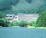
Kyukamura Fuji

Address
4,2 mi
634, Saori, Fujinomiya city, Shizuoka 418 0107, Japan.
4180107 Gotenba,,Gotenba-Shi
Japan

Time Information

Checkout: 10:00 - Checkin: 15:00
Reception
Weekday: 7:00 - 0:00
Weekend: closed


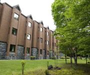
Villa Motosu

Address
4,5 mi
218 119, MOTOSU, FUJIKAWAGUCHIKO MACHI MINAMITSURU GUN, YAMANASHI, 401 0337, JAPAN.
4010337 Minamitsuru Gun Fujikawaguchiko Mac
Japan

Time Information

Checkout: 10:00 - Checkin: 14:00
Reception
Weekday: -
Weekend: closed


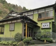
(RYOKAN) Shimobe Onsen Motoyu Ryokan Daikokuya

Address
4,5 mi
56, SHIMOBE, MINOBU CHO MINAMIKOMA GUN, YAMANASHI, 409 2942, JAPAN.
4092942 Minamikoma Gun Minobu Cho
Japan

Time Information

Checkout: 11:00 - Checkin: 14:30
Reception
Weekday: -
Weekend: closed


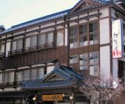
(RYOKAN) Kutsurogi no Yado Yukiya

Address
4,5 mi
48, SHIMOBE, MINOBU CHO MINAMIKOMA GUN, YAMANASHI, 409 2942, JAPAN.
4092942 Minamikoma Gun Minobu Cho
Japan

Time Information

Checkout: 11:00 - Checkin: 14:00
Reception
Weekday: 7:00 - 0:00
Weekend: closed


(RYOKAN) Gensenkan

Address
4,5 mi
45, SHIMOBE, MINOBU CHO MINAMIKOMA GUN, YAMANASHI, 409 2942, JAPAN.
4092942 Minamikoma Gun Minobu Cho
Japan

Time Information

Checkout: 11:00 - Checkin: 14:00
Reception
Weekday: -
Weekend: closed


(RYOKAN) Shimobe Onsen Yumoto Hotel

Address
4,6 mi
35, SHIMOBE, MINOBU CHO MINAMIKOMA GUN, YAMANASHI, 409 2942, JAPAN.
4092942 Minamikoma Gun Minobu Cho
Japan

Time Information

Checkout: 10:00 - Checkin: 14:00
Reception
Weekday: -
Weekend: closed


(RYOKAN) Shimobe Onsen Hana no Yado Takimoto

Address
4,6 mi
989, SHIMOBE, MINOBU CHO MINAMIKOMA GUN, YAMANASHI, 409 2942, JAPAN.
4092942 Minamikoma Gun Minobu Cho
Japan

Time Information

Checkout: 10:00 - Checkin: 14:00
Reception
Weekday: -
Weekend: closed


(RYOKAN) Motoyu Koyokan

Address
4,6 mi
997, SHIMOBE, MINOBU CHO MINAMIKOMA GUN, YAMANASHI, 409 2942, JAPAN.
4092942 Minamikoma Gun Minobu Cho
Japan

Time Information

Checkout: 10:00 - Checkin: 15:00
Reception
Weekday: -
Weekend: closed


Pension Motosu

Address
4,5 mi
218 127, MOTOSU, FUJIKAWAGUCHIKO MACHI MINAMITSURU GUN, YAMANASHI, 401 0337, JAPAN.
4010337 Minamitsuru Gun Fujikawaguchiko Mac
Japan

Time Information

Checkout: 10:00 - Checkin: 15:00
Reception
Weekday: -
Weekend: closed


Fuji Milkland Farm Inn

Address
4,7 mi
2390, Kamiide, Fujinomiya city, Shizuoka 418 0103, Japan.
4180103 Fujinomiya Shi
Japan

Time Information

Checkout: 10:00 - Checkin: 15:00
Reception
Weekday: -
Weekend: closed


Videos from this area

These are videos related to the place based on their proximity to this place.

NMVA Summer Camp 2012

Published: July 21, 2012
Length: 12:21 min
Rating: 5 of 5
Author: Ishikawa Yuichi

一般社団法人 日本ミリタリーヴィークル協会 平成24年3月25日 設立 目的 世界各国が研究開発した走破性の高い軍用車を 収集・再生・保存すると...


GoPro HD|ハンググライダー 雲底フライト

Published: September 20, 2010
Length: 10:00 min
Rating: 5 of 5
Author: HANG GLIDING TV

ハンググライダーにGoProHDを装着しての空撮動画です。 カメラの取り付けがイマイチでだいぶ振動しちゃってます... 撮影日時 2010/09/18 撮影場所...


Hang Glider Flight #0162@T2C,West Fuji

Published: July 23, 2014
Length: 30:36 min
Rating: 0 of 5
Author: jinkzm spring

土日は飛ばず、三連休最終日の月曜日。 I元さん、O田さん夫妻、N藤さん夫妻、M本さん、青Kさん、K合さん、私。お昼休みにK口さんが新車バイク...


The birth of the heroes in the paraglider story (complete)

Published: April 04, 2015
Length: 11:21 min
Rating: 5 of 5
Author: sages82

The Paraglider Story Restart in Asagiri Kogen ,Japan Waterfall of Shiraito,Waterfall of Jimba ,Fujinomiya-Yakisoba,Rainbow Trout iMovie ,Macbook Pro ,Hatsune Miku ,Logic Pro X.


【県道シリーズ】静岡県道414号【等倍】

Published: May 04, 2014
Length: 12:21 min
Rating: 0 of 5
Author: narry7

静岡県道414号朝霧富士宮線(旧国道139号) 起点:富士宮市麓(国道139号交点) 終点:富士宮市小泉(国道139号交点) http://goo.gl/maps/idFz8 http://yahoo.jp/qPVll9...


Tonbo 2013.03.03

Published: March 03, 2013
Length: 26:10 min
Rating: 0 of 5
Author: tonbo dandy


パラグライダーin朝霧

Published: March 20, 2012
Length: 00:04 min
Rating: 4 of 5
Author: tsubasa amma

2012/3/14静岡県朝霧高原にて flight near Mt.Fuji which takes 1 hour from Mt.Fuji-shizuoka airport.


心霊スポット逝ってみた  人穴  洞内の映像もあるぜよ 静岡県富士宮市

Published: May 28, 2013
Length: 05:29 min
Rating: 3 of 5
Author: ProjectKitabatake

2013年6月23日、有名心霊スポット人穴が世界文化遺産になりました。 心霊スポットで有名な静岡県富士宮の人穴に逝ってきました。 中には...。...


The birth of the heroes in the paraglider story (trailer)

Published: March 18, 2015
Length: 07:46 min
Rating: 5 of 5
Author: sages82

The Paraglider Story Restart in Asagiri Kogen ,Japan iMovie Macbook Pro.


2009-06-20 Paraglider flight near Mt. Fuji, Asagiri highland

Published: June 23, 2009
Length: 22:56 min
Rating: 5 of 5
Author: mytubevacuumtube

Paraglider flight near Mt. Fuji.


Videos provided by Youtube are under the copyright of their owners.

Attractions and noteworthy things

Distances are based on the centre of the city/town and sightseeing location. This list contains brief abstracts about monuments, holiday activities, national parcs, museums, organisations and more from the area as well as interesting facts about the region itself. Where available, you'll find the corresponding homepage. Otherwise the related wikipedia article.

Asagiri Plateau

The Asagiri Plateau is located at the southwest base of Mount Fuji in Fujinomiya, Shizuoka Prefecture, Japan. The Asagiri Plateau is richly utilized for its pasture land and many dairy farms are situated along it. The elevation of the plateau is generally around 800 m or 900 m . Asagiri Kogen is also home to one of the most spectacular Hang-gliding and Paragliding sites in Japan.

Located at 35.4133, 138.591 (Lat. / Lng.), about 2 miles away.
Wikipedia Article
Plateaus of Japan, Visitor attractions in Shizuoka Prefecture, Geography of Shizuoka Prefecture

13th World Scout Jamboree

The 13th World Jamboree was held August 2–10, 1971, on Asagiri Heights on the western side of Mount Fuji, in Fujinomiya, Japan, approximately 80 miles southwest of Tokyo. The Jamboree was interrupted by Typhoon Olive in which 16,000 of the participating Scouts were evacuated to shelters in the countryside for 48 hours. The Jamboree site was served from the south by Japan National Highway 139 and a turnpike from Fujinomiya.

Located at 35.3778, 138.586 (Lat. / Lng.), about 2 miles away.
Wikipedia Article
Scouting jamborees, Scouting in Japan

Mount Kenashi (Yamanashi, Shizuoka)

Mount Kenashi is a 1,964 m mountain on the border of Yamanashi and Shizuoka prefectures in Japan. At the base of the mountain stretches the Asagiri Plateau, which stretches until Mount Fuji. It is the highest peak in the Tenshi Mountains.

Located at 35.4158, 138.544 (Lat. / Lng.), about 1 miles away.
Wikipedia Article
Mountains of Yamanashi Prefecture, Mountains of Shizuoka Prefecture

capture of the webcam 猪之頭: Inokashira

猪之頭: Inokashira, 猪之頭 (source)

capture of the webcam 根原: National Highway No. 139 − Nevala 2 35.3Km (国道139号根原2 35.3Kp)

根原: National Highway No. 139 − Nevala 2 35.3Km (国道139号根原2 35.3Kp), 根原 (source)

capture of the webcam 根原: National Highway No. 139 − Nevala 1 32.2Km (国道139号根原1 32.2Kp)

根原: National Highway No. 139 − Nevala 1 32.2Km (国道139号根原1 32.2Kp), 根原 (source)

Webcams provided by webcam.travel are under the copyright of their owners.


This place is known by different names. Here the ones we know:
Fumoto, 麓