Safety Score: 2,8 of 5.0 based on data from 9 authorites. Meaning we advice caution when travelling to Japan.
Travel warnings are updated daily. Source: Travel Warning Japan. Last Update: 2024-08-13 08:21:03
Delve into Uebaru
Uebaru in Naha Shi (Okinawa) is located in Japan about 967 mi (or 1,557 km) south-west of Tokyo, the country's capital town.
Current time in Uebaru is now 08:40 PM (Thursday). The local timezone is named Asia / Tokyo with an UTC offset of 9 hours. We know of 8 airports close to Uebaru, of which one is a larger airport. The closest airport in Japan is Naha Airport in a distance of 1 mi (or 2 km), West. Besides the airports, there are other travel options available (check left side).
There is one Unesco world heritage site nearby. It's Gusuku Sites and Related Properties of the Kingdom of Ryukyu in a distance of 2 mi (or 3 km), North-East. If you need a hotel, we compiled a list of available hotels close to the map centre further down the page.
While being here, you might want to pay a visit to some of the following locations: Tomigusuku, Naha, Itoman, Urasoe and Nanjo. To further explore this place, just scroll down and browse the available info.
Local weather forecast
Todays Local Weather Conditions & Forecast: 22°C / 72 °F
| Morning Temperature | 22°C / 71 °F |
| Evening Temperature | 22°C / 71 °F |
| Night Temperature | 20°C / 68 °F |
| Chance of rainfall | 3% |
| Air Humidity | 79% |
| Air Pressure | 1018 hPa |
| Wind Speed | Fresh Breeze with 14 km/h (8 mph) from South |
| Cloud Conditions | Overcast clouds, covering 100% of sky |
| General Conditions | Moderate rain |
Friday, 22nd of November 2024
22°C (72 °F)
20°C (68 °F)
Moderate rain, moderate breeze, overcast clouds.
Saturday, 23rd of November 2024
22°C (71 °F)
20°C (67 °F)
Light rain, moderate breeze, broken clouds.
Sunday, 24th of November 2024
22°C (72 °F)
21°C (71 °F)
Light rain, moderate breeze, clear sky.
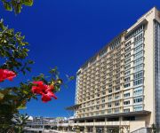
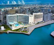
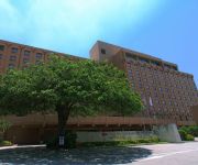
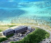
Hotels and Places to Stay
DoubleTree by Hilton Naha
RIHGA ROYAL GRAN OKINAWA
Naha Tokyu REI Hotel
Loisir Spa Tower Naha
Loisir Hotel Naha
ANA Crowne Plaza OKINAWA HARBORVIEW
Daiwa Roynet Hotel Okinawa-Kenchomae
Ryukyu Onsen Senagajima Hotel
Ryukyu Sun Royal Hotel
Pacific Hotel Okinawa
Videos from this area
These are videos related to the place based on their proximity to this place.
那覇マラソン2014 スタートからゴールまで (NAHA MARATHON)
スタートからゴールまでインターバル撮影(10秒間隔)したものを つなげて動画にしてみました。 那覇マラソンを検討している方の参考にと思い...
The Demonstration of F-15 Scramble Emergency Take-Off @ NAHA Air Base Open House 2009 ( Part I )
The Demonstration of F-15 Scramble Emergency Take-Off @ NAHA Air Base Open House 2009 , Okinawa , Japan.
NAHA AIR BASE @ OPEN HOUSE 2009 , OKINAWA , JAPAN
NAHA AIR BASE @ OPEN HOUSE 2009 , OKINAWA , JAPAN.
Okinawa Naha travel with grandmother ばあちゃん連れて沖縄那覇へ:旅
かなり高齢のおばあを連れて、那覇に行ってきました。 いくつになったんだかよくわかりません。 90歳後半です。 戦争遺族なんでね、慰霊とい...
那覇市山下町の真珠道跡 Okinawa Naha-City Madamamiti-Ato
那覇市山下町にある真珠道跡。 16世紀初頭、琉球王朝時代の首里城から那覇港までの幹線道路であり、軍用道路であった真珠道の跡を歩きます。...
[LCC機窓動画 那覇-関空線] Jetstar Japan GK180 OKA-KIX In-Flight Window View 2013.3.10
ジェットスタージャパン 180便 那覇空港-関西国際空港 2013.3.9 Jetstar Japan GK180 From Naha Airport To Kansai International Airport (Mar 10, 2013) - 機窓案内 - 00:00...
【車載動画】那覇市若狭→イオン那覇店
那覇市若狭の交差点から、うみそらトンネルを抜けてイオン那覇店までの道のりです。 This is the way to the "AEON Naha shopping center" from Wakasa,Naha city...
台風2号 in 沖縄 Typhoon 201102 (Songda) in Okinawa
Please join Our Facebook page! http://www.facebook.com/VisitOkinawa Typhoon 201102 (SONGDA) is coming to Okinawa Video recorded in Naha City, Okinawa at 5 P.M. on May 27th 2011 Video ...
Southernmost rail station in Japan 日本最南端の駅
Okinawa City Monorail Line 1000 series EMU at Akamine station, Naha. 「日本最南端の駅 ゆいレール赤嶺駅」の碑をバックに走る沖縄都市モノレール1000形。 沖繩都...
沖縄 新神楽 獅子舞編 Okinawa New Kagura Shishimai ver.
Original new Kagura ( a kind of 'Opera' expressing legend ) was presented by Okinogu 沖宮 (Shrine) at Naha city on May 1st, 2013. Kagura is not familiar with Okinawan people and place. However,...
Videos provided by Youtube are under the copyright of their owners.
Attractions and noteworthy things
Distances are based on the centre of the city/town and sightseeing location. This list contains brief abstracts about monuments, holiday activities, national parcs, museums, organisations and more from the area as well as interesting facts about the region itself. Where available, you'll find the corresponding homepage. Otherwise the related wikipedia article.
Ryukyu Kingdom
The Ryukyu Kingdom was an independent kingdom which ruled most of the Ryukyu Islands from the 15th century to the 19th century. The Kings of Ryukyu unified Okinawa Island and extended the kingdom to the Amami Islands in modern-day Kagoshima Prefecture, and the Sakishima Islands near Taiwan. Despite its small size, the kingdom played a central role in the maritime trade networks of medieval East and Southeast Asia.
Naha Airport
is a second class airport located 4 km west of the city office in Naha, Okinawa. The primary air terminal for passengers and freight traveling to and from Okinawa Prefecture, Japan, the airport handles international traffic to Taiwan, Hong Kong, Korea, and China. Japan's seventh busiest airport, it also carries domestic flights to Tokyo International Airport (Haneda) and many other cities on Japan's four main islands.
Lake Man
, is an area of wetlands in Japan that is located between the cities of Naha, Okinawa and Tomigusuku, and within Manko Park. Despite being called "Lake Man", it is in fact a wetland and not a lake. Lake Man is close to Naha Port, located at the confluence of the lower reaches of the Kokuba River and the Noha River, to the south of Naha. Travelers from outside Okinawa Prefecture, en route from Naha Airport to the city Naha, cross this estuary, with the left side commanding a view of Lake Man.
Roman Catholic Diocese of Naha
The Roman Catholic Diocese of Naha is a diocese located in the city of Naha in the Ecclesiastical province of Nagasaki 長崎 in Japan.
Gokoku-ji (Okinawa)
Gokoku-ji (護国寺, "Protection of the Nation Temple") is a Buddhist temple in Naha, Okinawa. Established in 1367, the temple served as a major national temple for the Okinawan kingdom of Chūzan and the unified Ryūkyū Kingdom which would follow. It is perhaps most well known for its associations with Christian missionary Dr. Bernard Jean Bettelheim and with the 1853-1854 visits by Commodore Matthew Perry to Okinawa.
Naha-kūkō Station
Naha-kūkō Station (那覇空港駅, Naha-kūkō-eki, lit. "Naha Airport Station") is a railway station, the terminus of the Okinawa Monorail, located in Naha, Okinawa, Japan. It is the westernmost station in Japan, and the southernmost airport station in the country. The station has two platforms, though platform 2 is for the most part only used during rush hour. The station is connected directly to the second floor of Naha Airport via an elevated pedestrian bridge with a moving walkway.
Okinawa Cellular Stadium
Okinawa Cellular Stadium, originally known as Naha City Ohnoyama Baseball Stadium, is a multi-purpose stadium in Naha, Japan. It is currently used mostly for baseball matches. The stadium was originally opened in 1959, but was renovated for 2010. It has a capacity of 30,000 spectators.
Naha Port Facility
The Naha Port Facility, formerly the Naha Military Port, is a United States Forces Japan facility located in Naha, Okinawa, Japan, at the mouse of Kokuba River, which flows into the East China Sea. The Naha Military Port was constructed by the U.S. troops after their landing on Okinawa Island in 1945. It served as a logistic base during the Vietnam War.








!['[LCC機窓動画 那覇-関空線] Jetstar Japan GK180 OKA-KIX In-Flight Window View 2013.3.10' preview picture of video '[LCC機窓動画 那覇-関空線] Jetstar Japan GK180 OKA-KIX In-Flight Window View 2013.3.10'](https://img.youtube.com/vi/aspPgYNLcG8/mqdefault.jpg)


