Safety Score: 2,8 of 5.0 based on data from 9 authorites. Meaning we advice caution when travelling to Japan.
Travel warnings are updated daily. Source: Travel Warning Japan. Last Update: 2024-08-13 08:21:03
Explore Ido
Ido in Yoshino-gun (Nara-ken) is a city in Japan about 231 mi (or 371 km) south-west of Tokyo, the country's capital.
Local time in Ido is now 01:09 PM (Friday). The local timezone is named Asia / Tokyo with an UTC offset of 9 hours. We know of 8 airports in the vicinity of Ido, of which 3 are larger airports. The closest airport in Japan is Kansai International Airport in a distance of 42 mi (or 68 km), West. Besides the airports, there are other travel options available (check left side).
There are several Unesco world heritage sites nearby. The closest heritage site in Japan is Buddhist Monuments in the Horyu-ji Area in a distance of 25 mi (or 40 km), North-West. If you need a place to sleep, we compiled a list of available hotels close to the map centre further down the page.
Depending on your travel schedule, you might want to pay a visit to some of the following locations: Ouda, Sakurai, Kashihara-shi, Gose and Gojo. To further explore this place, just scroll down and browse the available info.
Local weather forecast
Todays Local Weather Conditions & Forecast: 17°C / 63 °F
| Morning Temperature | 15°C / 60 °F |
| Evening Temperature | 18°C / 64 °F |
| Night Temperature | 16°C / 61 °F |
| Chance of rainfall | 0% |
| Air Humidity | 87% |
| Air Pressure | 1019 hPa |
| Wind Speed | Calm with 2 km/h (1 mph) from North |
| Cloud Conditions | Overcast clouds, covering 100% of sky |
| General Conditions | Overcast clouds |
Saturday, 16th of November 2024
21°C (70 °F)
19°C (66 °F)
Overcast clouds, light breeze.
Sunday, 17th of November 2024
21°C (69 °F)
18°C (64 °F)
Moderate rain, light breeze, overcast clouds.
Monday, 18th of November 2024
13°C (56 °F)
8°C (47 °F)
Light rain, moderate breeze, overcast clouds.
Hotels and Places to Stay
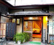
(RYOKAN) Matsuya
(RYOKAN) Kanko Ryokan Sugigase
Videos from this area
These are videos related to the place based on their proximity to this place.
Bowing deer, Deer Park, Nara Japan
For Yuko, my guide who put up with me being smitten by deers one can pet!
Kintetsu Railway Yoshino Station (近鉄吉野駅), Yoshinoyama Area, Nara Prefecture
Kintetsu Railway Yoshino Station (近鉄吉野駅) is a small but beautiful train station in the Yoshinoyama (Mt. Yoshino) area. Yoshinoyama (吉野山) is considered as one of...
Riding Train to Mt. Yoshino (Yoshinoyama), Nara Prefecture
This is a video footage of the last leg of my train ride on a Kintetsu Railway Train to Yoshinoyama. You can see from the footage how much fun it is with the mountainous Nara prefecture.
Mount Yoshino 【 うろうろ近畿 】 Sacred Sites and Pilgrimage Routes in the Kii Mountain Range
世界遺産 紀伊山地の霊場と参詣道 吉野大峯 )吉野山散策です。 桜の季節は駐車場がいっぱいで 車がにっちもさっちもいかなくなるとか...
Yoshimizu Shrine (吉水神社), Yoshino-yama Mountain, Nara Prefecture
Yoshimizu Shrine (吉水神社) is located on the Yoshino-yama mountain and it is one of the cluster of temples and shrines on the sacred Yoshino-yama mountain. Former Japanese Emperor...
2014 Sakura Fubuki at Yoshimizu Shrine in Yoshino, Nara (^-^)v
Watch this!!! (^-^)/ Spring season! Sakura fubuki (Cherry petals fell like snowflakes) at Yoshimizu Shrine in Yoshino, Nara prefecture on Wednesday, April 15, 2014. So beautiful!!! (^-^)v...
Videos provided by Youtube are under the copyright of their owners.
Attractions and noteworthy things
Distances are based on the centre of the city/town and sightseeing location. This list contains brief abstracts about monuments, holiday activities, national parcs, museums, organisations and more from the area as well as interesting facts about the region itself. Where available, you'll find the corresponding homepage. Otherwise the related wikipedia article.
Kii Peninsula
The Kii Peninsula is the largest peninsula on the island of Honshū in Japan. It is named after the ancient Kii Province. The area south of the “Central Tectonic Line” is called Nankii (南紀), and includes the most poleward living coral reefs in the world due to the presence of the warm Kuroshio Current, though these are threatened by global warming and human interference.
Sacred Sites and Pilgrimage Routes in the Kii Mountain Range
Sacred Sites and Pilgrimage Routes in the Kii Mountain Range is a UNESCO World Heritage Site located on the Kii Peninsula in Japan.


