Safety Score: 2,8 of 5.0 based on data from 9 authorites. Meaning we advice caution when travelling to Japan.
Travel warnings are updated daily. Source: Travel Warning Japan. Last Update: 2024-08-13 08:21:03
Delve into Kosugemachi
Kosugemachi in Nagasaki-shi (Nagasaki) is a city located in Japan about 597 mi (or 962 km) west of Tokyo, the country's capital town.
Current time in Kosugemachi is now 11:58 PM (Thursday). The local timezone is named Asia / Tokyo with an UTC offset of 9 hours. We know of 9 airports closer to Kosugemachi, of which 3 are larger airports. The closest airport in Japan is Nagasaki Airport in a distance of 14 mi (or 23 km), North. Besides the airports, there are other travel options available (check left side).
We saw 1 points of interest near this location. In need of a room? We compiled a list of available hotels close to the map centre further down the page.
Since you are here already, you might want to pay a visit to some of the following locations: Nagasaki, Isahaya, Omura, Saikai and Unzen. To further explore this place, just scroll down and browse the available info.
Local weather forecast
Todays Local Weather Conditions & Forecast: 16°C / 60 °F
| Morning Temperature | 13°C / 55 °F |
| Evening Temperature | 13°C / 56 °F |
| Night Temperature | 12°C / 54 °F |
| Chance of rainfall | 0% |
| Air Humidity | 55% |
| Air Pressure | 1019 hPa |
| Wind Speed | Gentle Breeze with 8 km/h (5 mph) from South |
| Cloud Conditions | Broken clouds, covering 73% of sky |
| General Conditions | Broken clouds |
Friday, 22nd of November 2024
16°C (61 °F)
11°C (51 °F)
Sky is clear, moderate breeze, clear sky.
Saturday, 23rd of November 2024
13°C (56 °F)
11°C (51 °F)
Sky is clear, moderate breeze, clear sky.
Sunday, 24th of November 2024
13°C (55 °F)
11°C (51 °F)
Scattered clouds, moderate breeze.
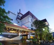
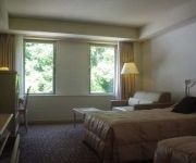
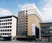
Hotels and Places to Stay
Yataro Honkan-Minamikan (Ryokan)
UNZEN SHINYU HOTEL
APA Hotel Nagasaki Ekiminami
Luke Plaza Hotel
Business Hotel Miyukisou
Comfort Hotel Nagasaki
Toyoko Inn Nagasaki Ekimae
Victoria Inn Nagasaki
(RYOKAN) Yataro Yataro Minamikan
Dormy Inn Nagasaki
Videos from this area
These are videos related to the place based on their proximity to this place.
Traditional Dragon Dance Lessons in Nagasaki, Japan
The traditional dragon dance is performed in Nagasaki, Japan. This ritual was originally performed as a rain dance in ancient China and later became part of the local culture in Nagasaki. Rain...
QueenMary2 leaves Nagasaki 豪華客船クイーン・メリー2号長崎港出港
長崎港を出航するクイーンメリー2号。大きくてとても美しい船が女神大橋をくぐる様は圧巻でした。また来てね!Queen Mary2 leaving Nagasaki Japan.
週末の長崎な写真。Nagasaki city walk(slide show)
大浦海岸エリアの長崎の写真です。 途中、野良猫が登場します。ちょっとプライド高めな猫でした。 ・出島ウァーフ ・水辺の森公園&女神...
日本初エレベーターとして作られた市道 The first in Japan. City road made in two elevators?
全国初のエレベーターとして作られた市道、長崎市道相生町上田町2号線です。 長崎市のふもと相生町と山腹にある上田町を結ぶ斜行エレベータ...
【九州No.11】Oranda-zaka オランダ坂と中華街
4 of us (2Kids + us) traveled North of Kyushu Japan ! No.11 walk around Nagasaki city travel by tram China town Oranda-zaka 2015年春...
h511 Oranda Zaka 長崎オランダ坂 HD
Oranda Zaka(Dutch slope) / Nagasaki Nagasaki Japan The slope paved with stone that is called "Dutch slope" is a sightseeing spot of Nagasaki City. A lot of foreigners lived around here for...
どんの山 DON NO YAMA hill
長崎市にある小高い丘、どんの山です。 Small hill DON NO YAMA at Nagasaki city, west side of Japan.
[V0523] 長崎10:女神大橋から原爆爆心地の平和公園方向に長崎港や出島へ
動画開始地点: 地図拡大表示の中心点 (RECORDING START POINT): Center point of this map http://maps.live.com/?v=2&cp=32.72363173233814~129.84355184917283&lvl=12.999999...
Videos provided by Youtube are under the copyright of their owners.
Attractions and noteworthy things
Distances are based on the centre of the city/town and sightseeing location. This list contains brief abstracts about monuments, holiday activities, national parcs, museums, organisations and more from the area as well as interesting facts about the region itself. Where available, you'll find the corresponding homepage. Otherwise the related wikipedia article.
Dejima
, in old Western documents latinized as 'Decima', 'Desjima', 'Dezima', 'Disma', or 'Disima', was a small fan-shaped artificial island built in the bay of Nagasaki in 1634 by local merchants. This island, which was formed by digging a canal through a small peninsula, remained as the single place of direct trade and exchange between Japan and the outside world during the Edo period. Dejima was built to constrain foreign traders as part of sakoku, the self-imposed isolationist policy.
Nagasaki Naval Training Center
The Nagasaki Naval Training Center was a naval training institute, between 1855 when it was established by the government of the Tokugawa shogunate, until 1859, when it was transferred to Tsukiji in Edo. During the Bakumatsu period, the Japanese government faced increasing incursions by ships from western nations, intent on ending the country's two centuries of national seclusion.
Glover Garden
Glover Garden is a park in Nagasaki, Japan built for Thomas Blake Glover, a Scottish merchant who contributed to the modernization of Japan in shipbuilding, coal mining, and other fields. In it stands the Glover Residence, the oldest Western style house surviving in Japan and Nagasaki's foremost tourist attraction. It is located on the Minamiyamate hillside overlooking Nagasaki harbor. It was built by Hidenoshin Koyama of Amakusa island and completed in 1863.
Confucius Shrine, Nagasaki
Confucius Shrine (孔子廟 Kōshi-byō) in Nagasaki, Japan is said to be the world's only Confucian shrine built outside China by Chinese hands. Even today the land on which it stands is Chinese territory and the land rights controlled by the Chinese Embassy in Tokyo.
Ōura Church
Ōura Church is a Roman Catholic church in Nagasaki, Japan, built soon after the end of the Japanese government's Seclusion Policy in 1853. It is also known as the Church of the 26 Japanese Martyrs. It was for many years the only western-style building declared a national treasure, and is said to be the oldest church in Japan.
Sōfuku-ji (Nagasaki)
Sōfuku-ji is an Ōbaku Zen temple that was built by the Chinese monk Chaonian in 1629 as the family temple of the Chinese from Fujian Province who settled in Nagasaki.
VOC Opperhoofden in Japan
VOC Opperhoofden in Japan were the chief traders of the Dutch East India Company (Vereenigde Oostindische Compagnie or VOC in old-spelling Dutch, literally "United East Indian Company") in Japan during the period of the Tokugawa shogunate, also known as the Edo period. Opperhoofd is a Dutch word (plural Opperhoofden) which literally means 'supreme head[man man]'.
Nagasaki Chinatown
Nagasaki Chinatown is an area located in Nagasaki, Nagasaki, Japan. This area today is a big shopping strip that covers many blocks.






!['[V0523] 長崎10:女神大橋から原爆爆心地の平和公園方向に長崎港や出島へ' preview picture of video '[V0523] 長崎10:女神大橋から原爆爆心地の平和公園方向に長崎港や出島へ'](https://img.youtube.com/vi/3EVqfQh24i4/mqdefault.jpg)


